Oristano is not likely to be on the main tourist route in Sardinia, Italy especially if time is limited. However, if you have the time, you should definitely check it out. There is a lot to do in this region of Sardinia. Here are the main sights we visited. In addition to the sights listed below, there are ancient Nuragic sites not far from here. For a map of Sardinia and to learn more about these sites, see my post here.
Is Aruttas Beach
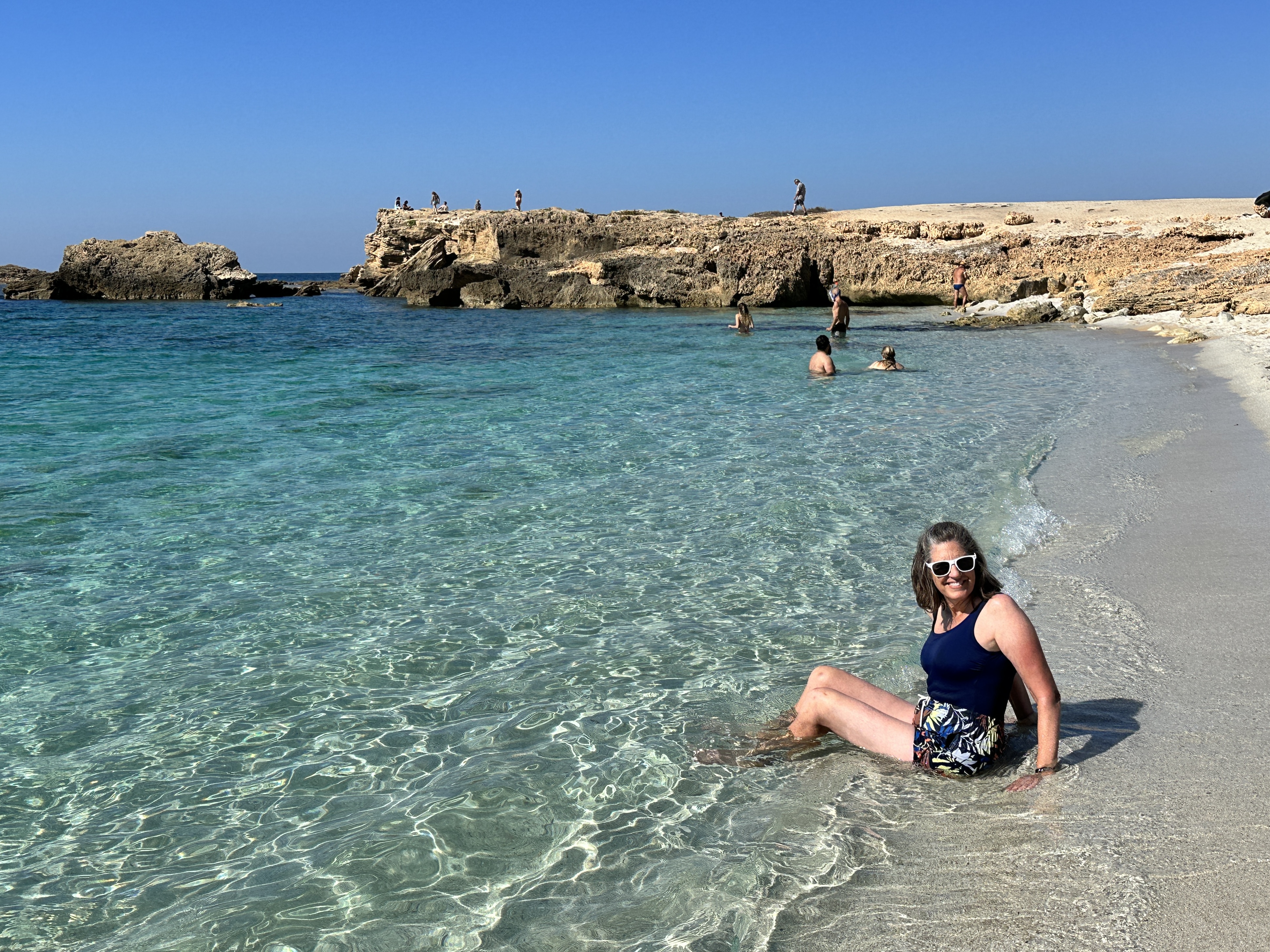
This beach on the Sinis peninsula is about 22 km (13 miles) from Oristano and one of the region’s most famous. There is a large parking lot and a refreshment stand near the beach. The quartz sand on this beach is amazing, I wish I had taken a close-up of it – it looks like translucent rice. Just another perfect beach in Sardinia! As with all beaches in Sardinia, it is a crime to remove the sand – be sure to leave the sand where it belongs on the beach for others to enjoy!
Views of Is Arutas Beach.
Tharros Roman Archeological Site
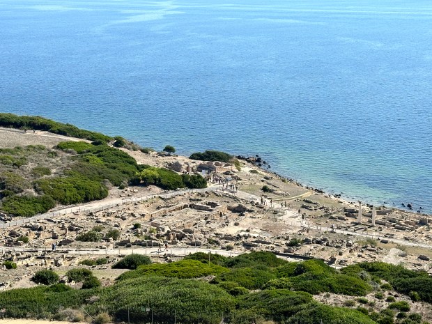
Tharros was occupied for nearly 2,000 years, from the 8th century BC to about 1050 AD. It sits near the end of the Sinis Peninsula, and it’s a spectacular setting.
A view of the ruins of Tharros and the late 15th-century San Giovanni Tower, which you can climb for a small additional fee.
Additional views of the ruins of Tharros.
This gorgeous beach is a stone’s throw from Tharros. Roman ruins, a 15th- century Spanish Tower and beautiful beach – what more could you ask for?!
Fordongianus Roman Archeological Site
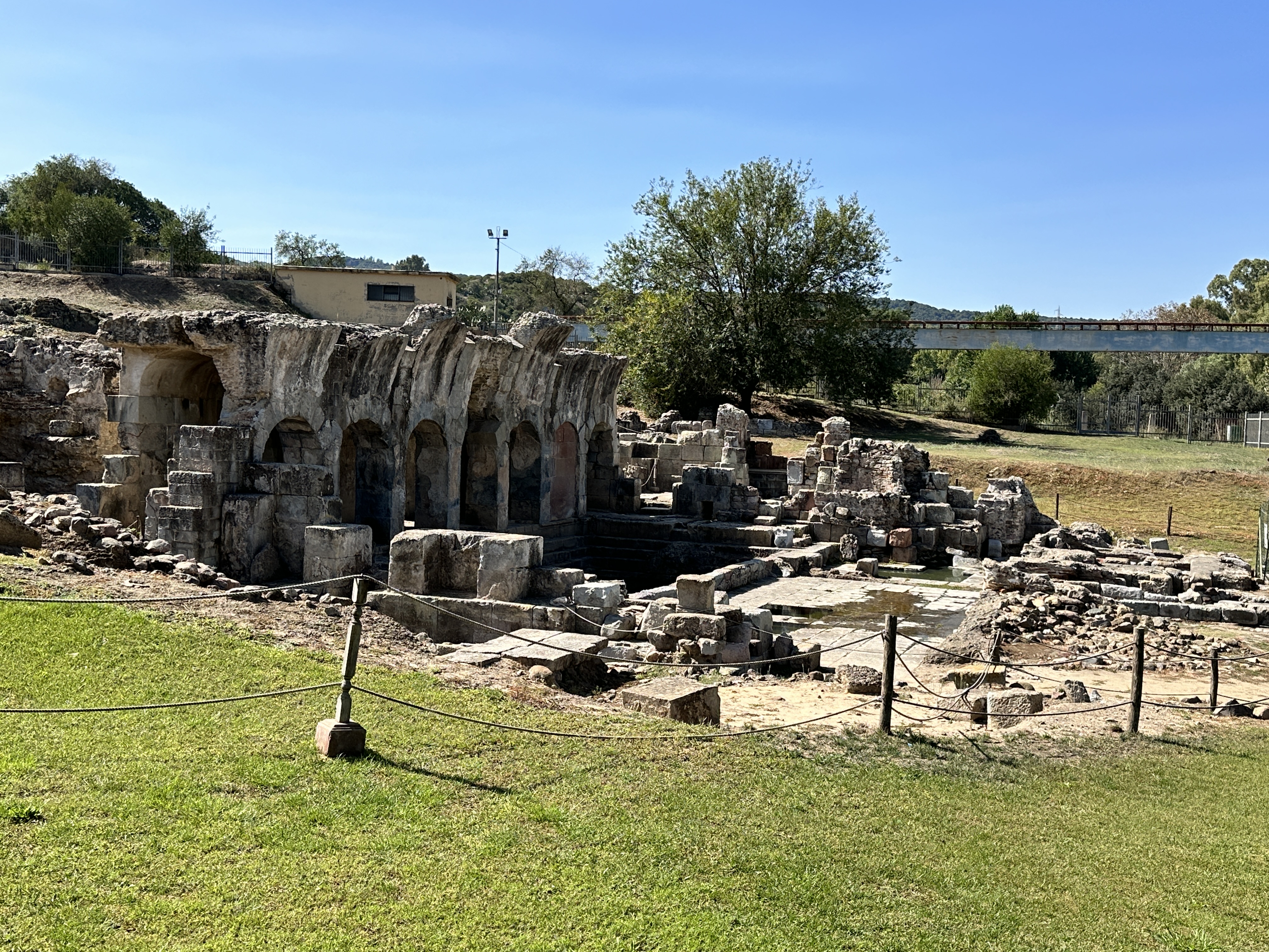
The water still runs warm from the natural springs at the 1st century AD Fordongianus Roman Baths. This site is about 25 km (14 miles) northeast of Oristano. We stopped by on our way into Oristano, but we arrived during siesta time so we had to settle for looking at the Baths through a wire fence, which actually offered some pretty good views. There is a fee to visit the Baths.
Fordongianus Roman Baths.
Just outside Fordongianus is this pretty 12th & 13th century Romanesque church, dedicated to San Lussorio, who was martyred by the Emperor Diocletian in 304 AD.
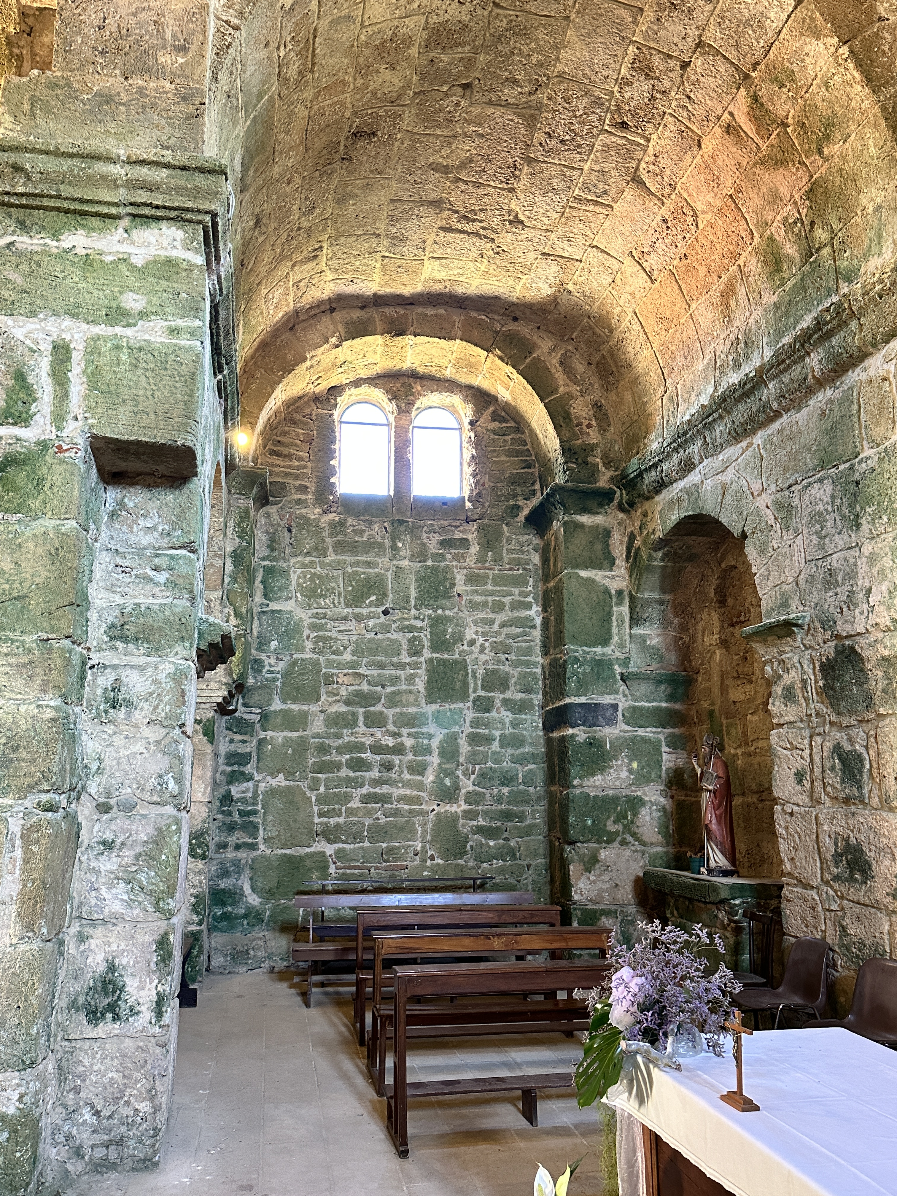
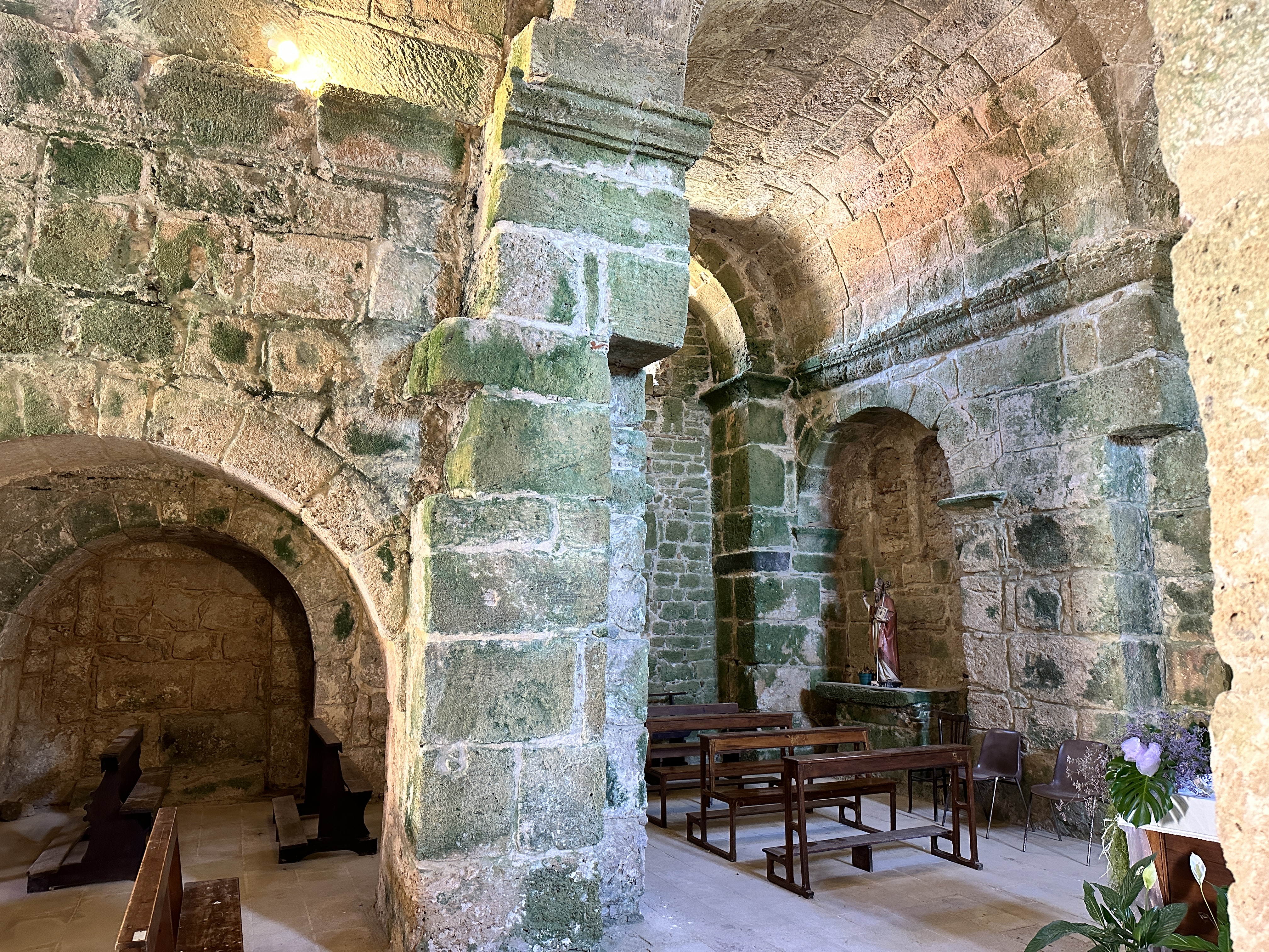
San Giovanni di Sinis Church
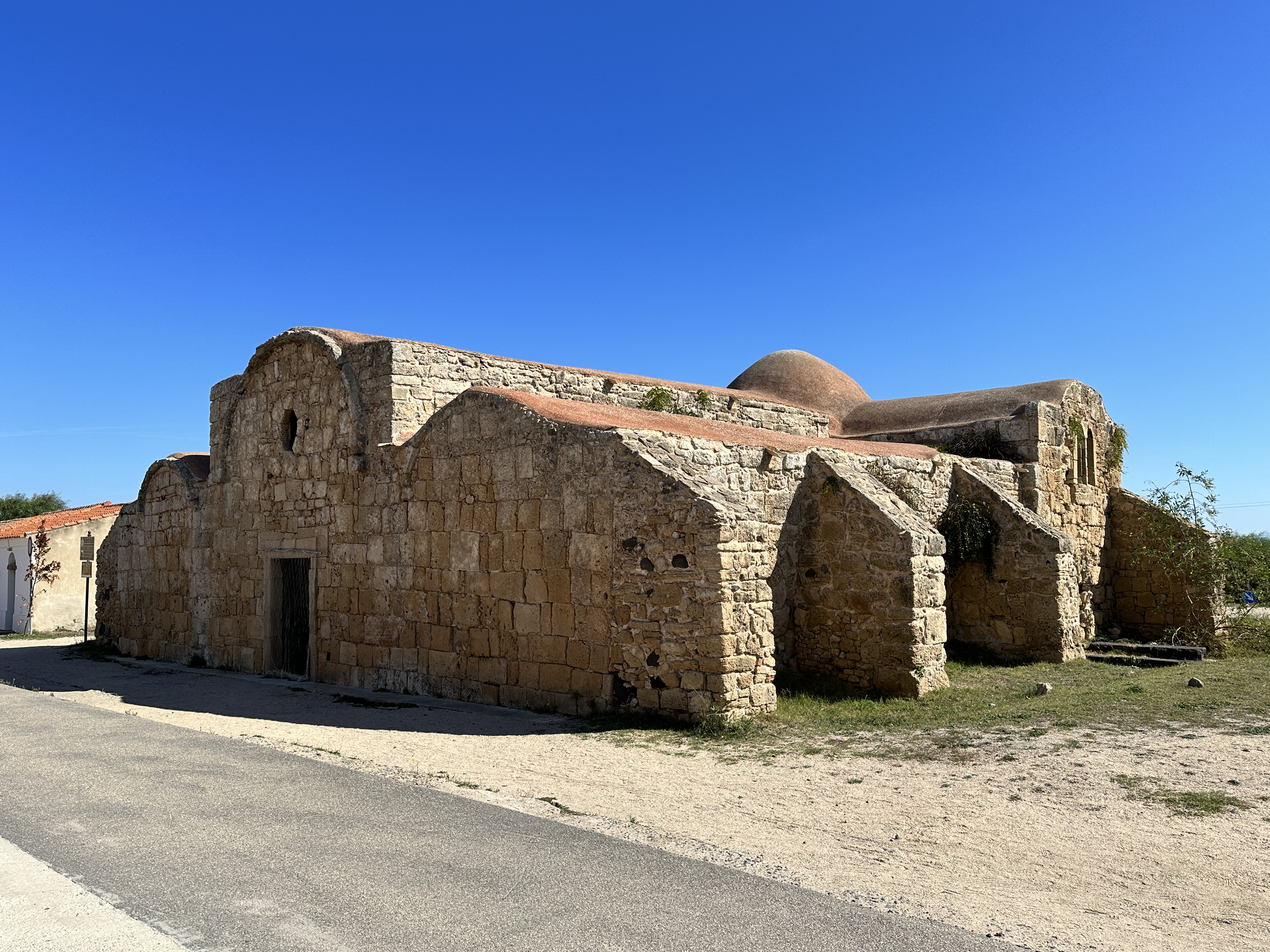
This interesting little church is right near the entrance to the Tharros archeological site. It is one of the two oldest churches in Sardinia, originally dating back to the 6th century – it still retains some of its Byzantine characteristics, such as the red roof. The present structure dates from the 9th and 11 centuries. The church sits in an ancient burial area. The church was free to enter and was definitely worth a stop.
San Giovanni di Sinis Church.
Views of the interior of San Giovanni di Sinis Church, with green algae covering some of the ancient stone walls.
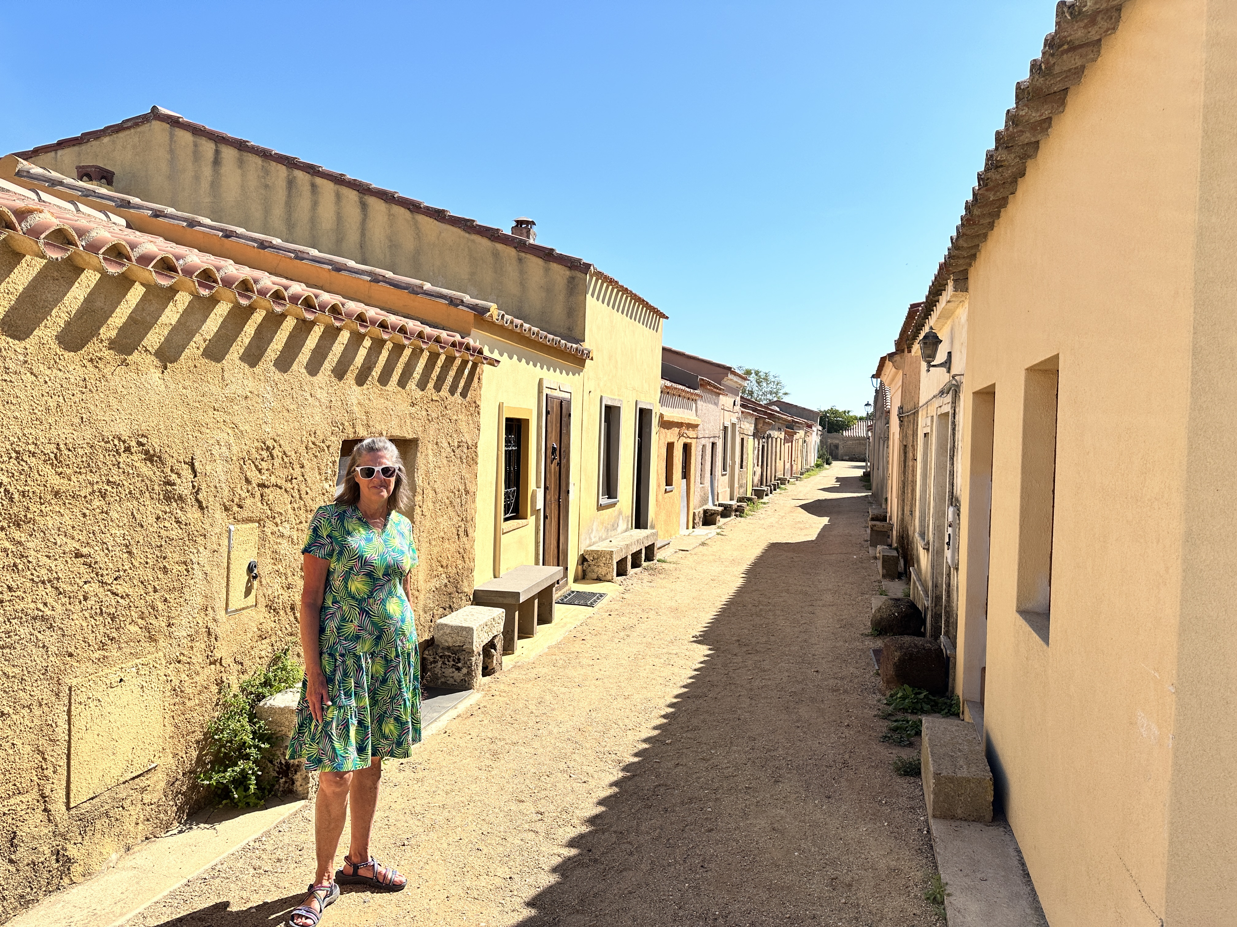
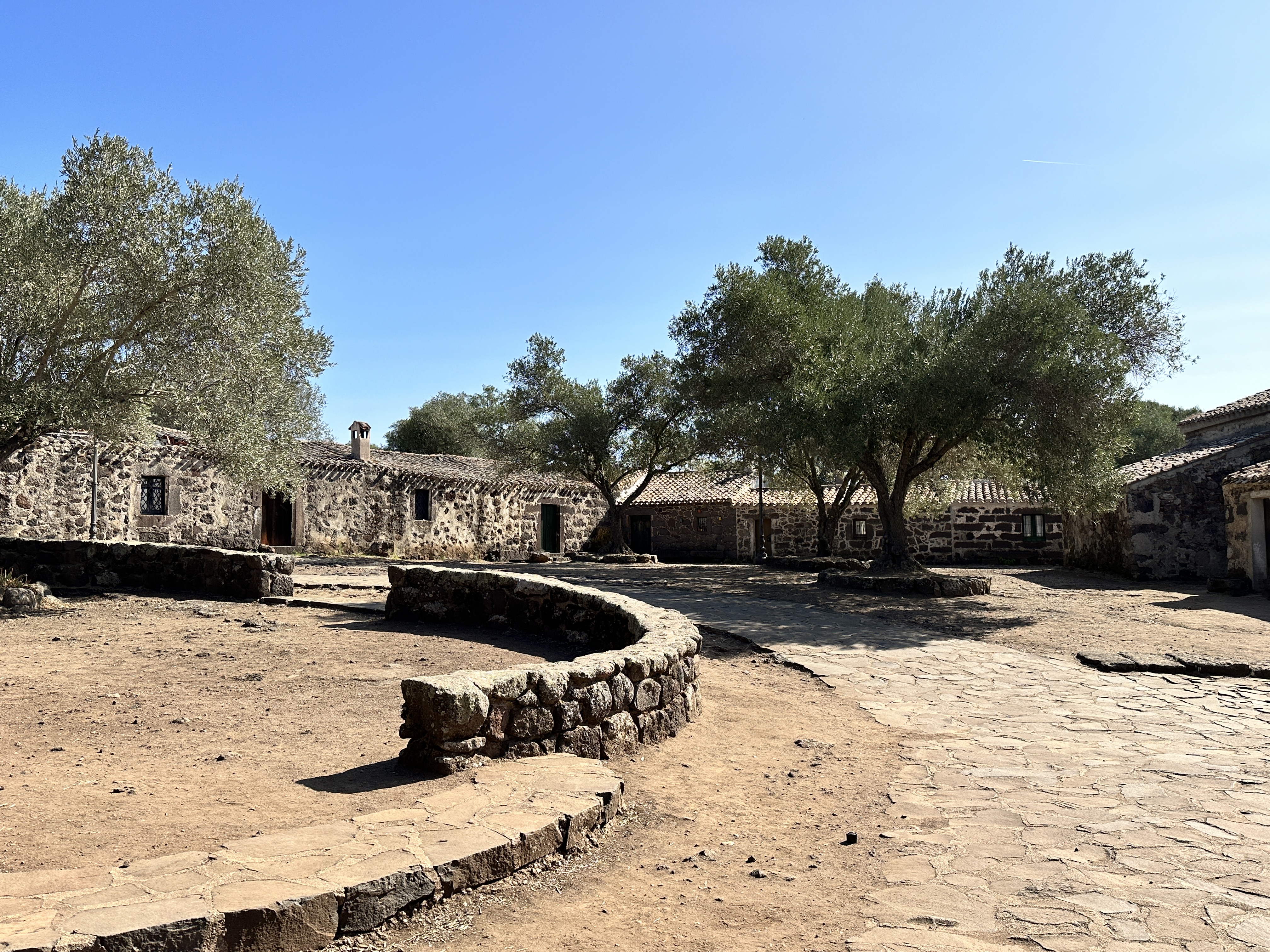
San Salvatore
San Salvatore, also close to Tharros, is a spaghetti-western filmset from the 1960’s. It has the feel of a old western U.S. ghost town. The town opens its dwellings’ doors during September each year to house pilgrims for the Festa di San Salvatore, a celebration focused on the village’s small church, which sits over the ruins of a Nuragic period (~1,500 BC) vault. It looked to us like there might be a few permanent residents here, we saw some homes that looked lived in.
Views of San Salvatore.
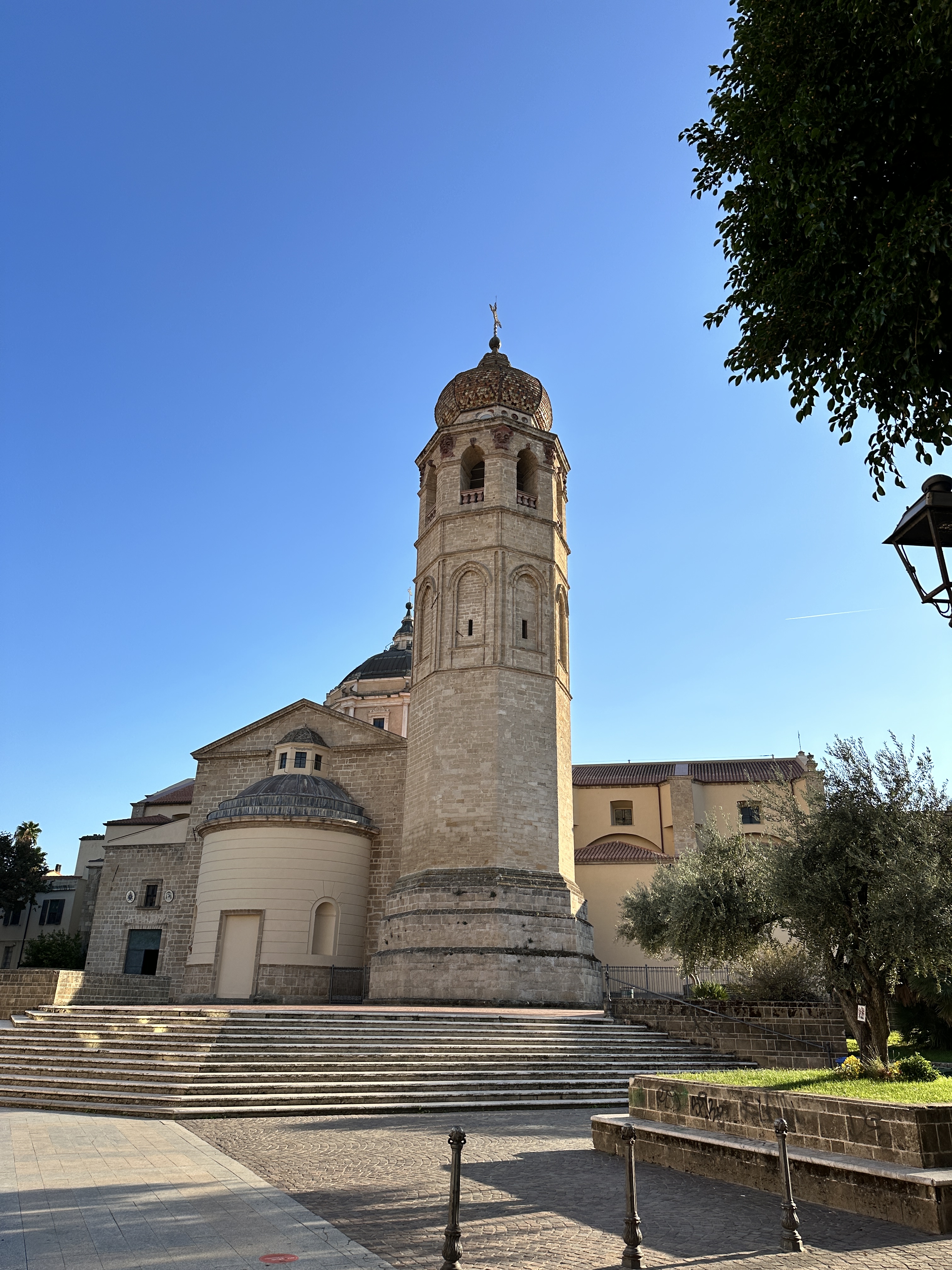
Oristano Town
Oristano seemed to us to be a pretty quiet town, without fewer tourists compared to other locations in Sardinia, even though there is much for the tourist to see in the vicinity. We enjoyed walking the streets in the evening without any throngs of tourists. It is a perfect place to call “home” during your stay in this part of Sardinia.
The 13th-century Torre di Mariano II was Oristano’s nothern gate, one of the few remains of the city’s medieval defenses.
Views of the Catedrale di Santa Maria Assunta. The 14th century bell tower still stands. The rest of the current structure is 18th century.Left – Torre di Portixedda, part of Oristano’s original medieval walls. Right – street scene in central Oristano.
About one hour south of Alghero by car (45 km or 28 miles) is the town of Bosa, home to Sardinia’s only navigable river (the Temo River). We visited Bosa as a day trip from Alghero and we made it part of an interesting loop drive – visiting Basilica della Santissima Trinità di Saccargia on the way (see below) and Nuraghe Santu Antine. It’s possible to visit all three sights in one day if you get going early from Alghero. (For a general map of the regions we visited in Sardinia, click here).
Bosa is an ancient town, it was established by the Phoenicians and continued to grow under the Romans. It’s easy to see why, Bosa is an ideal port location – close to the coast and at the mouth of the Temo River.
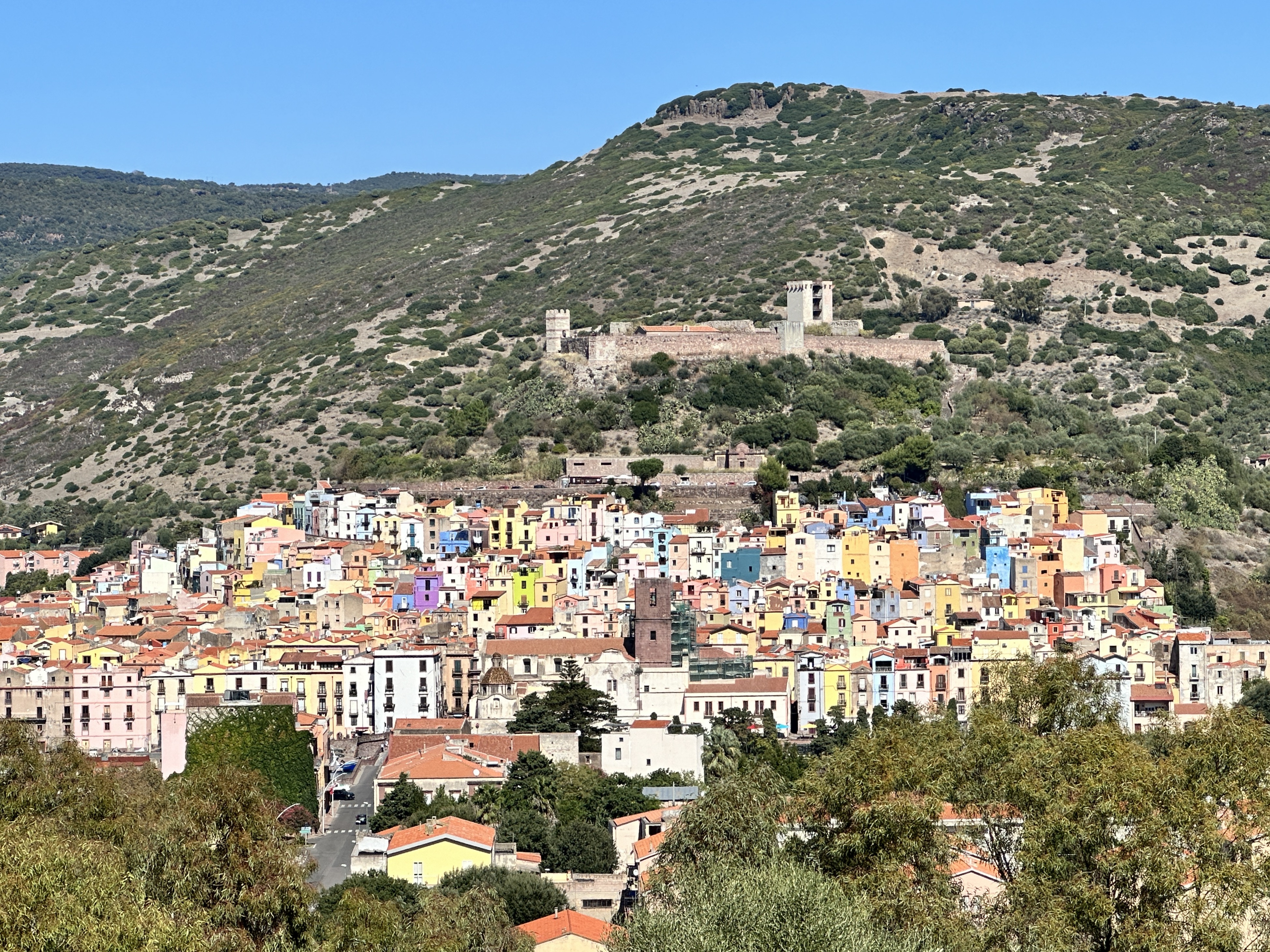
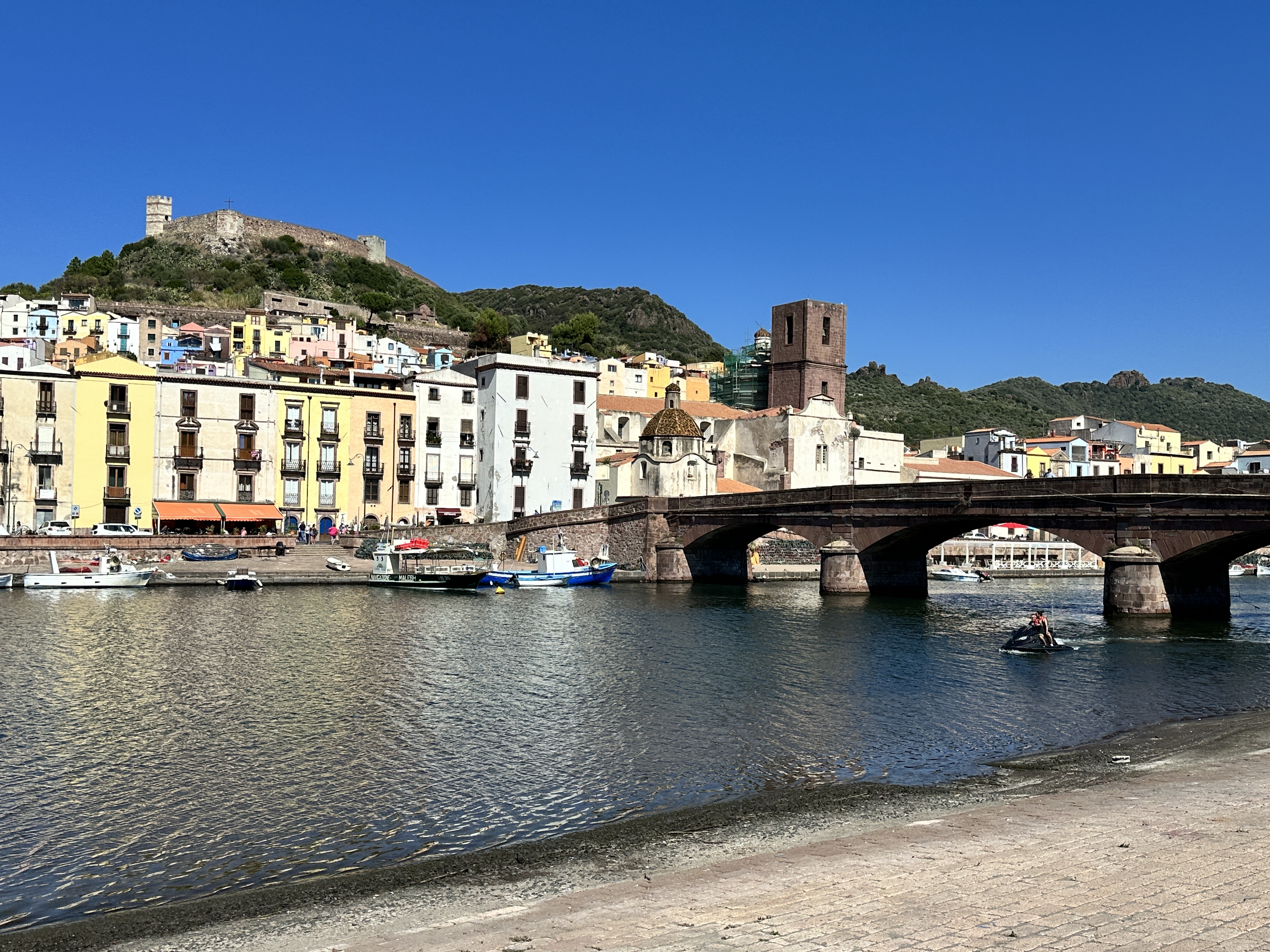
View of Bosa and its 13th century castle as seen from our drive into town.
Malaspina Castle
One of the main sights in Bosa is Malaspina Castle. You can drive up to the castle and park just below it. Even then, you have a steep walk up into the Castle. There is not much left of the Castle other than the walls (which you can walk), a few towers (which you can climb) and the 14th century Chiesa di Nostra Signora di Regnos Altos, which has some lovely frescoes.
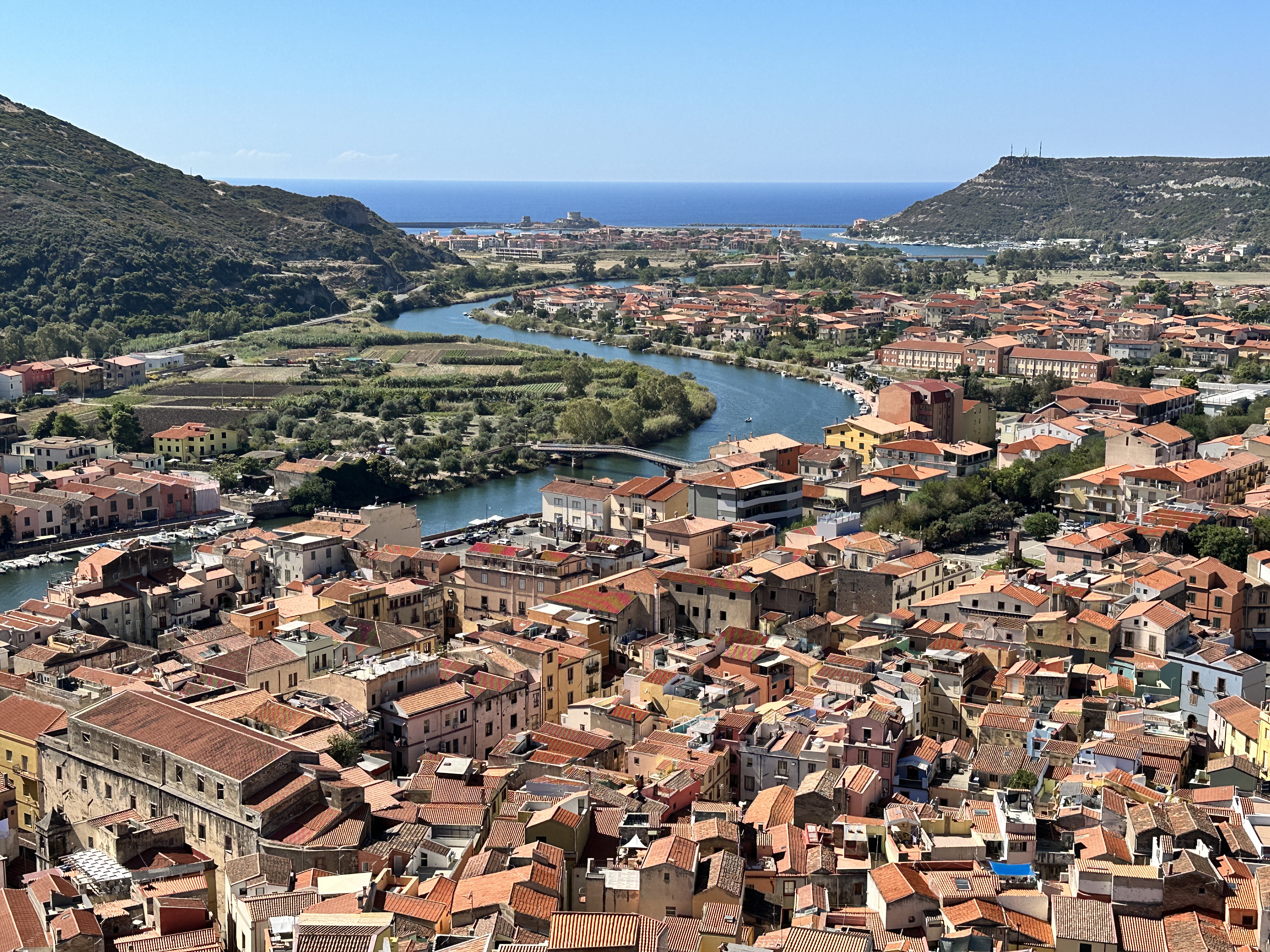
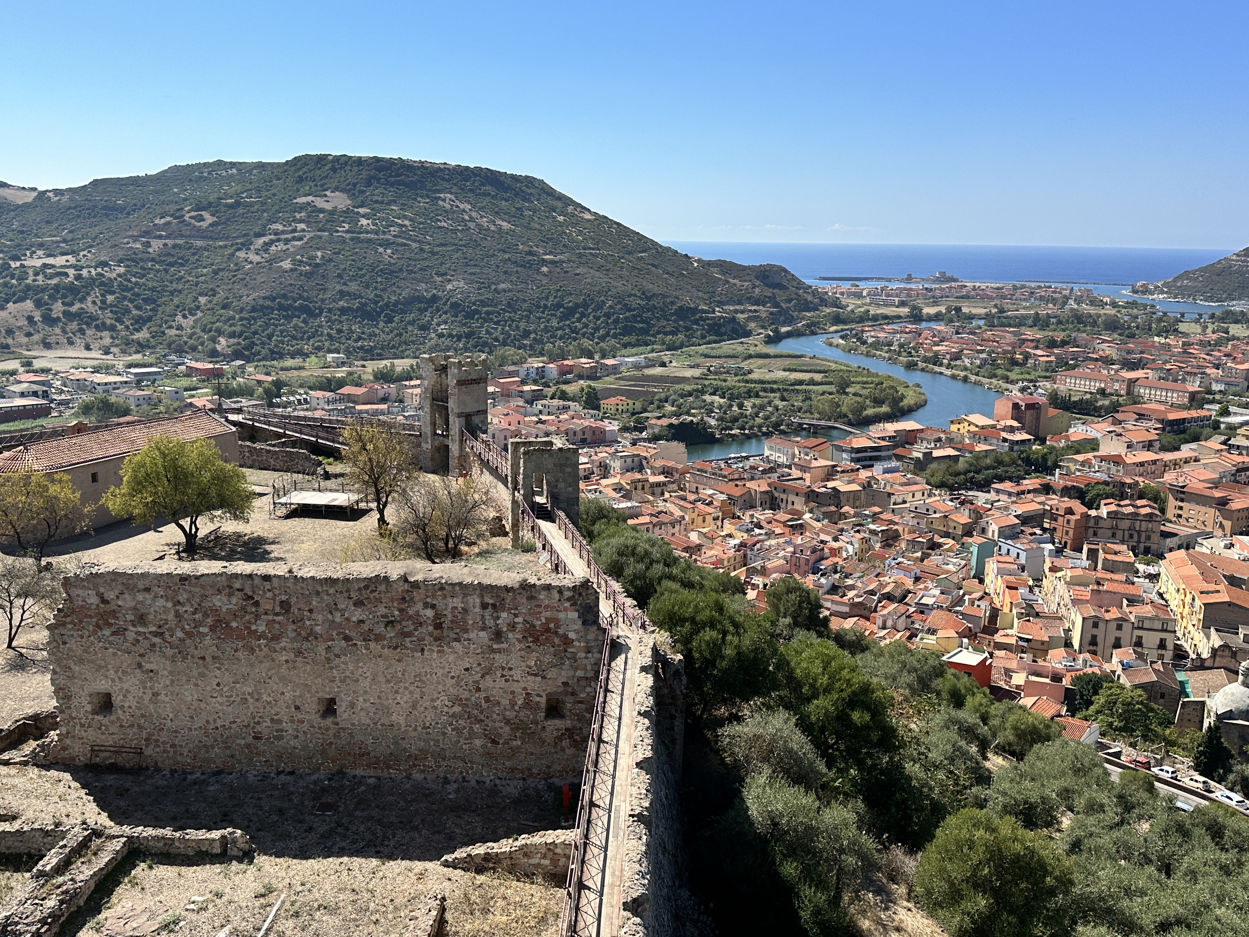
The view of Bosa from Malaspina Castle, built in the 12th and 13th centuries by a Tuscan noble family to protect Bosa from pirate raids.
14th century frescoes of Saints in the Chiesa di Nostra Signora di Regnos Altos, within the walls of Malaspina Castle.
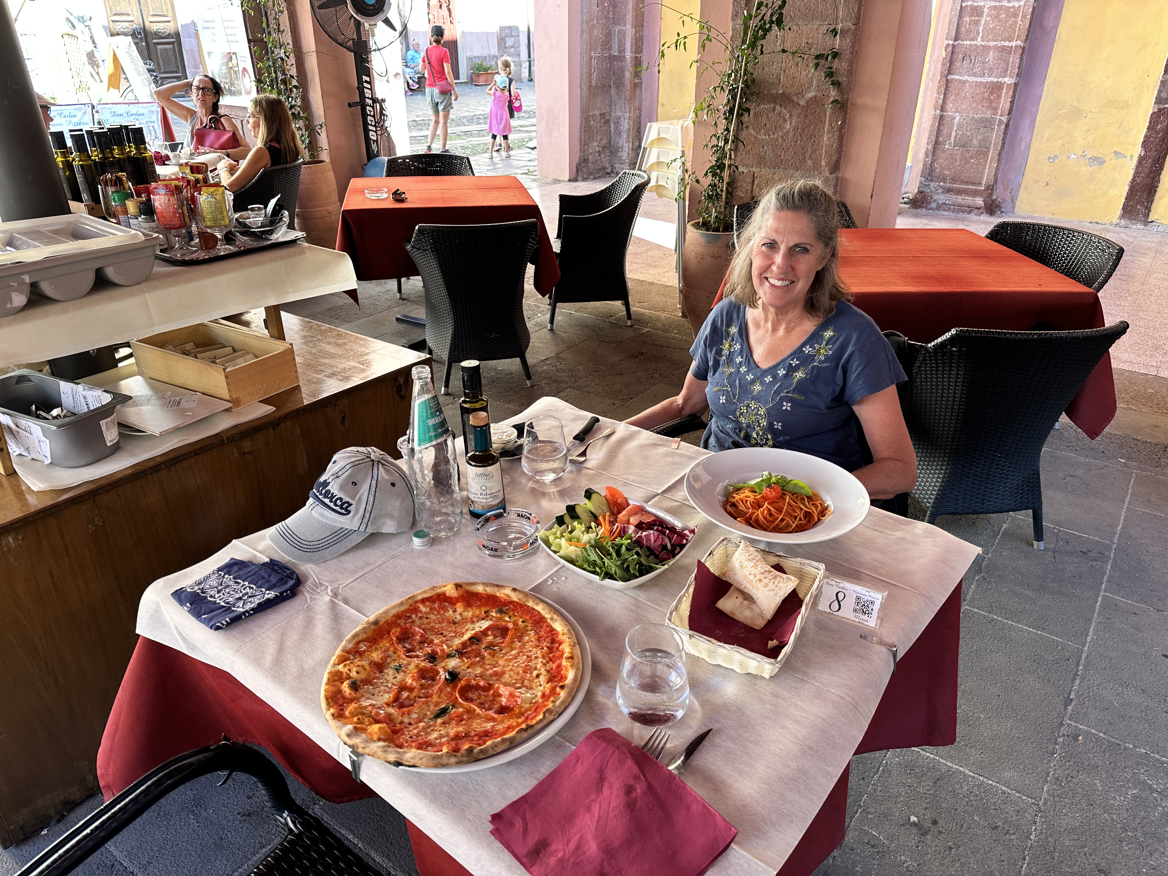
The old town of Bosa is a delight to wander, and as is possible in every Italian town, we enjoyed some great food!
A postcard view of Bosa with the Malaspina Castle in the distance, the old town across the river, and Ponte Vecchio spanning the Temo River. We parked for free near this spot, just a short walk from the old town.
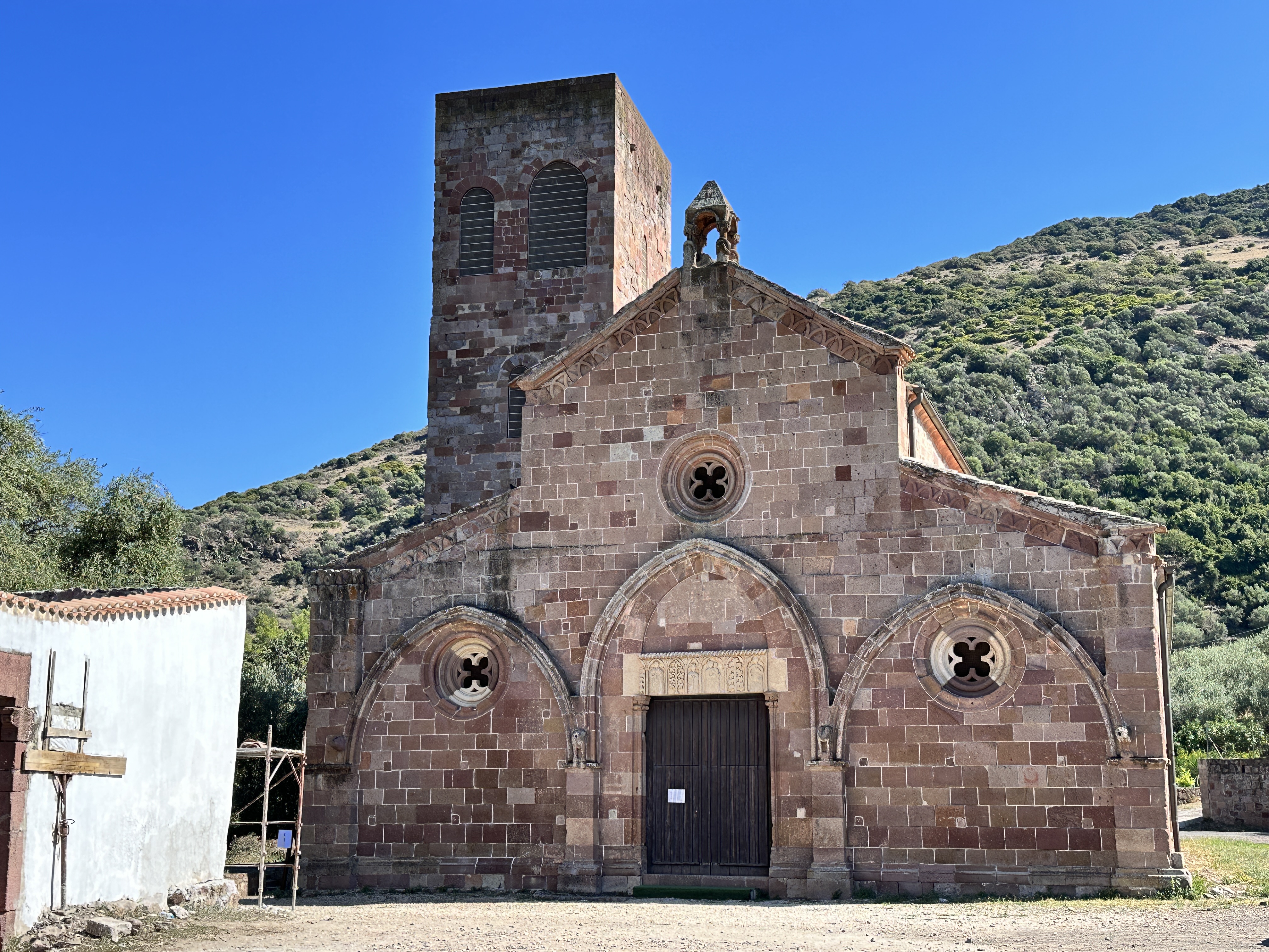
St. Peter’s Church
Just outside Bosa along the south shore of the Temo River is St. Peter’s Church, which dates from the second half of the 11th century. The Church can be visited, but was closed at the time of our visit. There is information posted about the Church near the entrance.
Views of St. Peter’s Church outside Bosa. The image on the right is a snapshot of a signpost at the Church, to at least provide a glimpse of the interior.
On the Drive to Bosa: Basilica della Santissima Trinità di Saccargia
The Church of the Holy Trinity Saccargia is about a 40-minute drive (50 km or 31 miles) from Alghero. It is well worth the “detour” to visit this fascinating 12th century Pisan-style basilica on the way to Bosa. The abbey was built on the site of a pre-existing monastery, of which there are some scant ruins.
Views of the exterior of The Church of the Holy Trinity Saccargia, constructed of alternating layers of white limestone and dark volcanic rock.Views of The Church of the Holy Trinity Saccargia’s nave. The frescoes are from the second half of the 12th century – amazingly well-preserved.Some interesting figures in the church – left – a face in the wall of the nave and right – cows carved into a pillar on the portico. Some believe the name of the Church comes from the Sardinian word for “cow with the spotted hide”, but this is not likely. The land surrounding the church is rural and probably has been perfect grazing pasture for centuries.
About 20 minutes south of The Church of the Holy Trinity Saccargia is the ancient archeological site of Nuraghe Santu Antine, also a very worthwhile stop before turning southwest on your drive towards Bosa. Since I covered our visits to Sardinia’s ancient Nuraghe in another post, I won’t comment further on it here.
After our visit to Bosa, we drove north along the west coast of Sardinia back to Alghero. It was a scenic, beautiful drive and the perfect end to another perfect day in Sardinia.
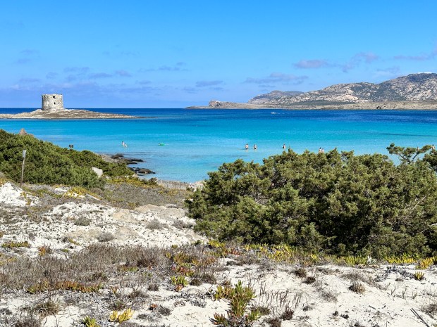
The island of Sardinia, Italy has so many lovely beaches it’s difficult to narrow down the list of “best beaches” but one that would have to be near the top is La Pelosa, near Stintino on the north west coast of Sardinia. This beach is so popular that you need to make reservations to visit it during the busy season (May – October). The reservations are not expensive nor difficult. To my knowledge, this is the only beach in Sardinia that requires a reservation. When you see it, you will understand why it is so popular.
La Pelosa Beach, with its signature 16th century Aragonese Tower overlooking this beautiful bay.
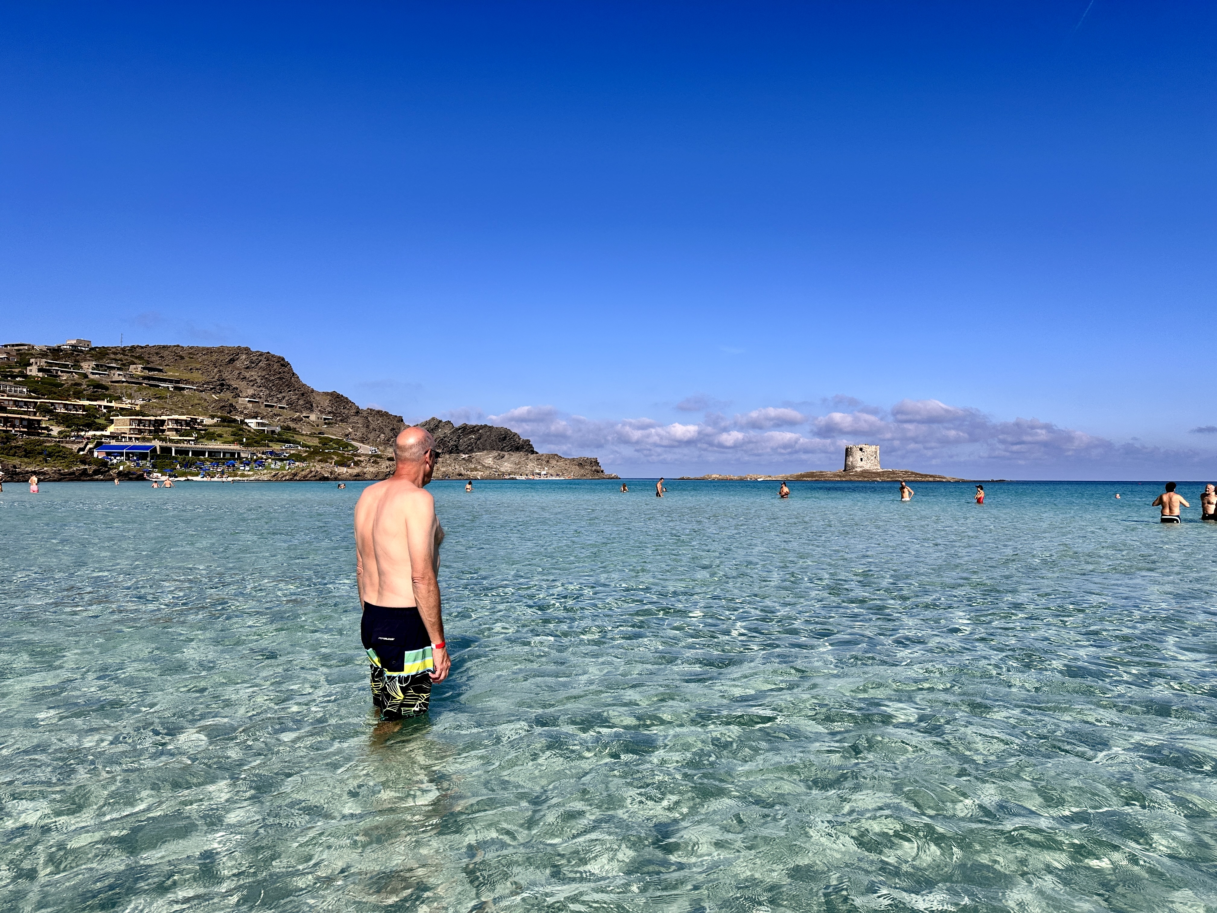
Other views of La Pelosa Beach, Sardinia.The water is calm and very shallow at La Pelosa, you can walk out a long way and the water may still not be up to your waist, making this a perfect beach for young children.
One of the boardwalks leading down to La Pelosa Beach.
There is paid parking along the street facing the beach – be sure to pay – you don’t want to get back to your parking spot after a lovely day at the beach and find your vehicle has been towed away! I recommend getting here early in the morning or later in the afternoon, not only will the beach be a little less busy, but convenient parking will be more plentiful too. We visited in early October, after an overnight stop in Castelsardo. The water was still warm and the beach was fairly busy, but it did not feel overcrowded at all. To check in at the beach, there is a kiosk where you get a wristband after showing your reservations on your phone or a hardcopy. Be sure to bring towel mats as well, to avoid taking home the precious sand – Sardinia is focused on keeping their beautiful sand where it belongs – on the beach.
Alghero
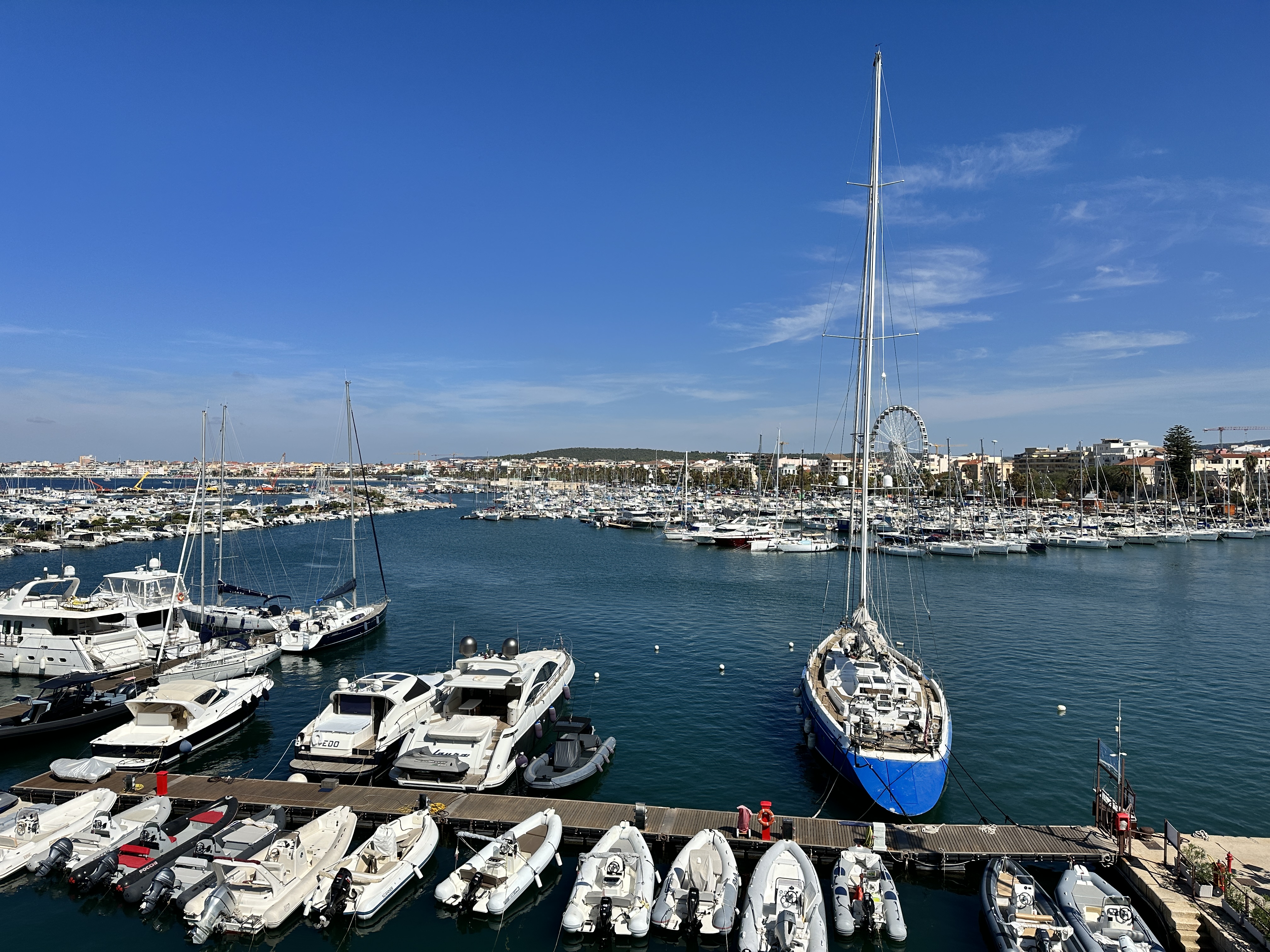
Less than an hour south of La Pelosa Beach is Alghero. Alghero was probably my favorite town in Sardinia. The combination of its magnificent setting and harbor, a beautiful old town with medieval towers and walls, and lively evening scene made this a perfect spot to stay for a few nights. We rented a lovely apartment that was just a ten minute walk from the old town.
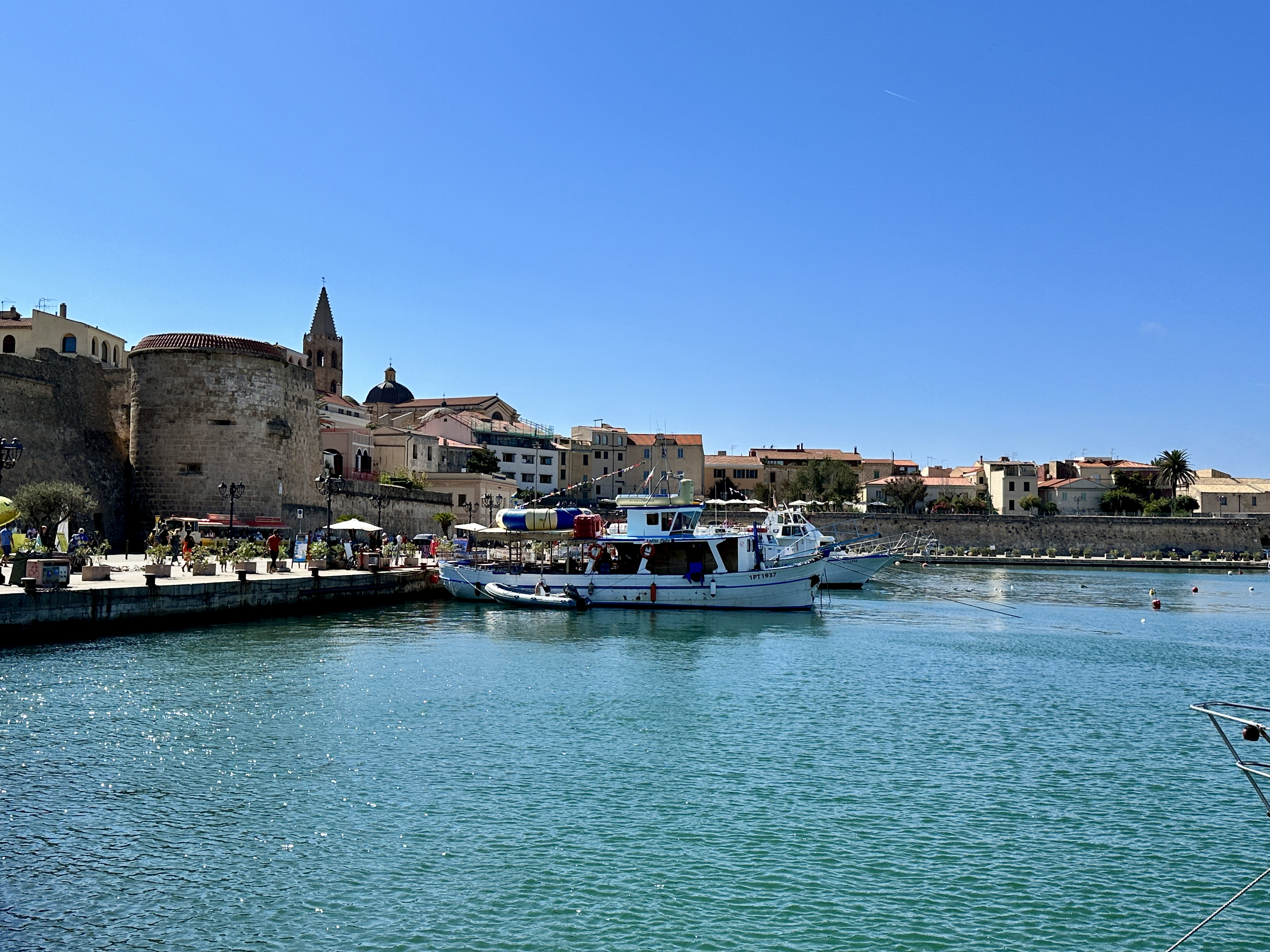
A view of Alghero’s Old Town from the Harbor.
Views of Alghero’s Harbor from the city walls.
Alghero’s lively Old Town.
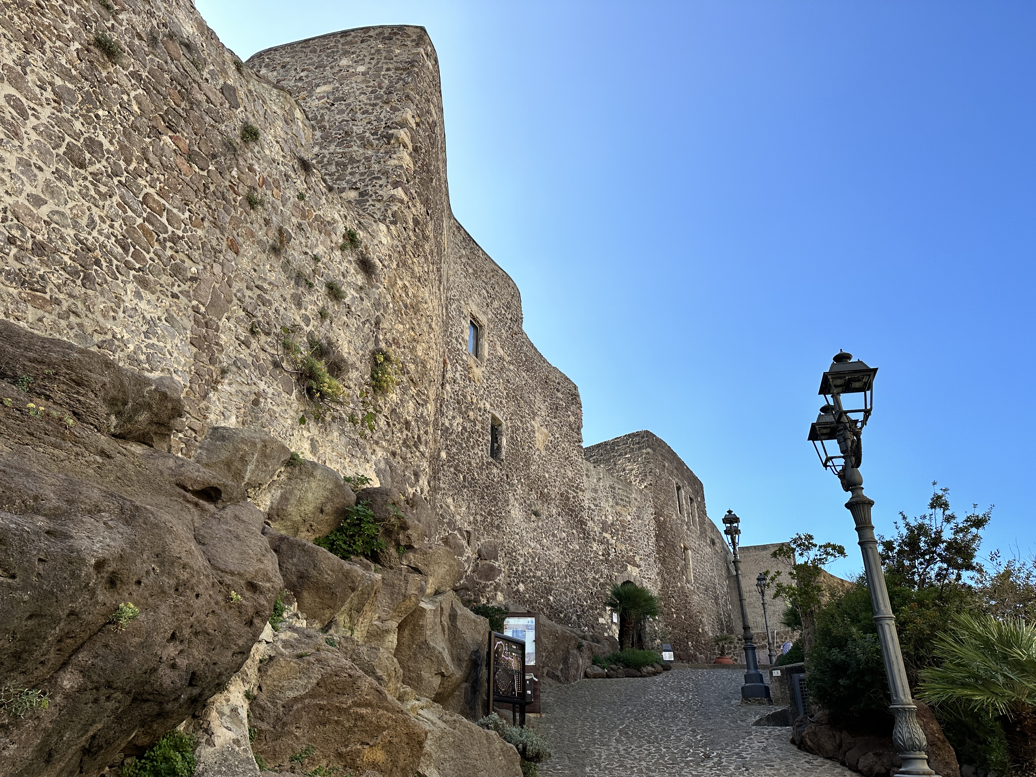
A great view of Alghero’s Old Town walls and towers.
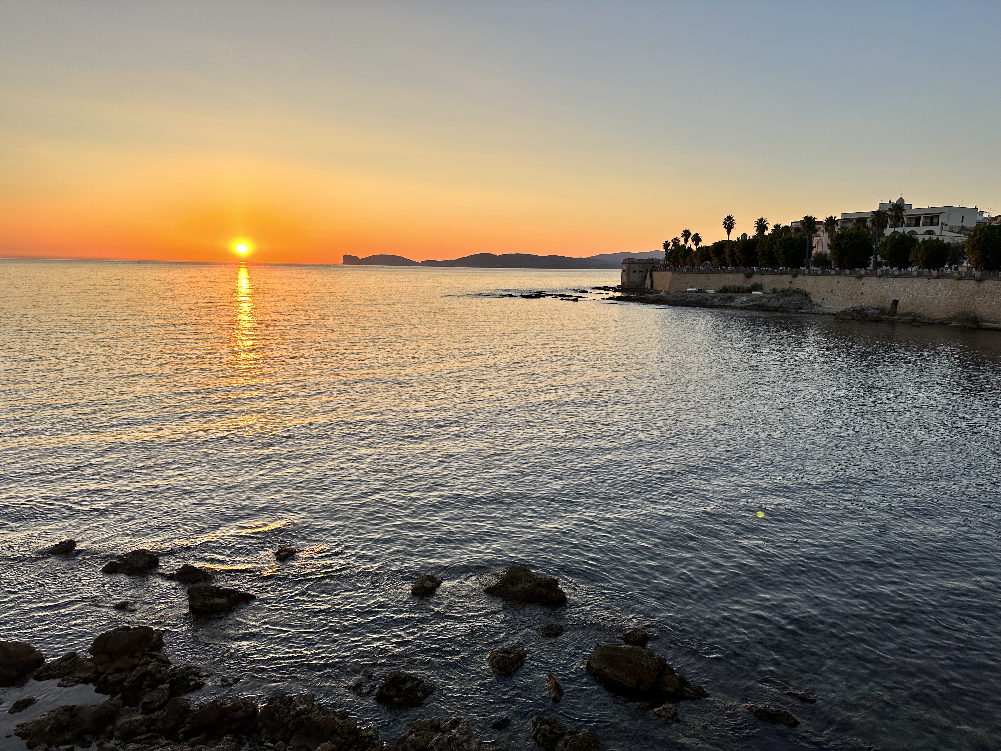
Alghero’s city walls are a perfect place to watch the sunset after another glorious day on this wonderful island.
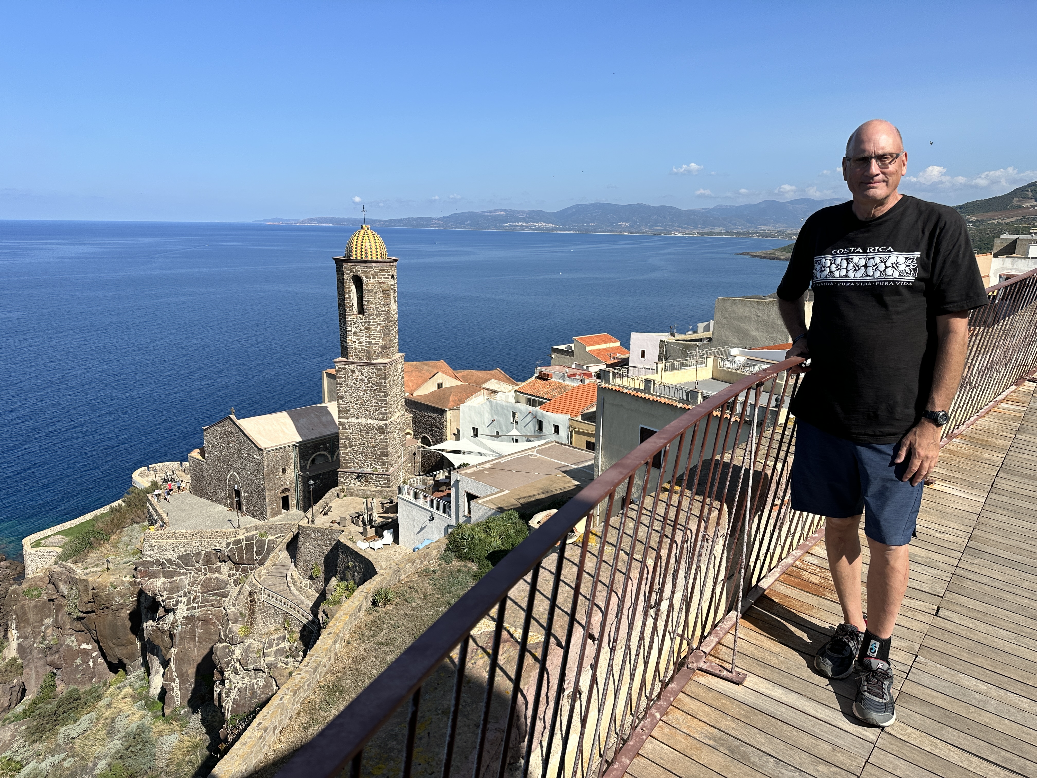
Castelsardo is a very picturesque little town on the north coast of Sardinia and worth an overnight stop if convenient in your travels, or a least a short visit on your way to other destinations. For us, we stopped here overnight on our way to the magnificent beach at La Pelosa (near Stintino, on the very northwest tip of Sardinia) and then on to Alghero.
Castello dei Doria
The 13th century castle at the top of the hill in Castelsardo is named after the Genoese family who was entrusted with its care. It is open to visitors and there are a few rooms you can visit with various displays, including the Museum of Mediterranean Interweaving.
At the top of the town lies the Castello dei Doria, with great views of the countryside and Mediterranean Sea.
A view from the top of Castello dei Doria.
Street Wandering
As with any small European town, it is fun to just wander the narrow, steep streets. Our hotel was on one of these little streets. There was plenty of car parking outside the old town on the sea side of Castelsardo.
Left – restaurants offering tables in the narrow alleys of Castelsardo. Right – Robyn pointing out our accommodation for the night in the heart of the old town. The rooftop of our little hotel offered a wonderful view of the sea and is where we had breakfast.
View of Castelsardo’s 16th century Cathedral, with a magnificent view of the Mediterranean Sea and Sardinian coast line in the distance.
I loved this image of an old 1st story floor/ceiling, in a visitor’s center near the Castle. I can’t imagine trying to build anything that would be square and level in those days!
Some of the other 16th buildings near the Cathedral in Castelsardo’s old town.
Elephant Rock
Just off a road leading into Castelsardo from the east is this interesting volcanic rock formation, aptly named “Elephant Rock”. What is even more interesting is that within this rock there are two pre-nuragic tombs, dating to a time before Sardinia’s Nuraghe were built, likely 5,000 or more years ago. We just pulled off the side of the road to take a look.
Just outside of Castelsardo is this interesting volcanic rock containing ancient tombs, aptly name “Elephant Rock”.
Views of ancient tombs carved into Elephant Rock. In the right and left images you can see the horns of a bull carved into the stone. It was a little difficult to get these photos, Elephant Rock is taller than it appears.
Don’t miss beautiful Castelsardo if you have the chance!
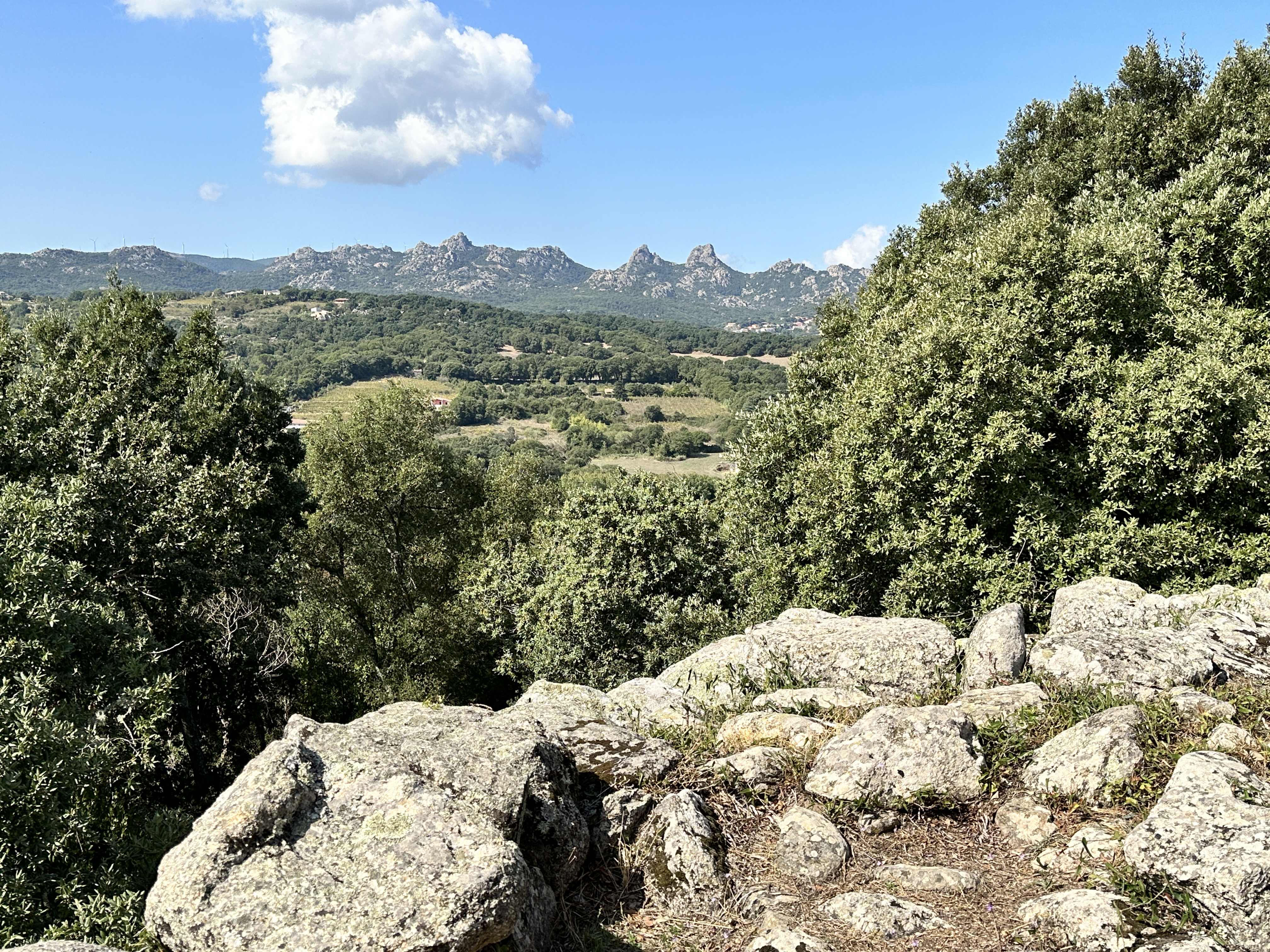
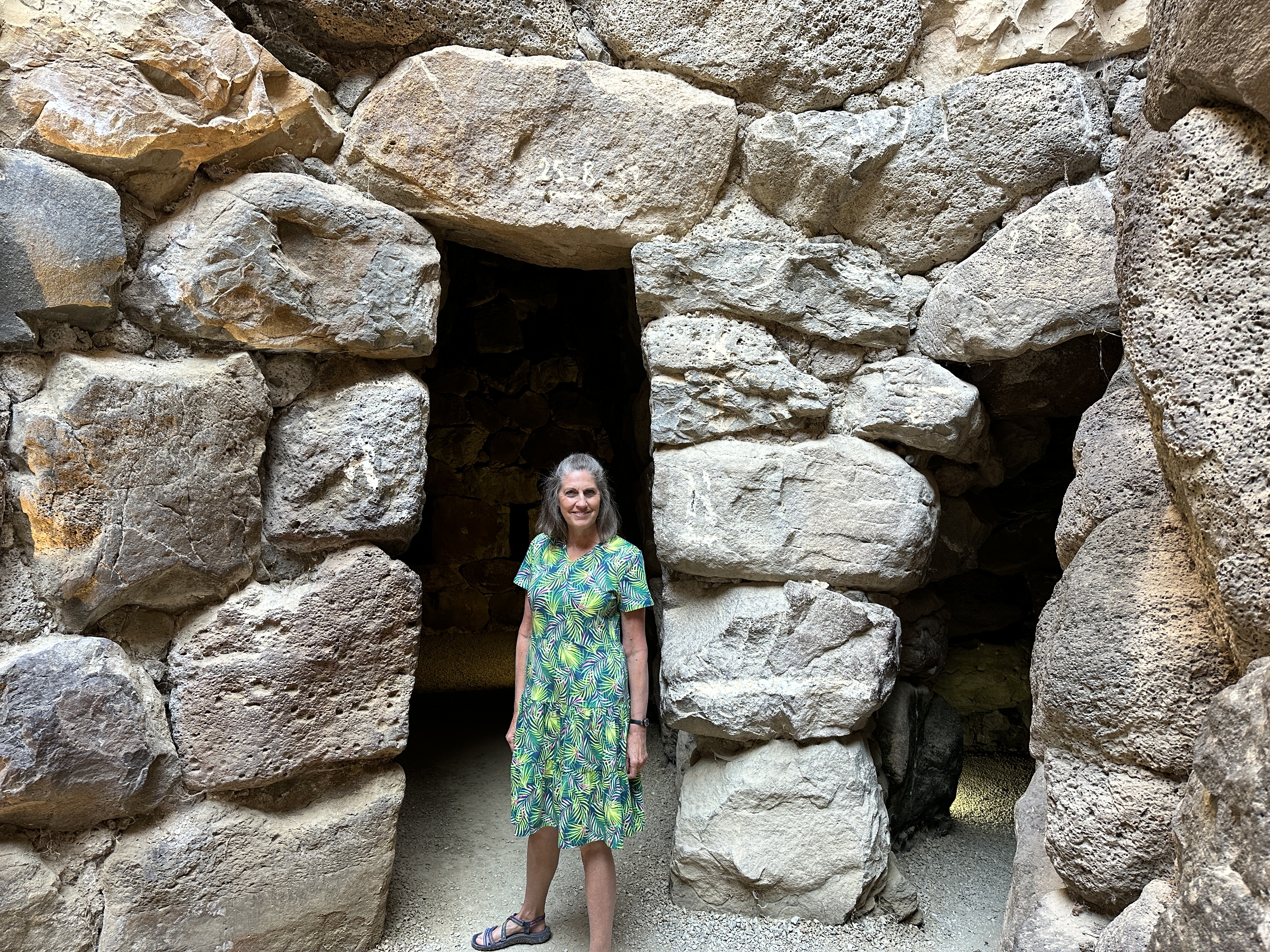
If you enjoy archeology, Sardinia, Italy should be high on your list of places to visit. There are a number of Bronze Age (approximately 1900 BC to 730 BC) settlements throughout the island. The main towers of these settlements are called Nuraghe (essentially ancient towers/castles surrounded by small villages) and they are unique to Sardinia. According to Wikipedia, more than 7,000 of these structures have been found on the island. Very little is known about the people who inhabited these structures or what they used these structures for.
Amazingly, a number of Nuraghe are in an excellent state of preservation and can be visited, including the interiors. The stone work is quite incredible and standing in these 3,000 year-old rooms and climbing the stairways of these towers was a fun experience, not unlike visiting the ancient pyramids of Egypt. Most sites allow you to visit the structures on your own, the only one that required a guide was Su Nuraxi Barumini, one the largest of these settlements in Sardinia. As with many ancient archeological sites, the builders in Sardinia understood much about astronomy and were close observers of the night sky.
The approximate location of the Nuraghe sites we visited are shown on the map of Sardinia above.
We visited 5 Nuraghe sites, which provided a nice sampling of Sardinia’s rich Bronze Age history.
Below is a brief overview of the sites we visited.
Nuraghe la Prisgiona & Coddu Vecchiu
Nuraghe la Prisgiona was one of the smaller nuraghe sites we visited. There are a number of interesting archeological sites near Arzachena, Sardinia (including this one), a person could easily spend a day or more exploring all the nearby sites.
Within walking distance of Nuraghe la Prisgiona is Coddu Vecchiu, called the Giants Tomb. The tomb is from the same era and part of the Nuraghic civilization, about 1800 BC.
Nuraghe Majori – Complete with Bats!
Nuraghe Majori is another small Nuraghe site. At the ticket office, they give you a flashlight so you can see the bats inside the main tower – right photo above: look closely to see the bats hanging from the roof interior.Left – Majori Nuraghe tower, Middle – one of the Nuraghe wall entrances, Right – view of the surrounding countryside. Most Nuraghe occupy a strategic location, such as a hilltop.
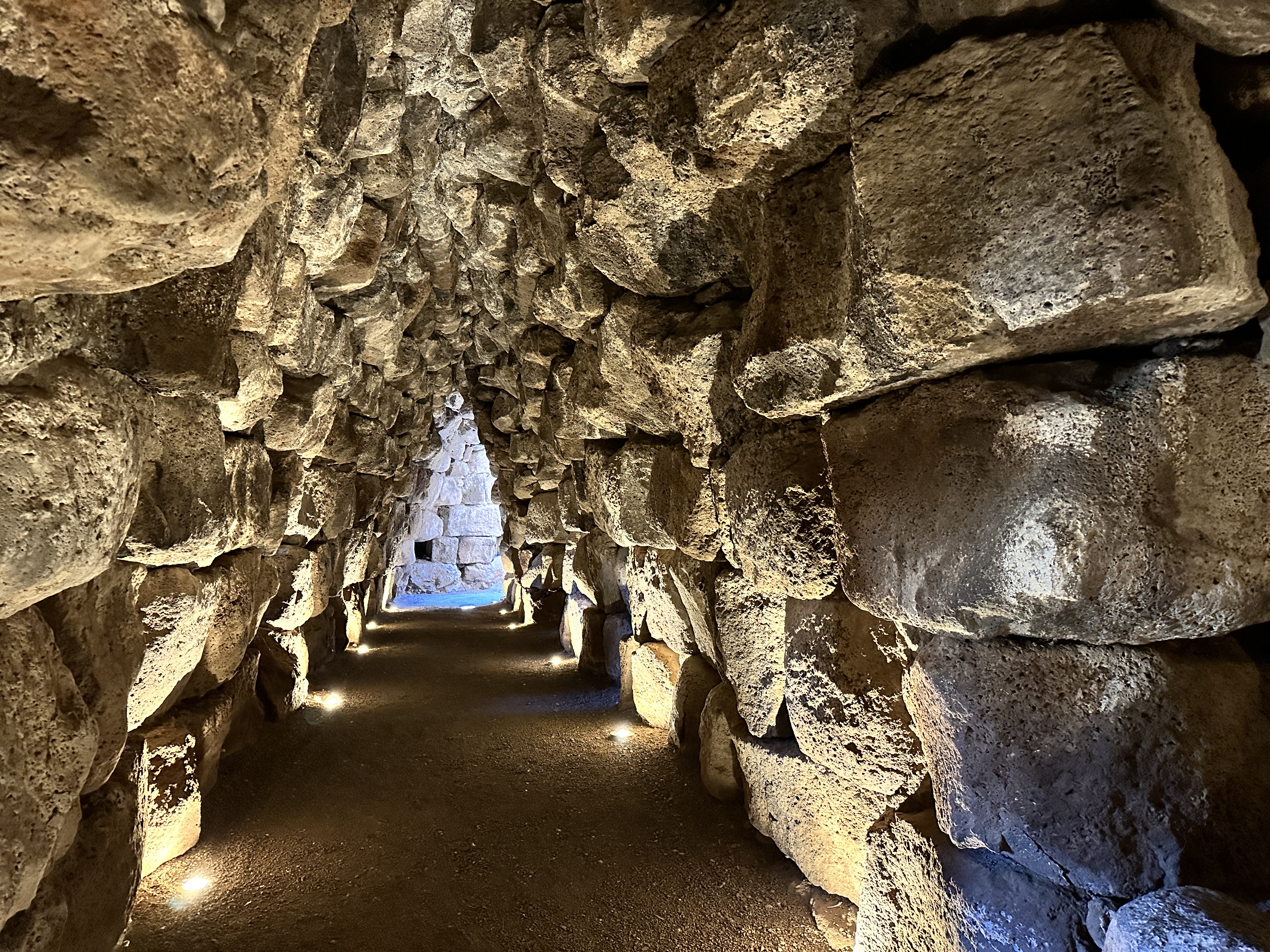
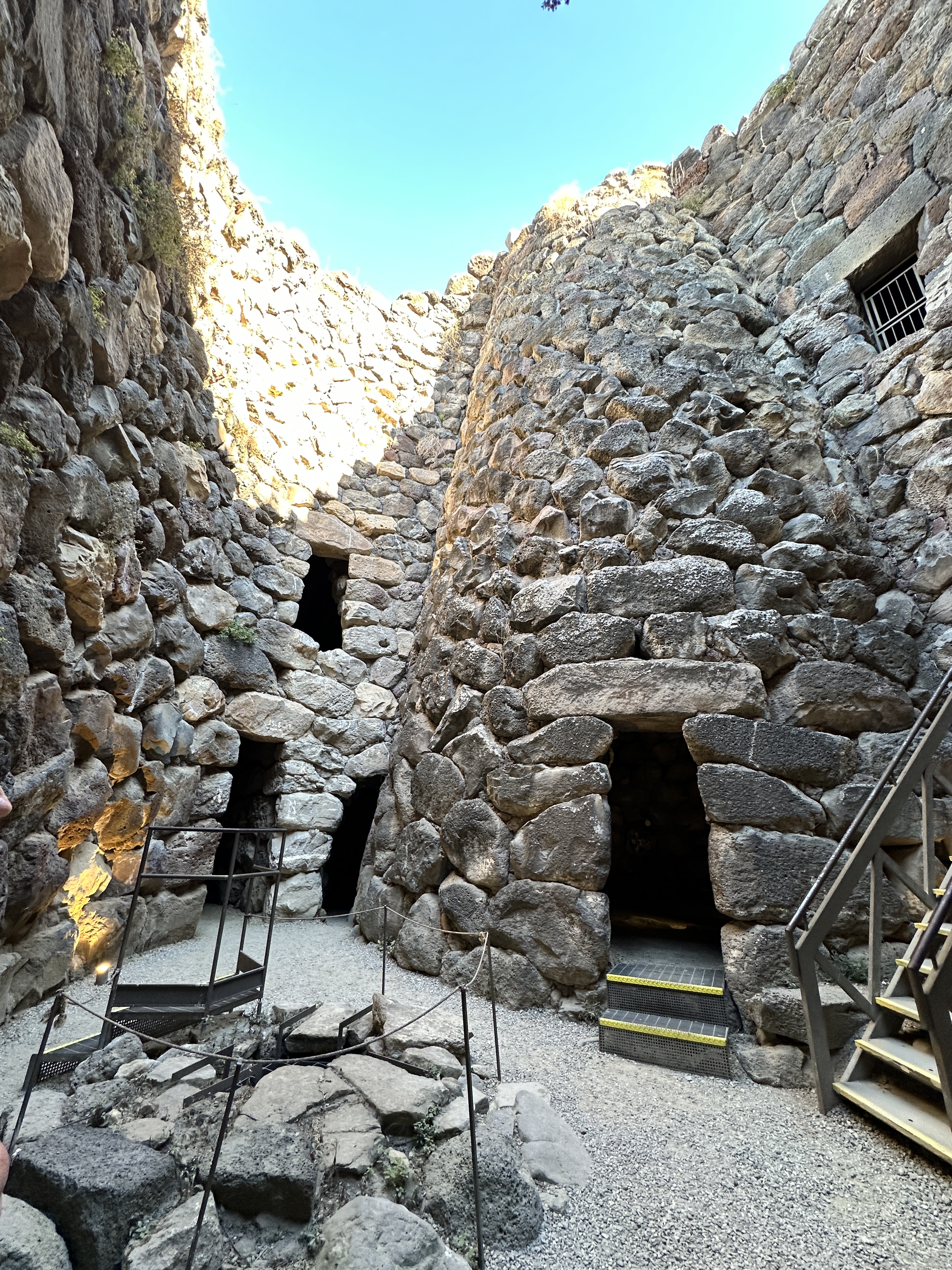
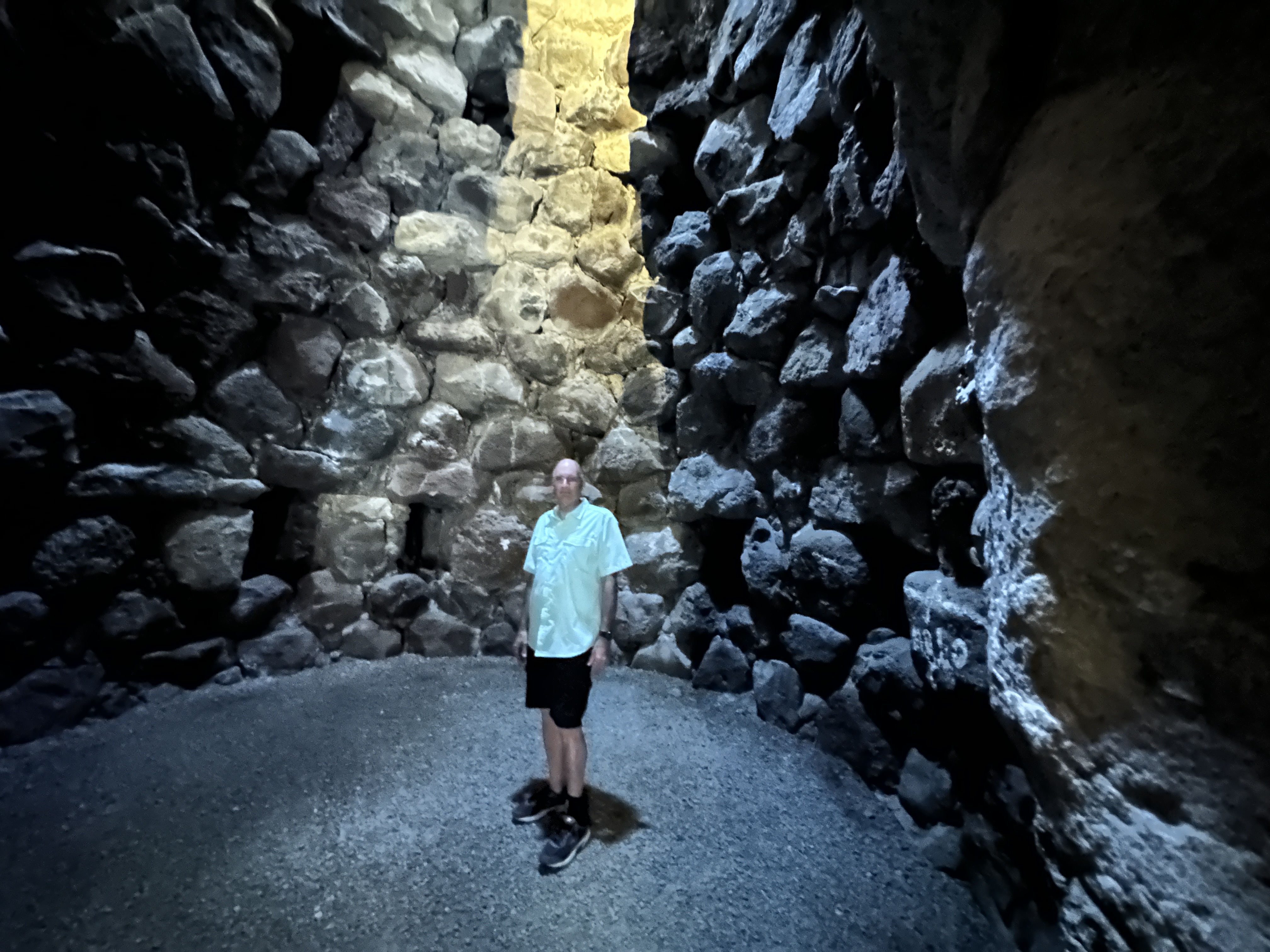
Nuraghe Santu Antine
A view of Nuraghe Santu Antine from the exterior. It doesn’t look that impressive or large from the exterior; however we were surprised how large and extensive the interior was once we entered.
Nuraghe Santu Antine – courtyard views – including a well in the left photo above.Interior views of Nuraghe Santu Antine – tall room, passageway, and stairway to 2nd level.
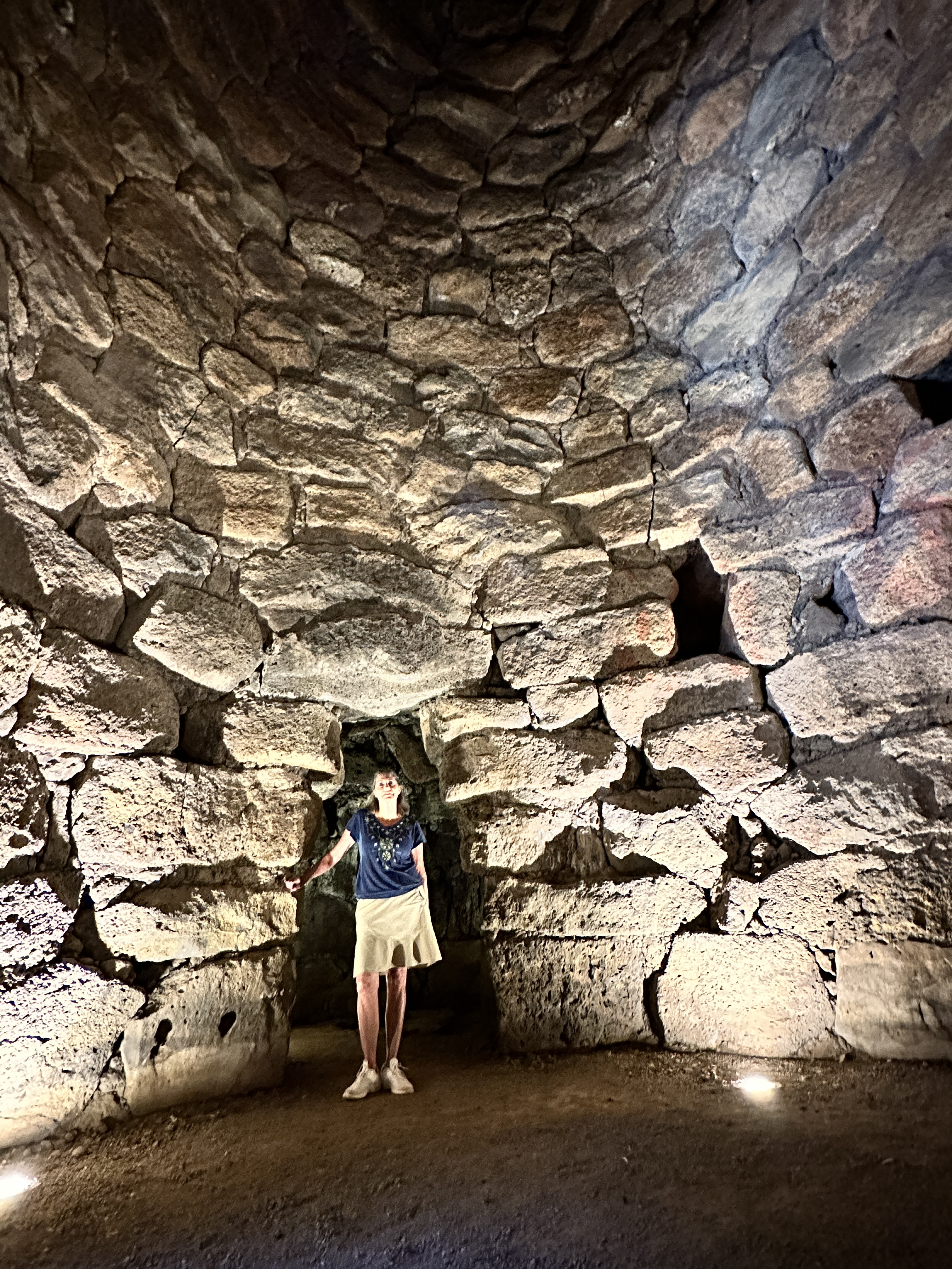
Nuraghe Santa Cristina
Santa Cristina may have been my favorite site, perhaps because there is so much to see here. There are Nuraghe ruins, including a fascinating ancient well, and medieval-era buildings also. It has been a site used for religious purposes for centuries.
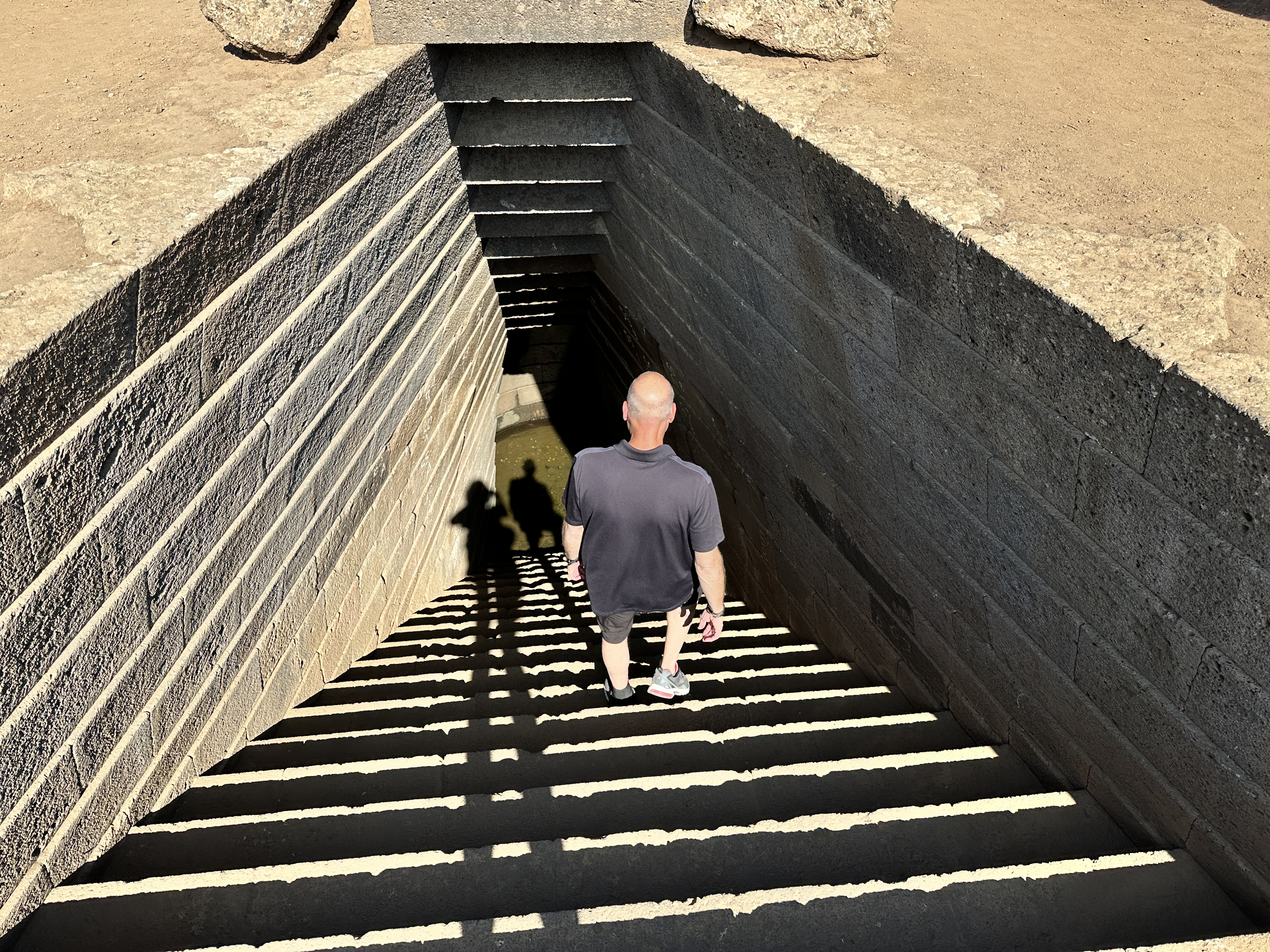
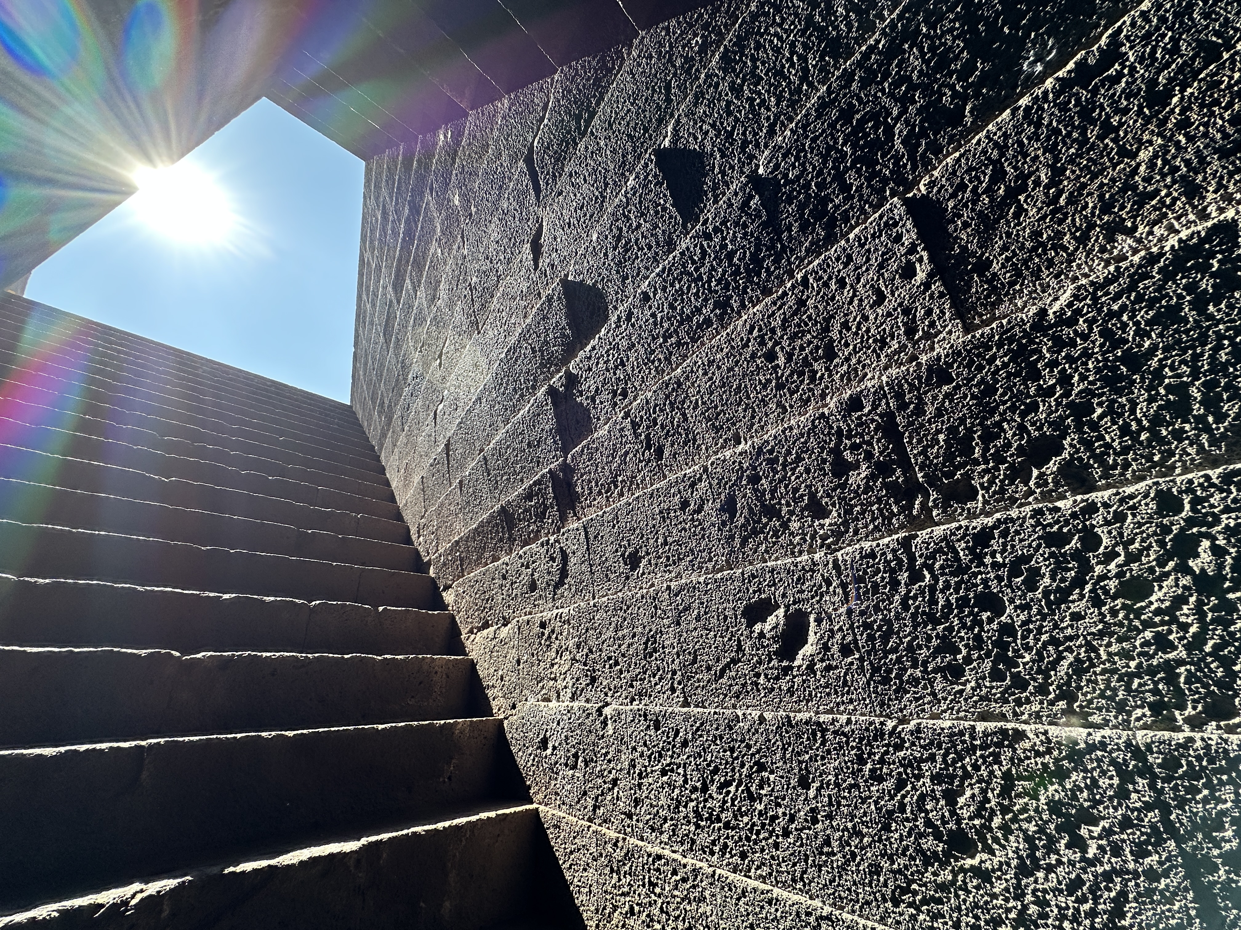
Sacred Well
Sacred Well from ground level. I was amazed how the stones and stairway have held up over 3,000 years – the Well dates from the 11th century BC.
View from the bottom of the well stairway.
Above – images at the bottom of the Sacred Well. Note the precise stone work.
Nuraghe
Nuraghe at Santa Cristina, part of the same complex as the Well and the Medieval village.
Medieval Church
Left – The little church at Santa Cristina was built around 1200 AD. Right – Monks’ quarters next to the church. These structures are between the Sacred Well and the Nuraghe. Be prepared to do a little walking at Santa Cristina.
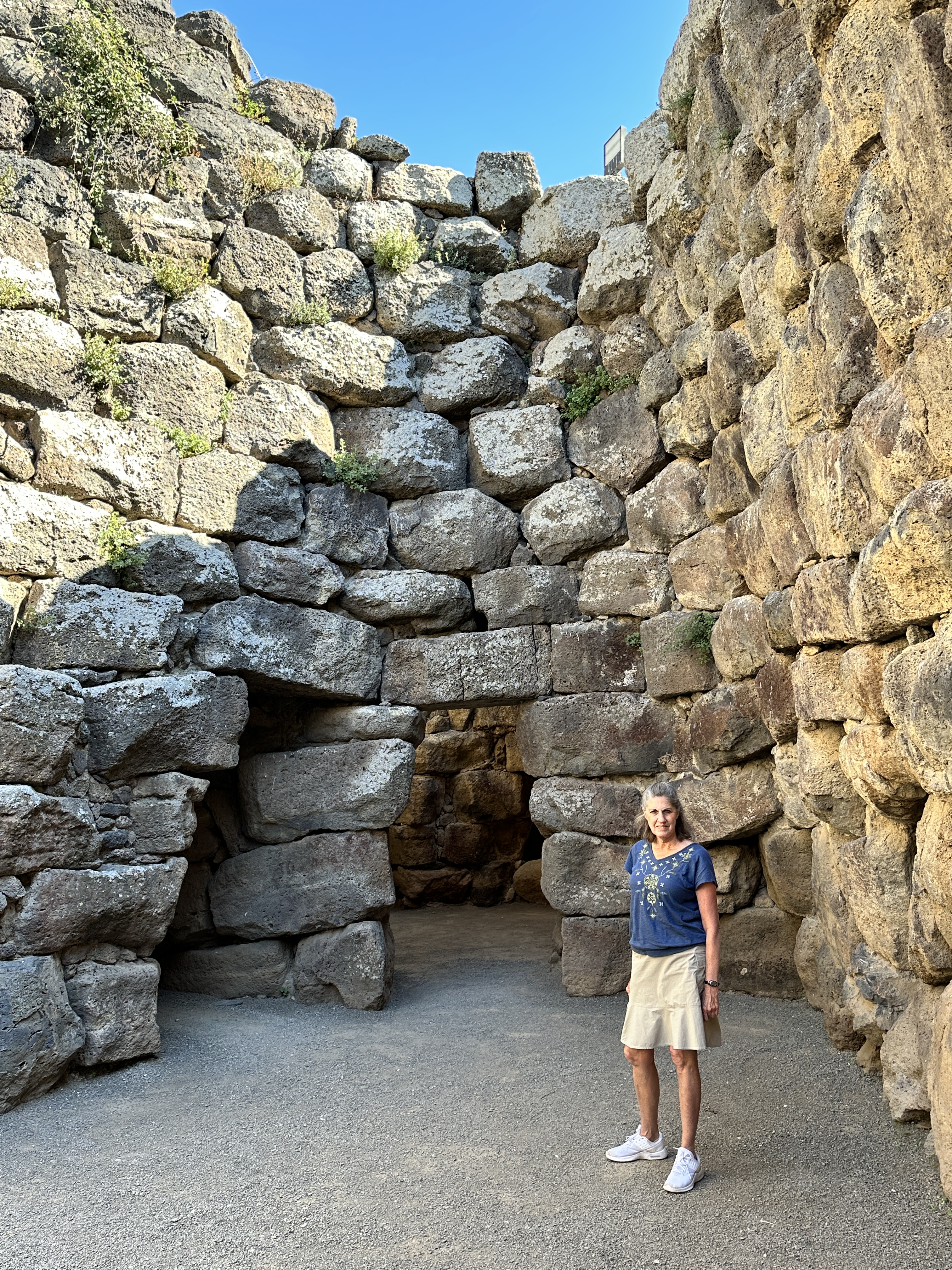
Su Nuraxi di Barumini
Su Nuraxi di Barumini is one of the largest, if not the largest Nuraghe site in Sardinia. It is a World Heritage Site, and when you purchase your ticket you must join a group with a guide to visit. Our tour guide was very kind and patient, he explained the features of the site in French and English, given the mix of our small group.
Above left – the main tower of Su Nuraxi from a distance. The image in the center shows what the Nuraghe looked like in its prime – very similar to a medieval castle. Right – the village dwellings below the main tower.Above – views of the village ruins.Images of the doorways and courtyard of Su Naraxi.Above – interior passage ways and rooms of Su Naraxi.
In addition to the glorious beaches of Sardinia, it is certainly worth your time to visit a few of the fascinating archeological sites. Be careful in the structures. Some of the stairway stones are very slick and trust me, it’s easy to slip. Also, watch your head, many of the passageways are short and narrow. The sites we visited were well sign-posted, had parking available and are well-maintained.
We started our Sardinia vacation by flying (from Frankfurt) into Olbia on the northeast coast of Sardinia. This was a great place to begin (and end) our Sardinian adventures. Olbia is ideally situated near the famous Costa Smeralda and the La Maddalena Archipelago, as well as other costal towns, archeological sites and beaches. (See here for an overview of regions we visited in Sardinia, we toured the island in a counter-clockwise route).
Olbia
While not a major tourist destination itself, Olbia has a lovely old town and is situated on a beautiful harbor. We spent our first night here, enjoying dinner in one of the many restaurants on the main pedestrian street and browsing the vendor booths lining the harbor promenade – a very festive atmosphere.
Views of Olbia and harbor, with Tavolara Island (right), the mountainous island with more beautiful beaches in the far distance.
The next morning we drove north toward Porto Cervo, the heart of Costa Smeralda, stopping at beaches along the way. Our first day started out cool, windy and slightly rainy, but by the afternoon it was warm and sunny. The weather didn’t stop us from enjoying the sights along the coast and wasn’t a factor for the rest of our trip.
Costa Smeralda
Costa Smeralda got its name and started becoming fashionable in the early 1960’s, due to development efforts led by Prince Karim Aga Khan. It’s maintained that status ever since. Our stay here was brief, given the many areas of Sardinia we wanted to visit. Below are a few images of the beautiful coastline of this region.
This sign, along the coastal road from Olbia to Porto Cervo lets you know you’re entering the fabled Costa Smeralda.
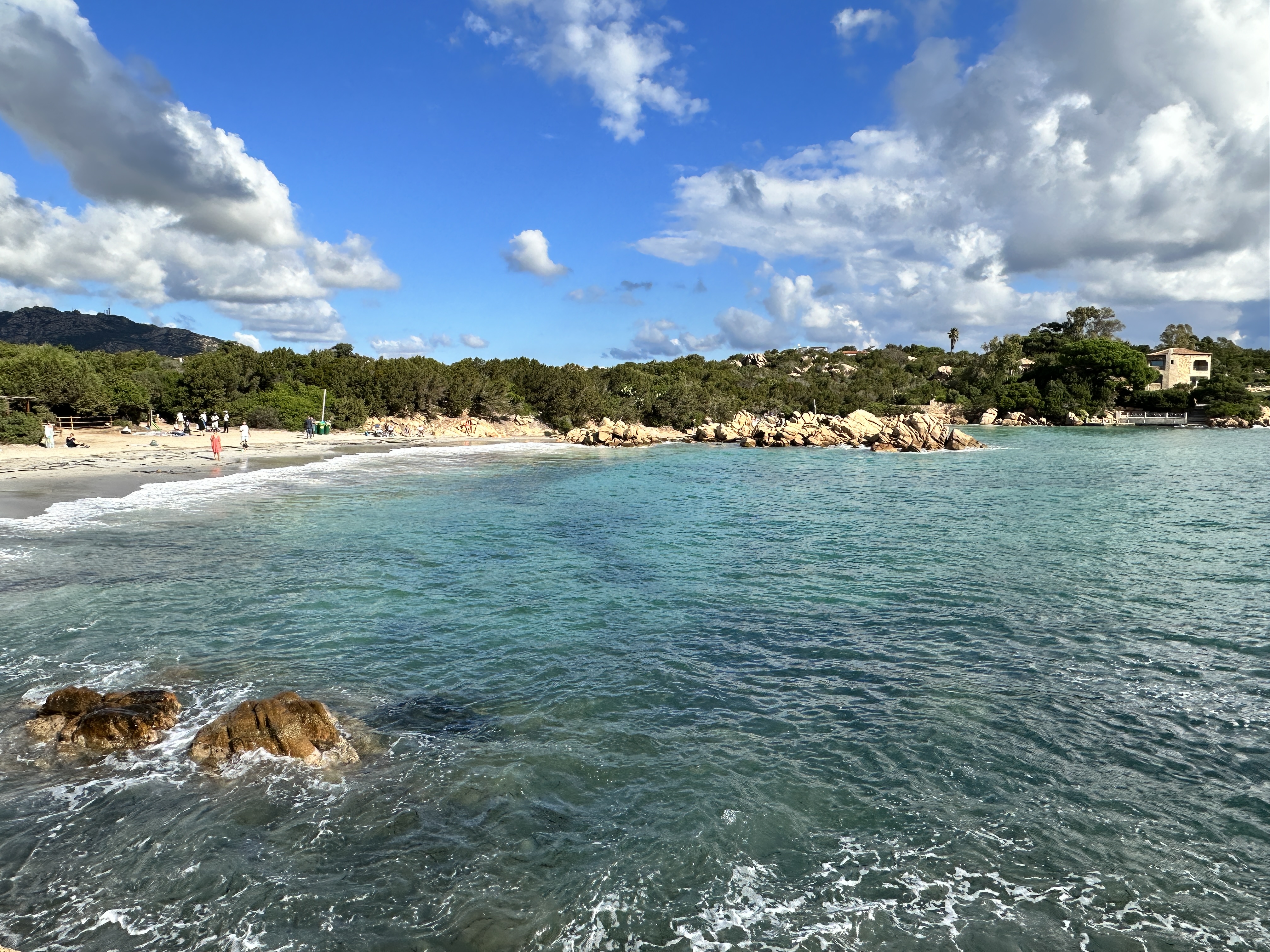
Capriccioli Beach
Spiaggia Principe, considered Sardinia’s most famous beach (although it’s only one of hundreds as beautiful), on Costa Esmarelda.
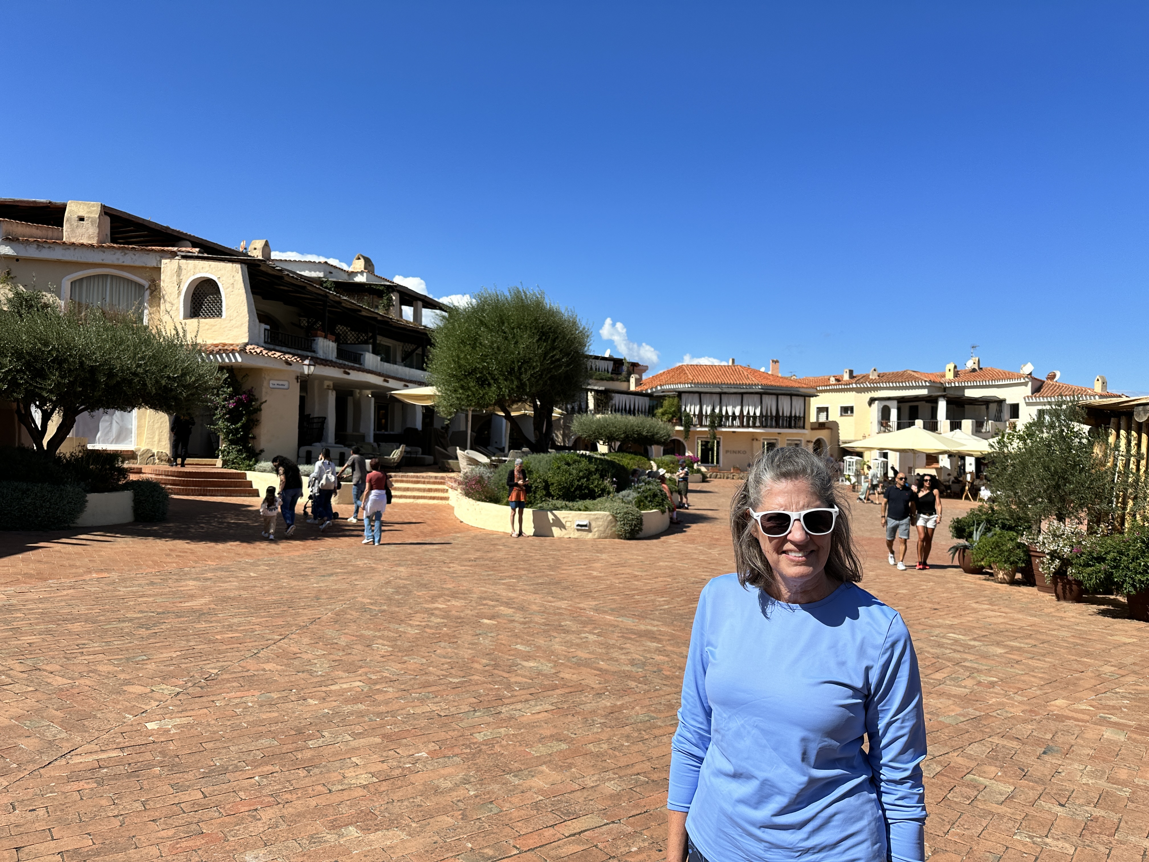
Porto Cervo, the center of Costa Smeralda, was pretty quiet in early October. We enjoyed walking around the harbor and the town, with many expensive shops.
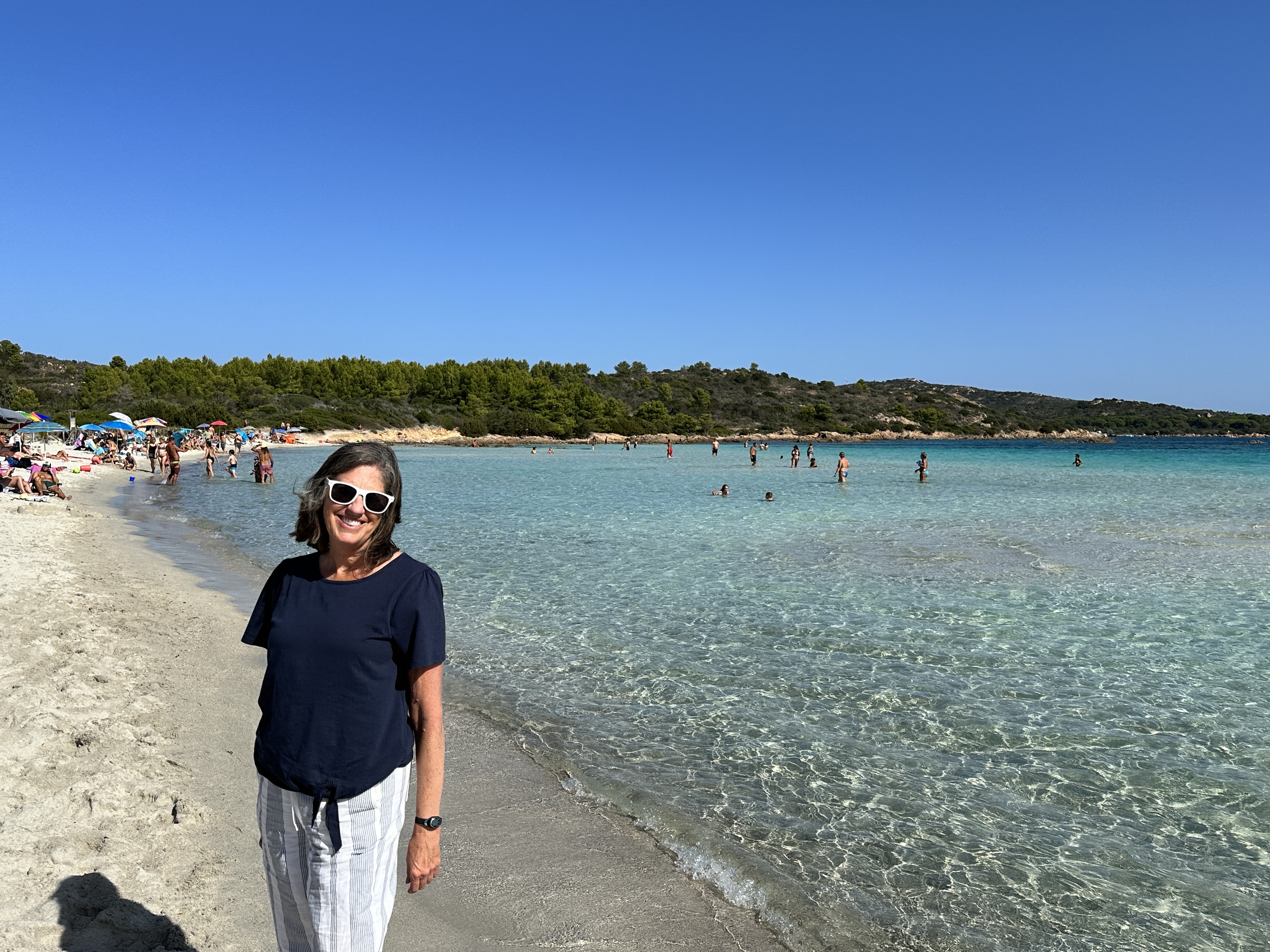
The calm, clear waters of La Celvia Beach, south of Porto Cervo.
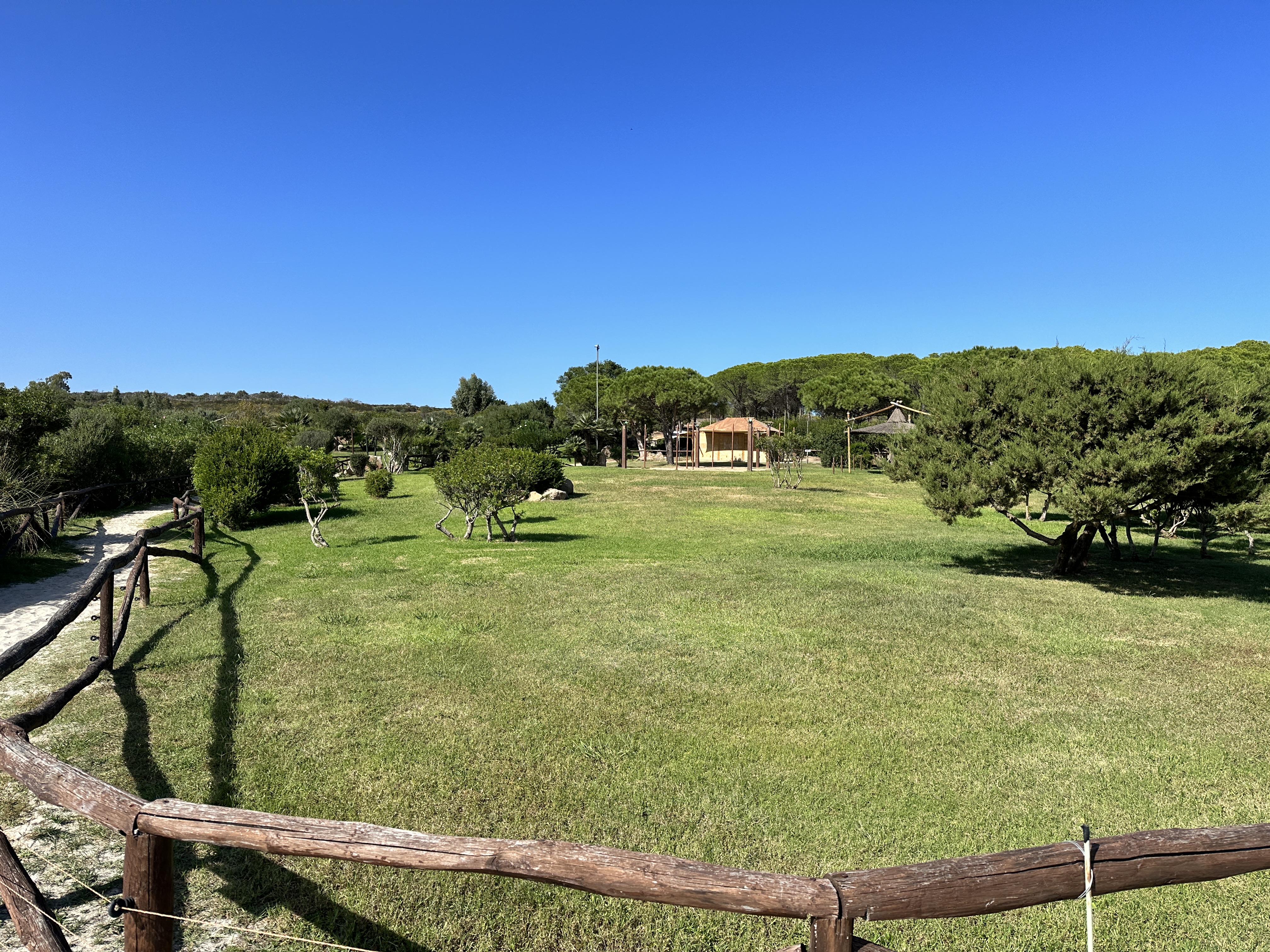
La Celvia beach (left and above), was just a short distance from our hotel in the Costa Smeralda resort area of Cala di Volpe (above right), and near a golf course as well as Capriccioli and Spiaggia Principe beaches. What more could you ask for!Although not directly part of Costa Smerelda, Spiaggia Cala Brandinchi, near San Teodoro, not far south of Olbia, is another great beach and park, with some lawn area just behind the beach for games or picnics. We were flying out of Sardinia shortly after our visit here and so we didn’t get to enjoy this beach for long!
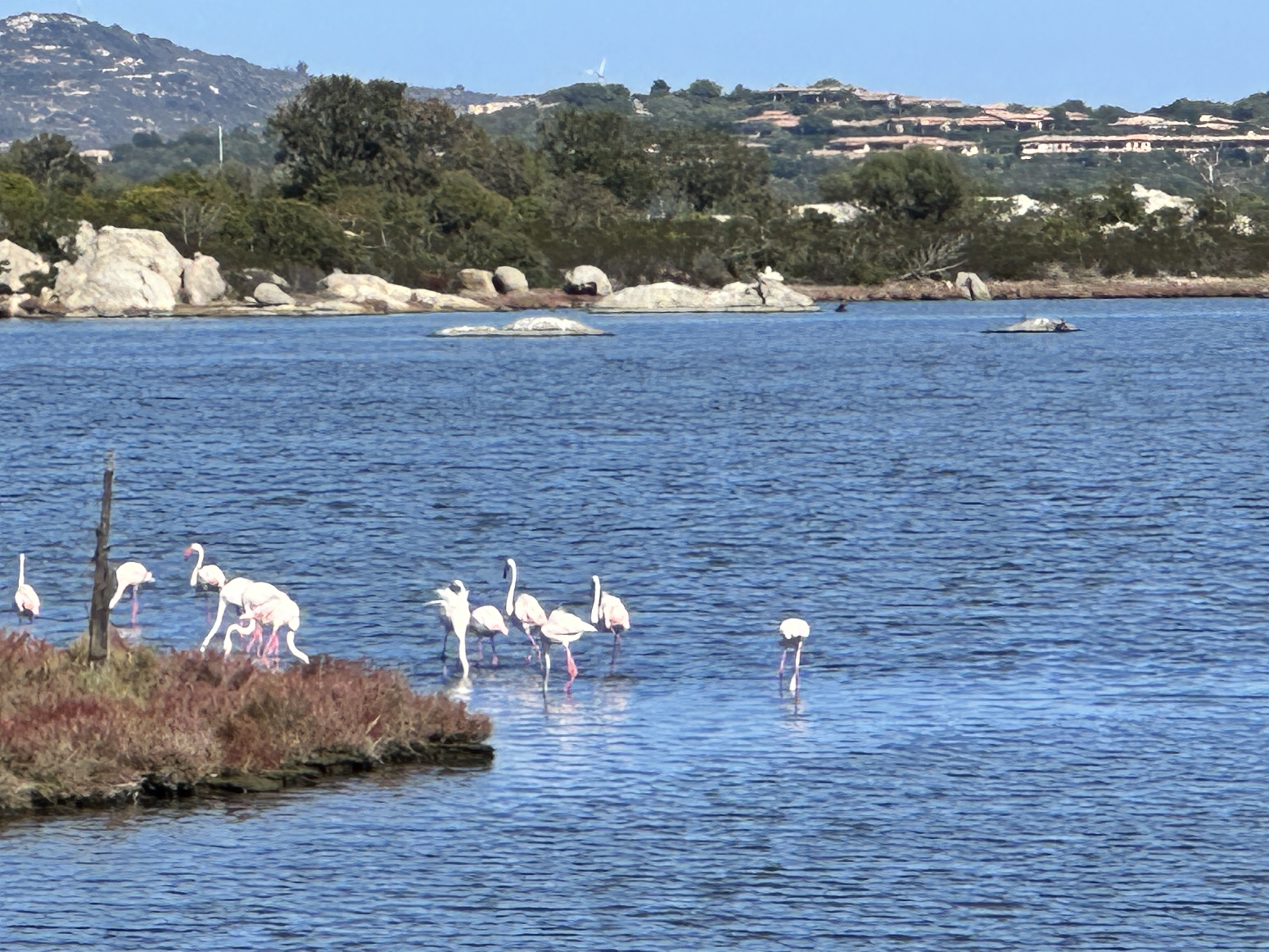
Real pink flamingoes near San Teodoro!
As with any region of Sardinia, it would be easy to spend your whole vacation right in (or around) Costa Esmeralda. If you want to live here, be ready to open your checkbook. It’s one of the most expensive regions in Europe and given its allure, it’s easy to see why.
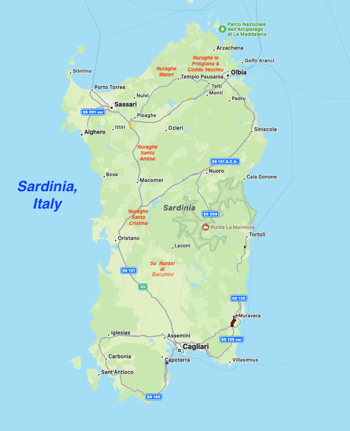
As I have mentioned is previous posts, we LOVE the islands of the Mediterranean. They are some of my favorite destinations in world. After visiting Mallorca and Menorca (which belong to Spain), the next island on our list was Sardinia (part of Italy). We had been to Sardinia’s northern island neighbor, Corsica (part of France) years ago and from the beautiful southern coastal town of Bonafacio we could see Sardinia in the distance, only about 12 km (7.5 miles) away. We visited Sardinia in October, which is a great time to go – the water was still warm and the crowds were limited.
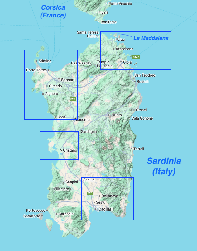
This map of Sardinia shows the five main regions we visited in Sardinia.
I will be sharing more posts on our Sardinian adventures soon, but first here are some things you may not know about about this beautiful island.
1. Sardinia is part of Italy
Although an autonomous region, Sardinia is definitely Italian. Some Americans have never heard of Sardinia and really have no idea that it’s part of Italy. The Sards have their own language but of course speak Italian, English, and other European languages quite fluently. It was easy for us to get by on English and a few Italian phrases. The food and gelato are wonderful, as in other regions of Italy.
2. Sardinia is big, and a relatively sparsely populated island
This is important to keep in mind when planning a trip – allow two or three weeks to see the whole island or if you have less time, perhaps concentrate your time in one region. Sardinia is the 2nd largest island in the Mediterranean (just slightly smaller than Sicily) but has just 1/3 of Sicily’s population. It is about 170 miles long and 90 miles wide. We covered a lot of ground in two weeks, but still did not see everything (see map above), including the southwest coast.
3. Sardinia boasts some of the most stunningly beautiful coastline (and water) in the world
Cala Goloritze, Gulf of Orosei, accessible only by boat or a 3.5 km hike. The color of the water was the most incredible turquoise hue I’ve ever seen.
Sardinia has an embarrassment of beaches – no matter where you are on the island, you’re close to some of the best beaches in the world. The Gulf of Orosei on the eastern side of the island has a breathtaking coast although it’s not easily accessible, except by boat or via some steep hiking trails.
4. There are hundreds of incredible beaches, many of which are undeveloped and uncrowded
La Pelosa Beach, near Stintino, Sardinia. You must make a reservation for this beach if visiting during high season. It is worth the hassle (which is not a big deal nor expensive).
Some beaches might have a refreshment stand, a few might be close to some resorts, but often there are no hotels or condos anywhere to be seen. Admittedly, there are (just a few) beaches that are so popular you must have reservations during the high season or can only be accessed with a guide, and there a few beaches that are not accessible at all – due to preservation efforts, speaking of which…
5. Sardinians take their beach sand seriously
From pink sand beaches to shiny quartz sand beaches to powdery white sand, the sand is beautiful everywhere. However, don’t even think about taking a sample home with you. You will be fined. You are also required to have mats underneath your beach towels so as to not inadvertently trap sand and take it home in your towels.
Spiaggia Rosa, on Budelli Island (near La Maddalena). You cannot set foot on this pink sand beach, they are protecting it for future generations. However you get a view of it from a boat tour, as in this photo.
Example of the fine quartz sand and pebbles found in Sardinia.
6. A car rental is essential
Unless you plan to go straight from the airport to a resort and straight back to the airport or plan on a tour by a group bus, a car is the only way to really see the island and reach some of the beaches and tourist sites. Some sights or hiking trails are remote. Since the island’s population is sparse, driving was not a problem – I did not feel rushed or on edge with crazy drivers pushing me to speed up or forcing me to get out of the way.
7. Sardinia offers something for everyone
Friendly, welcoming locals – check. Beautiful beaches – check. Warm, clear water – check and check. Charming medieval towns – check. Fascinating ancient historical sights – check. Remote mountains, rock climbing, forests and hiking trails – check, check, check and check. Diving – check. Excellent food – check. What more could a person want?
A view of Alghero, on the northwest coast of Sardinia, a beautiful medieval town, one of our favorites on Sardinia.
Nurhage La Prisigona Historical Site (14th century BC), near Arzachena, Sardinia.
8. Sardinia has its own island get-aways
As funny as it may sound, Sardinia can be considered a ‘mainland’ and just off its coast (such as the northeast coast) lie an archipelago of islands (the main island is La Maddalena – see map above) accessible by only ferry and smaller boat, some of which are part of a national park. These islands are home to some of the best beaches and best hikes anywhere in Sardinia.
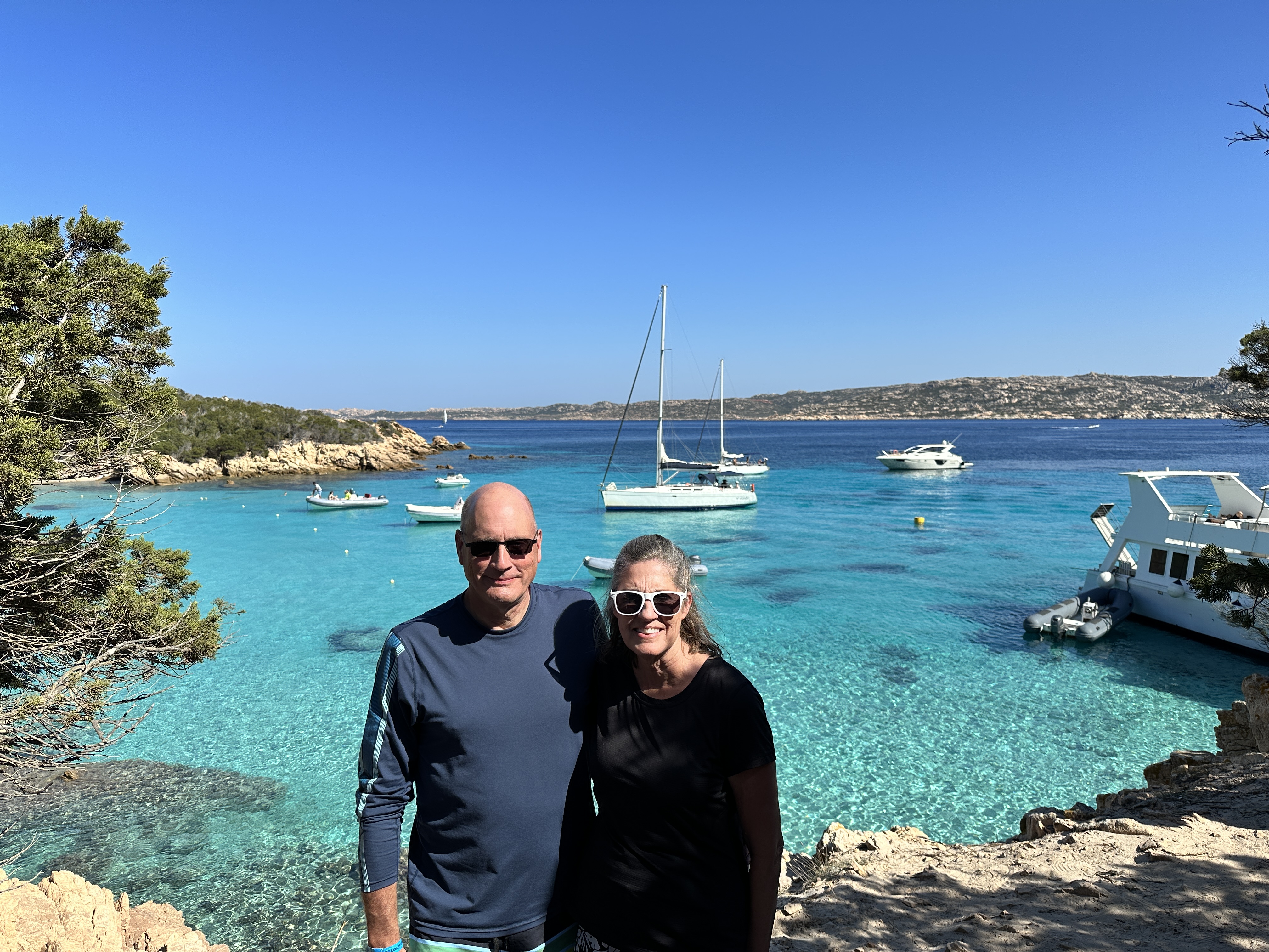
The island of Spargi, part of the La Maddalena Archipelago. We could have stayed here our whole trip!
9. Sardinia is not just for the jet-setting crowd
In the 1960’s Coasta Esmeralda was popularized and has since become a jet-setting hotspot. This part of the northeast coast (near Olbia) certainly has some beautiful beaches and coastline. While you will find big yachts, high-end real estate, retail and eating establishments here, this is just one small enclave of the island. The rest of the island seems unfazed (and untouched) by the movie star and billionaire crowd.
View of Porto Cervo, the center of Coasta Esmeralda.
10. Go Now
Sardinia isn’t quite on the main tourist map yet, although posts like this don’t help! The majority of visitors are Italian (this is their backyard!), followed by French and Germans. On one of our boat tours, we were with some Swiss and Belgian tourists. We ran into a few tourists from the U.S., but not many. Very few tourists seem to explore the whole island, there are lots of “untouched” little mountain villages and quiet beaches to find solitude if that’s your thing.
The cute little village of Gavoi in north central Sardinia.
Word is getting out, so go now! Here’s one of my recommended websites for great information on Sardinia tourism. I read almost every post Claudia has written, very helpful. Of course, I will be publishing information on each region of Sardinia we visited over the course of the coming weeks.
Note: Featured image – Cala Marilou, Gulf of Orosei