On our last full day in Sardinia, Italy we decided to take a small boat tour along the eastern coastline, specially the Gulf of Orosei. All of Sardinia was amazing, but this day-trip was icing on the cake. The coastline is amazing – towering cliffs and some of the prettiest beaches and water anywhere on the planet.
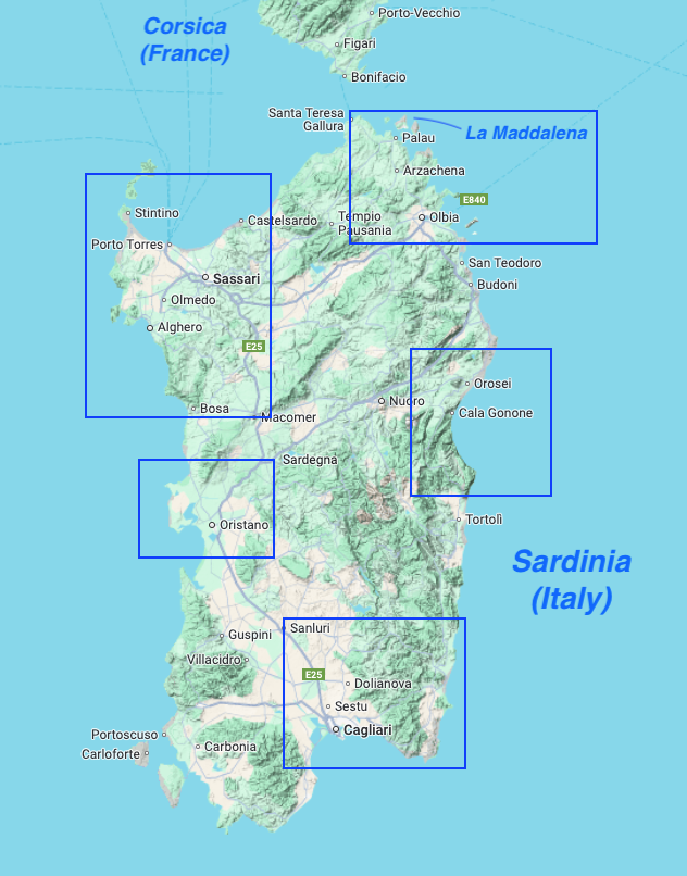
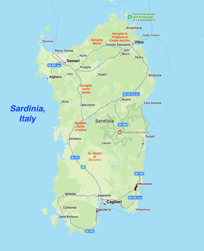
This maps show the general regions we visited in Sardinia. The Gulf of Orosei is on the central east coast.
We stayed two nights in the small town of Santa Maria Navarrese, a perfect spot from which to take the boat tour and a lovely place to visit in itself. Our visit was in late September and early October, after the summer crowds were gone but yet still warm enough for boating and swimming.
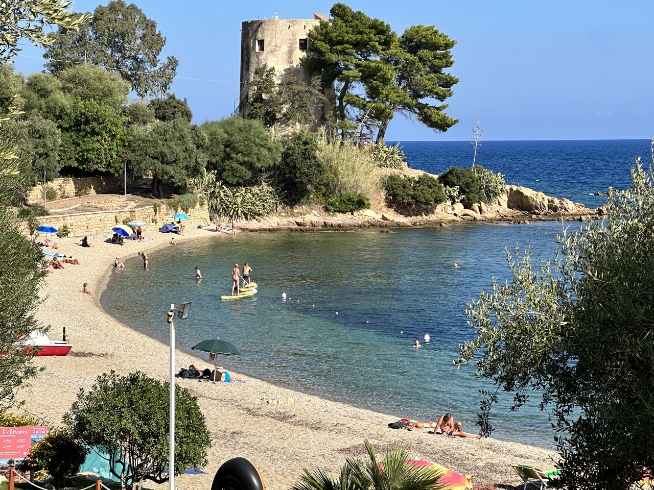
A view of Santa Maria Navarrese’s own beach, right next to the small town.
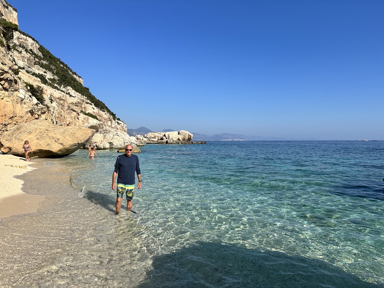
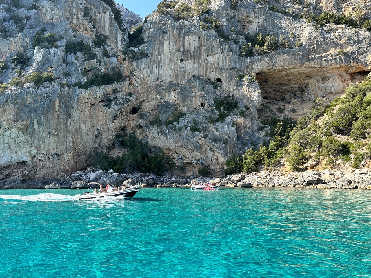
Below are a few of the images captured during our full-day boat trip. Our boat held about 10 people, which was perfect. We visited a few secluded sea caves and coves before visiting some of the more popular beach and swim stops.
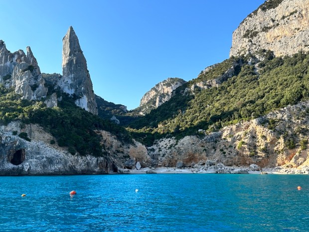
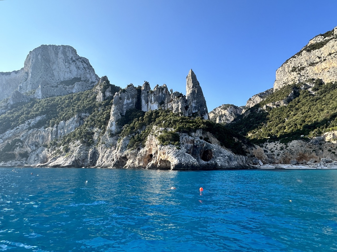
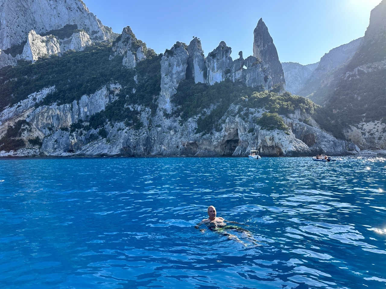
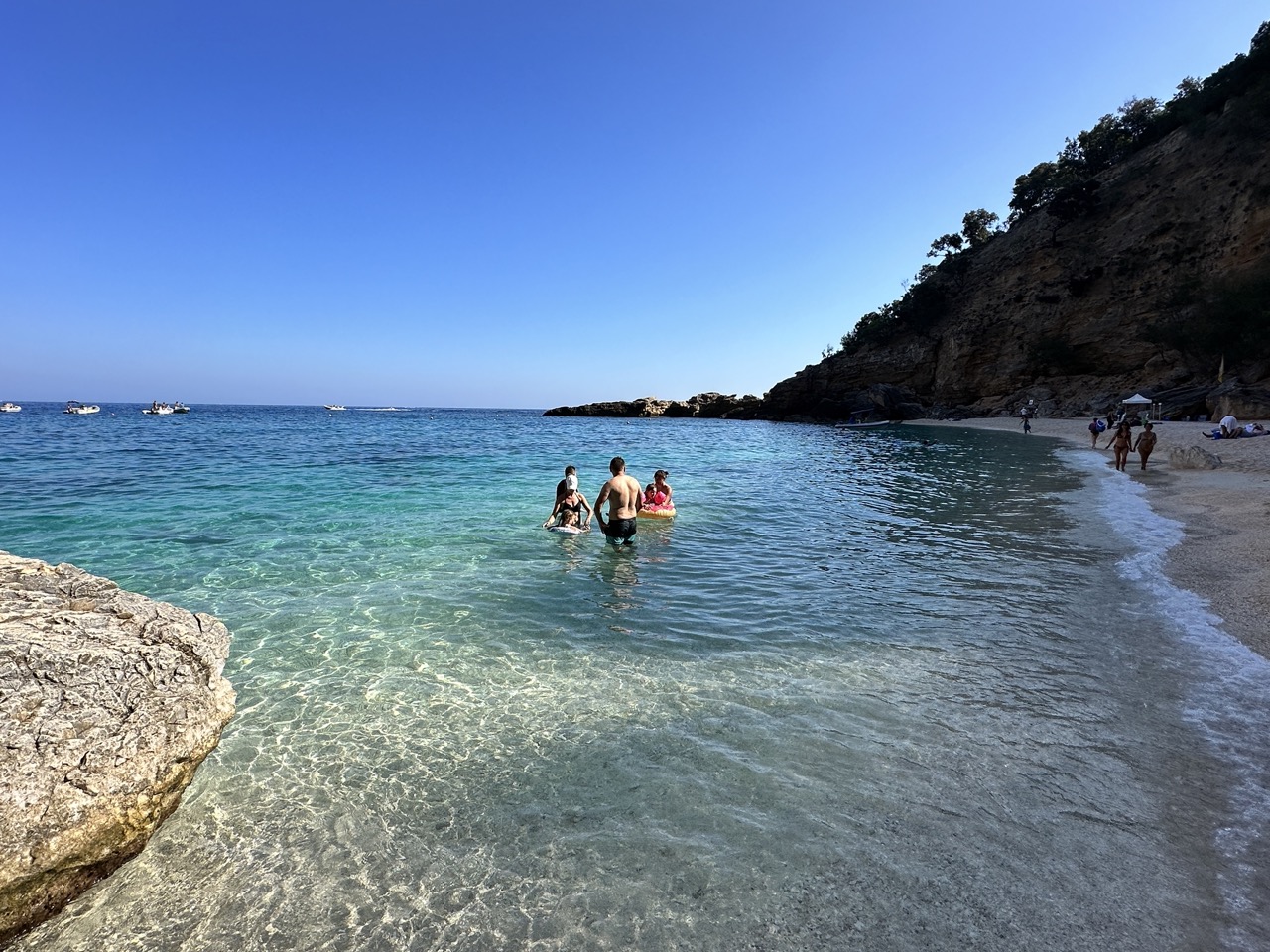
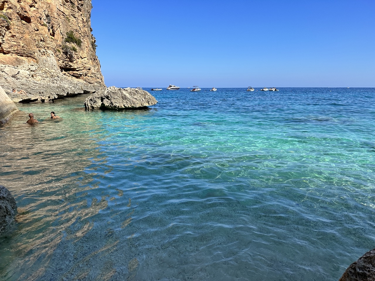
One of the postcard images of Sardinia, Cala Goloritzè. You can take a pretty steep and long hike down to the beach, but we opted for the boat tour to get this view. The boats do not land on the beach (I believe they are forbidden to do so), but do allow time to swim in the area.
We stopped by Cala Goloritzè again in the afternoon for a swim, on our way back to Santa Maria Navarrese. I cannot adequately describe the beauty of the turquoise water.
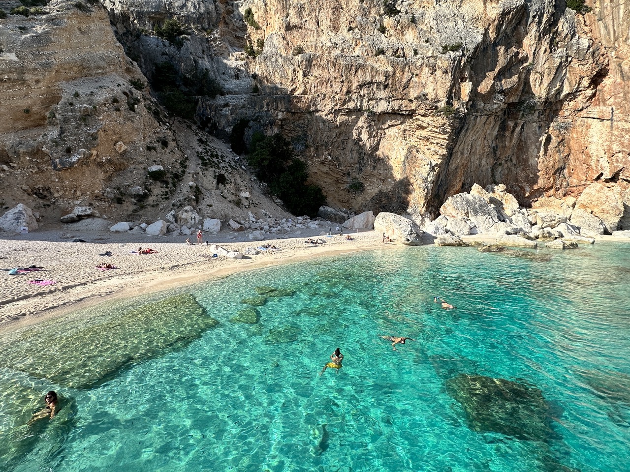
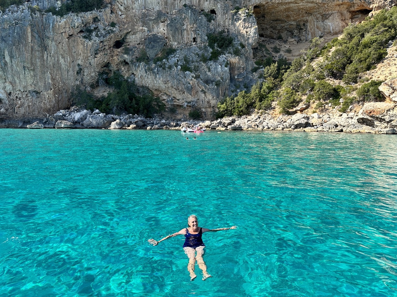
A view of Cala Marilou, one of my favorite stops along the Gulf of Orosei. What made it a favorite is that there are several beaches and coves to explore, such as shown below.
Another part of Cala Marilou, a small cove of stunning cliffs and beautiful water.
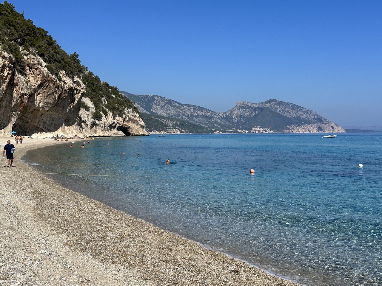
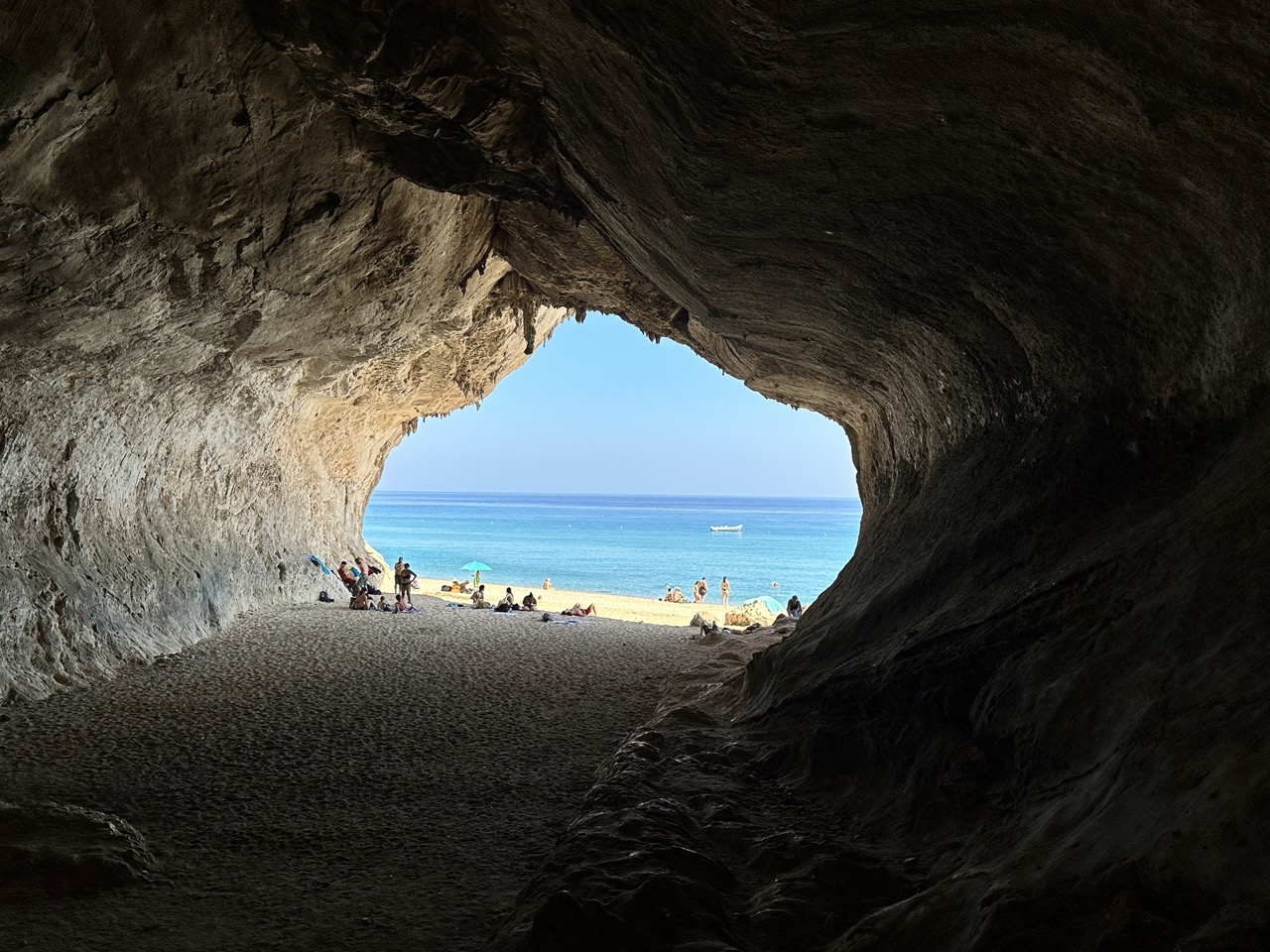
A view of Cala Luna, we stopped here over lunch time. There is a small bar and cafe behind the beach area.
A large cave on the beach at Cala Luna – a great place to get out of the sunshine if needed!
Above – another swim stop along the coastline of the Gulf of Orosei.One of our last stops of the day, Cala Biriola.
Villasimius is one of my top three locations for tourists in Sardinia, Italy (the other two would be the Gulf of Orosei, which I will write about shortly) and the La Maddalena Archipelago which you can learn about here. Villasimius is about an hour by car (62 km) southeast of Cagliari, Sardinia’s capital.
Villasimius is at the very southeast tip of Sardinia.
There are around 20 fantastic beaches near Villasimius, plus there is a golf course nearby and a number of vacation rental options in the area.
Main street in Villasimius.
We stayed in a little villa just outside of town. The landlord met us in town and led us out to the villa. Even though you are only 62 km from Cagliari, this part of the island is pretty rural and quiet.
The courtyard and pool at our villa in Villasimius. Breakfast was served on the patio (left side of photo).
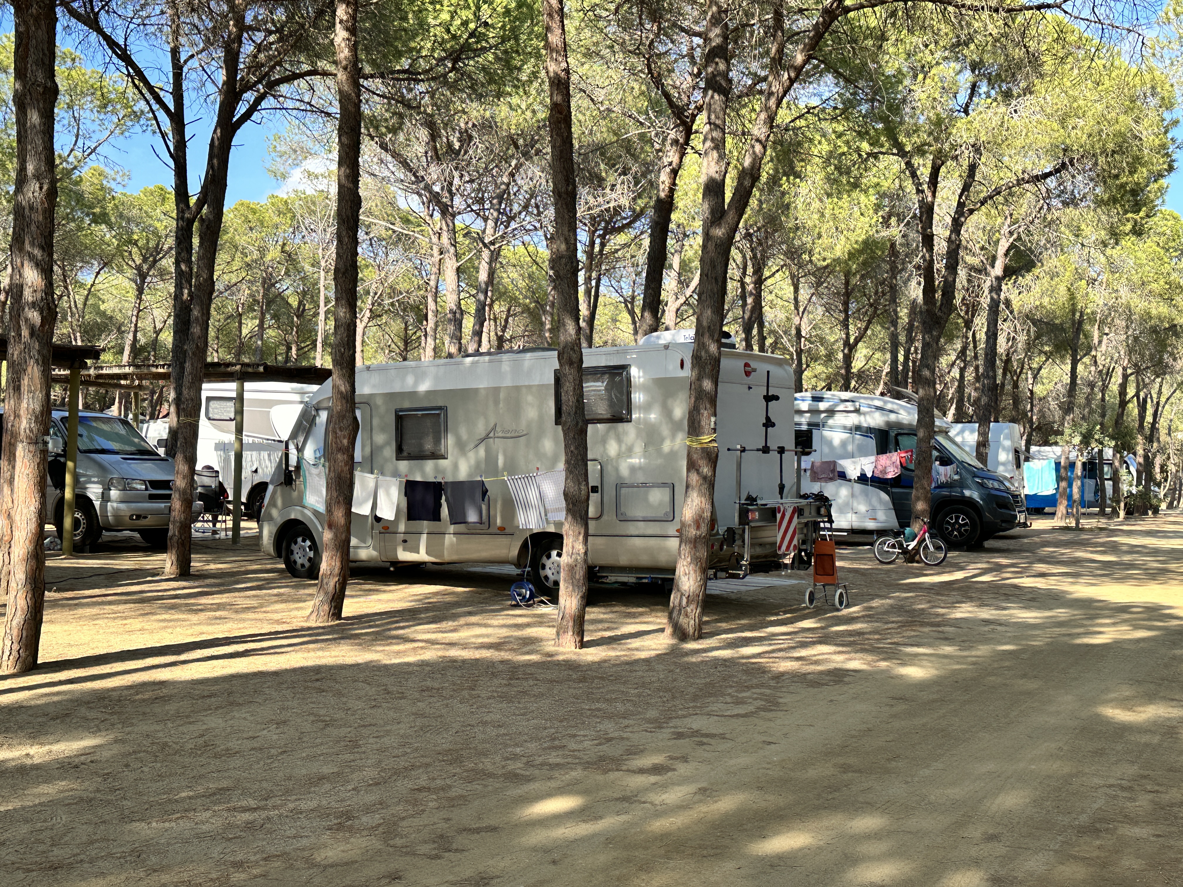
RV’s are a popular option in Sardinia too. This RV park was just outside Villasimius.
Villasimius Beaches
We visited a few beaches during our two-night stay. It would have been easy to spend a week here.
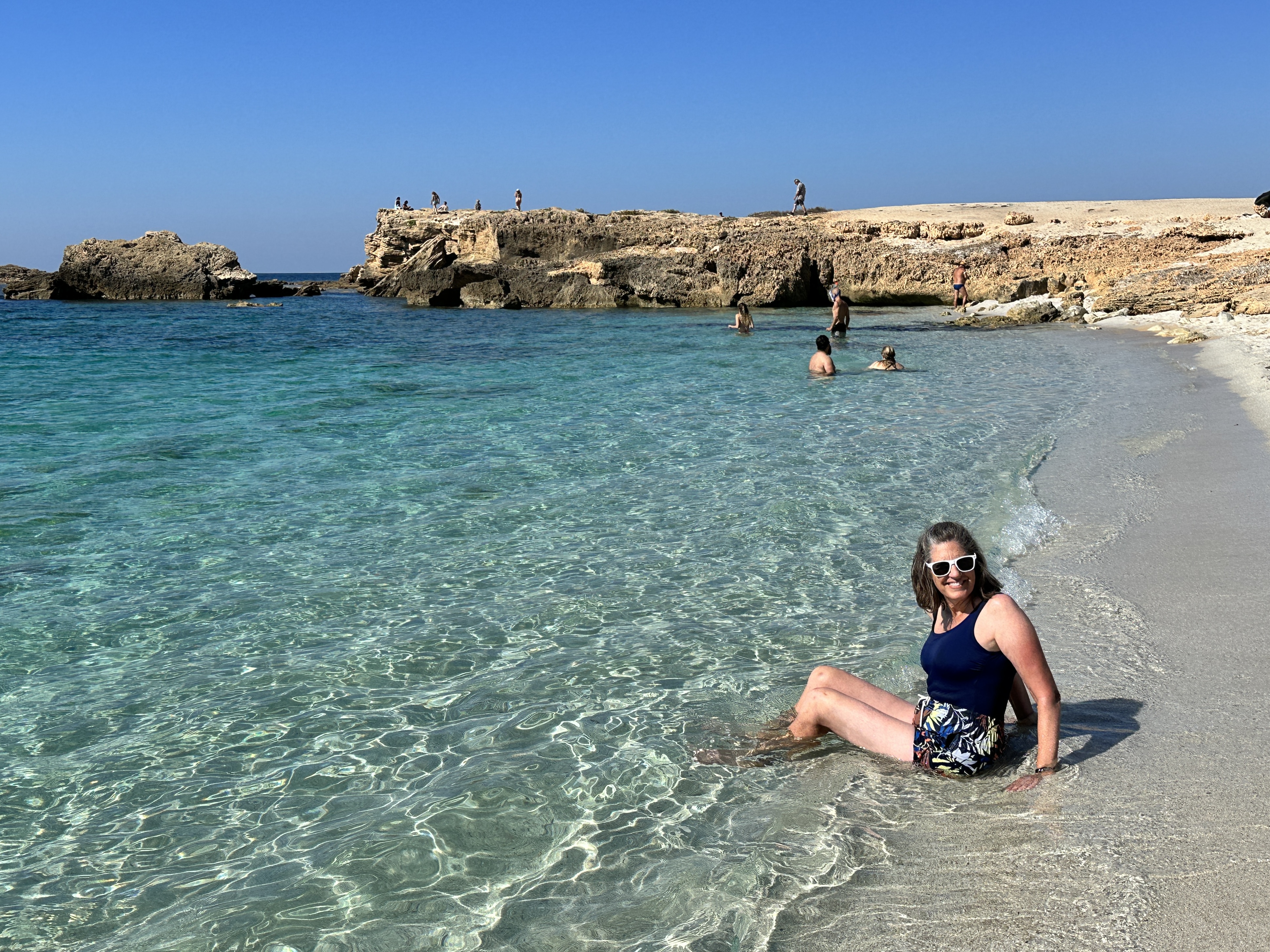
Above – a couple views of Spiaggia del Riso (known as “rice beach” – due to the quartz sand).Above left – Spiaggia di Porto Guinco, right – the 16th century Torre di Porto Guinco at the south end of the Spiaggia. Amazing clear and shallow water of Spiaggia di Simius Beach, just north of Spiaggia di Porto Guinco. We spent a morning here, it was about as perfect a setting as can be. There is a paid car park close by and cafes for snacks.
After a hard day at the beach, there was nothing like a delicious dessert crepe in the town of Villasimius to end another perfect day!
Oristano is not likely to be on the main tourist route in Sardinia, Italy especially if time is limited. However, if you have the time, you should definitely check it out. There is a lot to do in this region of Sardinia. Here are the main sights we visited. In addition to the sights listed below, there are ancient Nuragic sites not far from here. For a map of Sardinia and to learn more about these sites, see my post here.
Is Aruttas Beach
This beach on the Sinis peninsula is about 22 km (13 miles) from Oristano and one of the region’s most famous. There is a large parking lot and a refreshment stand near the beach. The quartz sand on this beach is amazing, I wish I had taken a close-up of it – it looks like translucent rice. Just another perfect beach in Sardinia! As with all beaches in Sardinia, it is a crime to remove the sand – be sure to leave the sand where it belongs on the beach for others to enjoy!
Views of Is Arutas Beach.
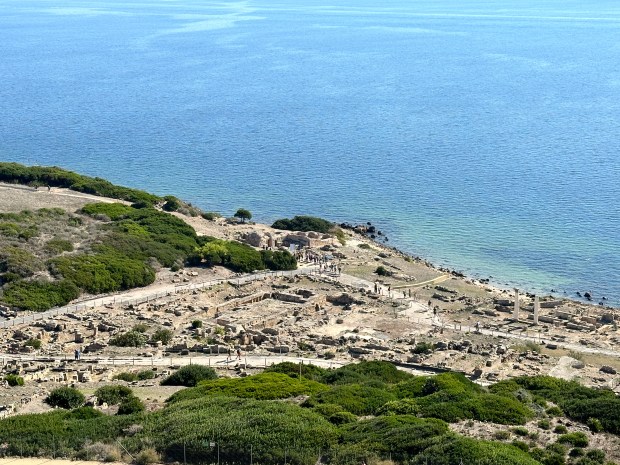
Tharros Roman Archeological Site
Tharros was occupied for nearly 2,000 years, from the 8th century BC to about 1050 AD. It sits near the end of the Sinis Peninsula, and it’s a spectacular setting.
A view of the ruins of Tharros and the late 15th-century San Giovanni Tower, which you can climb for a small additional fee.
Additional views of the ruins of Tharros.
This gorgeous beach is a stone’s throw from Tharros. Roman ruins, a 15th- century Spanish Tower and beautiful beach – what more could you ask for?!
Fordongianus Roman Archeological Site
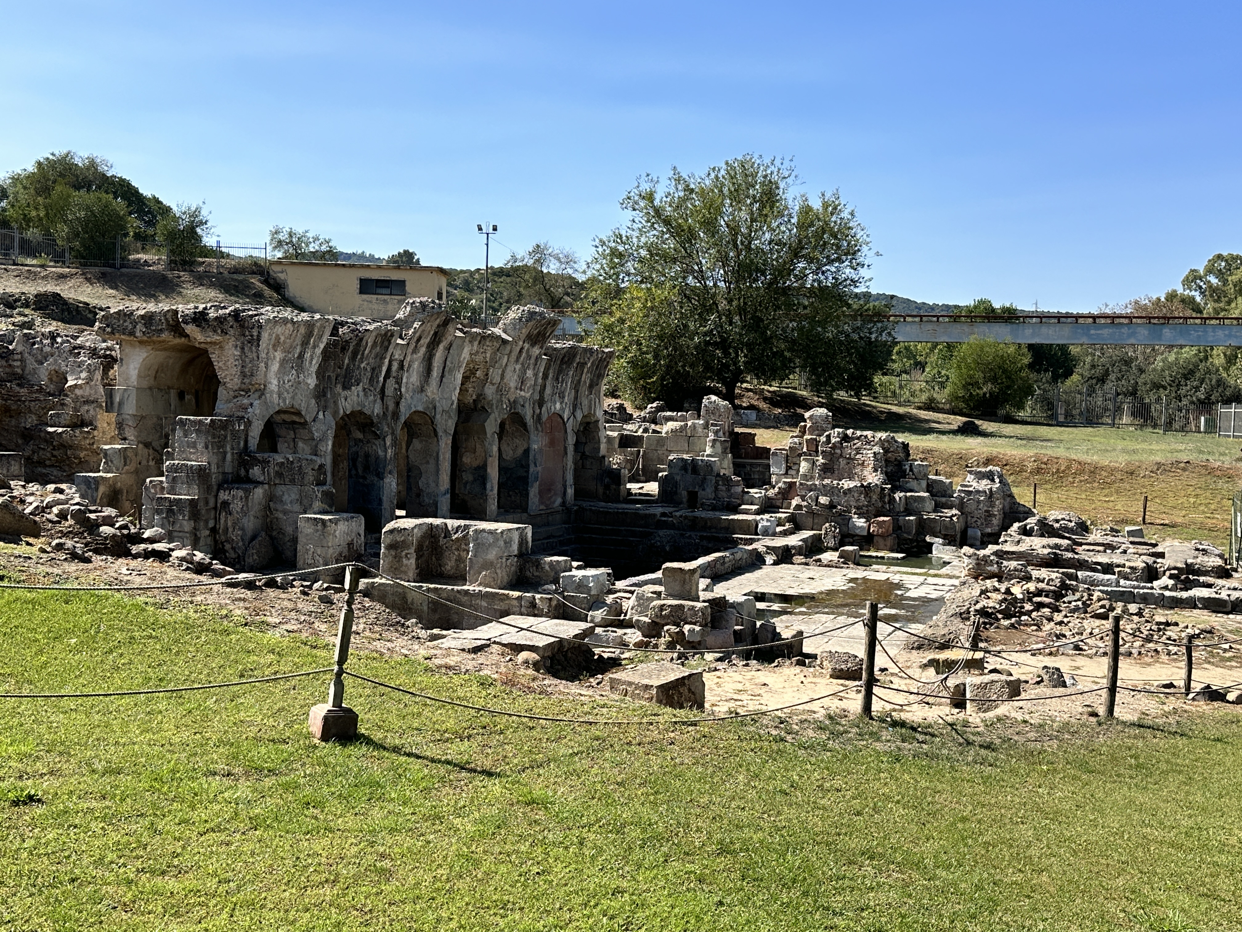
The water still runs warm from the natural springs at the 1st century AD Fordongianus Roman Baths. This site is about 25 km (14 miles) northeast of Oristano. We stopped by on our way into Oristano, but we arrived during siesta time so we had to settle for looking at the Baths through a wire fence, which actually offered some pretty good views. There is a fee to visit the Baths.
Fordongianus Roman Baths.
Just outside Fordongianus is this pretty 12th & 13th century Romanesque church, dedicated to San Lussorio, who was martyred by the Emperor Diocletian in 304 AD.
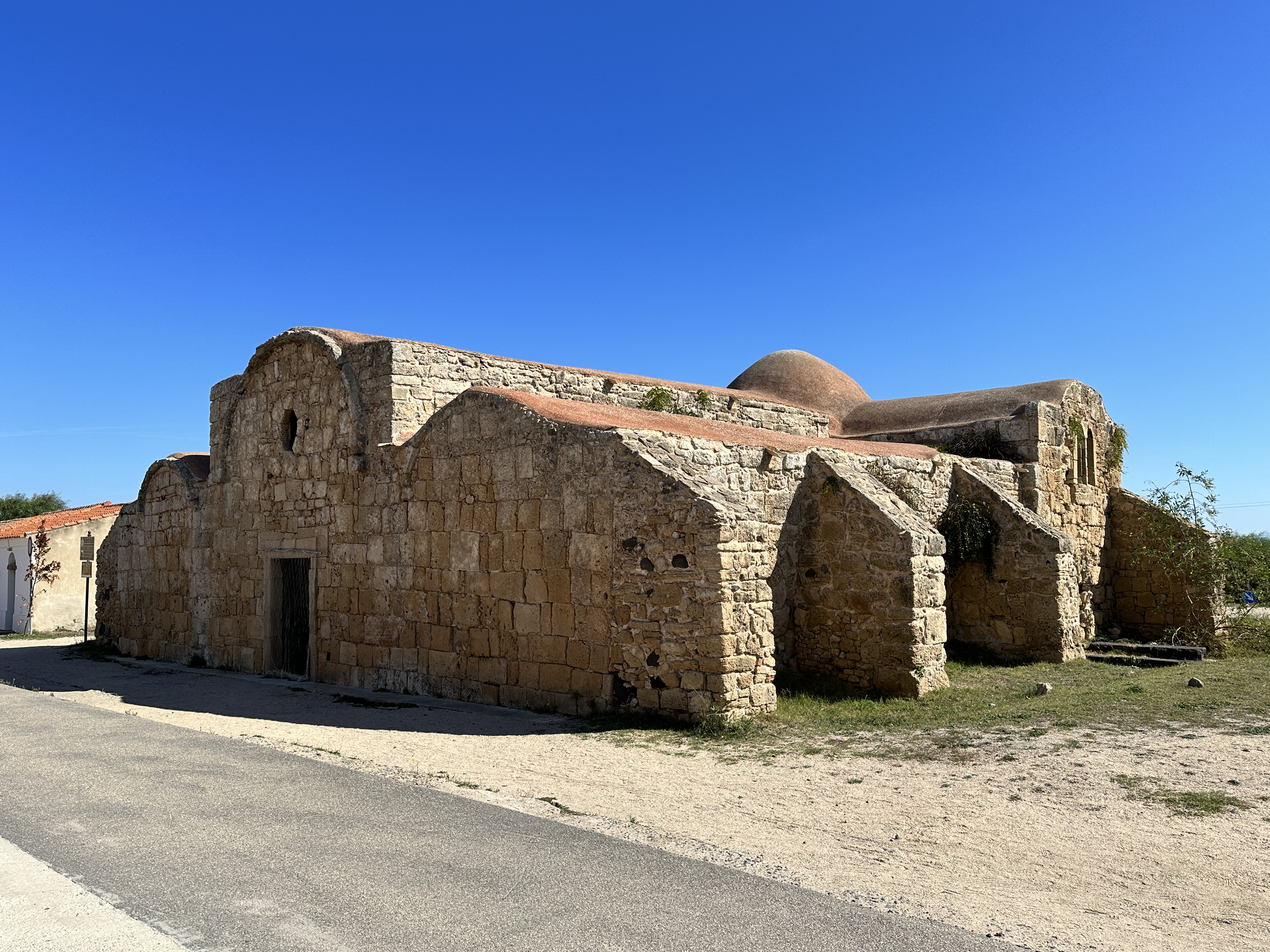
San Giovanni di Sinis Church
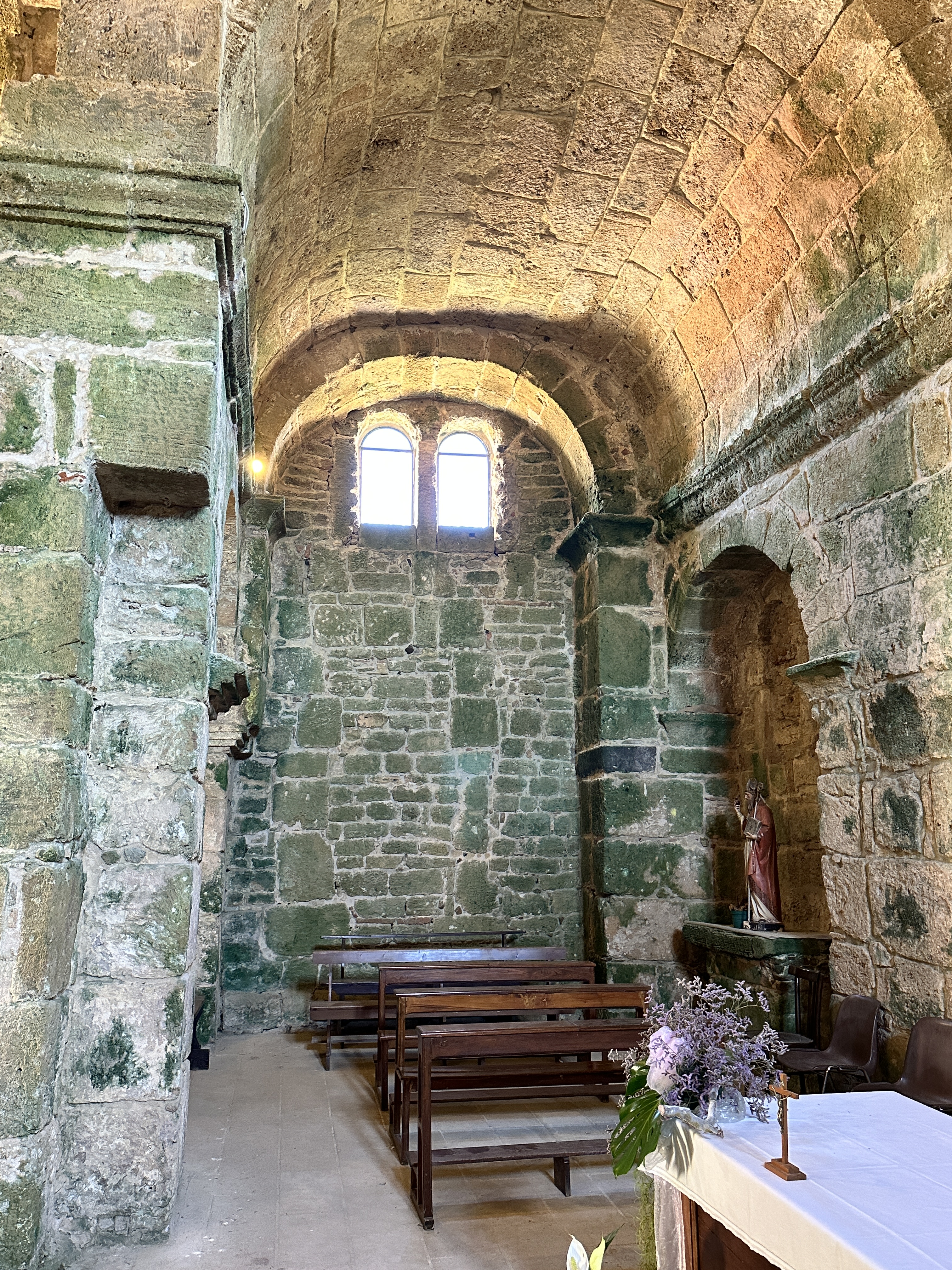
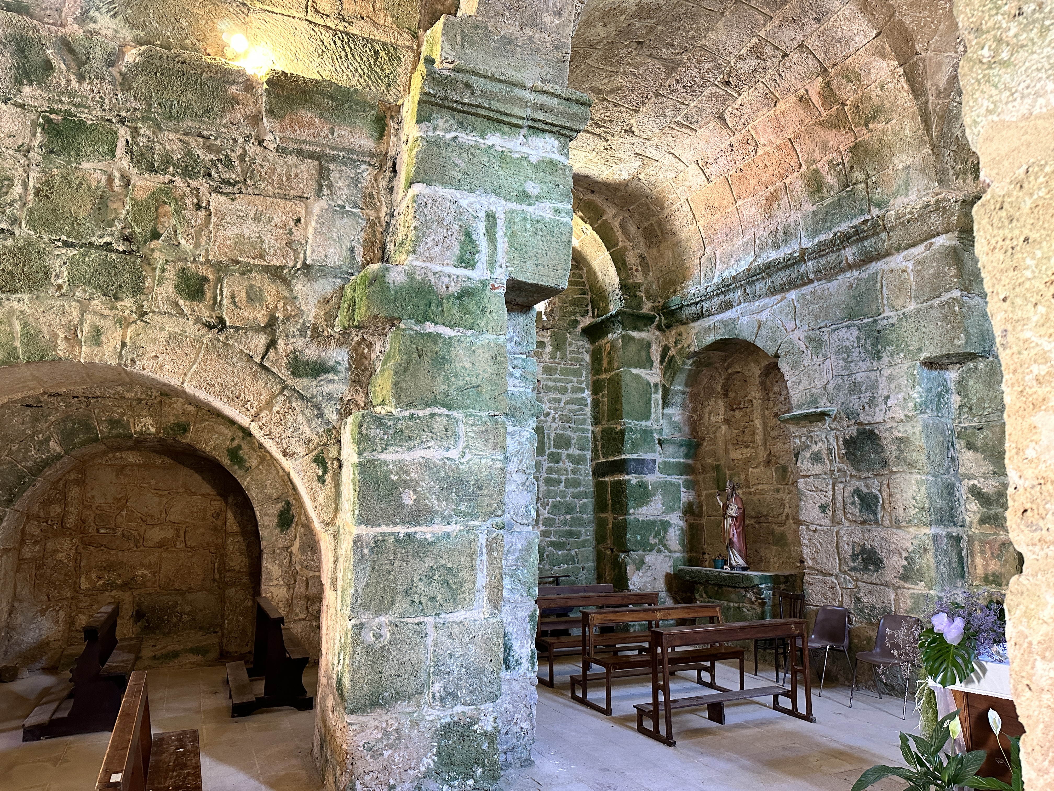
This interesting little church is right near the entrance to the Tharros archeological site. It is one of the two oldest churches in Sardinia, originally dating back to the 6th century – it still retains some of its Byzantine characteristics, such as the red roof. The present structure dates from the 9th and 11 centuries. The church sits in an ancient burial area. The church was free to enter and was definitely worth a stop.
San Giovanni di Sinis Church.
Views of the interior of San Giovanni di Sinis Church, with green algae covering some of the ancient stone walls.
San Salvatore
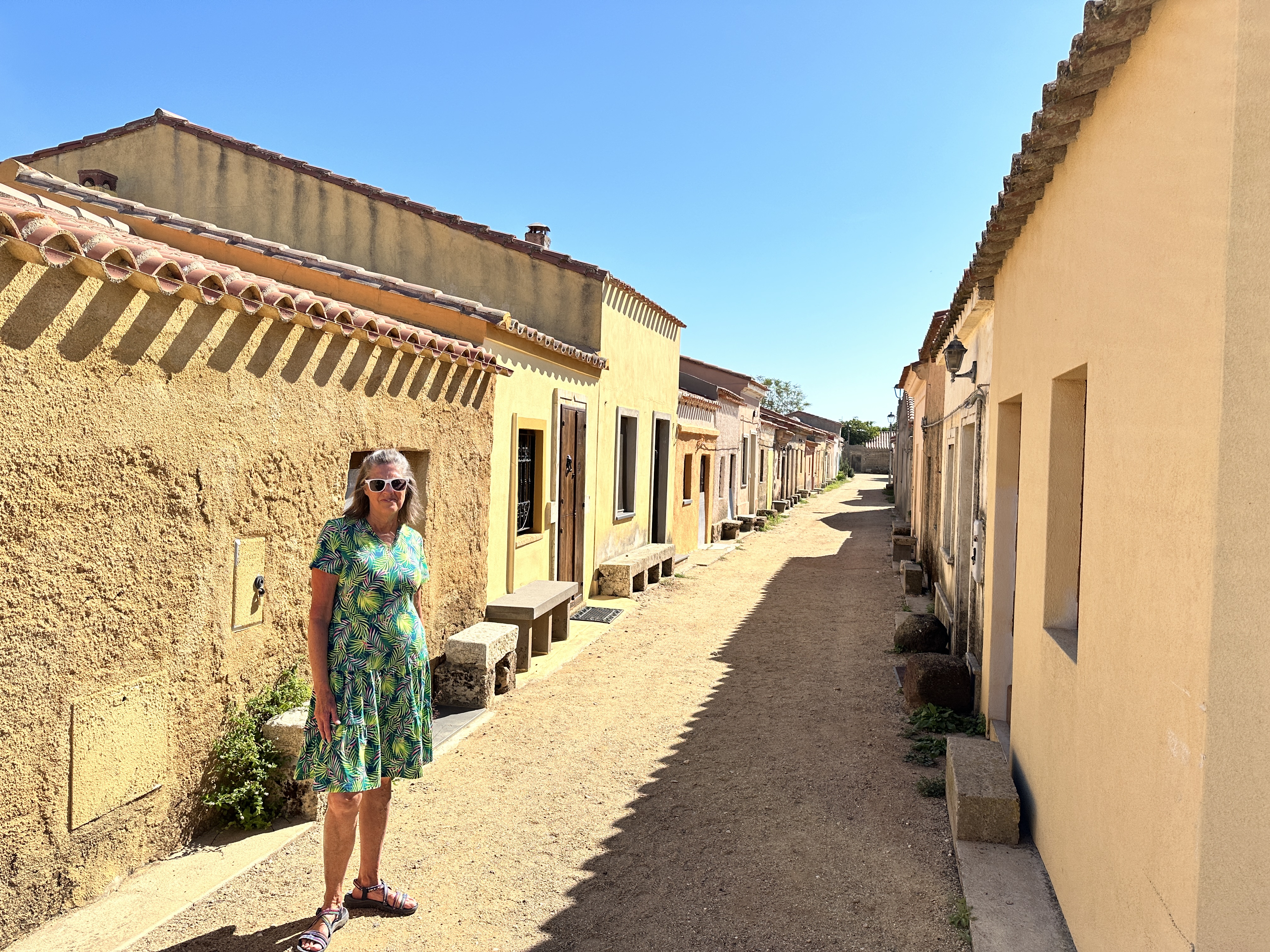
San Salvatore, also close to Tharros, is a spaghetti-western filmset from the 1960’s. It has the feel of a old western U.S. ghost town. The town opens its dwellings’ doors during September each year to house pilgrims for the Festa di San Salvatore, a celebration focused on the village’s small church, which sits over the ruins of a Nuragic period (~1,500 BC) vault. It looked to us like there might be a few permanent residents here, we saw some homes that looked lived in.
Views of San Salvatore.
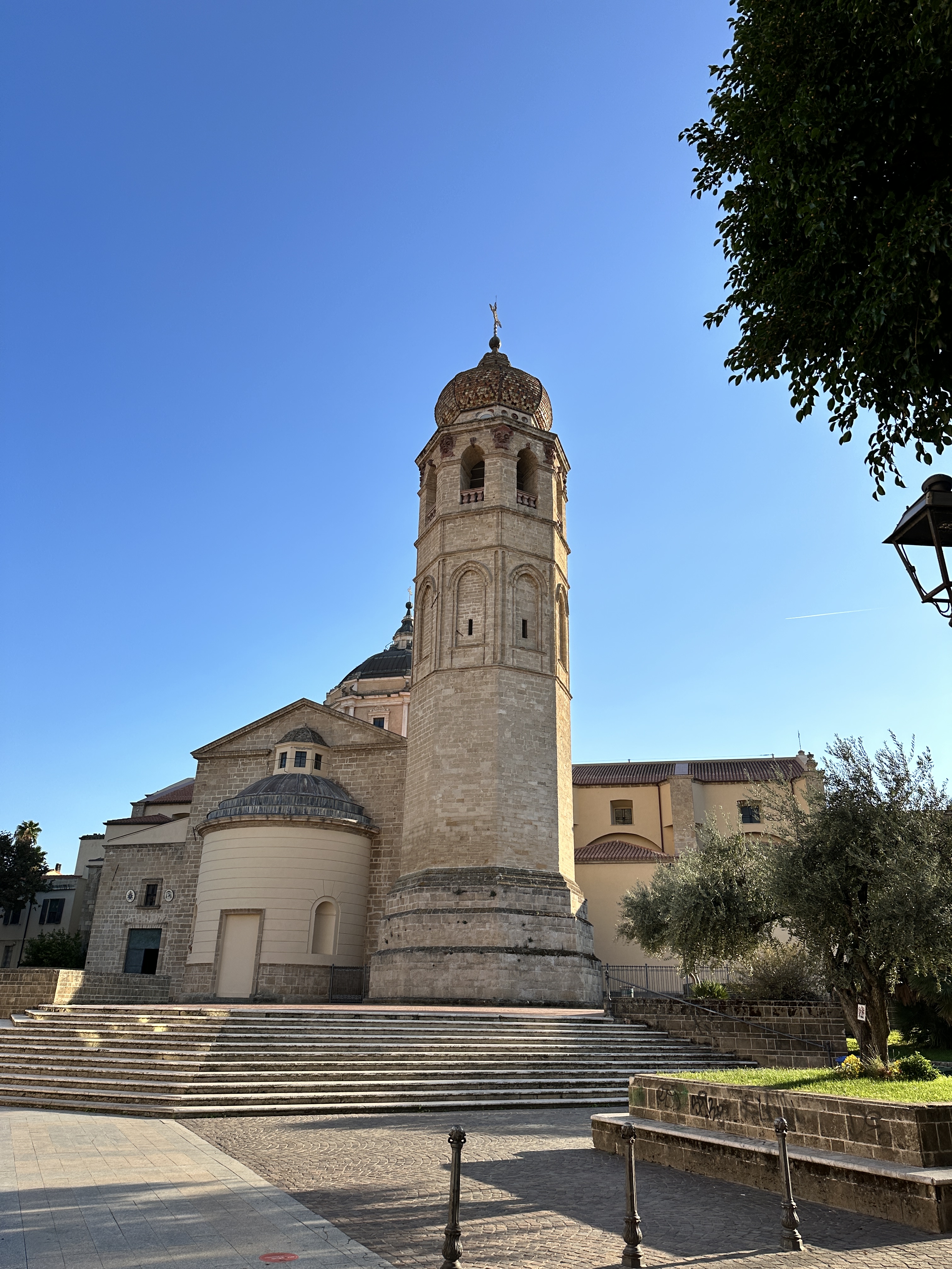
Oristano Town
Oristano seemed to us to be a pretty quiet town, without fewer tourists compared to other locations in Sardinia, even though there is much for the tourist to see in the vicinity. We enjoyed walking the streets in the evening without any throngs of tourists. It is a perfect place to call “home” during your stay in this part of Sardinia.
The 13th-century Torre di Mariano II was Oristano’s nothern gate, one of the few remains of the city’s medieval defenses.
Views of the Catedrale di Santa Maria Assunta. The 14th century bell tower still stands. The rest of the current structure is 18th century.Left – Torre di Portixedda, part of Oristano’s original medieval walls. Right – street scene in central Oristano.
From our start in Olbia and Sardinia’s Costa Esmeralda, we traveled north a short distance and took (with our rental car) the 15-minute ferry ride from Palau over to La Maddalena Island and town, which is part of the La Maddalena Archipelago, located at the very north east edge of Sardinia, Italy. We spent 3 nights on La Maddalena, which gave us enough time to see La Maddalena Island, Caprera Island (reached by bridge from La Maddalena) and then a day-trip boat tour of some of the other islands in the Archipelago. I’ll share a bit about each day below.
La Maddalena
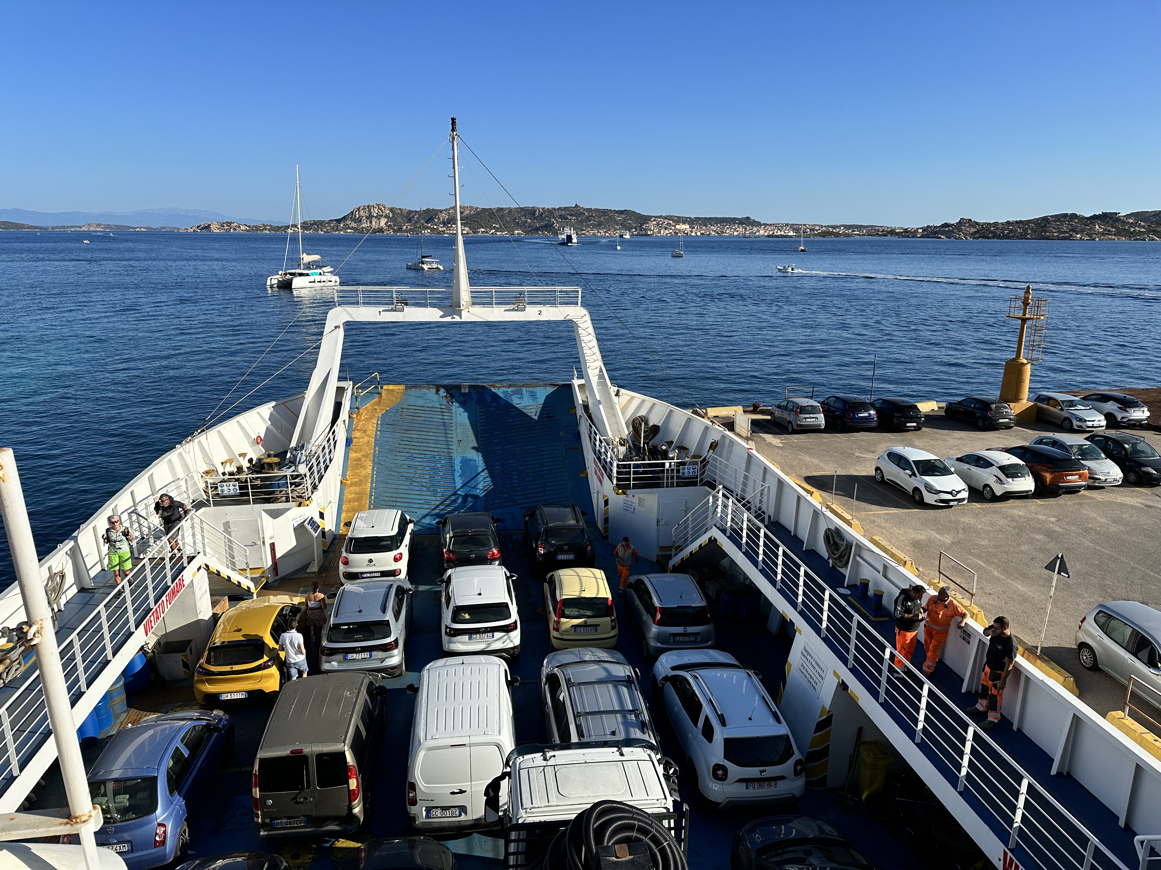
We caught a morning ferry to La Maddalena from Palau, no reservations were needed in October and the ferries run continuously all day. A round trip ticket for car and passengers was about 40 Euro.
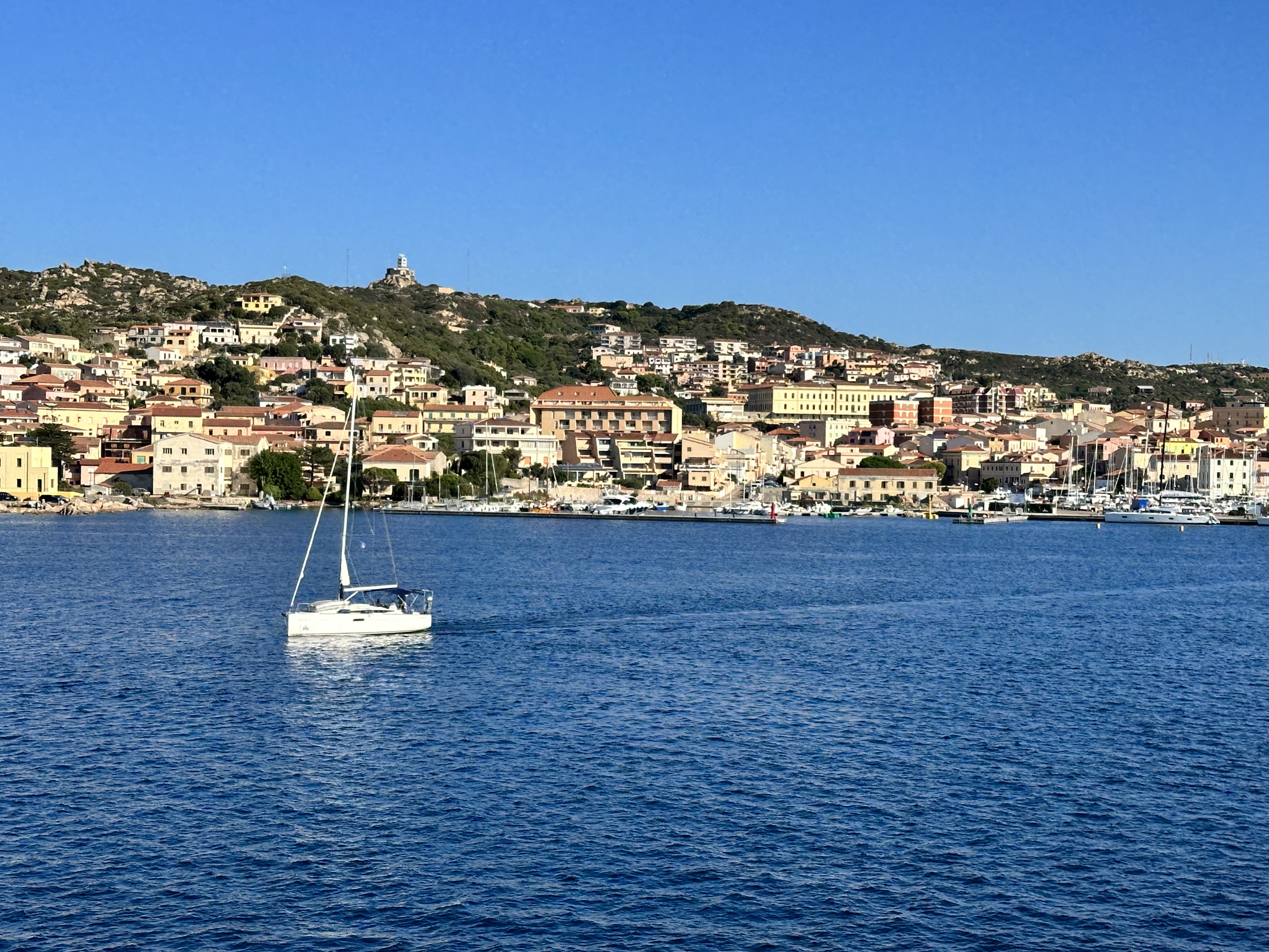
Left – our ferry, with La Maddalena in the distance. Right – a view of La Maddalena town and harbor from the ferry.
Upon arrival. we immediately headed for Cala Francese beach, not far from the main town and then explored a few other beaches around the island before checking into our hotel later in the afternoon. La Maddalena is not big, you could probably drive around the island in 30 minutes or less.
Above – Cala Francese, on the southwest coast of La Maddalena. You have to take a very short drive on a dirt road to get to the parking area and then walk on a trail for 5 minutes to get to the beach.Left – Spiaggia Bassa Trinita, Right – Spiaggia del Cardellino, both beaches are on the northwest coast of La Maddalena.
Cala Lunga, at the northern tip of La Maddalena.
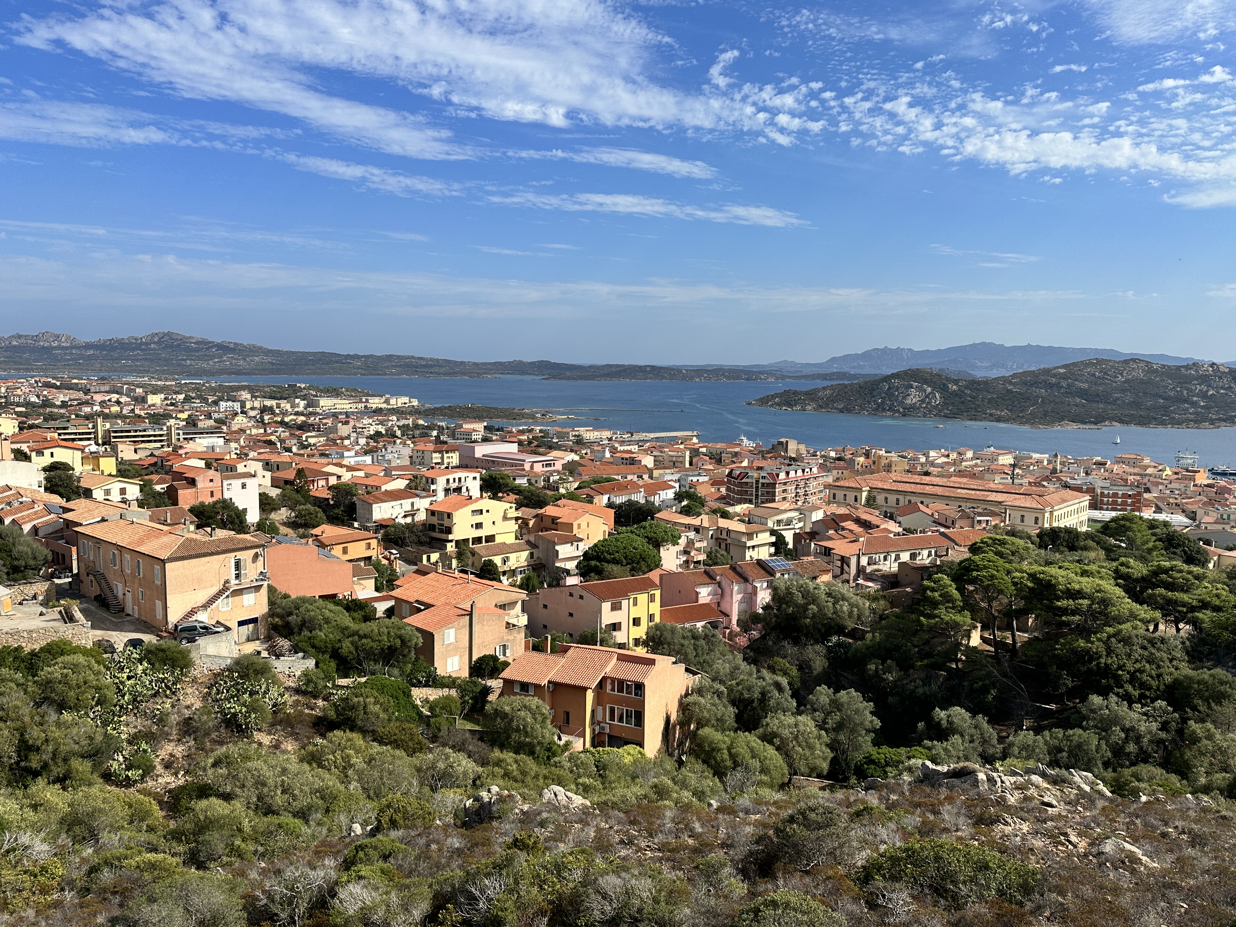
Left – Spiaggia di Cala Spalmatore, on the eastern side of La Maddalena. Right – a view of La Maddalena town as we drove back after our tour of the island.
The town was fun to explore, and many boat tours are offered from the harbor.
Caprera Island
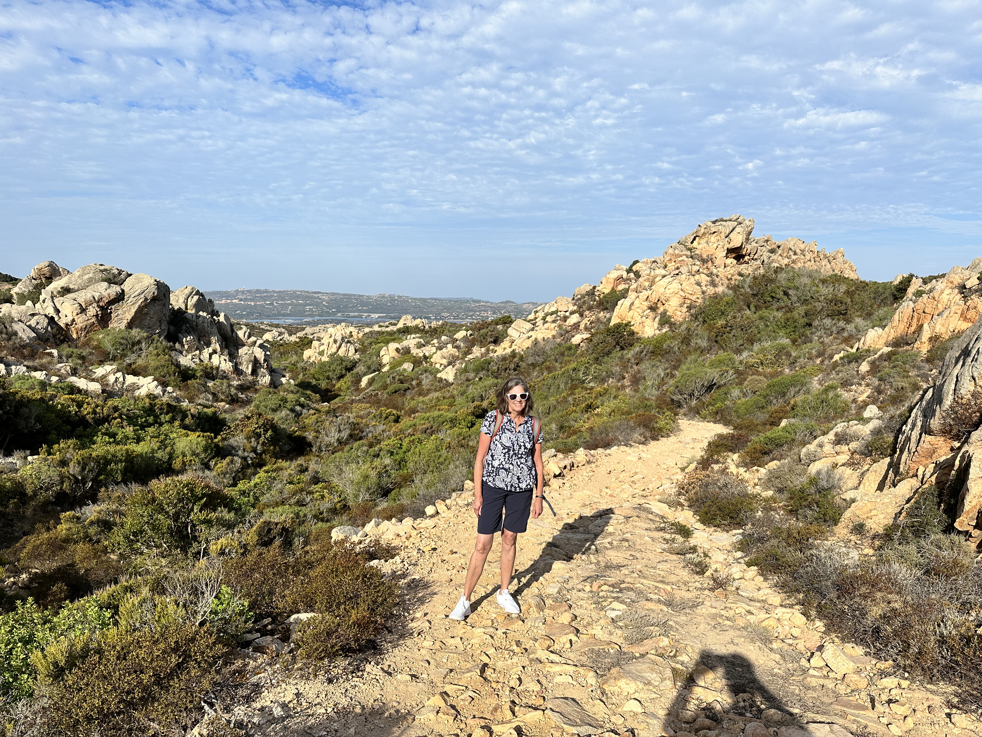
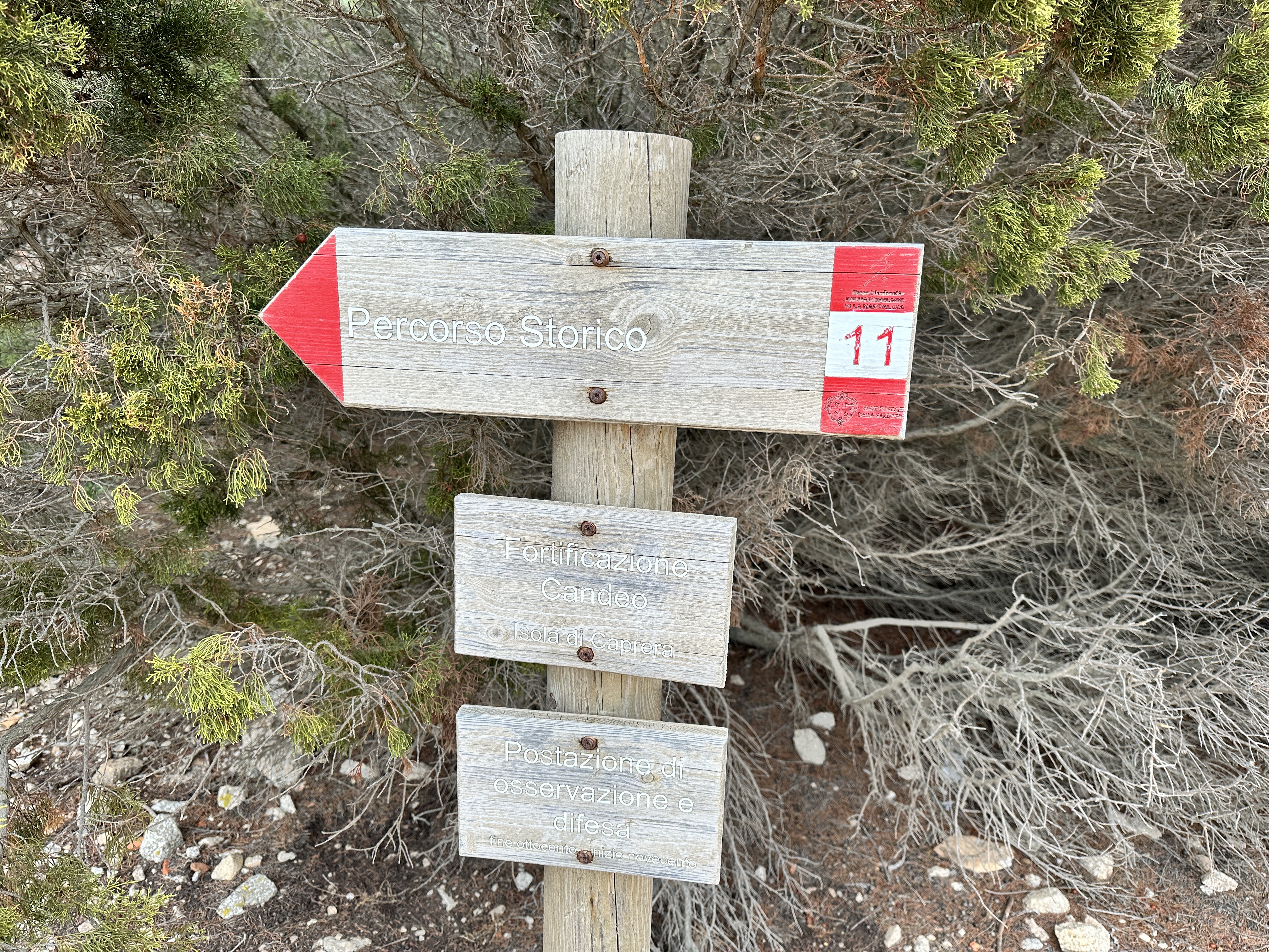
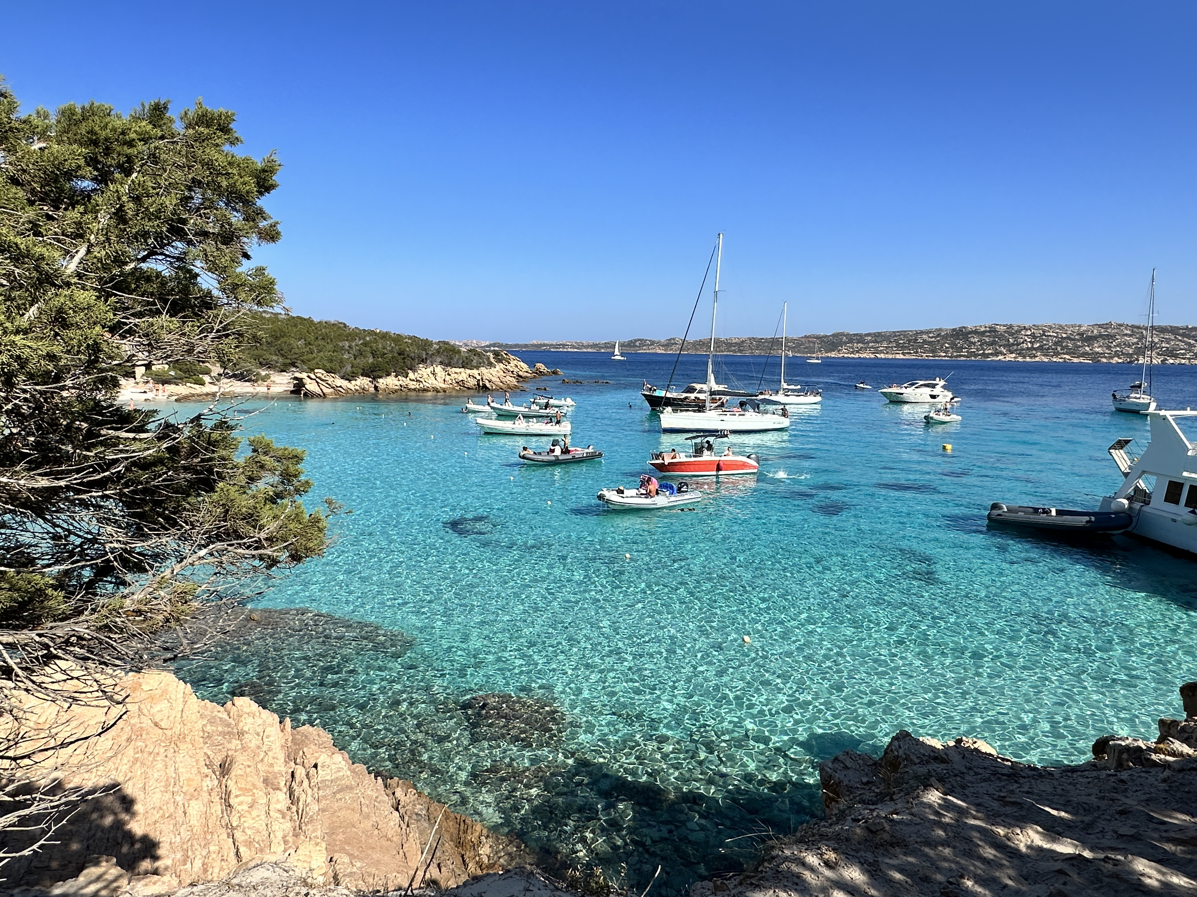
After a wonderful day on La Maddalena, we decided to spend our second day on Caprera, an island connected to La Maddalena via a bridge. Caprera is far less populated, and largely National Park land. There are numerous beaches and hiking trails and to start our day we decided to do a hike on the north end of the island, to the Batteria de Candeo, a really interesting site.
There are numerous trails criss-crossing the northern end of Caprera, and they are well signposted. There were very few people on the trails, we pretty much had them to ourselves.
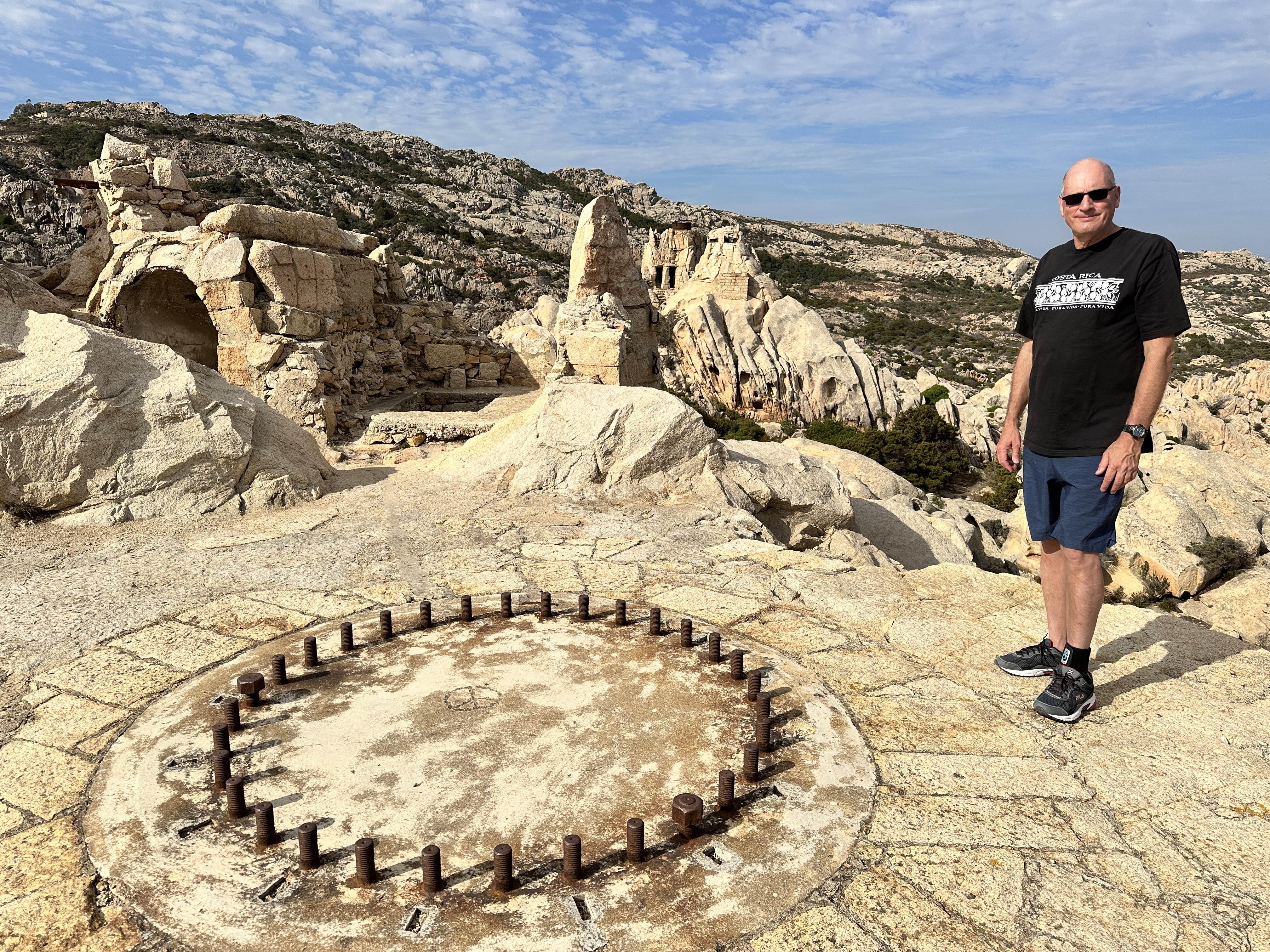
At the north end of Caprera is the military site of Batteria de Candeo, an anti-aircraft and ship emplacement built between World War I and World Ward II. It was built from the natural rock in the area and was well camouflaged – even today it looks like part of the natural landscape except for the doorways.
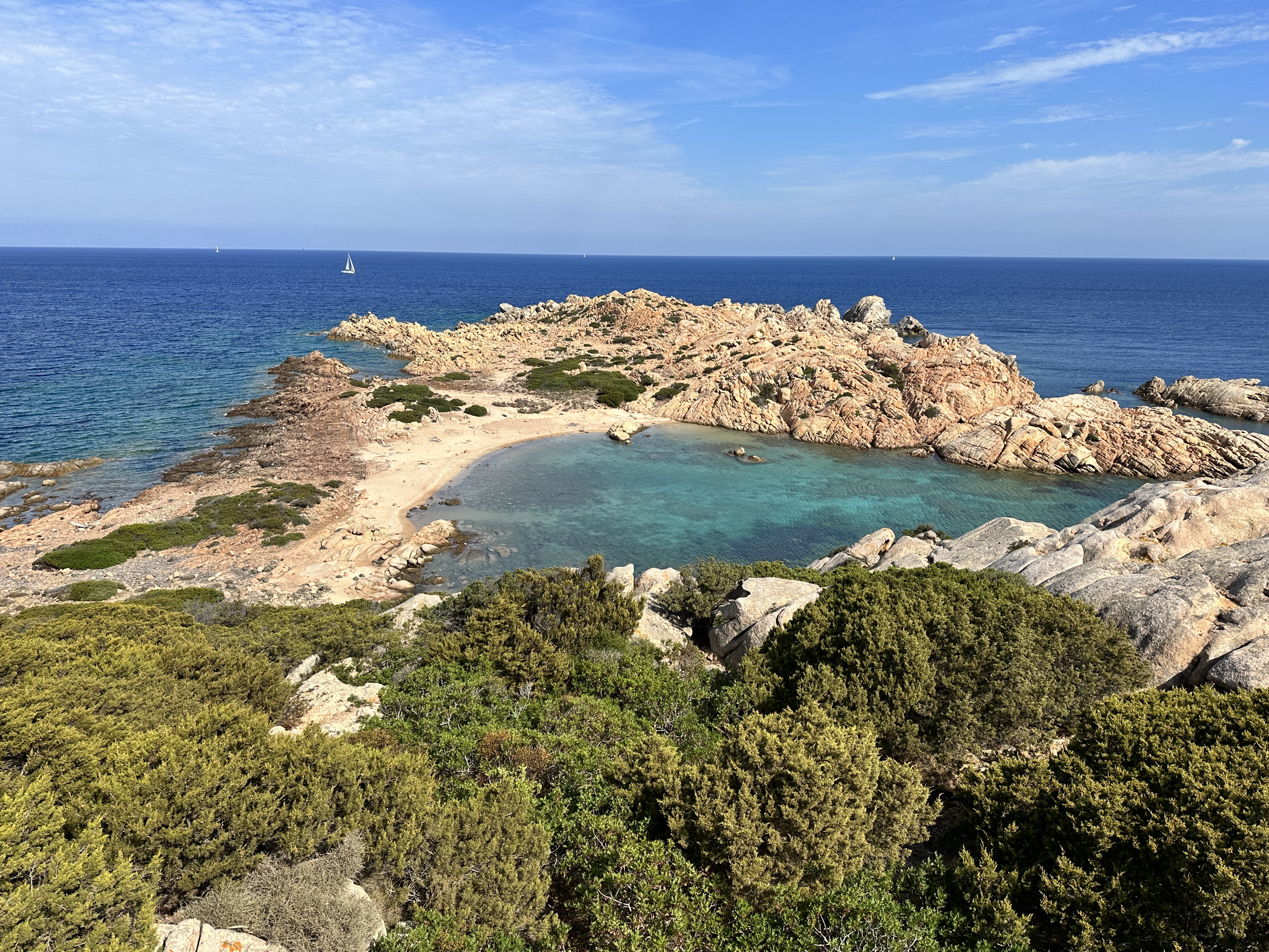
Other views of Candeo. Candeo can be accessed via the Caprera trail system.Other views and beaches accessed from the trail system in Caprera – left to right: Cala Crucitta, Cala Nepoletana, Cala Caprarese.
There are some beaches on the south end of the island also, such as Spiaggia Due Mari, for example. We visited the south end and spent a while lounging on Spiaggia Due Mari beach after our hike, but unfortunately I did not capture a photo!
Note: I had wanted to visit Cala Coticcio beach on Caprera, one of the most famous beaches in Sardinia. The only way to visit is with a guide (they limit access to this beach to preserve its natural state). I reserved a date with the guide, but I also needed a Park pass, and for some reason this was difficult to do online, so I gave up and cancelled our visit to this particular beach. It is a fairly long hike to Cala Coticcio and if we had done that hike, we would not have had time to do the hiking discussed above. I think it’s just a trade off on how you want to spend your time. As shown above, there are other stunning beaches and sights that don’t have the limitations of Cala Coticcio.
Day Trip Boat Tour
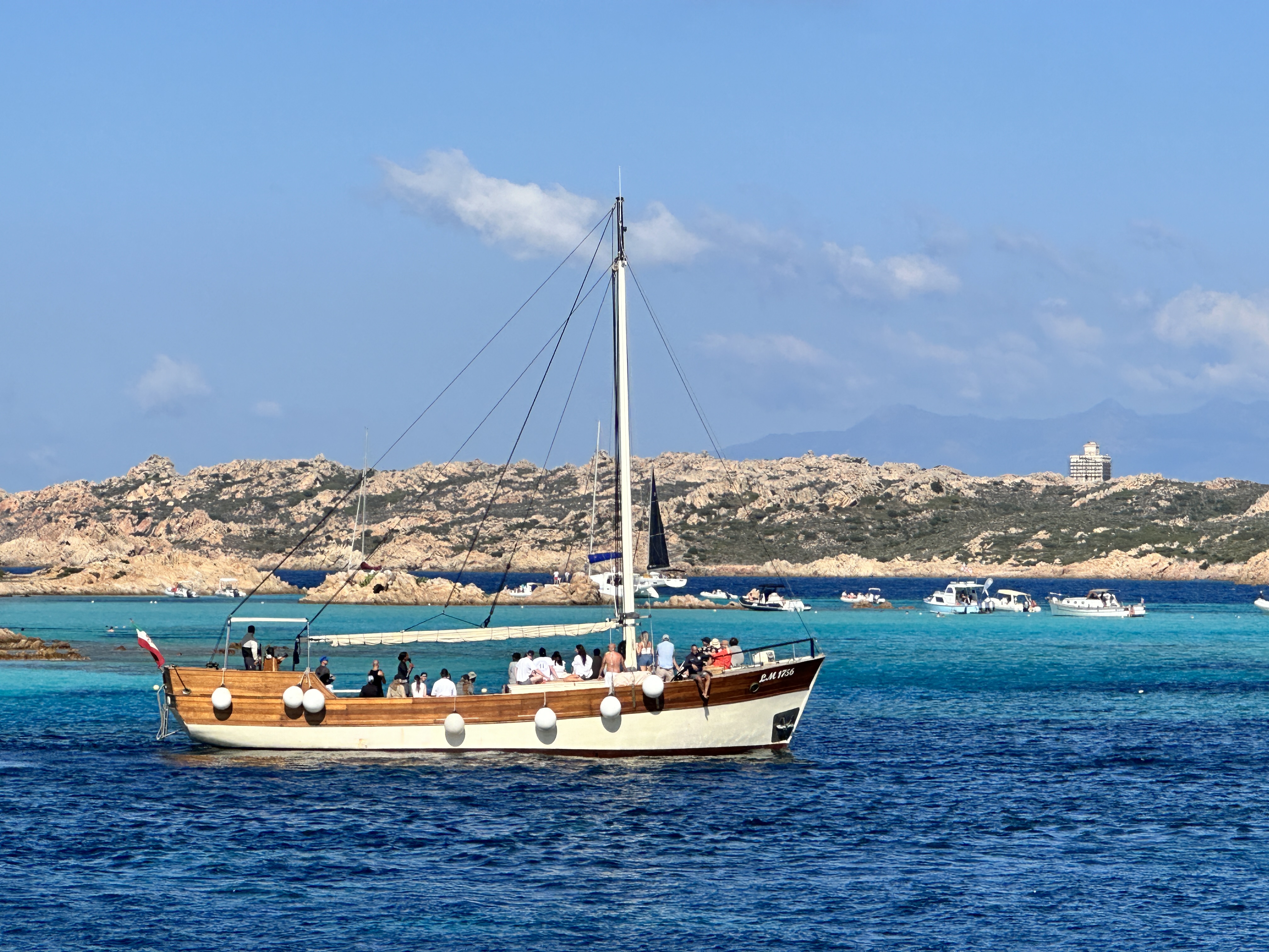
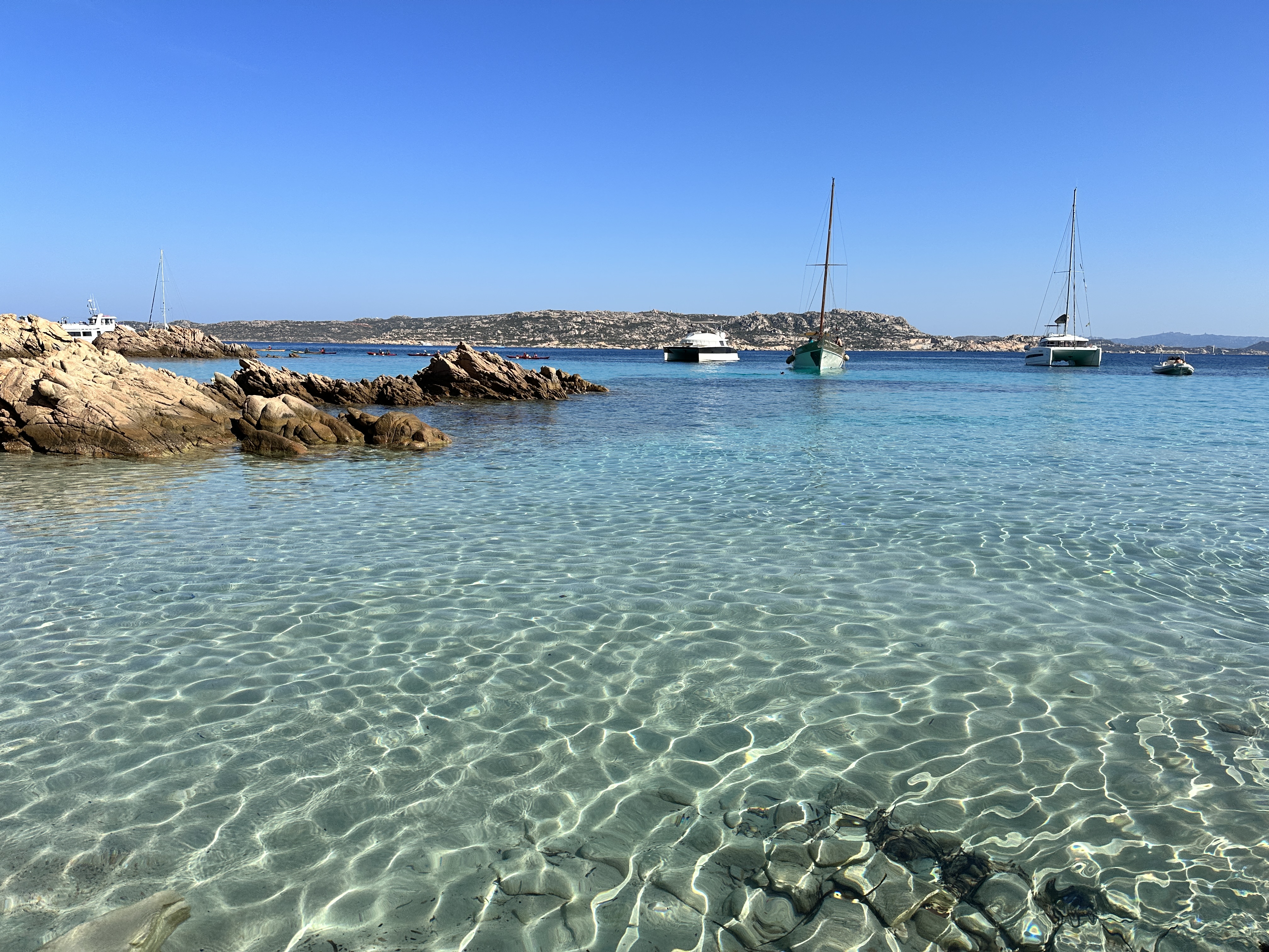
On our final day in La Maddalena, we decided to do a 6-hour boat tour of some other islands in the La Maddalena Archipelago and we’re glad we did. Below are photos from our various stops during the boat tour. It was a perfect day.
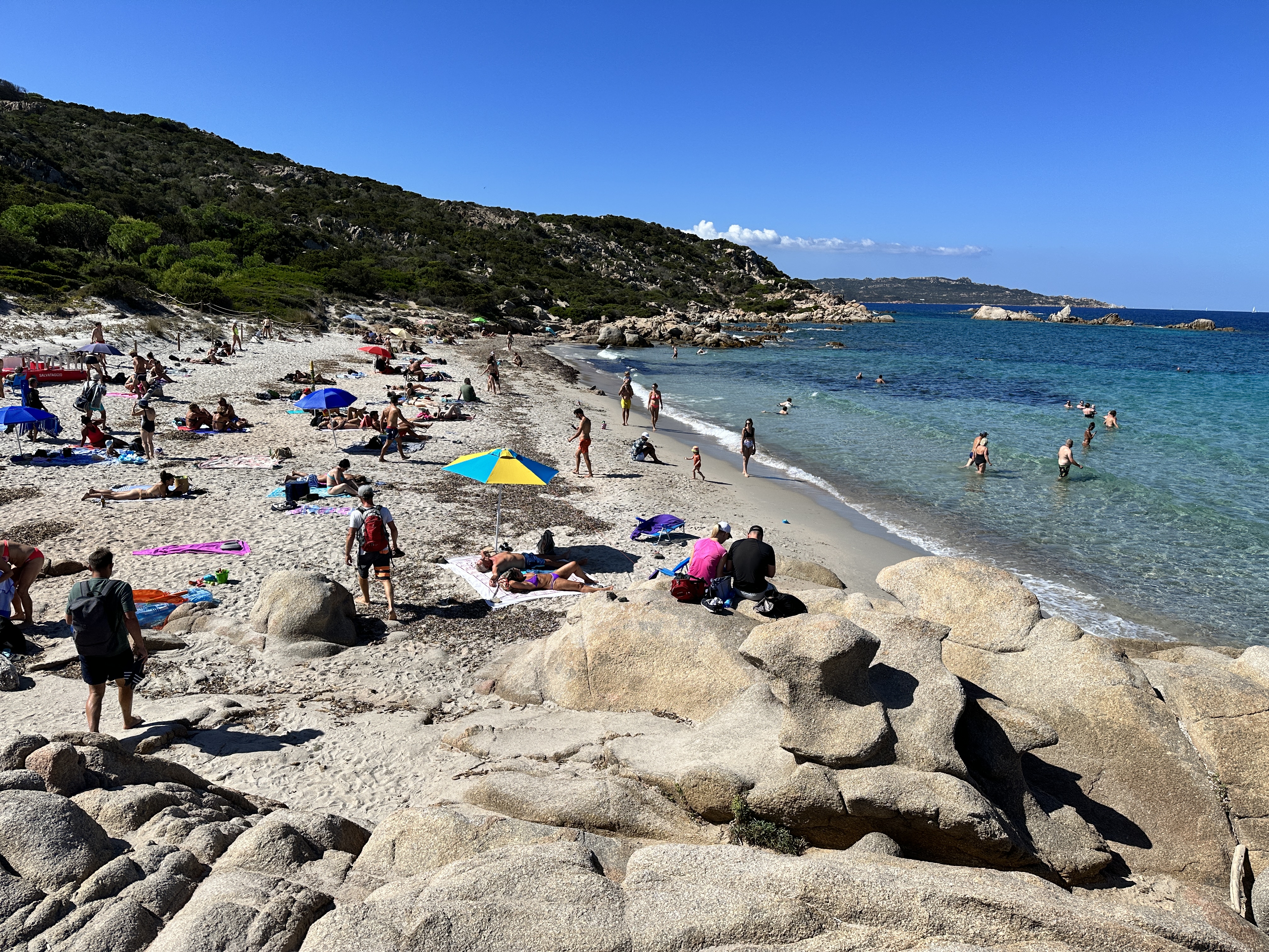
Buddelli Island and Pools – Buddelli Island is known for its pink sand beach (above left – small photo), but you cannot access the beach directly, they are trying to preserve and rehabilitate the pink sand. However, we did jump off the boat and swim in what they call the “Buddelli Pools” nearby – beautiful protected water.Santa Maria Island (above), we stopped at this island and beach for about 90 minutes. Spargi Island (above and below), the beaches here were stunning. We were able to swim and lounge for about two hours.Two more views of Spargi Island – with the wild boar terrorizing visitors on the left – we were warned to not bring food on the beach – the boar wandered around the beach area and were pretty aggressive in rummaging through beach bags! Another view of Spargi’s coves on the right – what a setting!
As with every other region of Sardinia, it would be easy to spend a week or more in these islands. The water was super clear, and the beaches were beautiful. If you go to Sardinia, don’t miss La Maddalena!
We started our Sardinia vacation by flying (from Frankfurt) into Olbia on the northeast coast of Sardinia. This was a great place to begin (and end) our Sardinian adventures. Olbia is ideally situated near the famous Costa Smeralda and the La Maddalena Archipelago, as well as other costal towns, archeological sites and beaches. (See here for an overview of regions we visited in Sardinia, we toured the island in a counter-clockwise route).
Olbia
While not a major tourist destination itself, Olbia has a lovely old town and is situated on a beautiful harbor. We spent our first night here, enjoying dinner in one of the many restaurants on the main pedestrian street and browsing the vendor booths lining the harbor promenade – a very festive atmosphere.
Views of Olbia and harbor, with Tavolara Island (right), the mountainous island with more beautiful beaches in the far distance.
The next morning we drove north toward Porto Cervo, the heart of Costa Smeralda, stopping at beaches along the way. Our first day started out cool, windy and slightly rainy, but by the afternoon it was warm and sunny. The weather didn’t stop us from enjoying the sights along the coast and wasn’t a factor for the rest of our trip.
Costa Smeralda
Costa Smeralda got its name and started becoming fashionable in the early 1960’s, due to development efforts led by Prince Karim Aga Khan. It’s maintained that status ever since. Our stay here was brief, given the many areas of Sardinia we wanted to visit. Below are a few images of the beautiful coastline of this region.
This sign, along the coastal road from Olbia to Porto Cervo lets you know you’re entering the fabled Costa Smeralda.
Capriccioli Beach
Spiaggia Principe, considered Sardinia’s most famous beach (although it’s only one of hundreds as beautiful), on Costa Esmarelda.
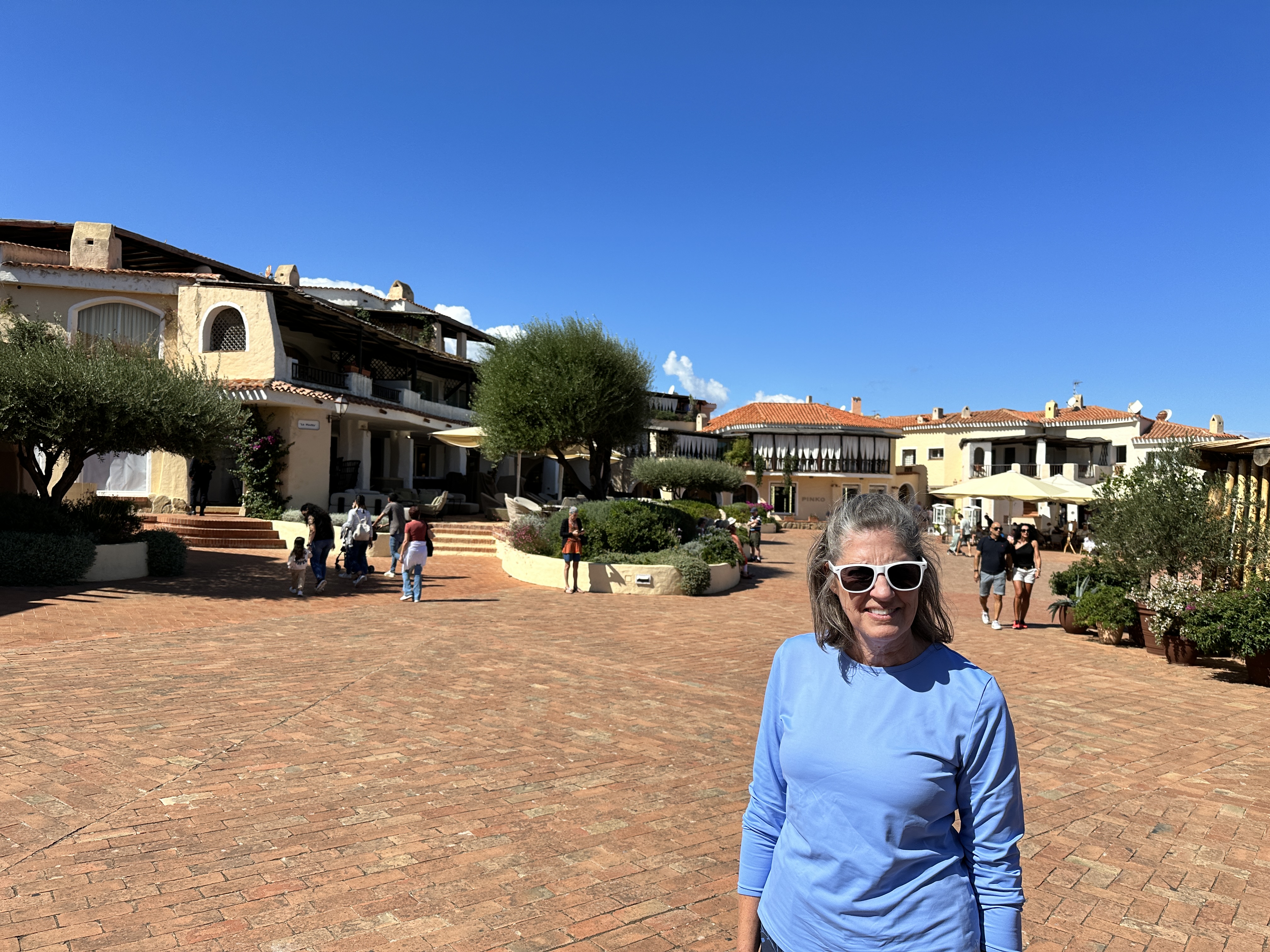
Porto Cervo, the center of Costa Smeralda, was pretty quiet in early October. We enjoyed walking around the harbor and the town, with many expensive shops.
The calm, clear waters of La Celvia Beach, south of Porto Cervo.
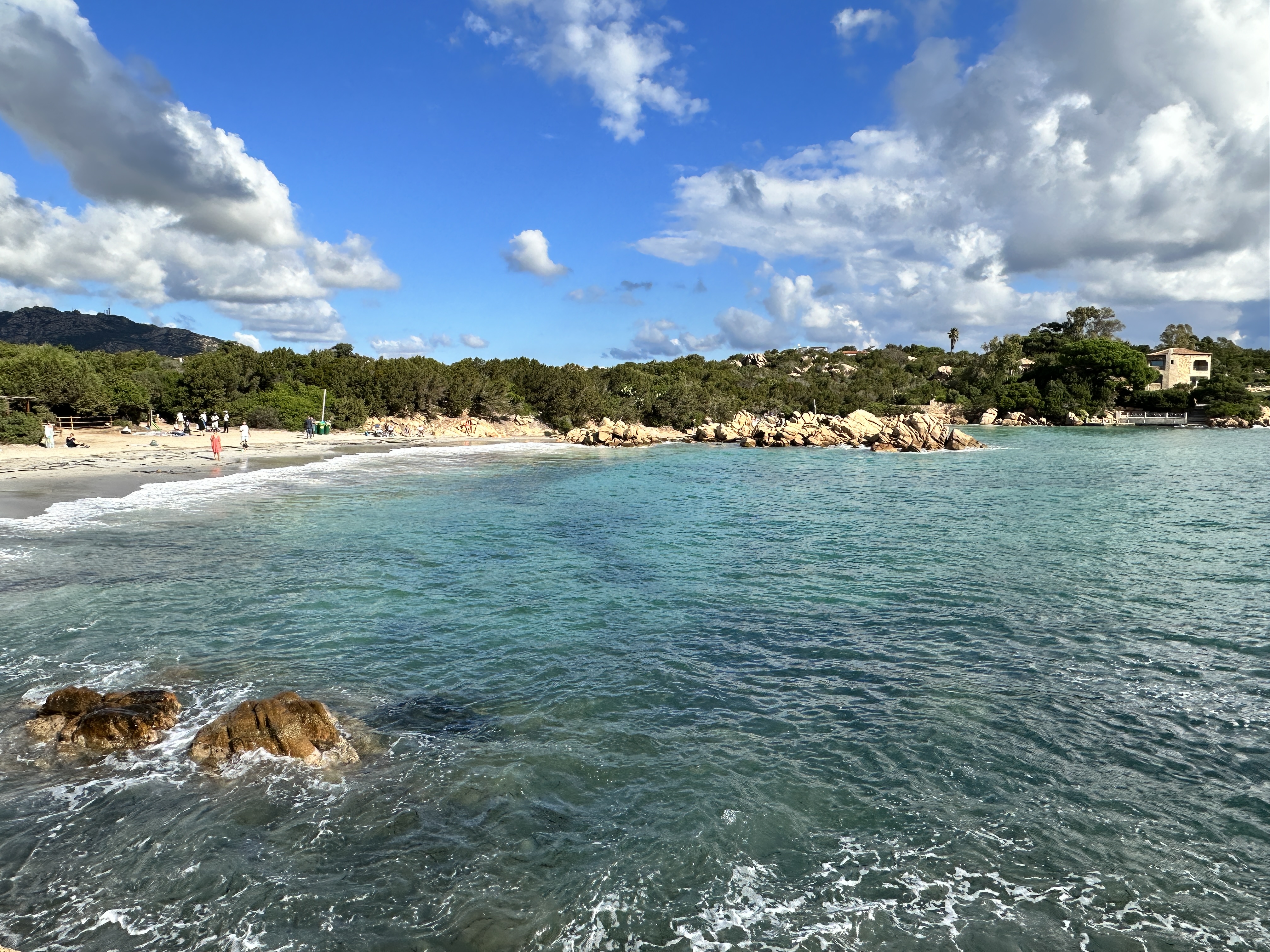
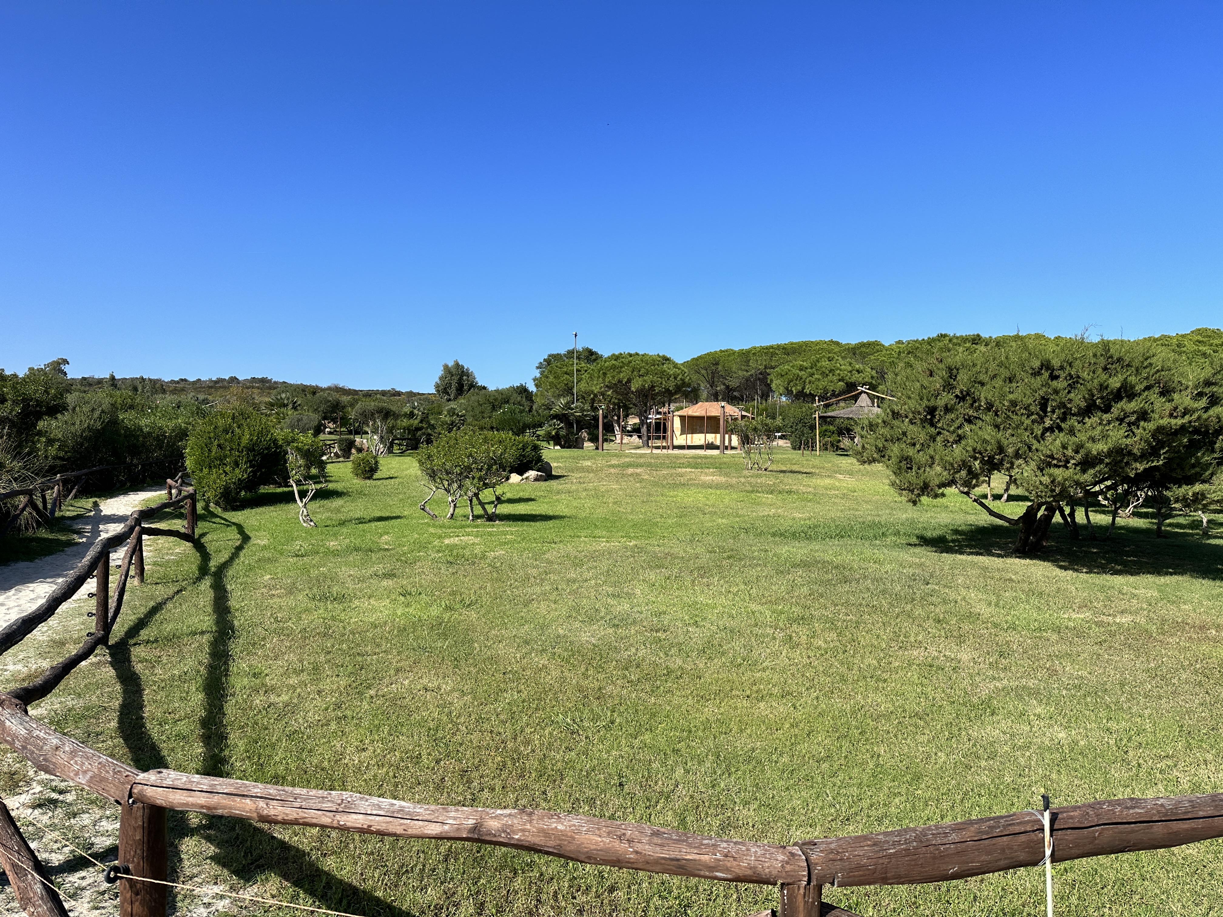
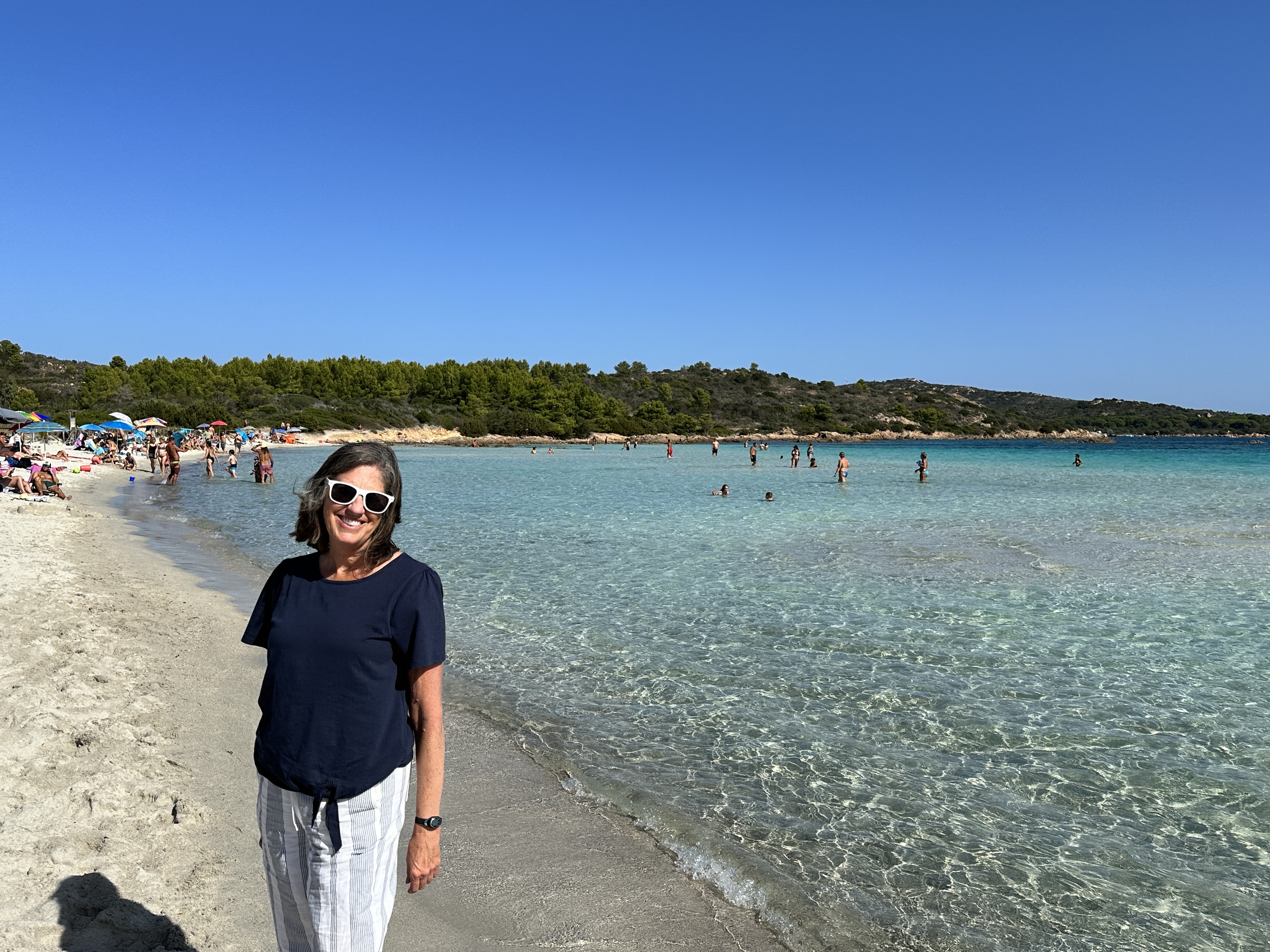
La Celvia beach (left and above), was just a short distance from our hotel in the Costa Smeralda resort area of Cala di Volpe (above right), and near a golf course as well as Capriccioli and Spiaggia Principe beaches. What more could you ask for!Although not directly part of Costa Smerelda, Spiaggia Cala Brandinchi, near San Teodoro, not far south of Olbia, is another great beach and park, with some lawn area just behind the beach for games or picnics. We were flying out of Sardinia shortly after our visit here and so we didn’t get to enjoy this beach for long!
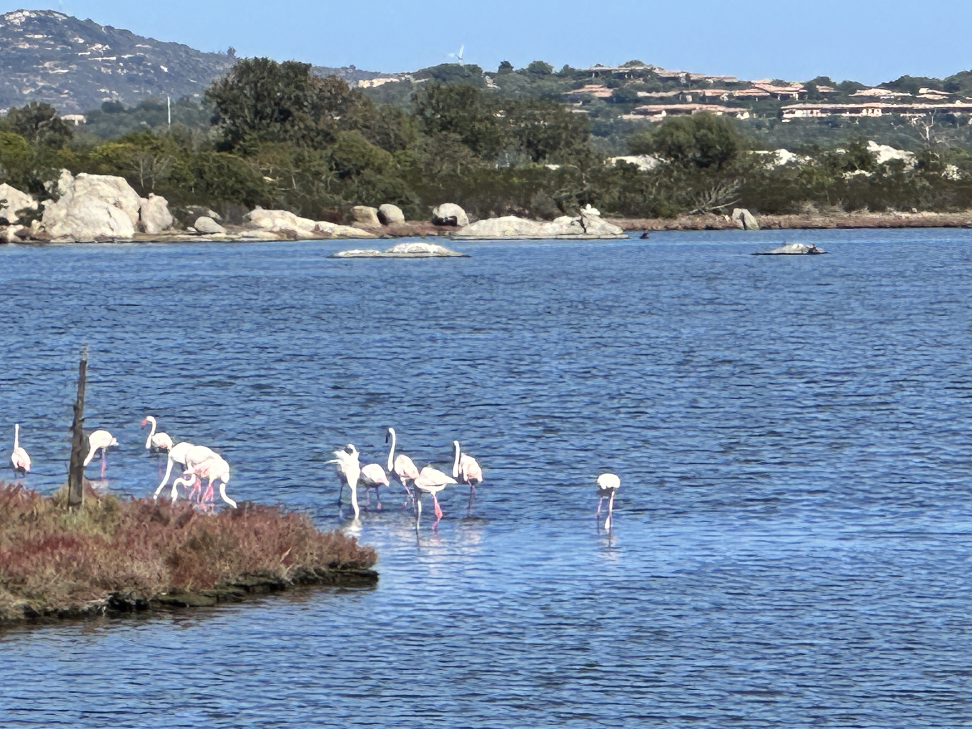
Real pink flamingoes near San Teodoro!
As with any region of Sardinia, it would be easy to spend your whole vacation right in (or around) Costa Esmeralda. If you want to live here, be ready to open your checkbook. It’s one of the most expensive regions in Europe and given its allure, it’s easy to see why.