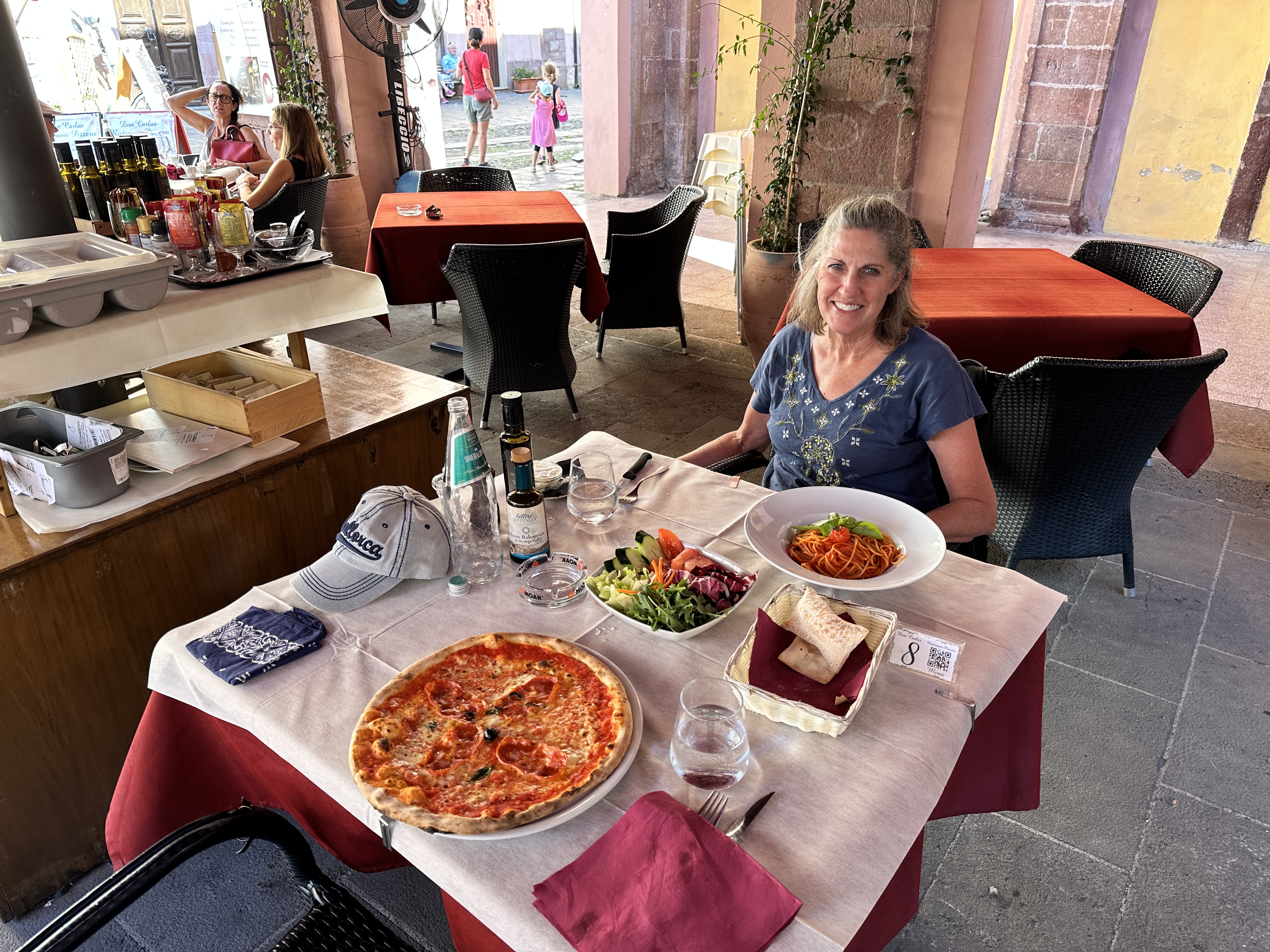
On our last full day in Sardinia, Italy we decided to take a small boat tour along the eastern coastline, specially the Gulf of Orosei. All of Sardinia was amazing, but this day-trip was icing on the cake. The coastline is amazing – towering cliffs and some of the prettiest beaches and water anywhere on the planet.
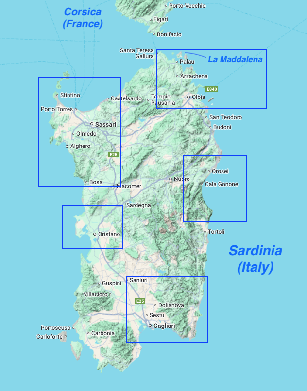
This maps show the general regions we visited in Sardinia. The Gulf of Orosei is on the central east coast.
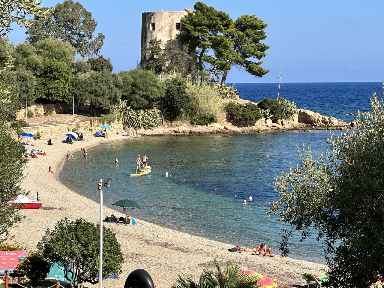
We stayed two nights in the small town of Santa Maria Navarrese, a perfect spot from which to take the boat tour and a lovely place to visit in itself. Our visit was in late September and early October, after the summer crowds were gone but yet still warm enough for boating and swimming.
A view of Santa Maria Navarrese’s own beach, right next to the small town.
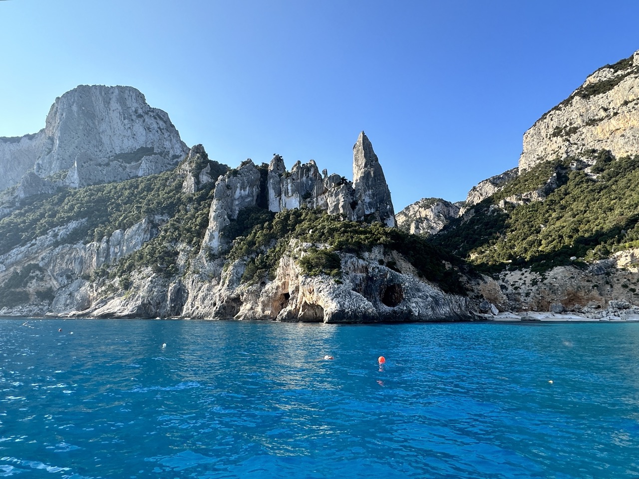
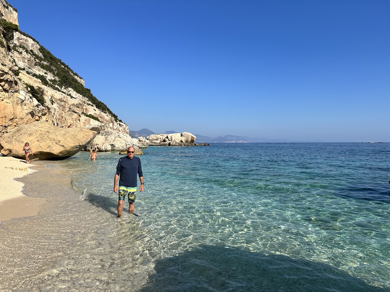
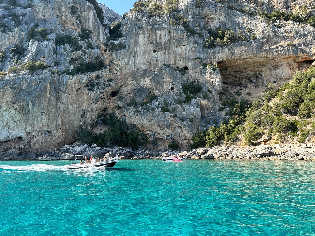
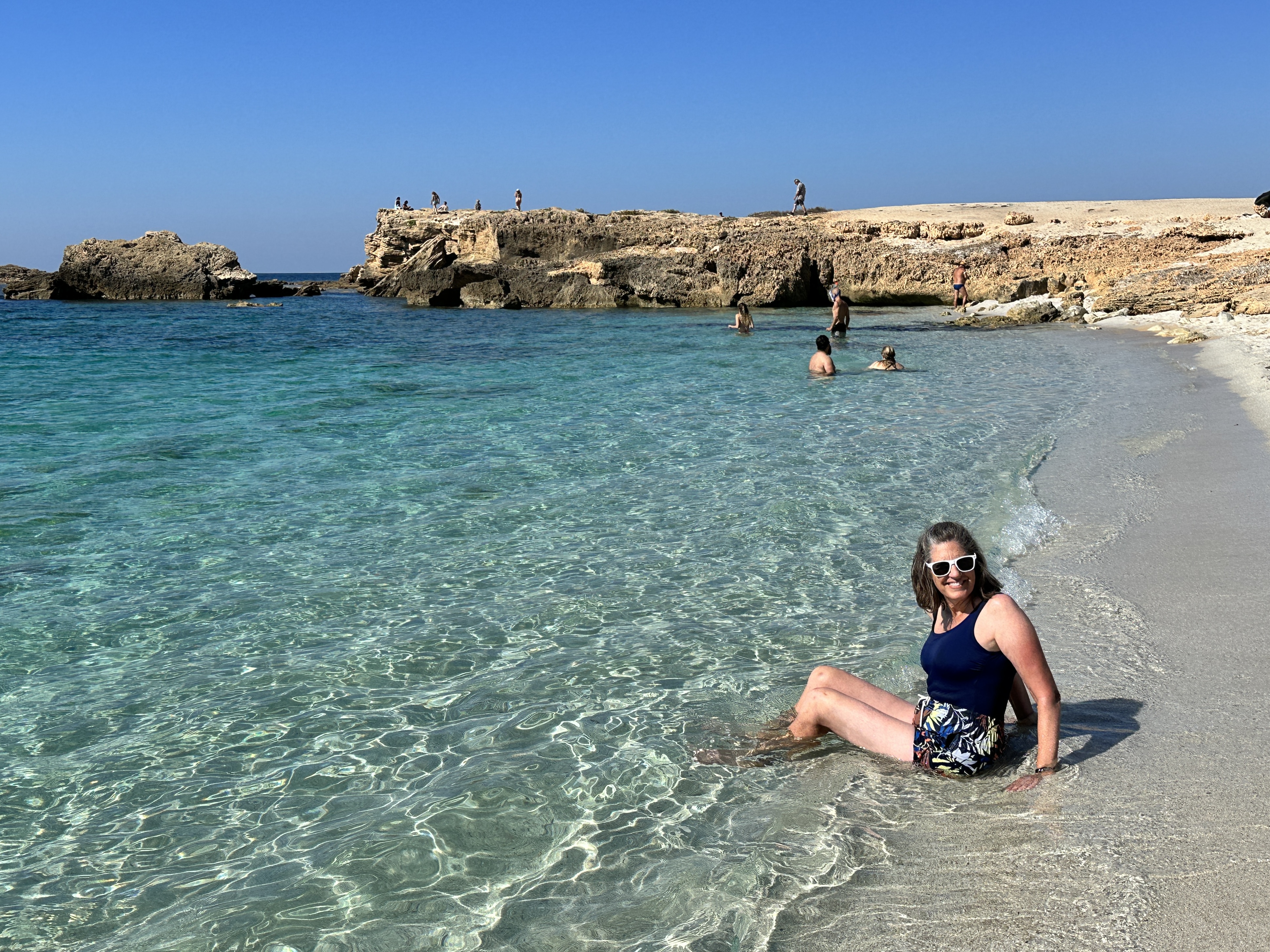
Below are a few of the images captured during our full-day boat trip. Our boat held about 10 people, which was perfect. We visited a few secluded sea caves and coves before visiting some of the more popular beach and swim stops.
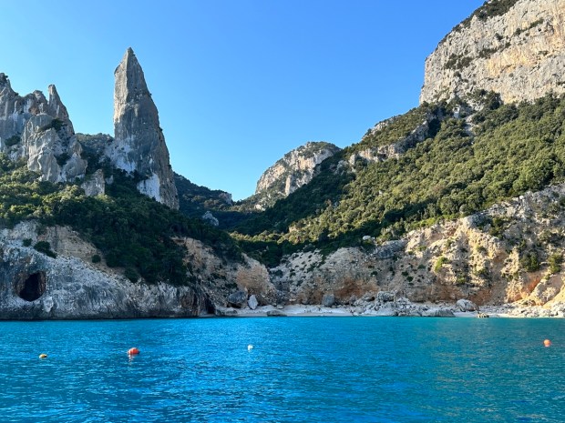
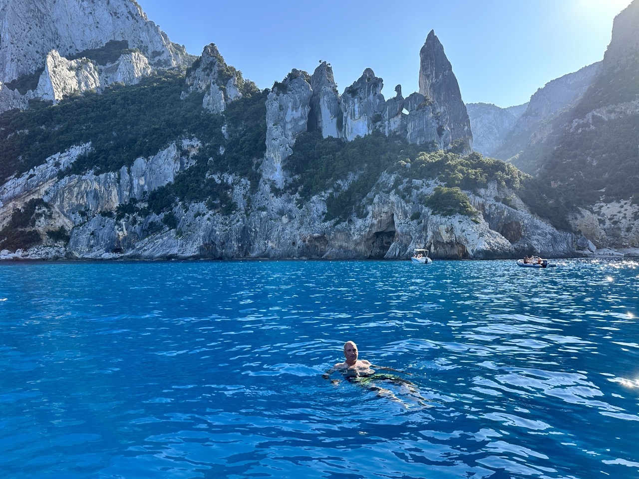
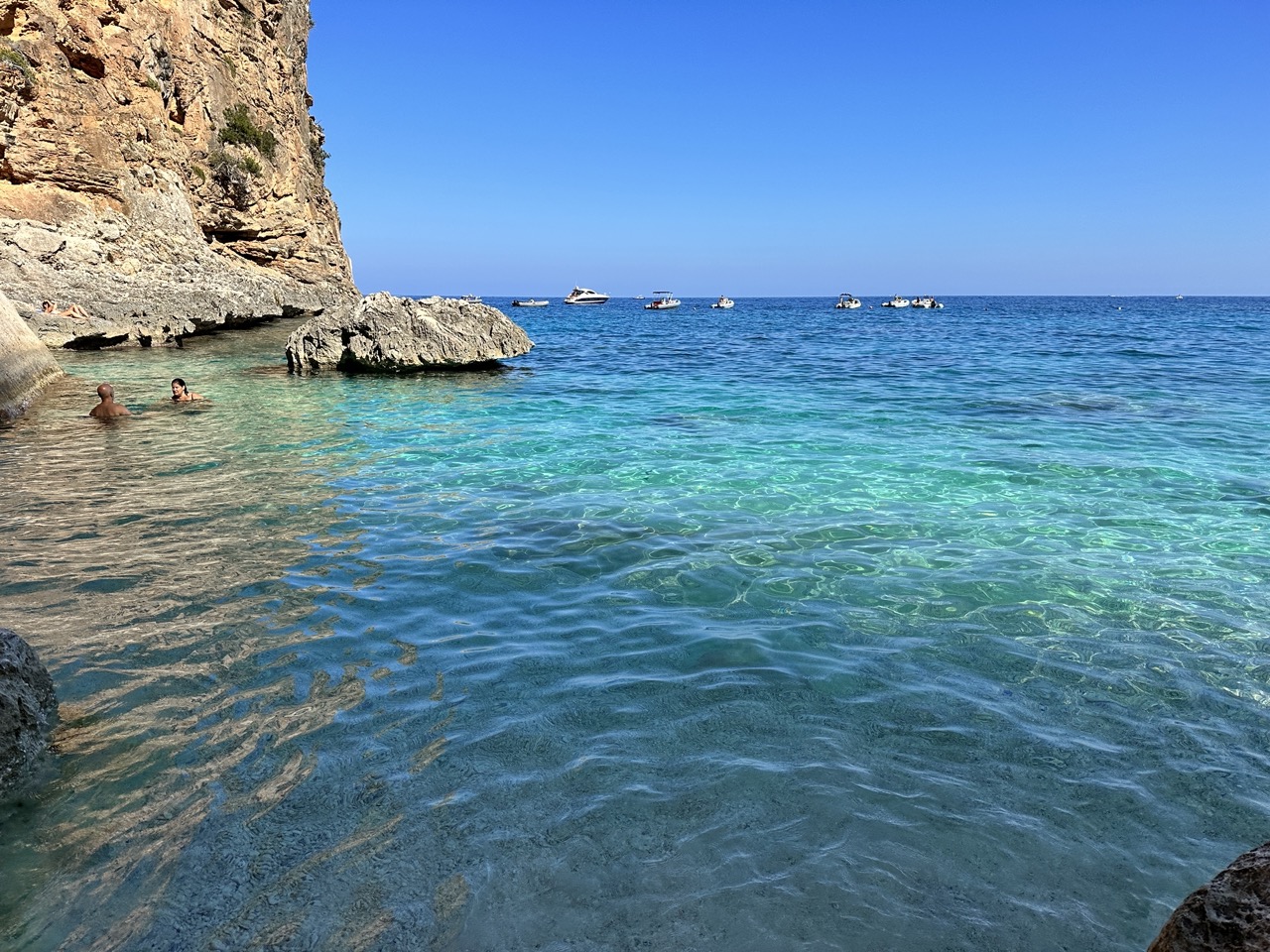
One of the postcard images of Sardinia, Cala Goloritzè. You can take a pretty steep and long hike down to the beach, but we opted for the boat tour to get this view. The boats do not land on the beach (I believe they are forbidden to do so), but do allow time to swim in the area.
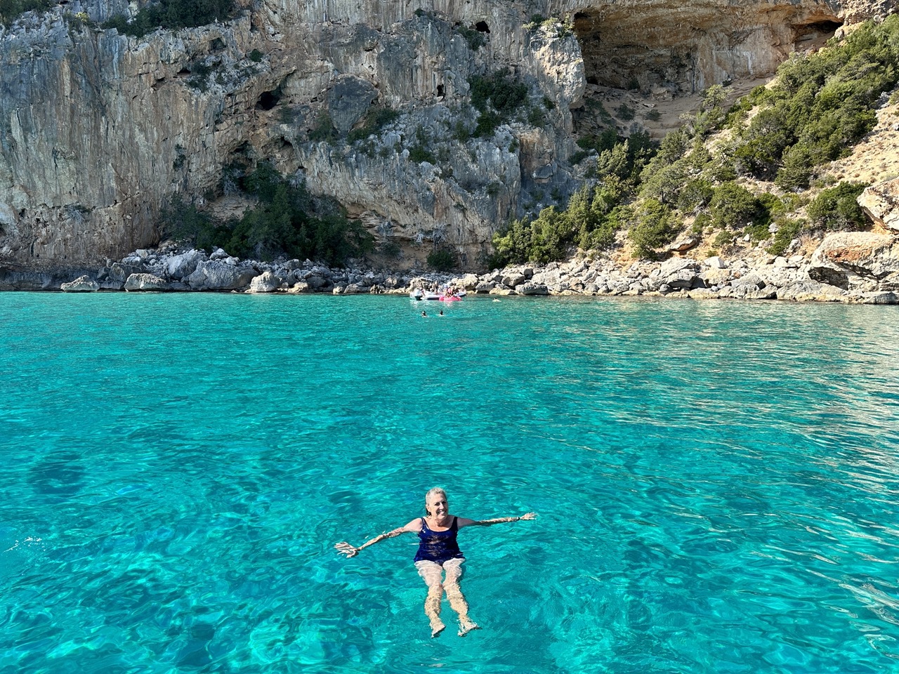
We stopped by Cala Goloritzè again in the afternoon for a swim, on our way back to Santa Maria Navarrese. I cannot adequately describe the beauty of the turquoise water.
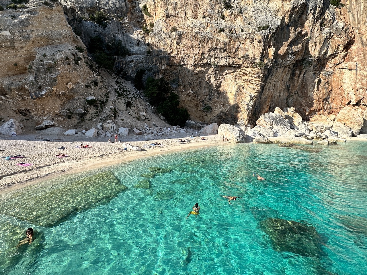
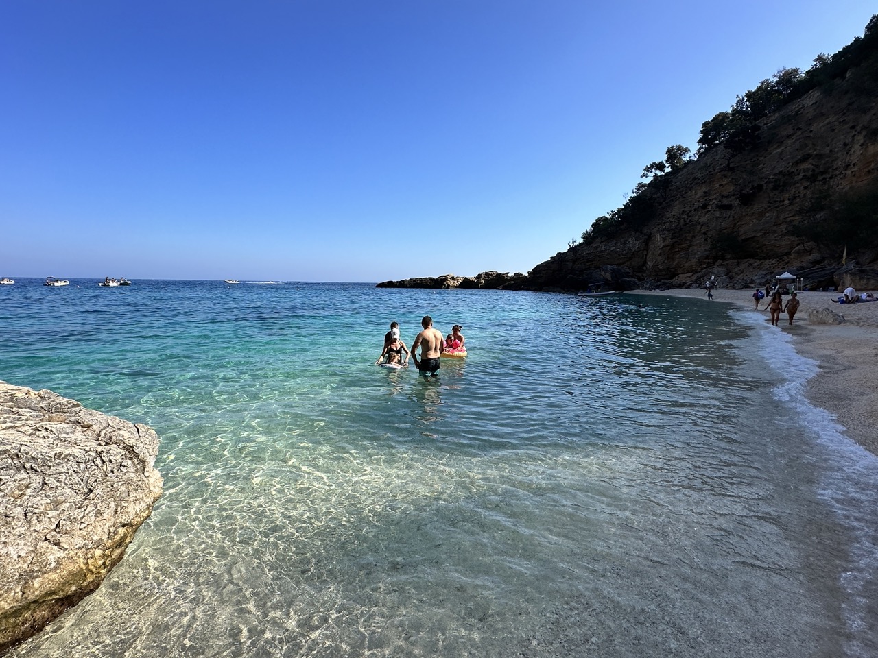
A view of Cala Marilou, one of my favorite stops along the Gulf of Orosei. What made it a favorite is that there are several beaches and coves to explore, such as shown below.
Another part of Cala Marilou, a small cove of stunning cliffs and beautiful water.
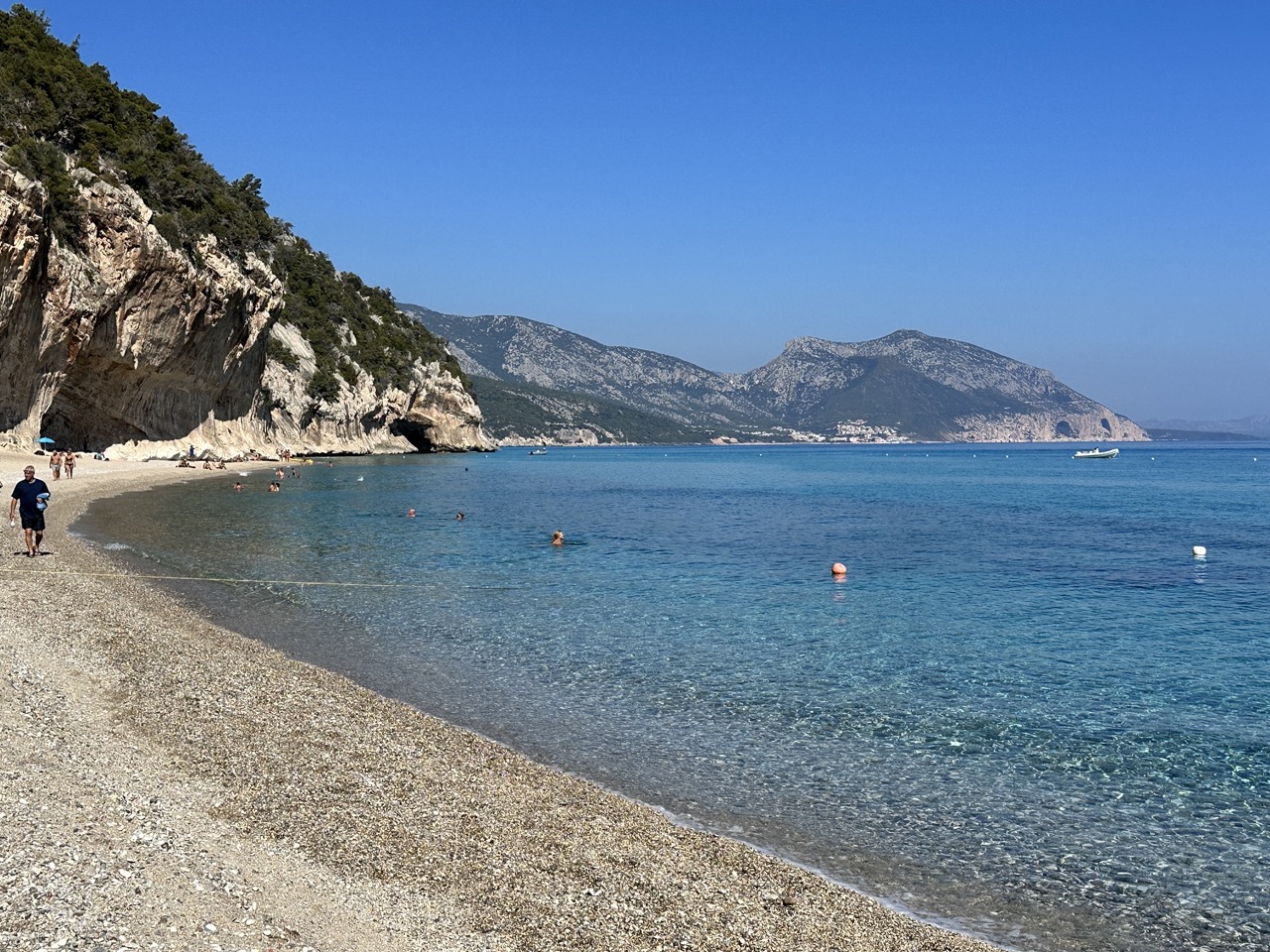
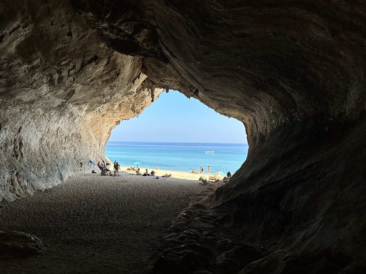
A view of Cala Luna, we stopped here over lunch time. There is a small bar and cafe behind the beach area.
A large cave on the beach at Cala Luna – a great place to get out of the sunshine if needed!
Above – another swim stop along the coastline of the Gulf of Orosei.One of our last stops of the day, Cala Biriola.
Located at the south end of Sardinia the city of Cagliari is the island’s capital, main city and port. Its population is roughly 150,000. Some cruise lines do make a port call at Cagliari. My recommendation would be to give the city itself 1-2 days and spend the rest of your time in Sardinia elsewhere because there is so much to see on this lovely island, one of Italy’s many treasures.
Unfortunately we didn’t get to do a lot of sightseeing in Cagliari; I had eight hours of business webinars to facilitate from my hotel room which took a chunk of the two days we had planned for our visit here. In spite of my work commitments, we still were able to get out and see a few things in Cagliari.
Cripta Santa Restituta
This church doesn’t look like much until you enter the crypt, and then you realize what a historical gem it is. The crypt is a natural limestone cavern that has a history dating back about 3,500 years to an era of pagan worship. The crypt is named for Restituta, a martyr who made cavern her home in the 5th century. You can see a few faded frescoes from the 13th century and World War II – era graffiti when local residents used the crypt as an air-raid shelter. This crypt was definitely a highlight of our time in Cagliari.
View of the Church above the Cripta Santa Restituta.
Views of the crypt, including a image of Saint Restituta – right.
Thirteenth century fresco of John the Baptist in Cripta Santa Restituta.
Some of the graffiti from those who sheltered in the crypt during World War II – 1939-1943.
Tuvixeddu Necropolis
If you’d like to see something a bit off the tourist radar, check out Tuvixeddu Necropolis. It is on the edge of the older part of Cagliari and does not seem to get many visitors. There is no fee to visit, and the walking paths are used by locals taking their dogs for a walk. For some reason, the informational placards have been allowed to fade and are hard to read. I understand you can get a tour guide to assist you with your visit and that could be very helpful. There are about 1,000 tombs here, originally developed in the 6th to 3rd centuries BC by the Carthaginians and then reused in Roman times. These tombs were also used as air-raid shelters in WWII. The necropolis is definitely worth a visit! A few images below.
Tombs in the cliffsides at Tuvixeddu Necropolis.Tombs carved into the hillside at Tuvixeddu. It must have been a huge amount of work to carve these tombs in hard rock, and to get the walls so smooth.
This image shows how deep some of the rock tombs are – I’m guessing this one is about 15 feet deep, over twice my height. Other are deeper. I would love to explore these, but it’s clear the local authorities don’t want you doing that from the signs and access barriers.
Bastione San Remy
This 19th-century structure is one of Cagliari’s iconic locations. From the terrace, you are rewarded with a sweeping view of Cagliari and the shoreline. There are a number of restaurants below Bastione San Remy, this is a good area to wander in the evening as the sun sets.
View of Cagliari from the Bastione San Remy.
View of Bastione San Remi from the street level.
The terrace archway at Bastione San Remi.
Il Castello
This is Cagliari’s hilltop citadel, surrounded by huge walls with several towers and gates. The interior of the citadel seemed pretty quiet – there is a university here and cathedral and some small squares, but not many tourists!
The massive walls of the Il Castello, Cagliari.
Views of the Cathedral of Santa Maria, located in the citadel, which dates from the 13th century (specifically the square bell tower – left image). The cathedral has been renovated over the centuries. The image on the right is the Sanctuary of Martyrs, the only one of several underground rooms open to the public. The relics of 179 martyrs are kept here.Left – one of the citadel’s little public squares, right – view of the bay and harbor from the citadel.
Other Views of Cagliari
Other beautiful churches in Cagliari – I would have loved to have the time to explore these more.
This is about the only view I could get of the Roman amphitheater in Cagliari, which dates from the 2nd century AD. Unfortunately, it was closed during the time of our visit for restoration work. The amphitheater is just outside the Il Castello.
I would have also liked to visit Poetto Beach – just to the south of Cagliari’s old town. It looks lovely. However, we had visited many other beaches in Sardinia so we decided to prioritize our time to see the city’s other sights.
Hotel
We stayed at the Palazzo Tirso hotel in Cagliari, a beautiful hotel right on the waterfront and close to everything we visited above. The service was excellent and the room was very comfortable. I wanted to ensure I had good internet capability and I needed an early check-in, so we chose this hotel. Definitely recommended!
Views from the Palazzo Tirso hotel rooftop.
The pool and lounge area on the rooftop of the Palazzo Tirso Hotel.
Outside Cagliari
There are several other interesting sights not too far from Cagliari that could make nice day-trips, including the ancient Su Nuraxi di Barumini (which you can read more about here). Also, the Roman settlement of Nora (west of Cagliari) is definitely worth visiting and the fantastic resort area of Villasimius, southeast of Cagliari – with so many beautiful beaches it’s hard to know where to begin! I will be posting about Nora and Villasimius soon.
Oristano is not likely to be on the main tourist route in Sardinia, Italy especially if time is limited. However, if you have the time, you should definitely check it out. There is a lot to do in this region of Sardinia. Here are the main sights we visited. In addition to the sights listed below, there are ancient Nuragic sites not far from here. For a map of Sardinia and to learn more about these sites, see my post here.
Is Aruttas Beach
This beach on the Sinis peninsula is about 22 km (13 miles) from Oristano and one of the region’s most famous. There is a large parking lot and a refreshment stand near the beach. The quartz sand on this beach is amazing, I wish I had taken a close-up of it – it looks like translucent rice. Just another perfect beach in Sardinia! As with all beaches in Sardinia, it is a crime to remove the sand – be sure to leave the sand where it belongs on the beach for others to enjoy!
Views of Is Arutas Beach.
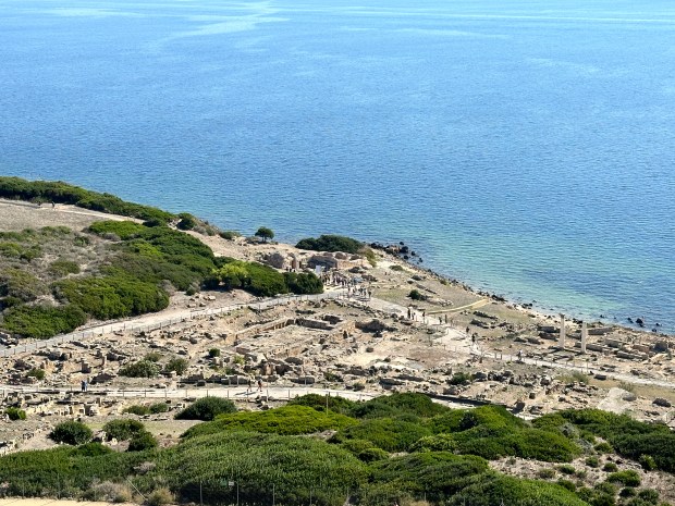
Tharros Roman Archeological Site
Tharros was occupied for nearly 2,000 years, from the 8th century BC to about 1050 AD. It sits near the end of the Sinis Peninsula, and it’s a spectacular setting.
A view of the ruins of Tharros and the late 15th-century San Giovanni Tower, which you can climb for a small additional fee.
Additional views of the ruins of Tharros.
This gorgeous beach is a stone’s throw from Tharros. Roman ruins, a 15th- century Spanish Tower and beautiful beach – what more could you ask for?!
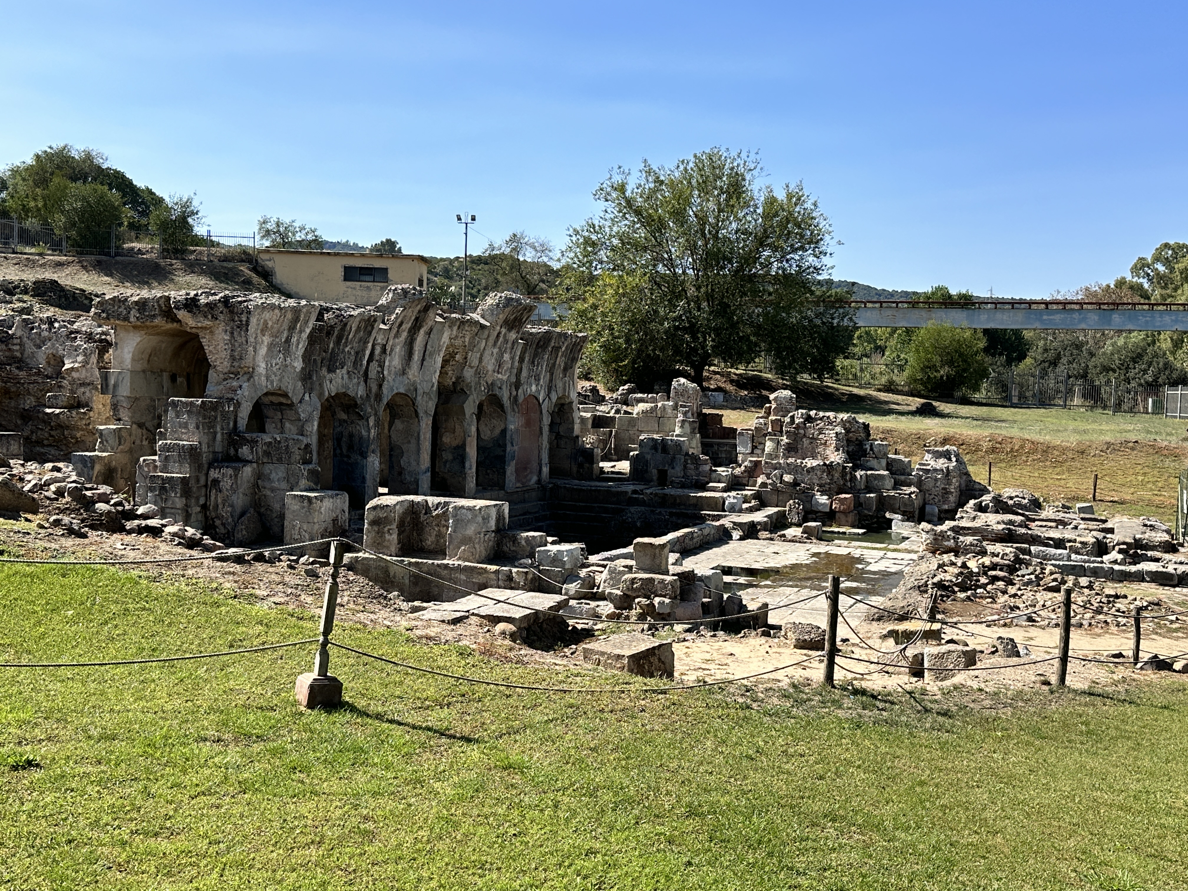
Fordongianus Roman Archeological Site
The water still runs warm from the natural springs at the 1st century AD Fordongianus Roman Baths. This site is about 25 km (14 miles) northeast of Oristano. We stopped by on our way into Oristano, but we arrived during siesta time so we had to settle for looking at the Baths through a wire fence, which actually offered some pretty good views. There is a fee to visit the Baths.
Fordongianus Roman Baths.
Just outside Fordongianus is this pretty 12th & 13th century Romanesque church, dedicated to San Lussorio, who was martyred by the Emperor Diocletian in 304 AD.
San Giovanni di Sinis Church
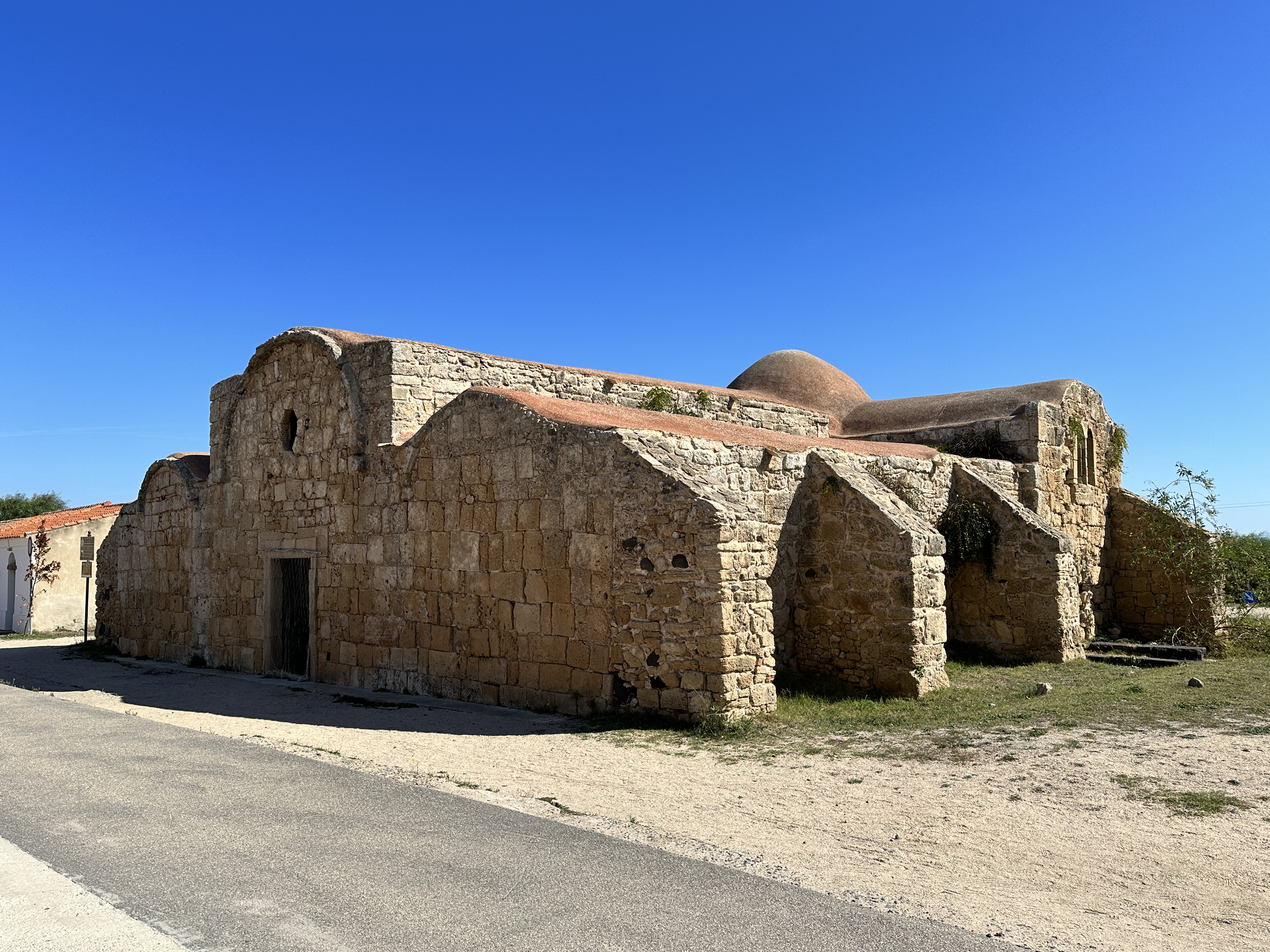
This interesting little church is right near the entrance to the Tharros archeological site. It is one of the two oldest churches in Sardinia, originally dating back to the 6th century – it still retains some of its Byzantine characteristics, such as the red roof. The present structure dates from the 9th and 11 centuries. The church sits in an ancient burial area. The church was free to enter and was definitely worth a stop.
San Giovanni di Sinis Church.
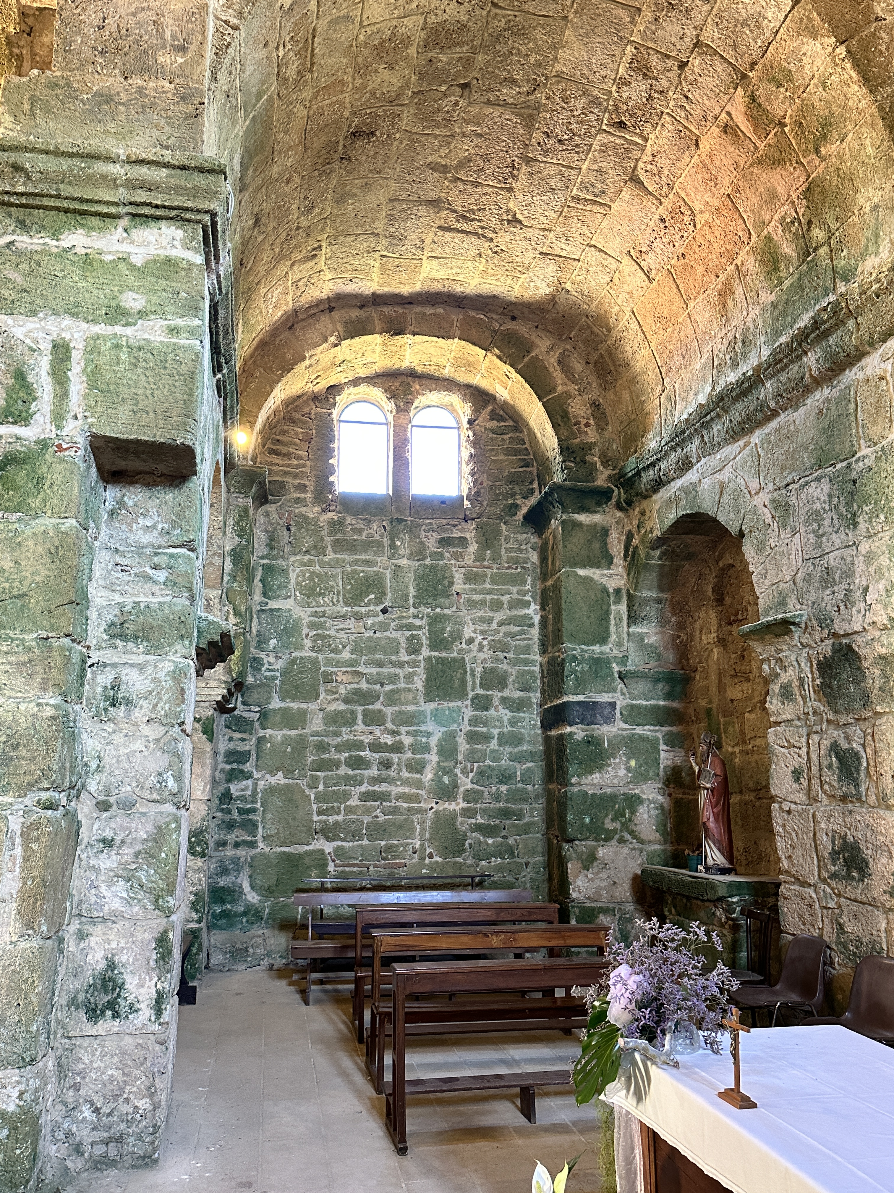
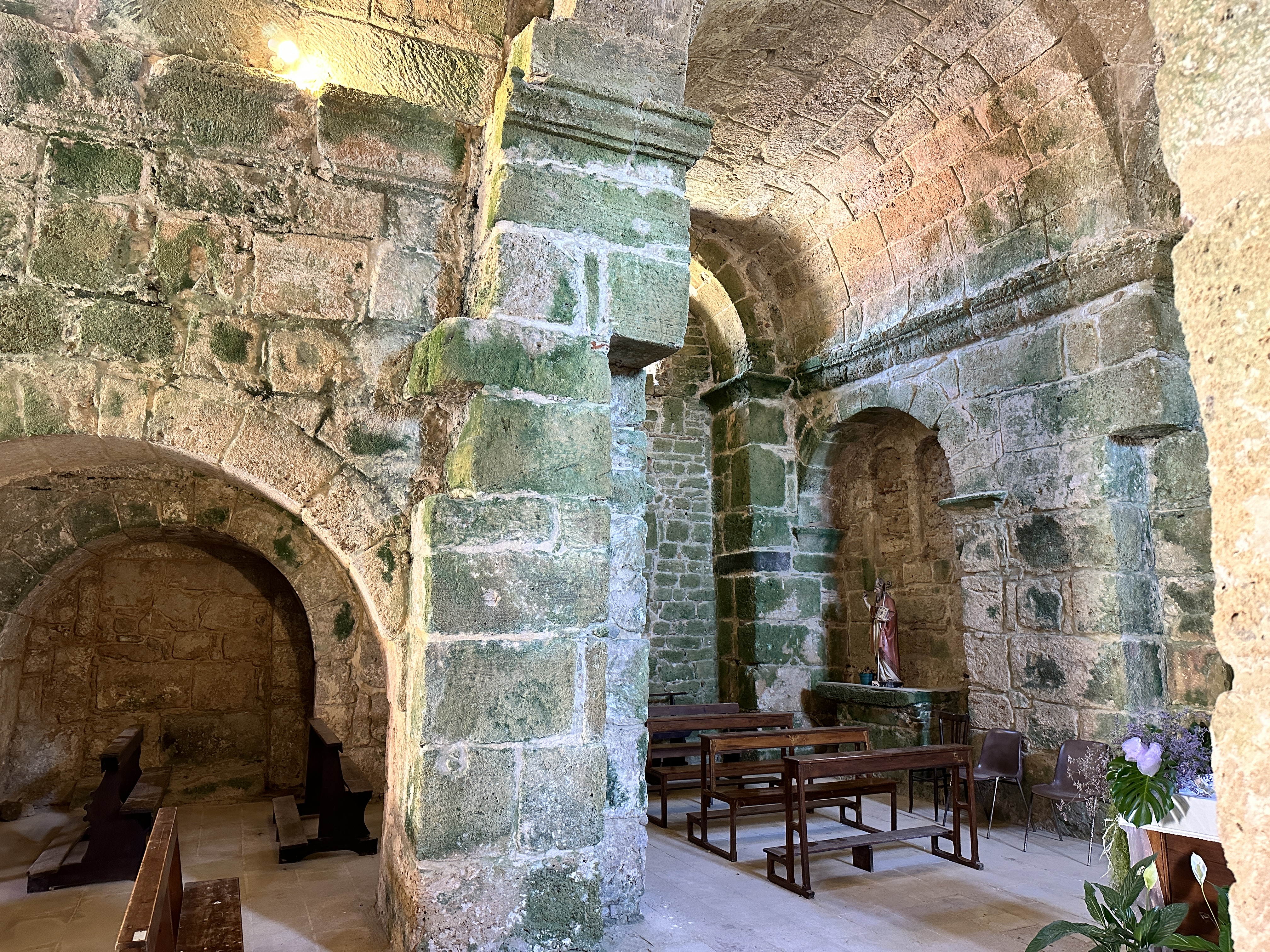
Views of the interior of San Giovanni di Sinis Church, with green algae covering some of the ancient stone walls.
San Salvatore
San Salvatore, also close to Tharros, is a spaghetti-western filmset from the 1960’s. It has the feel of a old western U.S. ghost town. The town opens its dwellings’ doors during September each year to house pilgrims for the Festa di San Salvatore, a celebration focused on the village’s small church, which sits over the ruins of a Nuragic period (~1,500 BC) vault. It looked to us like there might be a few permanent residents here, we saw some homes that looked lived in.
Views of San Salvatore.
Oristano Town
Oristano seemed to us to be a pretty quiet town, without fewer tourists compared to other locations in Sardinia, even though there is much for the tourist to see in the vicinity. We enjoyed walking the streets in the evening without any throngs of tourists. It is a perfect place to call “home” during your stay in this part of Sardinia.
The 13th-century Torre di Mariano II was Oristano’s nothern gate, one of the few remains of the city’s medieval defenses.
Views of the Catedrale di Santa Maria Assunta. The 14th century bell tower still stands. The rest of the current structure is 18th century.Left – Torre di Portixedda, part of Oristano’s original medieval walls. Right – street scene in central Oristano.
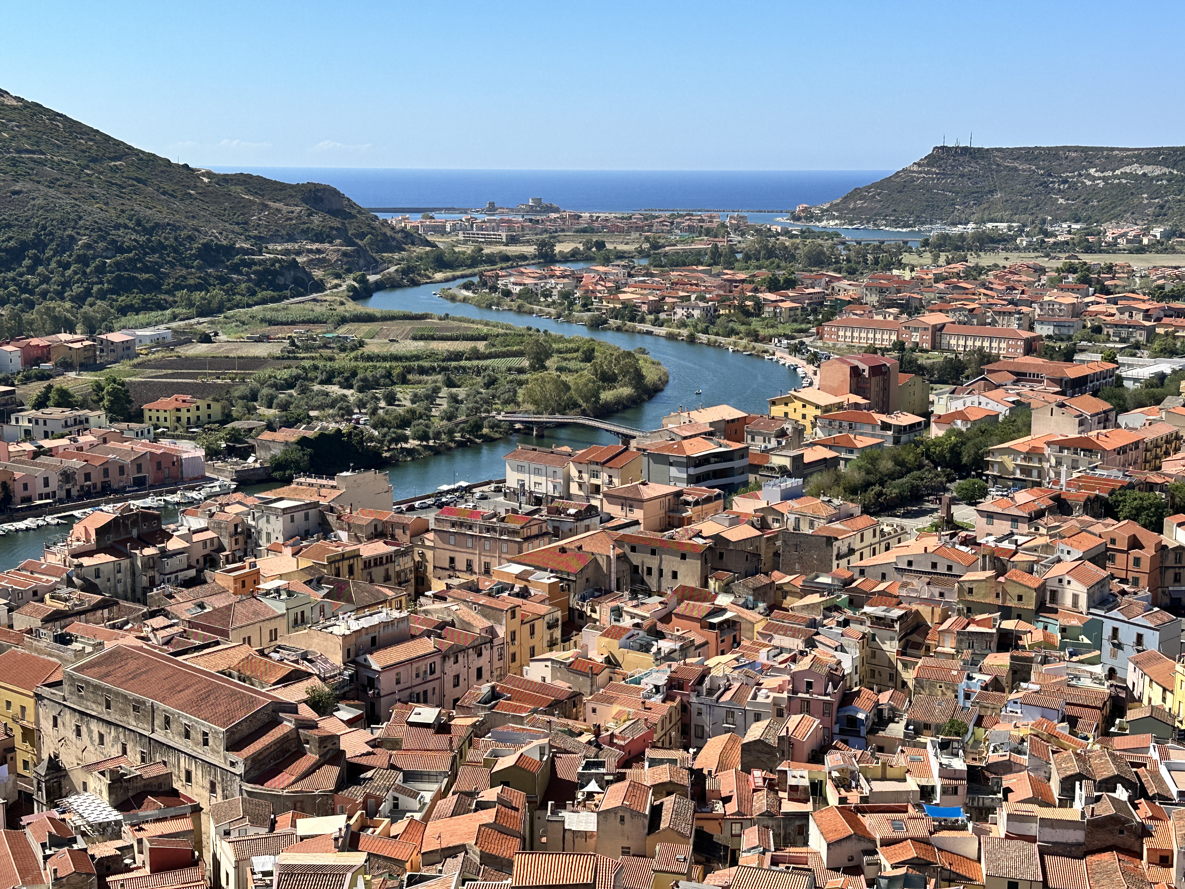
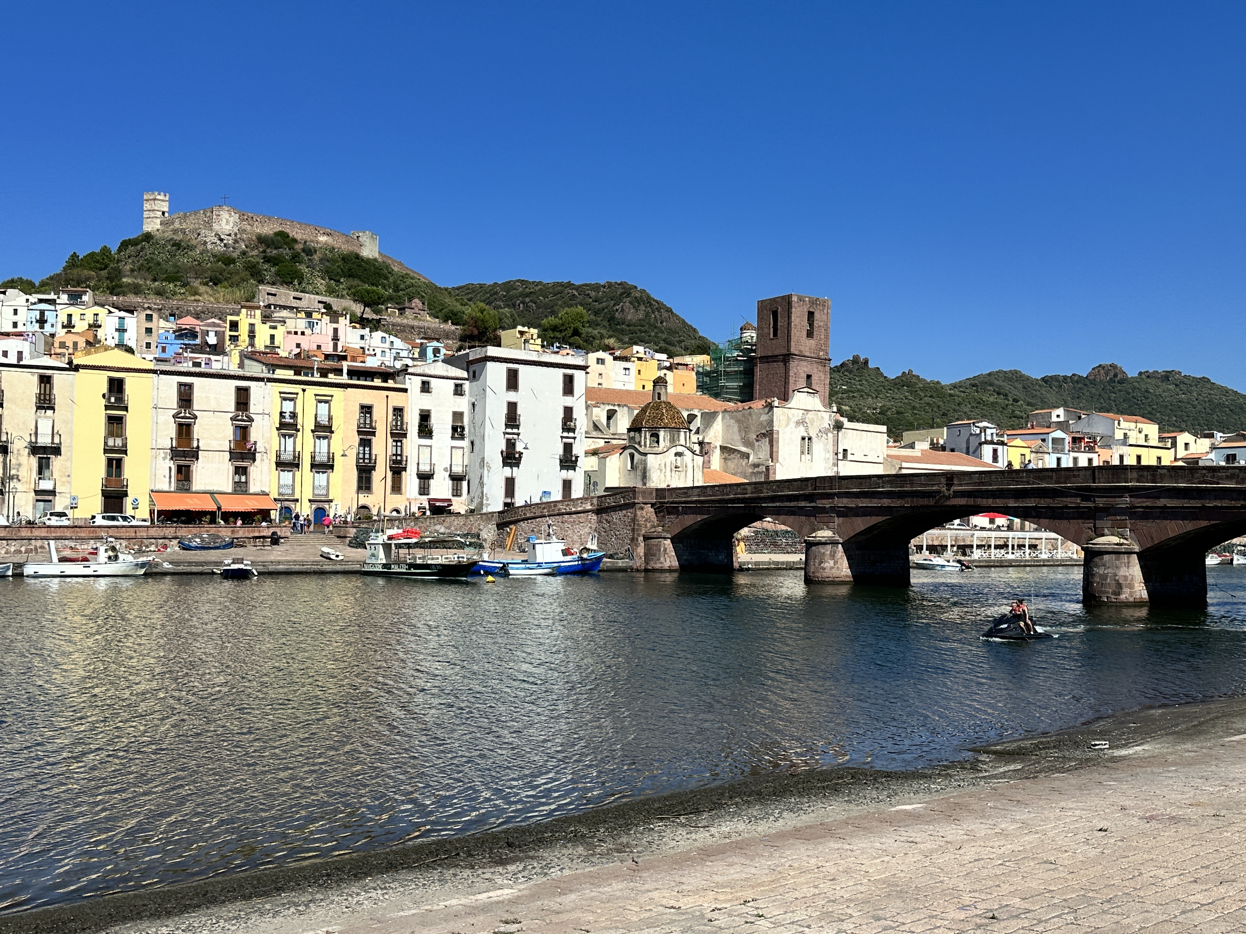
About one hour south of Alghero by car (45 km or 28 miles) is the town of Bosa, home to Sardinia’s only navigable river (the Temo River). We visited Bosa as a day trip from Alghero and we made it part of an interesting loop drive – visiting Basilica della Santissima Trinità di Saccargia on the way (see below) and Nuraghe Santu Antine. It’s possible to visit all three sights in one day if you get going early from Alghero. (For a general map of the regions we visited in Sardinia, click here).
Bosa is an ancient town, it was established by the Phoenicians and continued to grow under the Romans. It’s easy to see why, Bosa is an ideal port location – close to the coast and at the mouth of the Temo River.
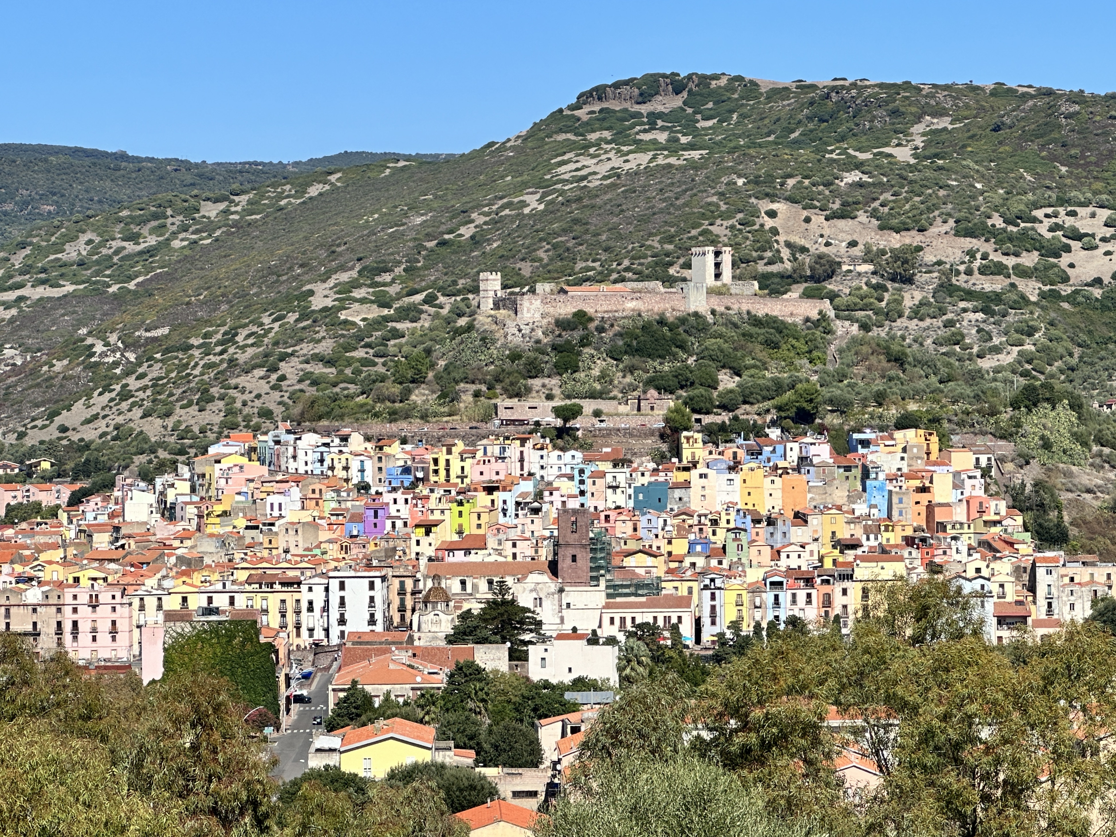
View of Bosa and its 13th century castle as seen from our drive into town.
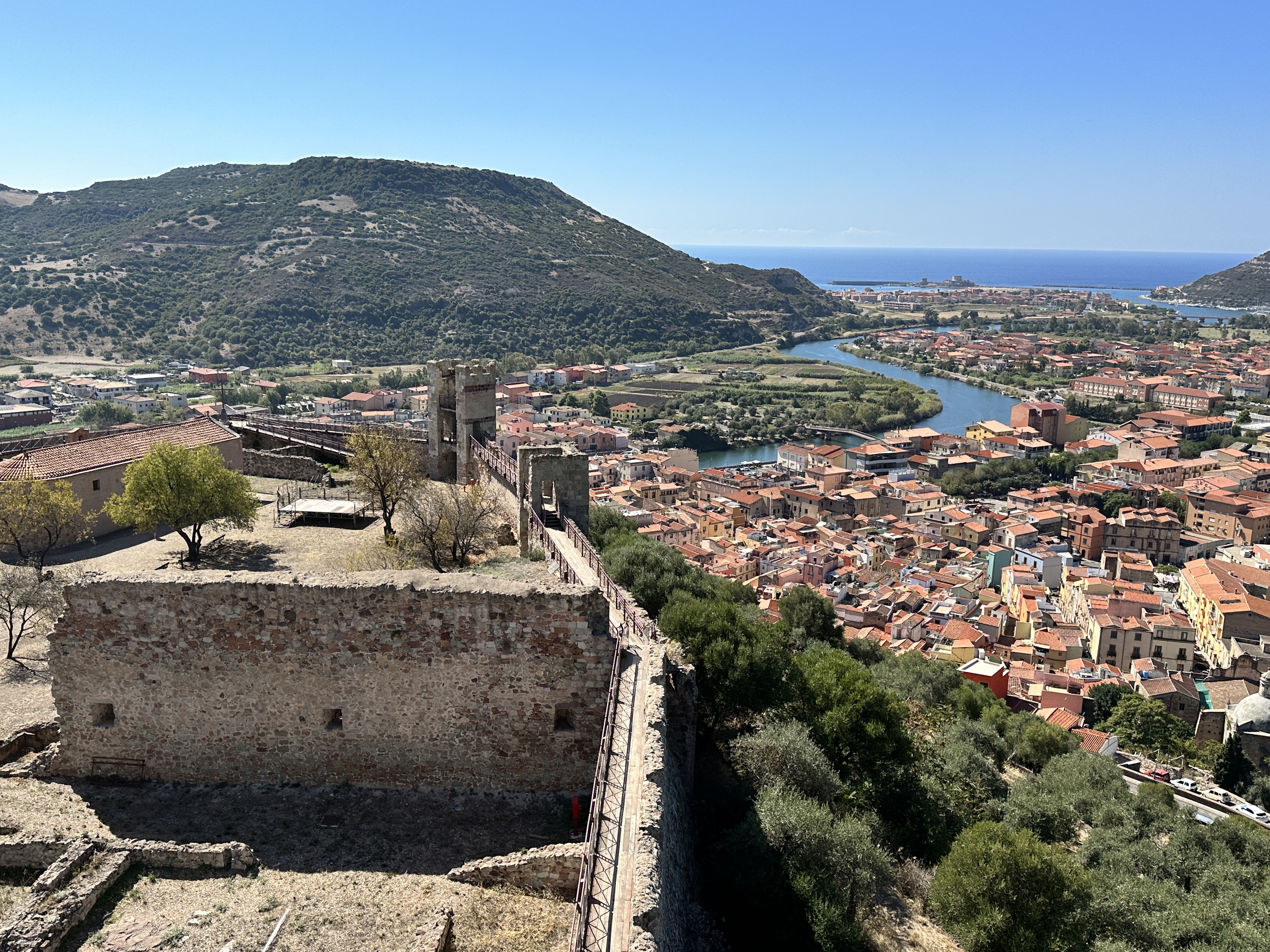
Malaspina Castle
One of the main sights in Bosa is Malaspina Castle. You can drive up to the castle and park just below it. Even then, you have a steep walk up into the Castle. There is not much left of the Castle other than the walls (which you can walk), a few towers (which you can climb) and the 14th century Chiesa di Nostra Signora di Regnos Altos, which has some lovely frescoes.
The view of Bosa from Malaspina Castle, built in the 12th and 13th centuries by a Tuscan noble family to protect Bosa from pirate raids.
14th century frescoes of Saints in the Chiesa di Nostra Signora di Regnos Altos, within the walls of Malaspina Castle.
The old town of Bosa is a delight to wander, and as is possible in every Italian town, we enjoyed some great food!
A postcard view of Bosa with the Malaspina Castle in the distance, the old town across the river, and Ponte Vecchio spanning the Temo River. We parked for free near this spot, just a short walk from the old town.
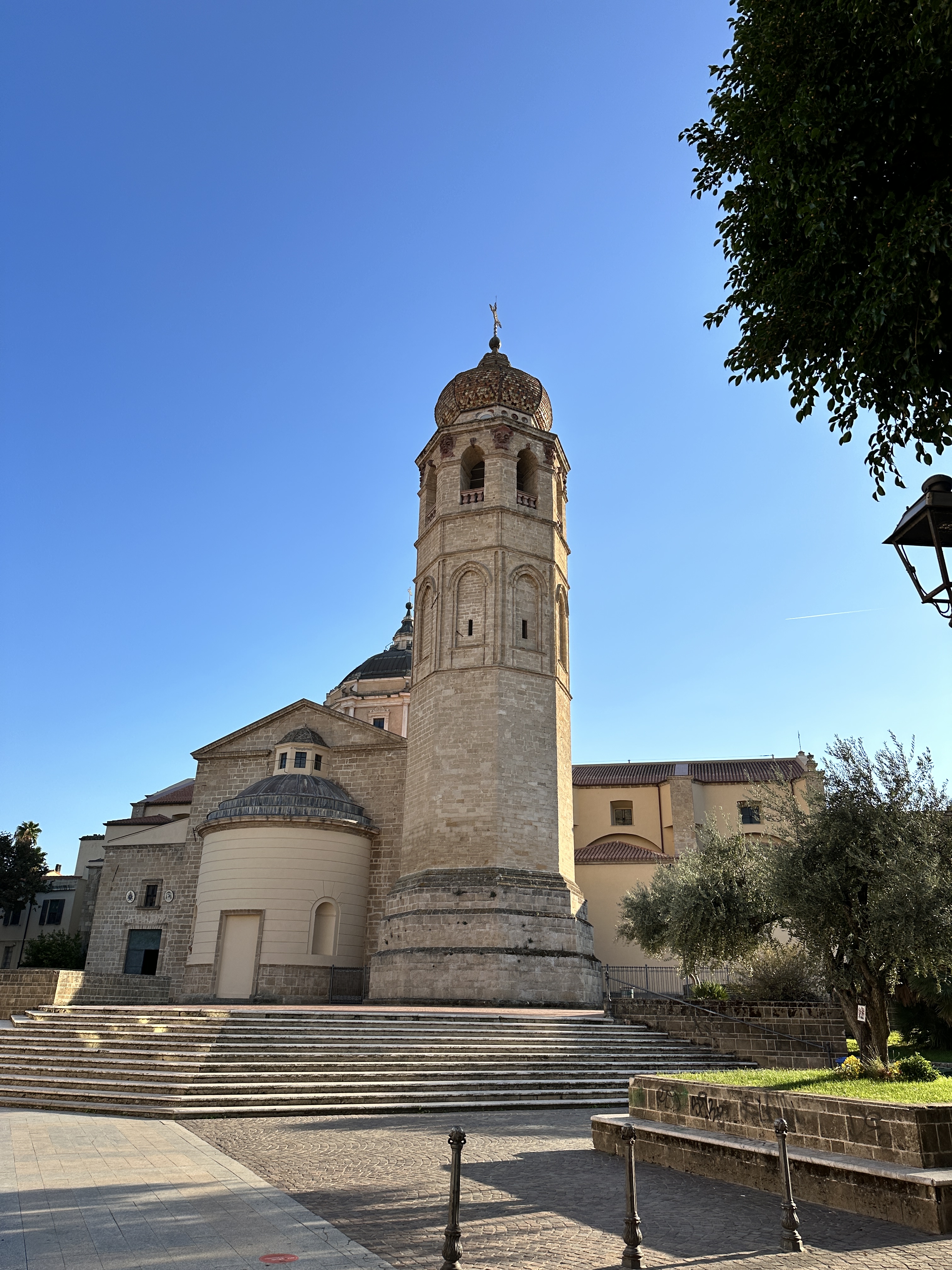
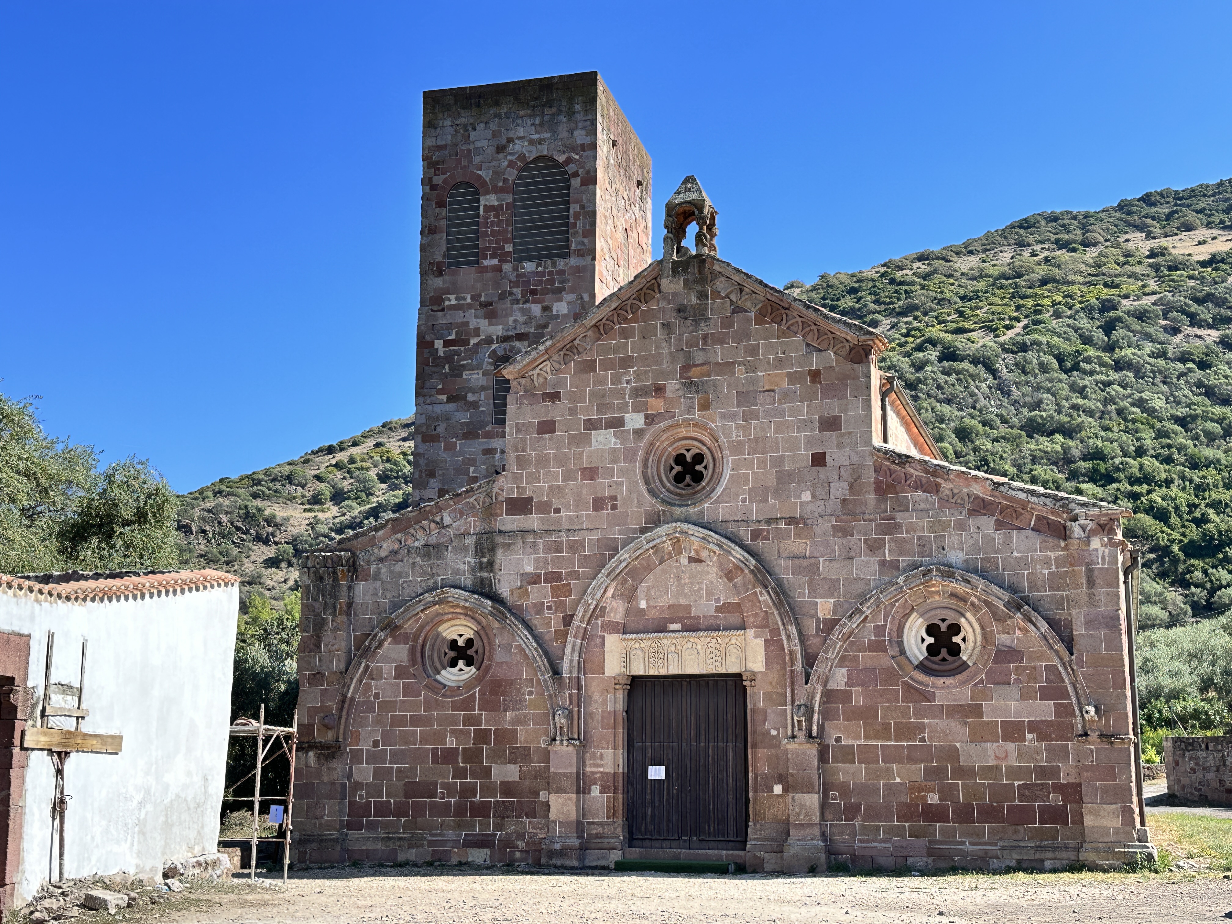
St. Peter’s Church
Just outside Bosa along the south shore of the Temo River is St. Peter’s Church, which dates from the second half of the 11th century. The Church can be visited, but was closed at the time of our visit. There is information posted about the Church near the entrance.
Views of St. Peter’s Church outside Bosa. The image on the right is a snapshot of a signpost at the Church, to at least provide a glimpse of the interior.
On the Drive to Bosa: Basilica della Santissima Trinità di Saccargia
The Church of the Holy Trinity Saccargia is about a 40-minute drive (50 km or 31 miles) from Alghero. It is well worth the “detour” to visit this fascinating 12th century Pisan-style basilica on the way to Bosa. The abbey was built on the site of a pre-existing monastery, of which there are some scant ruins.
Views of the exterior of The Church of the Holy Trinity Saccargia, constructed of alternating layers of white limestone and dark volcanic rock.Views of The Church of the Holy Trinity Saccargia’s nave. The frescoes are from the second half of the 12th century – amazingly well-preserved.Some interesting figures in the church – left – a face in the wall of the nave and right – cows carved into a pillar on the portico. Some believe the name of the Church comes from the Sardinian word for “cow with the spotted hide”, but this is not likely. The land surrounding the church is rural and probably has been perfect grazing pasture for centuries.
About 20 minutes south of The Church of the Holy Trinity Saccargia is the ancient archeological site of Nuraghe Santu Antine, also a very worthwhile stop before turning southwest on your drive towards Bosa. Since I covered our visits to Sardinia’s ancient Nuraghe in another post, I won’t comment further on it here.
After our visit to Bosa, we drove north along the west coast of Sardinia back to Alghero. It was a scenic, beautiful drive and the perfect end to another perfect day in Sardinia.