While there’s a lot to see in Barcelona, Spain there’s also a lot to do outside this beautiful city. We were only in Barcelona for three days and decided to spend one of those three days visiting the famous monastery of Montserrat, known as Santa Maria de Montserrat.
Getting There
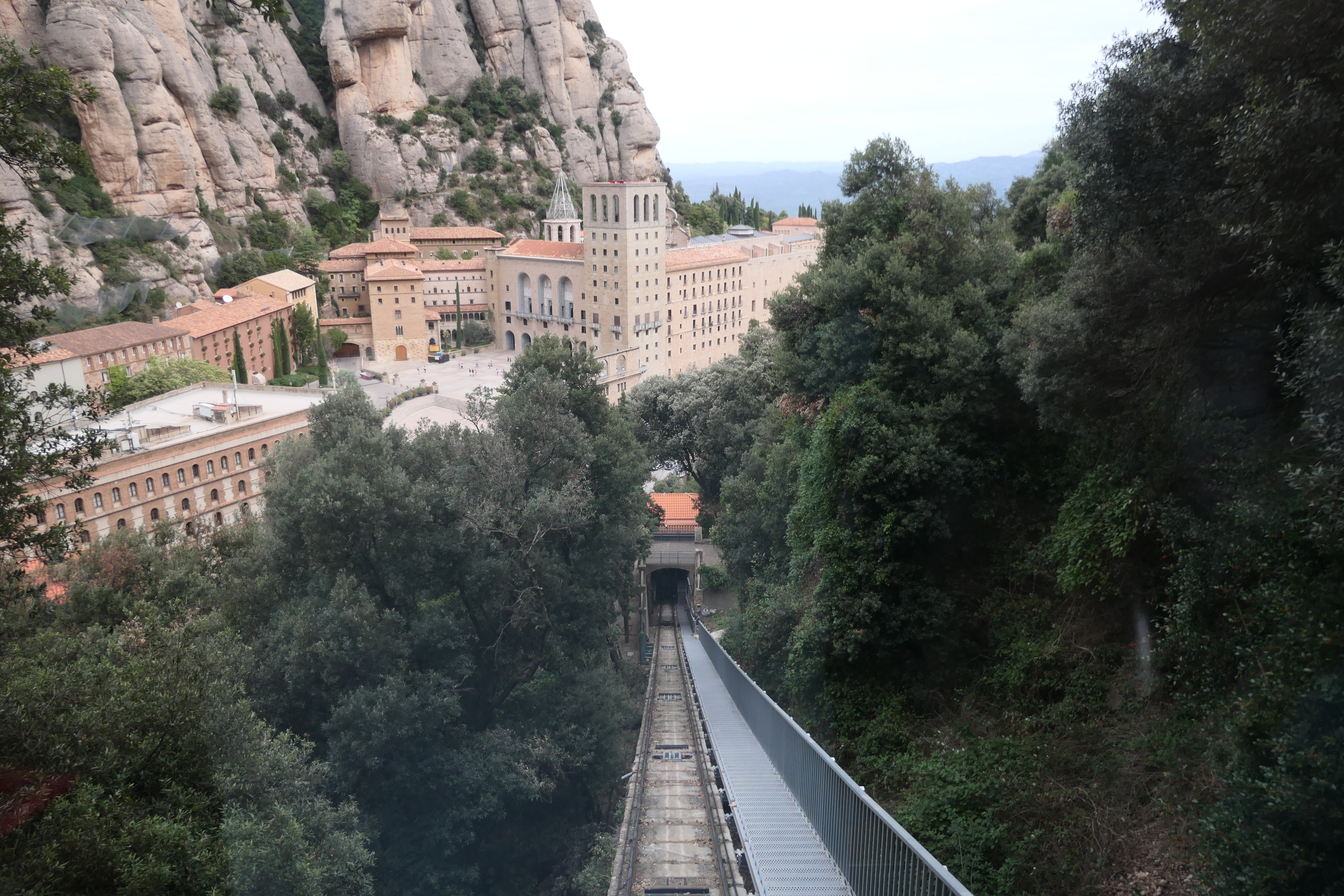
There are various ways to get to Montserrat, you can take a train from Barcelona, drive a car, hike up the steep hills (as pilgrims have done for centuries), or take a tour. We decided to take the easy route by joining a day-tour from Barcelona. We made our reservation at a tour kiosk on the beautiful Las Ramblas street in Barcelona. The tour bus drove us up to the head of the valley right below Montserrat and then we took a steep train ride (Cremallera Rack Railway) the rest of the way up the mountain.
A view of the Rack Railway Station where we took the train up the steep mountain side to the Montserrat Monastery.
On the return, our tour bus met us at the bus parking area next to the Monastery and we drove all the way back down to Barcelona. The bus ride was about one hour each way. I think we had about 3 1/2 hours to visit the monastery, which was enough time to visit the Basilica where the Black Madonna is housed, visit the various shops, walk up to the St. Michael’s Cross overlook/viewpoint (fairly steep but paved most of the way), take the Sant Joan funicular (super steep!) behind the monastery to a spectacular viewpoint and access point for the hiking trails high above the monastery, and to be back to the Basilica in time enough to get in line to (hopefully) see the Boys Choir perform. Reservations are now required to see the Boys Choir and our tour did not include those reservations – our tour guide warned us of that fact when we got on the bus. However, we waited in a line in front of the Basilica shortly before the afternoon performance and we were able to get in and find seats at the last minute.
Monastery
One of the best features of the monastery is its striking setting in the Montserrat mountains. It was originally founded in 1025, and I can see why it was founded here – a protected site that is not easy to get to and pretty easy to defend! The Monastery has a long and famous history, it’s been a pilgrimage site for a thousand years because of the Black Madonna, housed prominently in the Basilica.
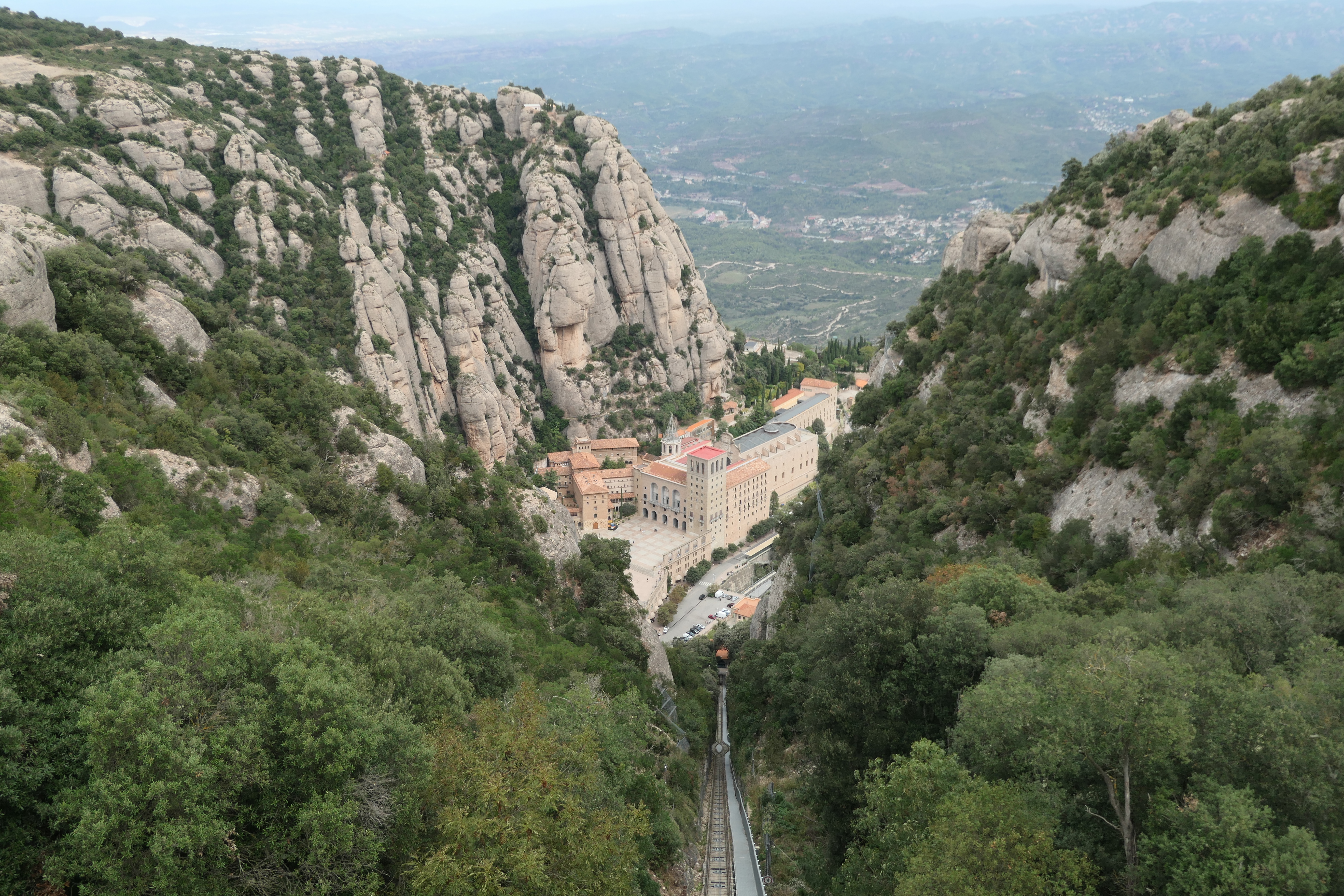
View of Montserrat Monastery from the Sant Joan Funicular.
Above – various views around the Monastery grounds, including the entrance to the courtyard of the Basilica (left), and Monastery Hotel (right).
A very interesting statue of a knight – his eyes followed you left or right – you could swear they moved!
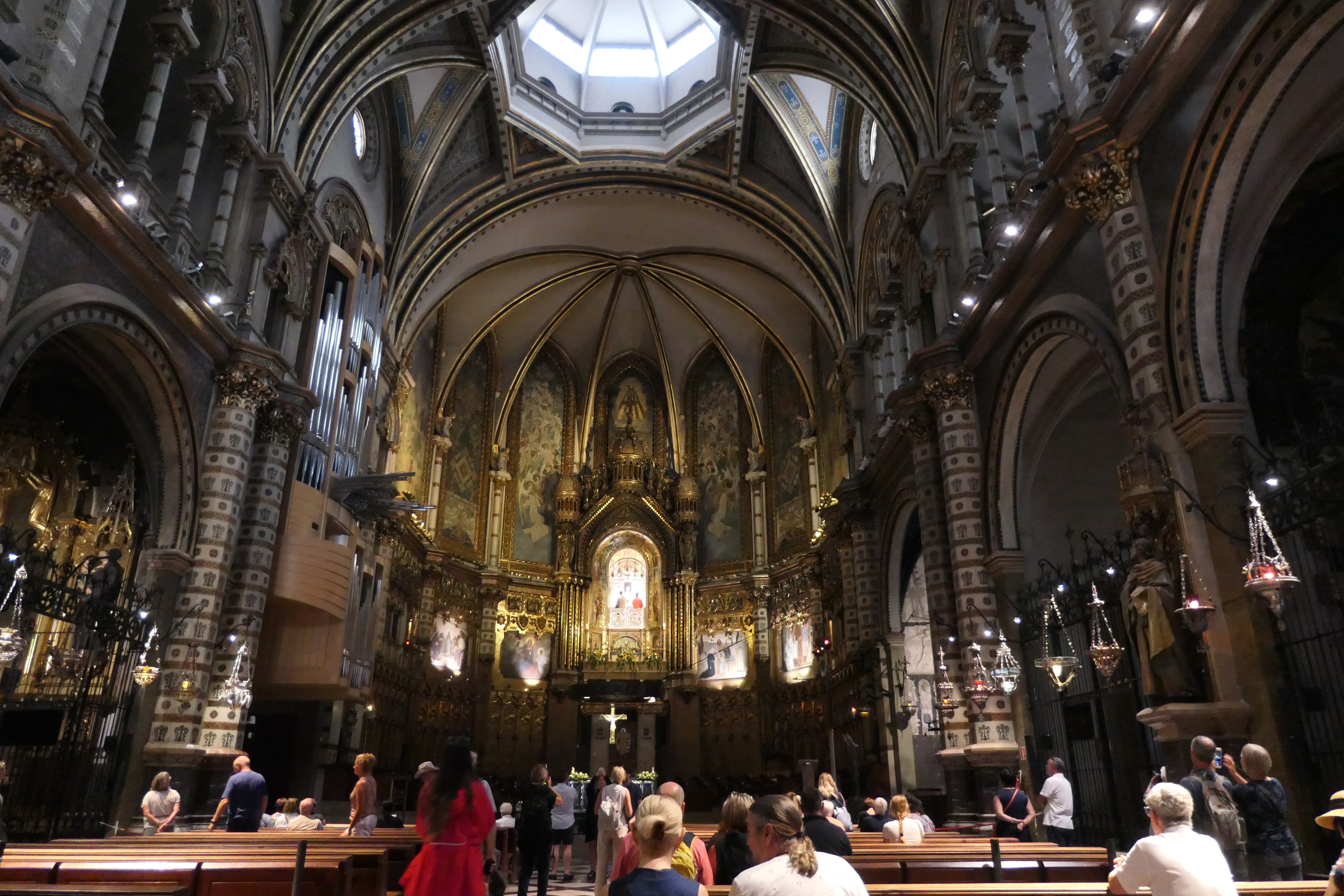
The Basilica courtyard (left) and interior (right) – the Black Madonna is in the upper center of the image – it was hard to get a good zoom-in photo in this light. You can buy a ticket to get a closer look.
One of Montserrat’s Benedictine Monks.
More about Montserrat’s history can be found here. In addition to a day trip, you can stay overnight at the hotel on the Monastery’s grounds if you wish.
Montserrat Boys Choir
Montserrat Monastery is home to one of the oldest boys’ choirs and music schools in Europe, dating back to the 14th century. It’s called Escolania de Montserrat. More information on the choir can be found here. We were so glad that we were able to see them perform. We visited in October and they were doing a couple of performances that day, and luckily we were able to get into the Basilica for their afternoon performance, in perfect timing with our tour visit.
A view of the Boys Choir at Montserrat’s Basilica.
A short video of the Boys Choir performance.
Views From Around the Monastery
Sant Joan Funicular
You can buy a ticket to take the steep funicular ride up the hill behind the Monastery. I highly recommend this if you have time. The views are incredible, and you can hike all around the tops of these mountains.
View from the top of the funicular at Montserrat Monastery.
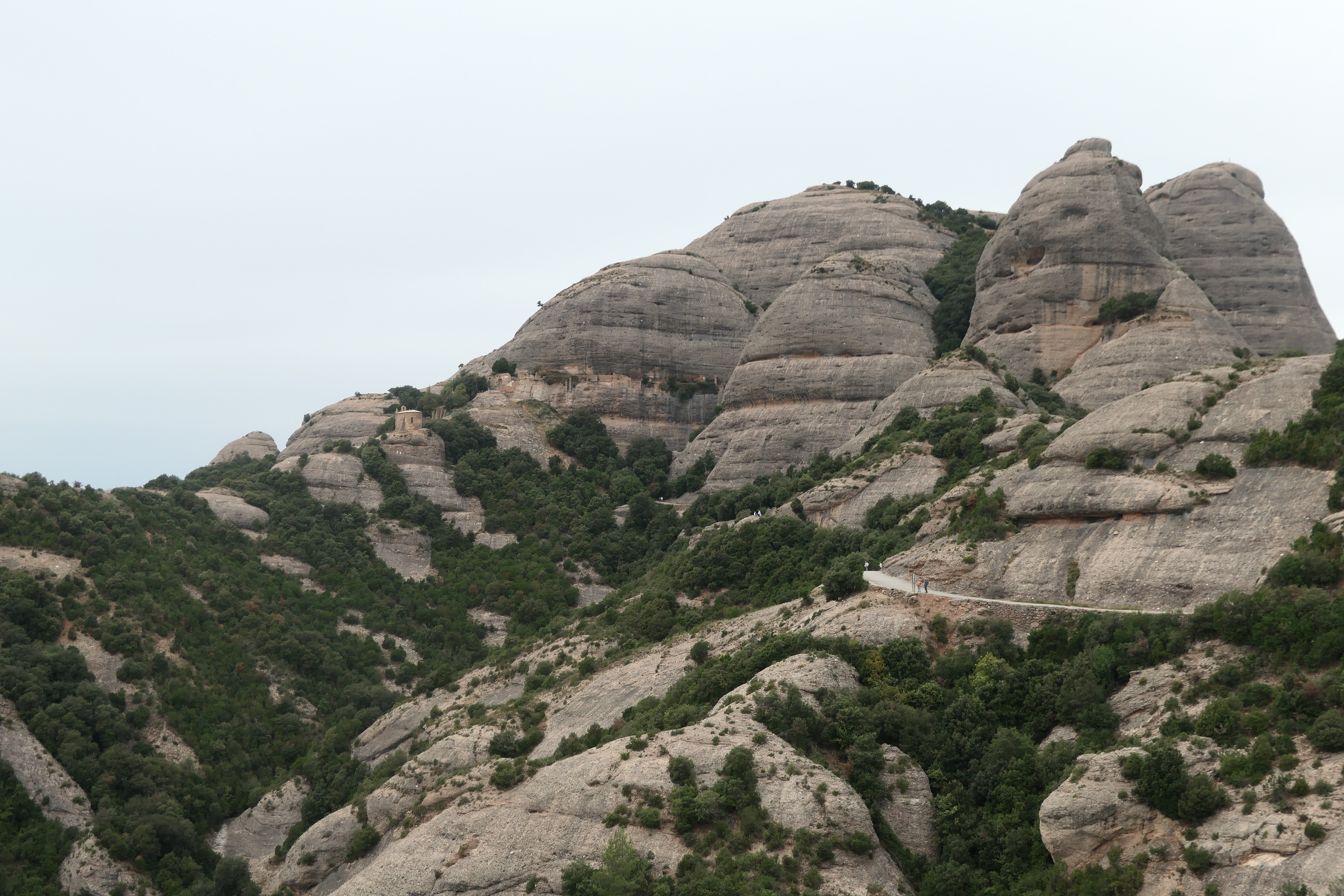
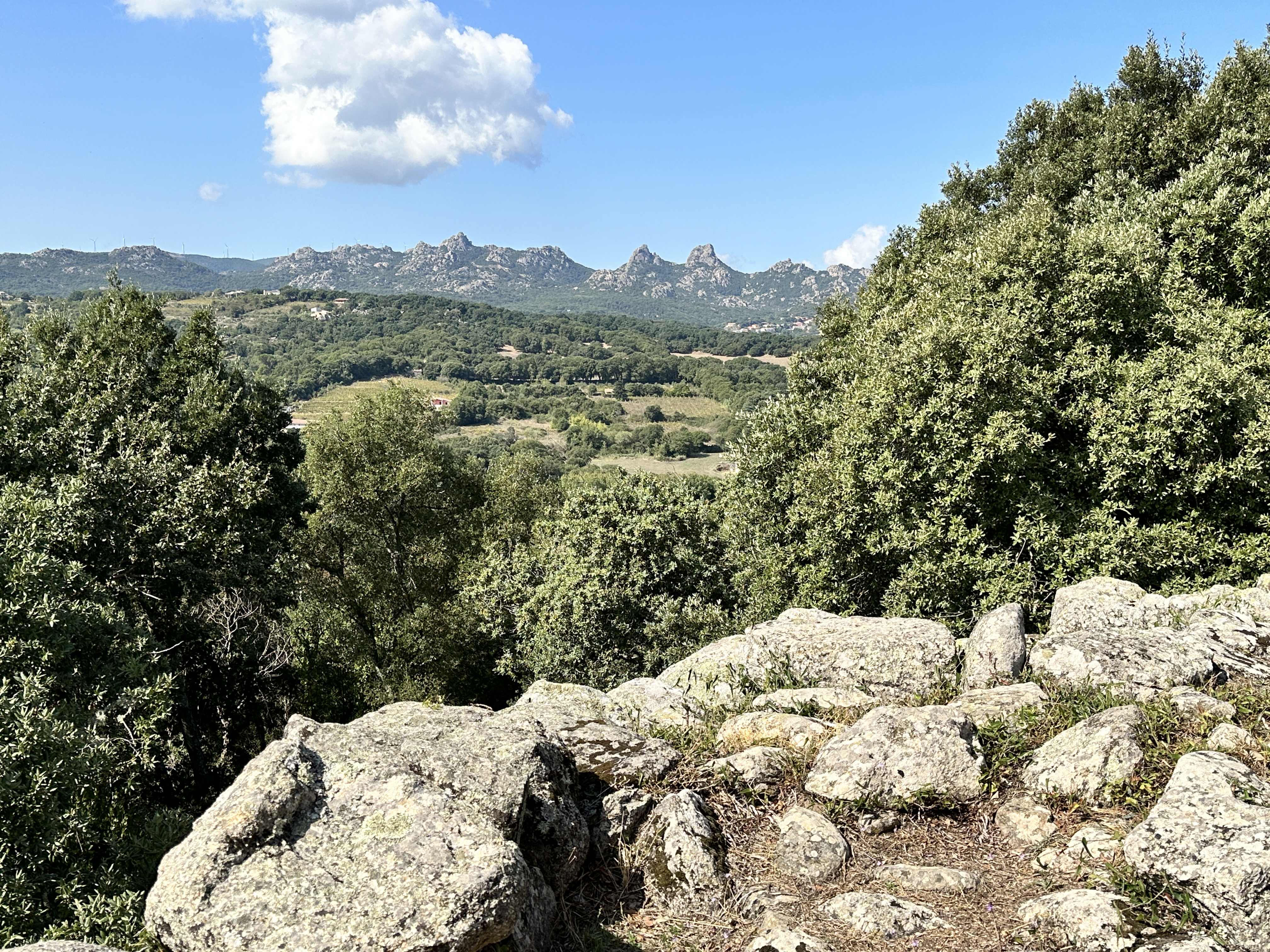
View looking west from the top of the Sant Joan’s Funicular at Montserrat. There are a number of trails in the area, including pilgrimage routes down to the Monastery. We went a short distance on several trails just to check them out, but we didn’t have time to explore the area too much. We loved the interesting rock formations – the mountains reminded us of the Front Range (part of the Rocky Mountains) near Denver, Colorado.
St. Michael’s Cross Viewpoint
A short steep hike from the Monastery takes you to St. Michael’s Cross, also known as Creu de Sant Miquel, which has a commanding view of the Monastery and the valley below. The trails are well sign-posted.
Visiting Santa Maria de Montserrat is a great way to spend a day in the Barcelona region. If time allows, definitely make the visit!
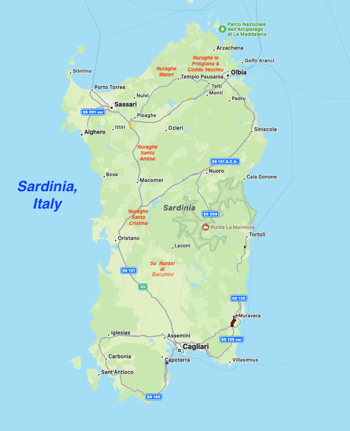
If you enjoy archeology, Sardinia, Italy should be high on your list of places to visit. There are a number of Bronze Age (approximately 1900 BC to 730 BC) settlements throughout the island. The main towers of these settlements are called Nuraghe (essentially ancient towers/castles surrounded by small villages) and they are unique to Sardinia. According to Wikipedia, more than 7,000 of these structures have been found on the island. Very little is known about the people who inhabited these structures or what they used these structures for.
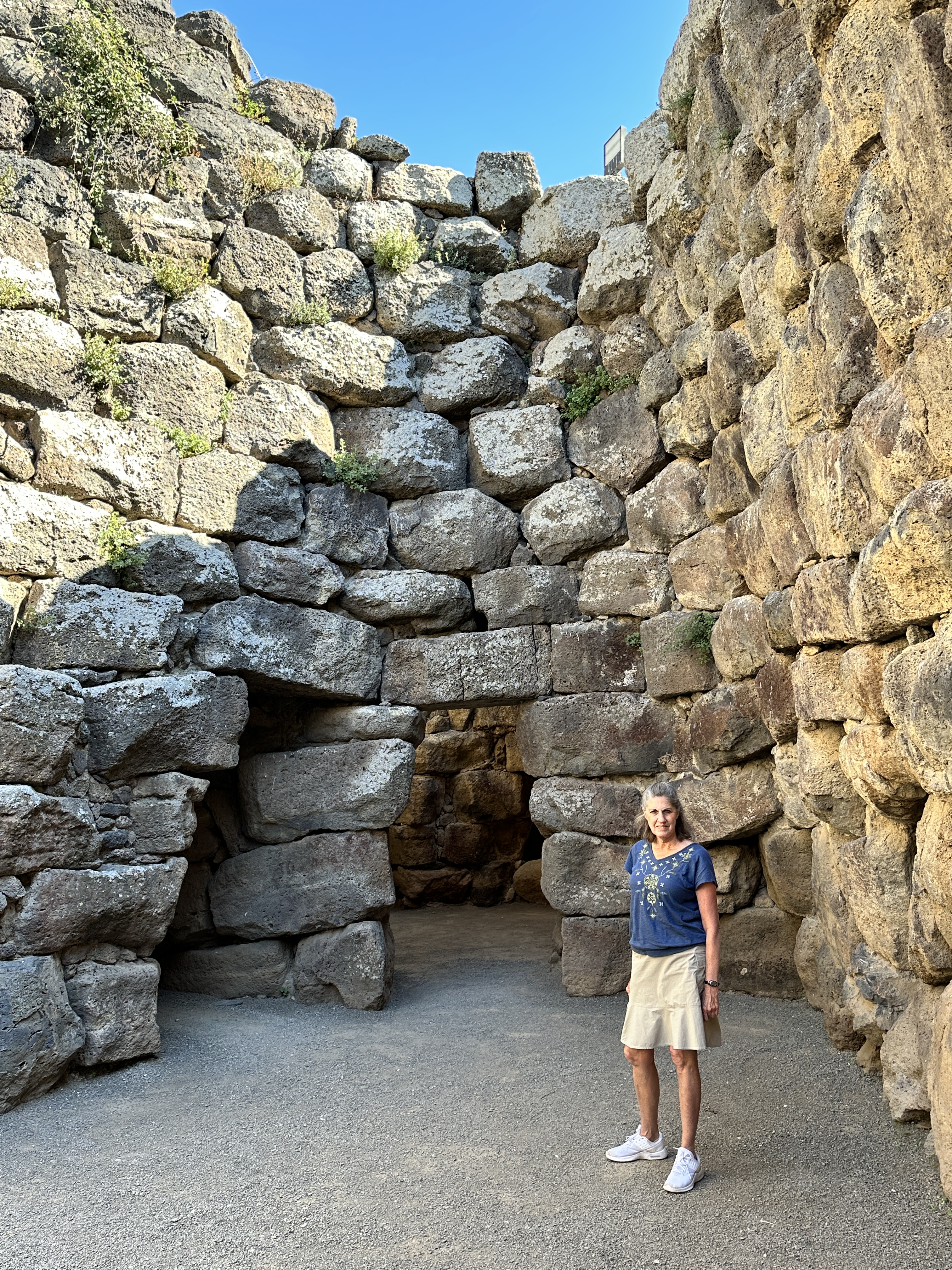
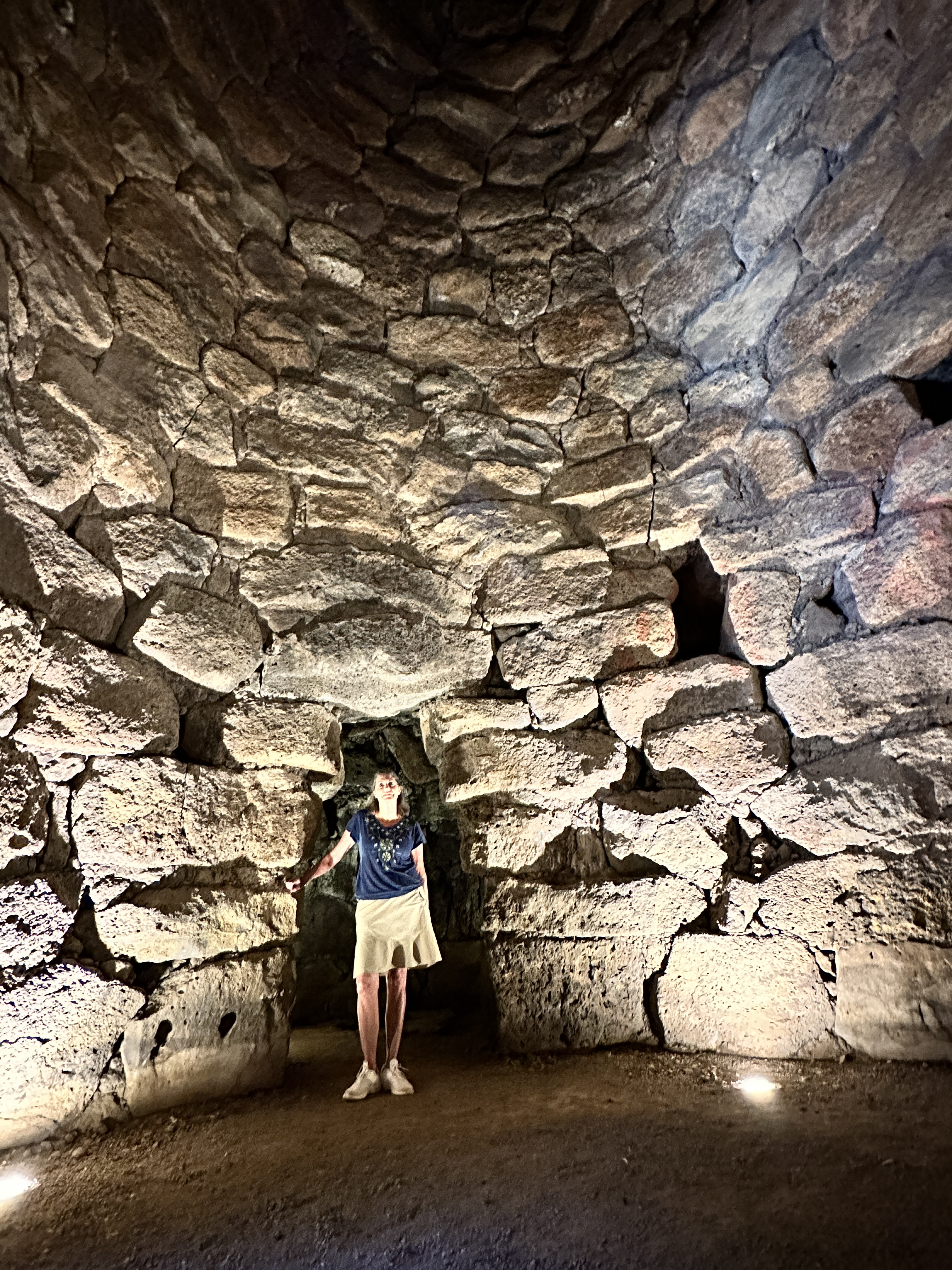
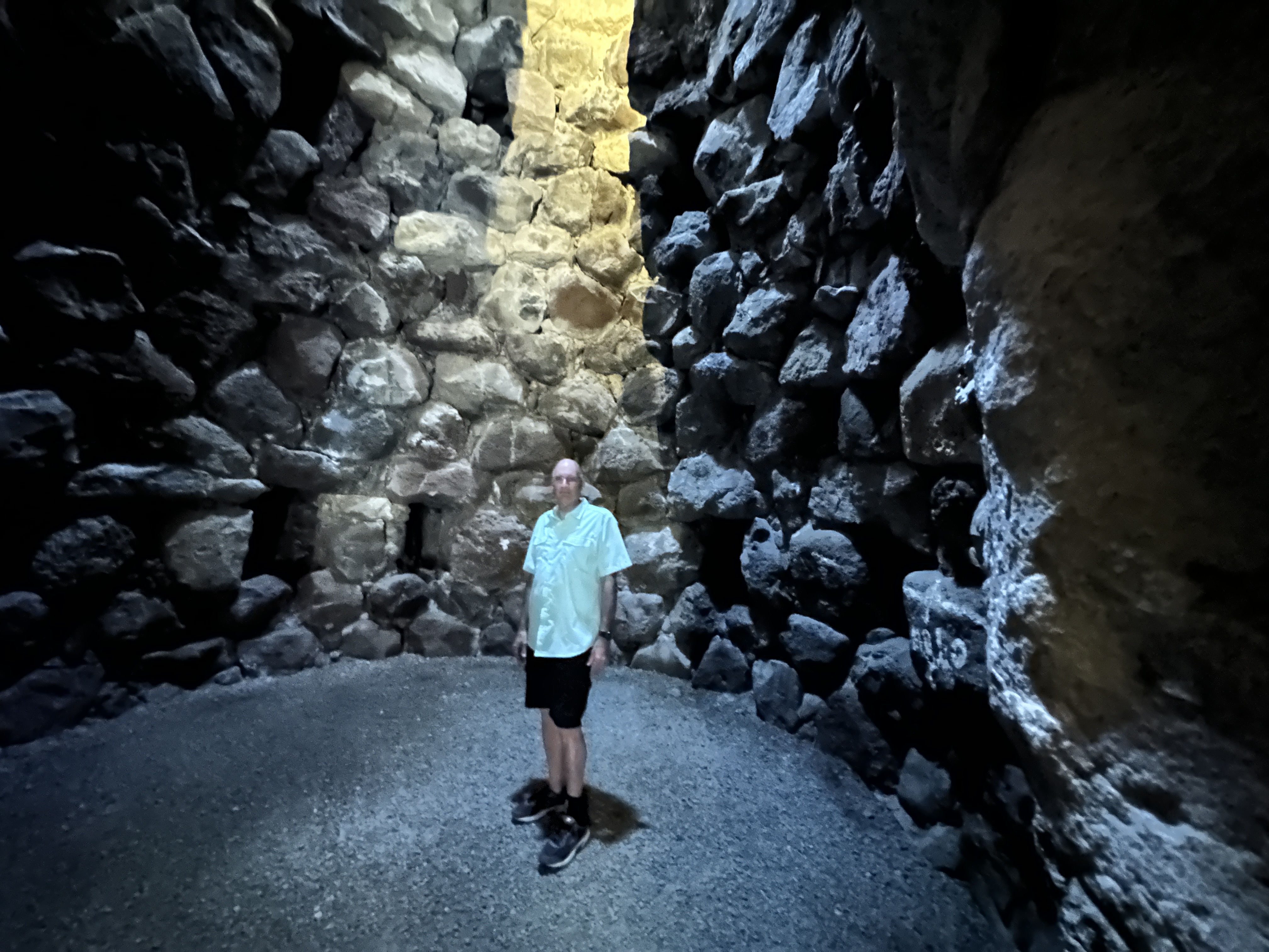
Amazingly, a number of Nuraghe are in an excellent state of preservation and can be visited, including the interiors. The stone work is quite incredible and standing in these 3,000 year-old rooms and climbing the stairways of these towers was a fun experience, not unlike visiting the ancient pyramids of Egypt. Most sites allow you to visit the structures on your own, the only one that required a guide was Su Nuraxi Barumini, one the largest of these settlements in Sardinia. As with many ancient archeological sites, the builders in Sardinia understood much about astronomy and were close observers of the night sky.
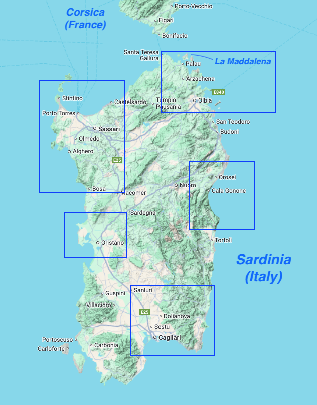
The approximate location of the Nuraghe sites we visited are shown on the map of Sardinia above.
We visited 5 Nuraghe sites, which provided a nice sampling of Sardinia’s rich Bronze Age history.
Below is a brief overview of the sites we visited.
Nuraghe la Prisgiona & Coddu Vecchiu
Nuraghe la Prisgiona was one of the smaller nuraghe sites we visited. There are a number of interesting archeological sites near Arzachena, Sardinia (including this one), a person could easily spend a day or more exploring all the nearby sites.
Within walking distance of Nuraghe la Prisgiona is Coddu Vecchiu, called the Giants Tomb. The tomb is from the same era and part of the Nuraghic civilization, about 1800 BC.
Nuraghe Majori – Complete with Bats!
Nuraghe Majori is another small Nuraghe site. At the ticket office, they give you a flashlight so you can see the bats inside the main tower – right photo above: look closely to see the bats hanging from the roof interior.Left – Majori Nuraghe tower, Middle – one of the Nuraghe wall entrances, Right – view of the surrounding countryside. Most Nuraghe occupy a strategic location, such as a hilltop.
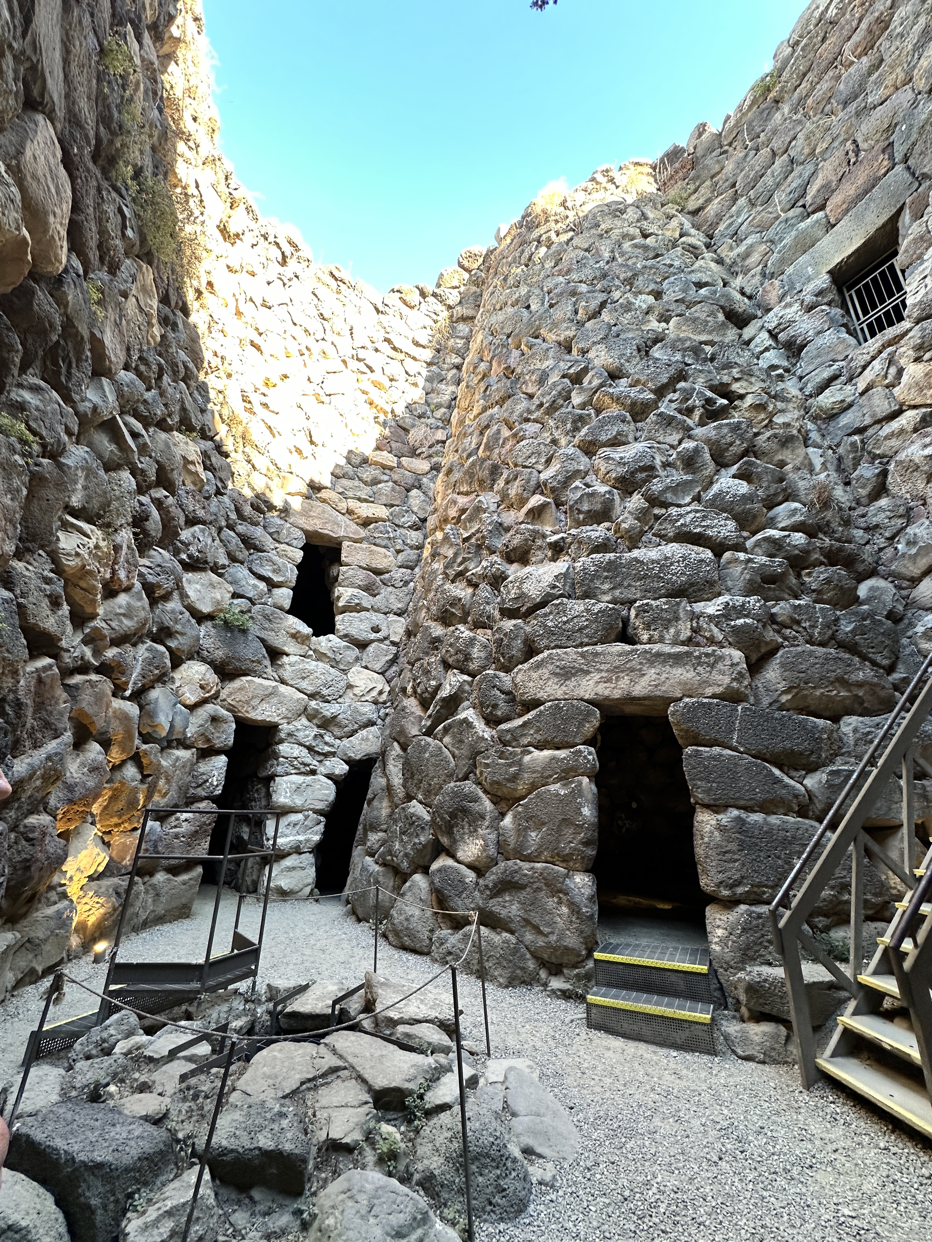
Nuraghe Santu Antine
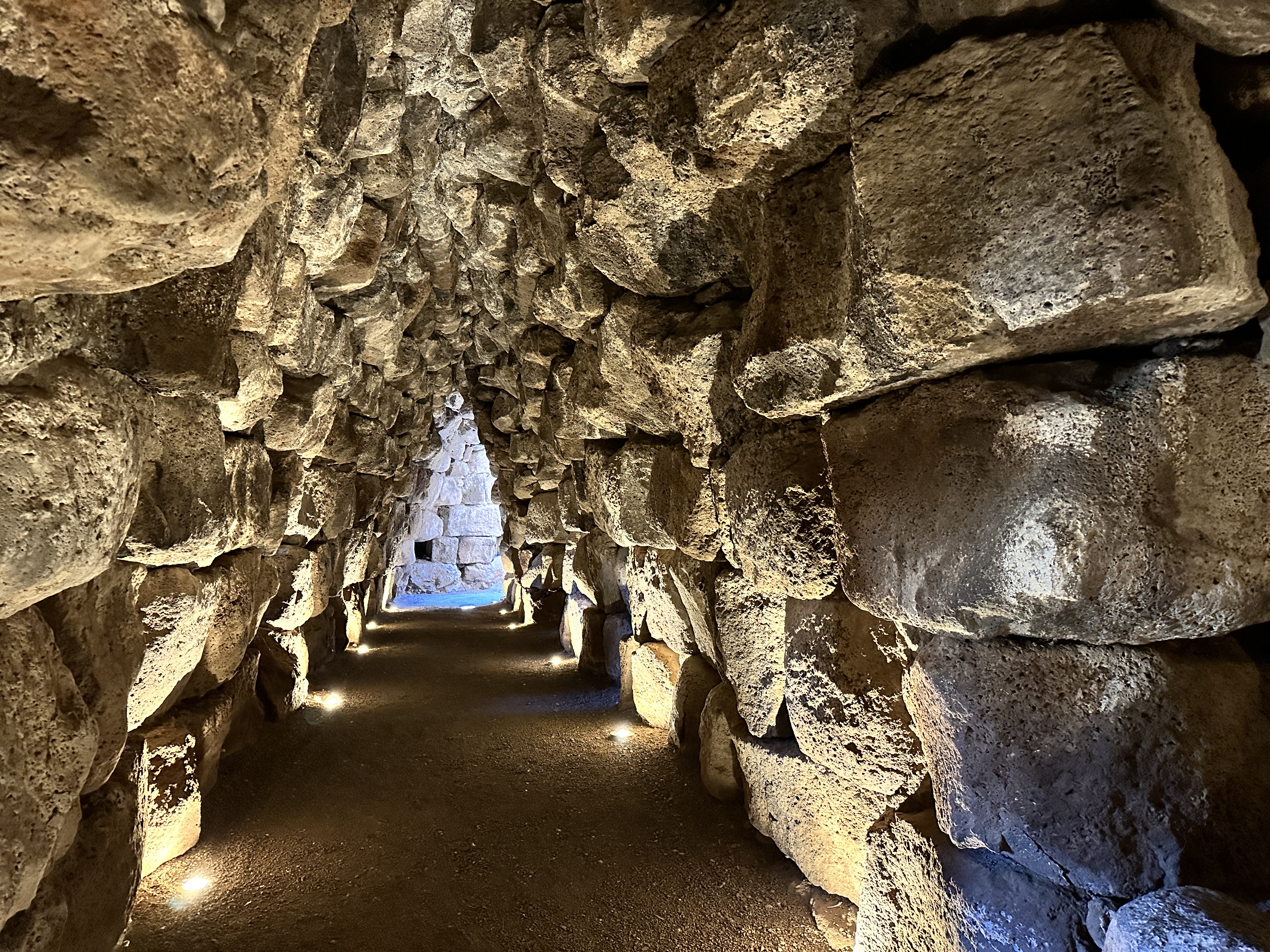
A view of Nuraghe Santu Antine from the exterior. It doesn’t look that impressive or large from the exterior; however we were surprised how large and extensive the interior was once we entered.
Nuraghe Santu Antine – courtyard views – including a well in the left photo above.Interior views of Nuraghe Santu Antine – tall room, passageway, and stairway to 2nd level.
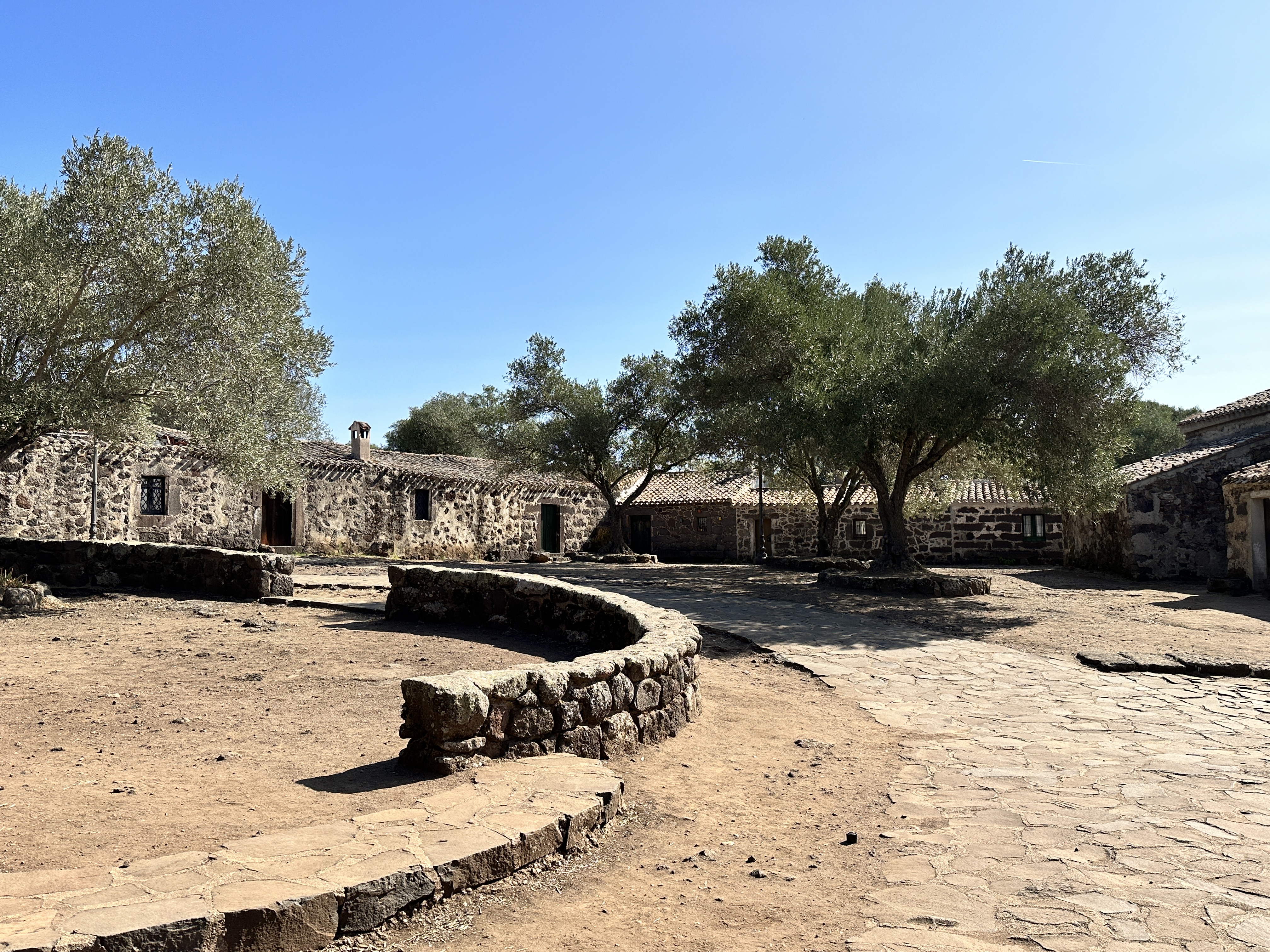
Nuraghe Santa Cristina
Santa Cristina may have been my favorite site, perhaps because there is so much to see here. There are Nuraghe ruins, including a fascinating ancient well, and medieval-era buildings also. It has been a site used for religious purposes for centuries.
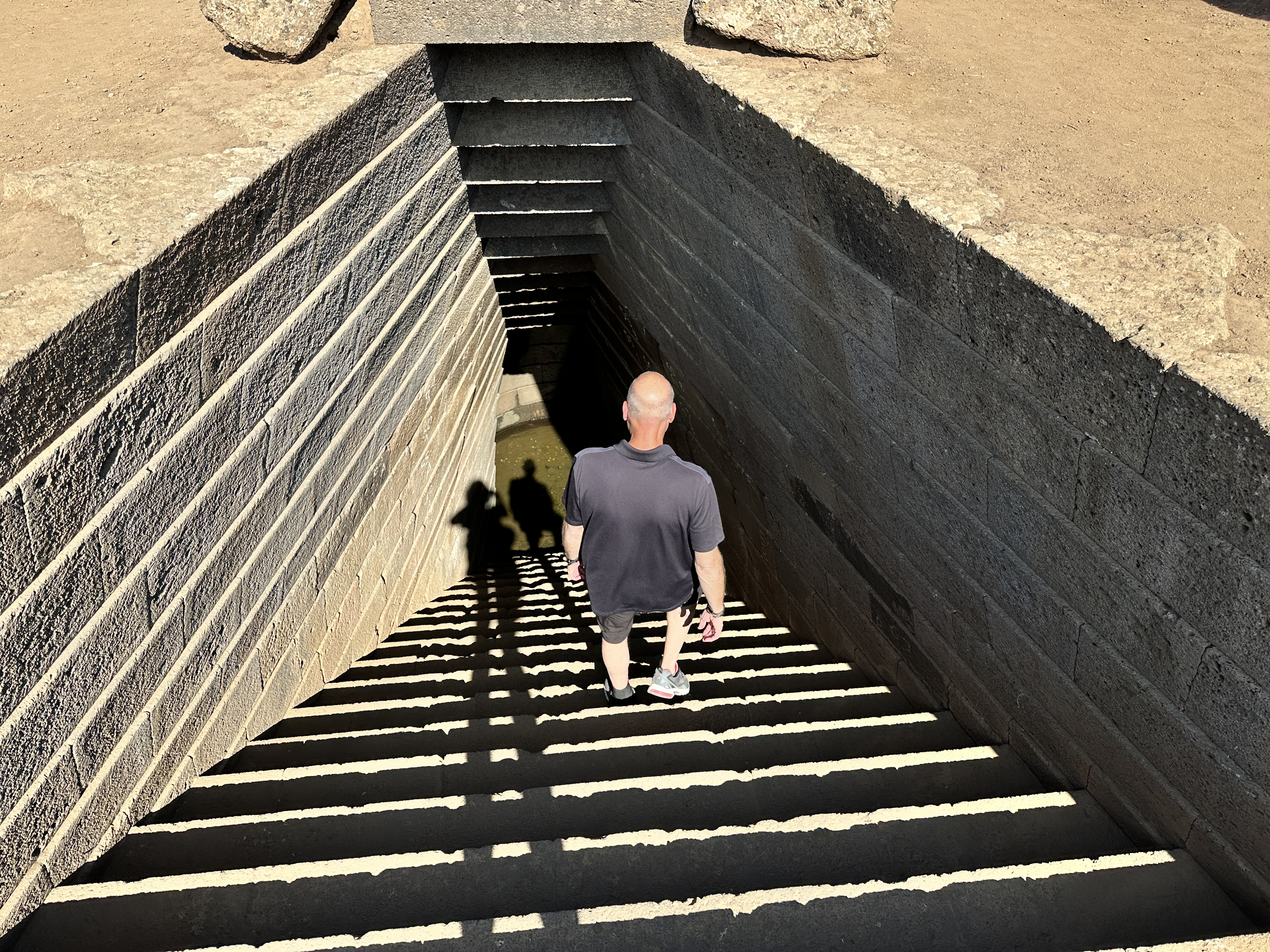
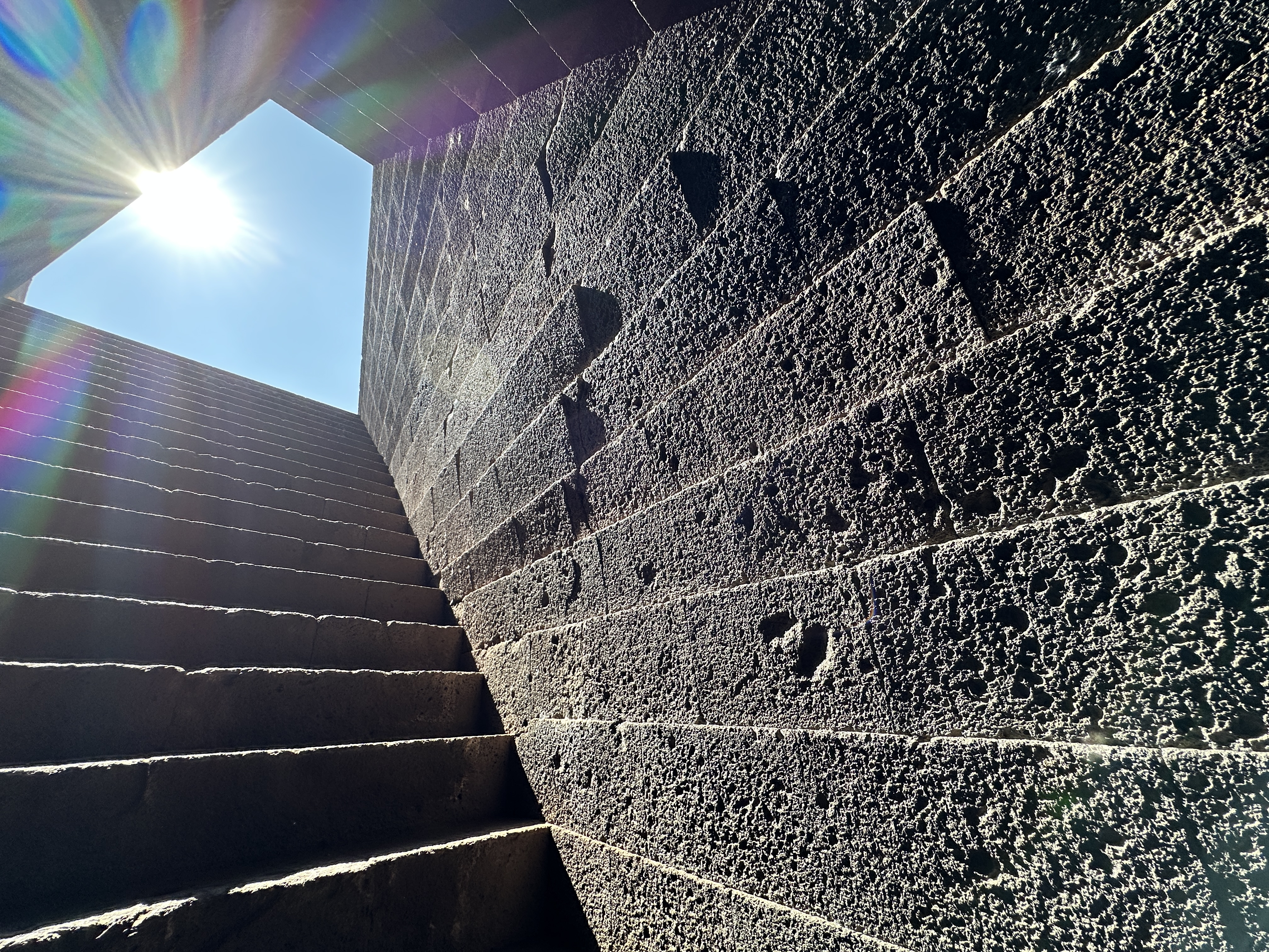
Sacred Well
Sacred Well from ground level. I was amazed how the stones and stairway have held up over 3,000 years – the Well dates from the 11th century BC.
View from the bottom of the well stairway.
Above – images at the bottom of the Sacred Well. Note the precise stone work.
Nuraghe
Nuraghe at Santa Cristina, part of the same complex as the Well and the Medieval village.
Medieval Church
Left – The little church at Santa Cristina was built around 1200 AD. Right – Monks’ quarters next to the church. These structures are between the Sacred Well and the Nuraghe. Be prepared to do a little walking at Santa Cristina.
Su Nuraxi di Barumini
Su Nuraxi di Barumini is one of the largest, if not the largest Nuraghe site in Sardinia. It is a World Heritage Site, and when you purchase your ticket you must join a group with a guide to visit. Our tour guide was very kind and patient, he explained the features of the site in French and English, given the mix of our small group.
Above left – the main tower of Su Nuraxi from a distance. The image in the center shows what the Nuraghe looked like in its prime – very similar to a medieval castle. Right – the village dwellings below the main tower.Above – views of the village ruins.Images of the doorways and courtyard of Su Naraxi.Above – interior passage ways and rooms of Su Naraxi.
In addition to the glorious beaches of Sardinia, it is certainly worth your time to visit a few of the fascinating archeological sites. Be careful in the structures. Some of the stairway stones are very slick and trust me, it’s easy to slip. Also, watch your head, many of the passageways are short and narrow. The sites we visited were well sign-posted, had parking available and are well-maintained.
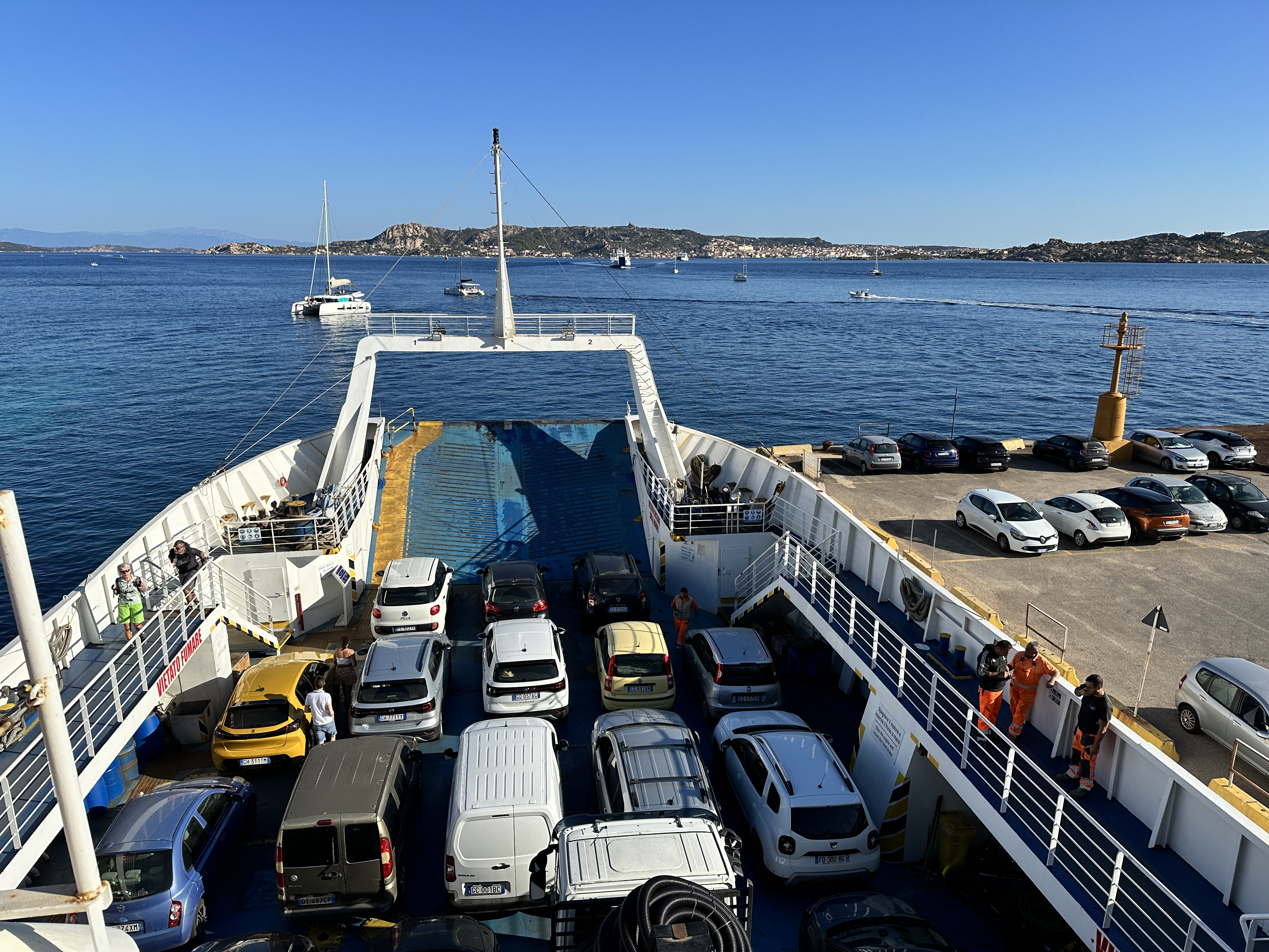
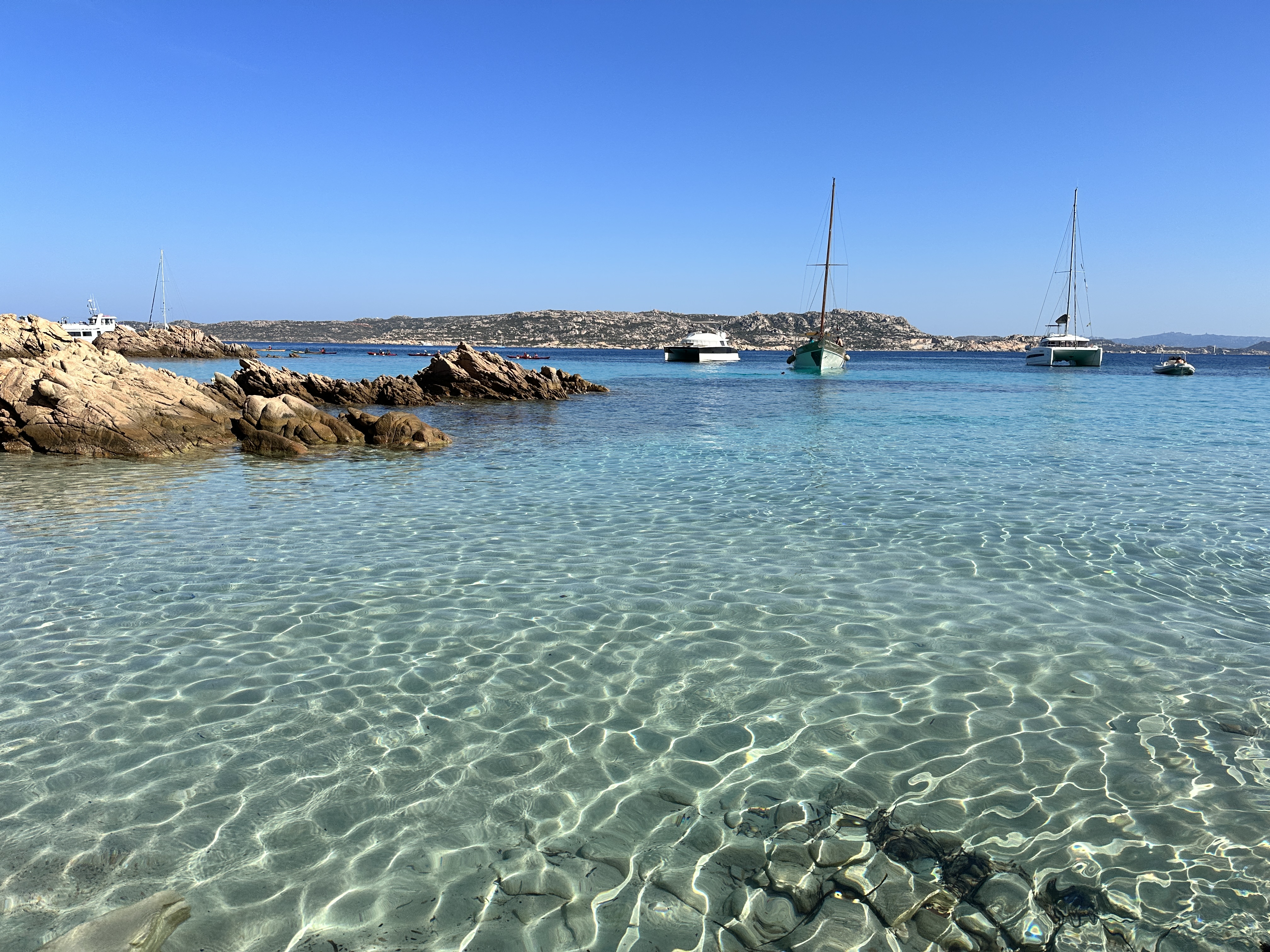
From our start in Olbia and Sardinia’s Costa Esmeralda, we traveled north a short distance and took (with our rental car) the 15-minute ferry ride from Palau over to La Maddalena Island and town, which is part of the La Maddalena Archipelago, located at the very north east edge of Sardinia, Italy. We spent 3 nights on La Maddalena, which gave us enough time to see La Maddalena Island, Caprera Island (reached by bridge from La Maddalena) and then a day-trip boat tour of some of the other islands in the Archipelago. I’ll share a bit about each day below.
La Maddalena
We caught a morning ferry to La Maddalena from Palau, no reservations were needed in October and the ferries run continuously all day. A round trip ticket for car and passengers was about 40 Euro.
Left – our ferry, with La Maddalena in the distance. Right – a view of La Maddalena town and harbor from the ferry.
Upon arrival. we immediately headed for Cala Francese beach, not far from the main town and then explored a few other beaches around the island before checking into our hotel later in the afternoon. La Maddalena is not big, you could probably drive around the island in 30 minutes or less.
Above – Cala Francese, on the southwest coast of La Maddalena. You have to take a very short drive on a dirt road to get to the parking area and then walk on a trail for 5 minutes to get to the beach.Left – Spiaggia Bassa Trinita, Right – Spiaggia del Cardellino, both beaches are on the northwest coast of La Maddalena.
Cala Lunga, at the northern tip of La Maddalena.
Left – Spiaggia di Cala Spalmatore, on the eastern side of La Maddalena. Right – a view of La Maddalena town as we drove back after our tour of the island.
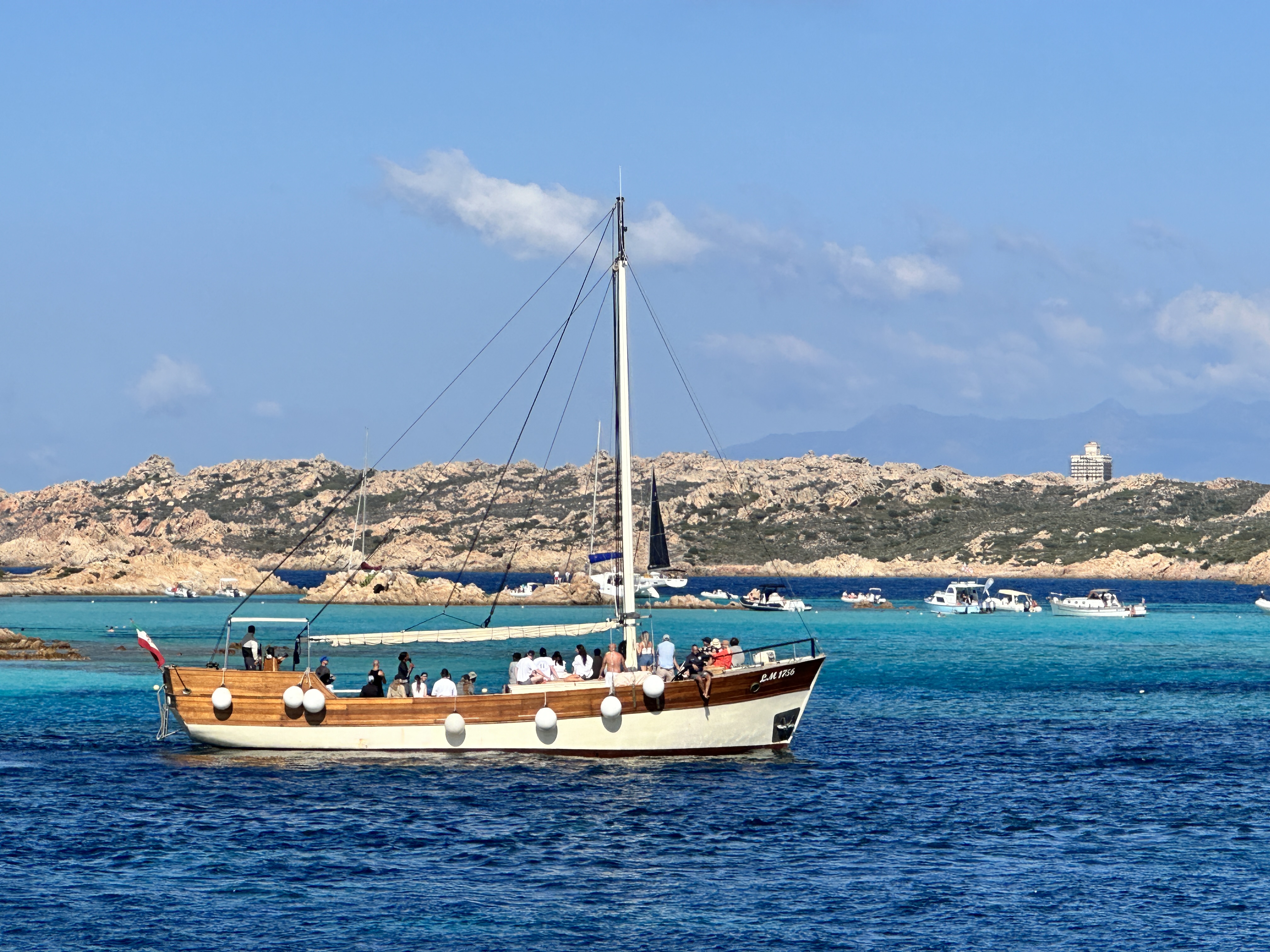
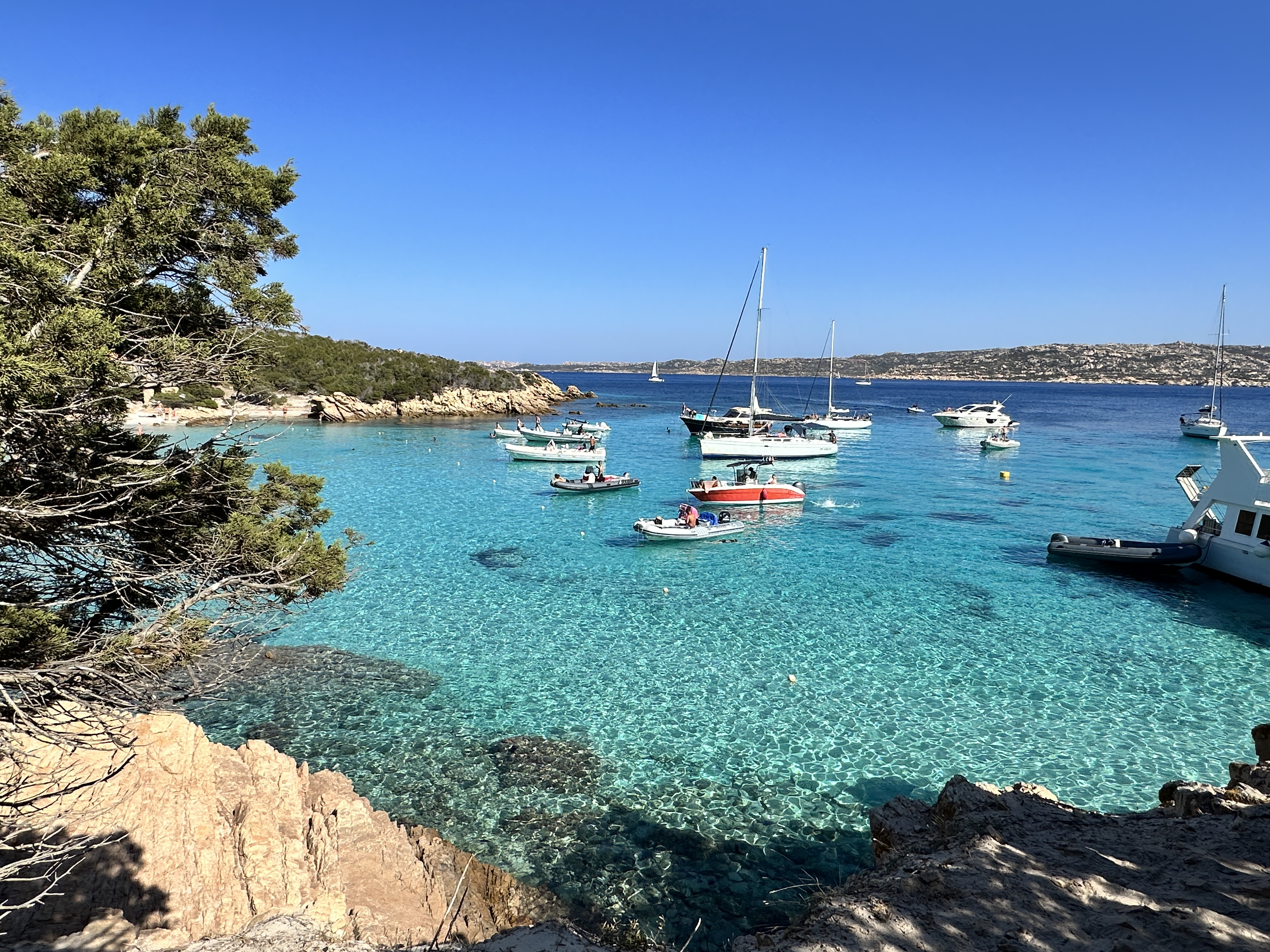
The town was fun to explore, and many boat tours are offered from the harbor.
Caprera Island
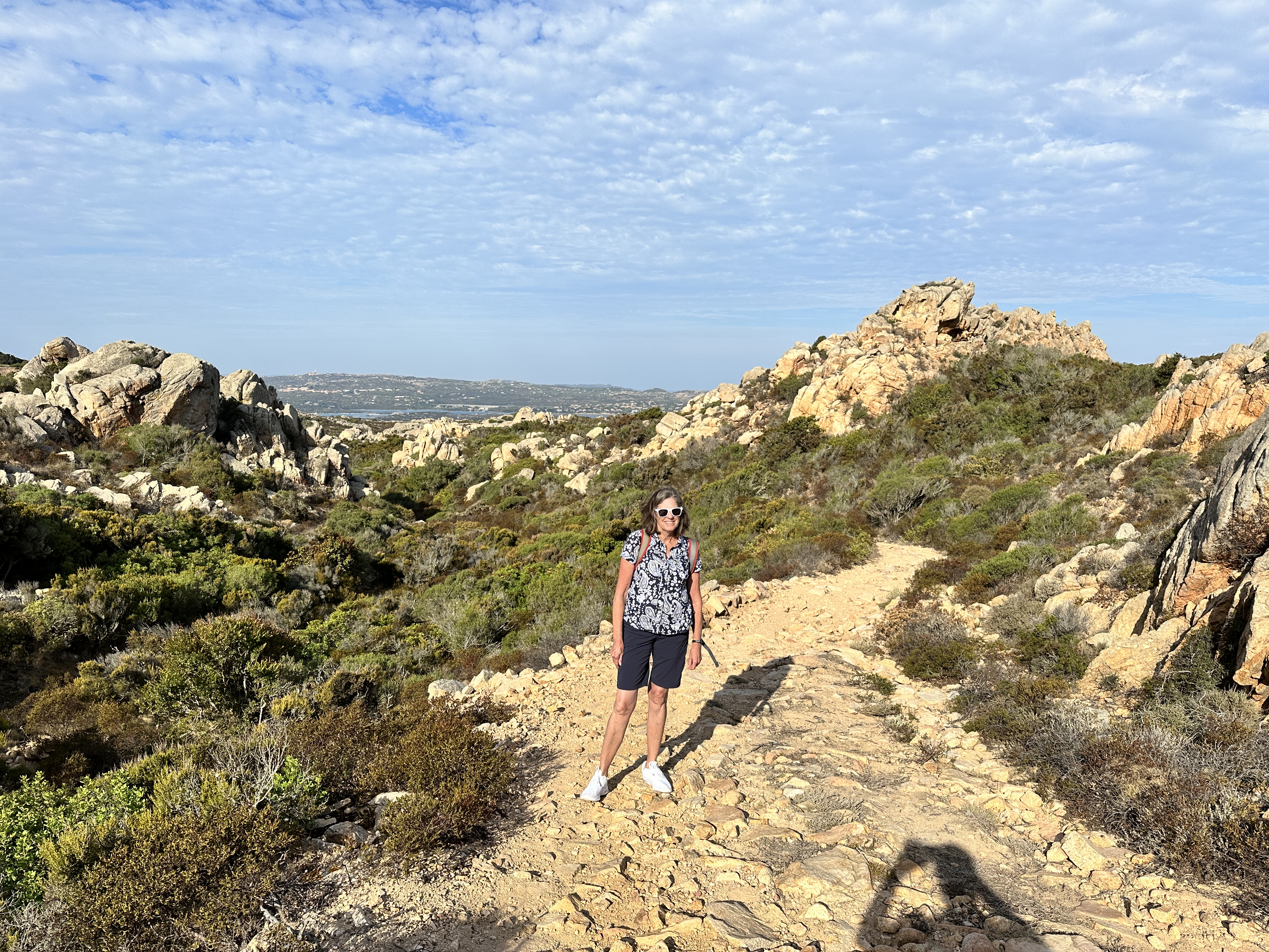
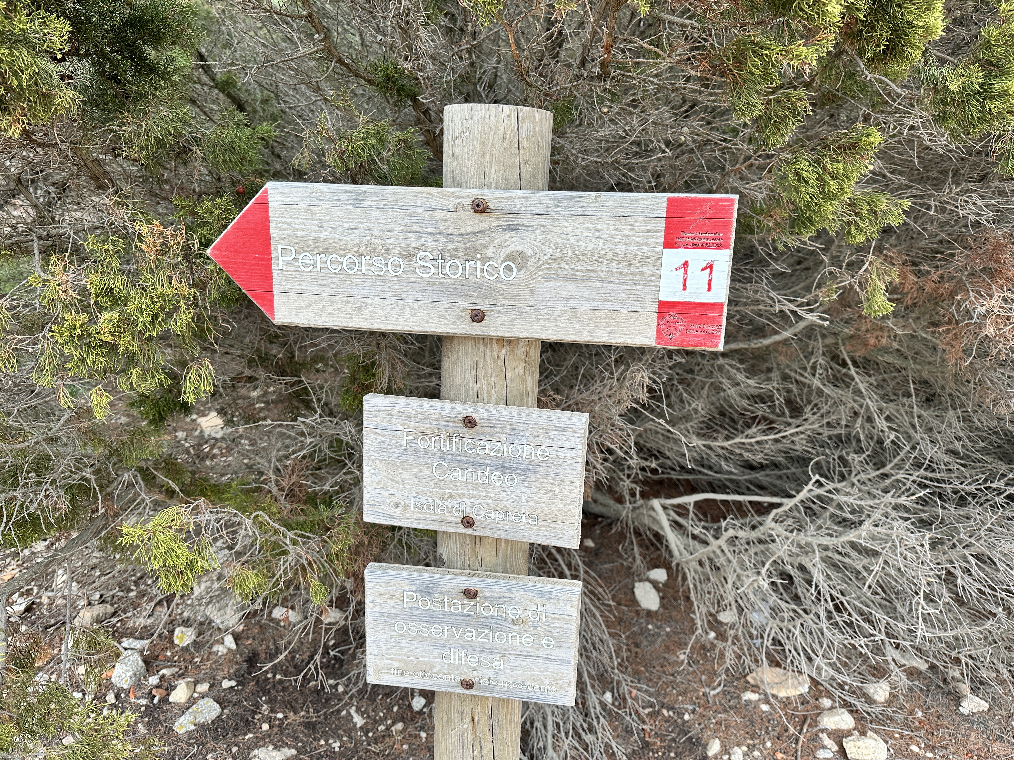
After a wonderful day on La Maddalena, we decided to spend our second day on Caprera, an island connected to La Maddalena via a bridge. Caprera is far less populated, and largely National Park land. There are numerous beaches and hiking trails and to start our day we decided to do a hike on the north end of the island, to the Batteria de Candeo, a really interesting site.
There are numerous trails criss-crossing the northern end of Caprera, and they are well signposted. There were very few people on the trails, we pretty much had them to ourselves.
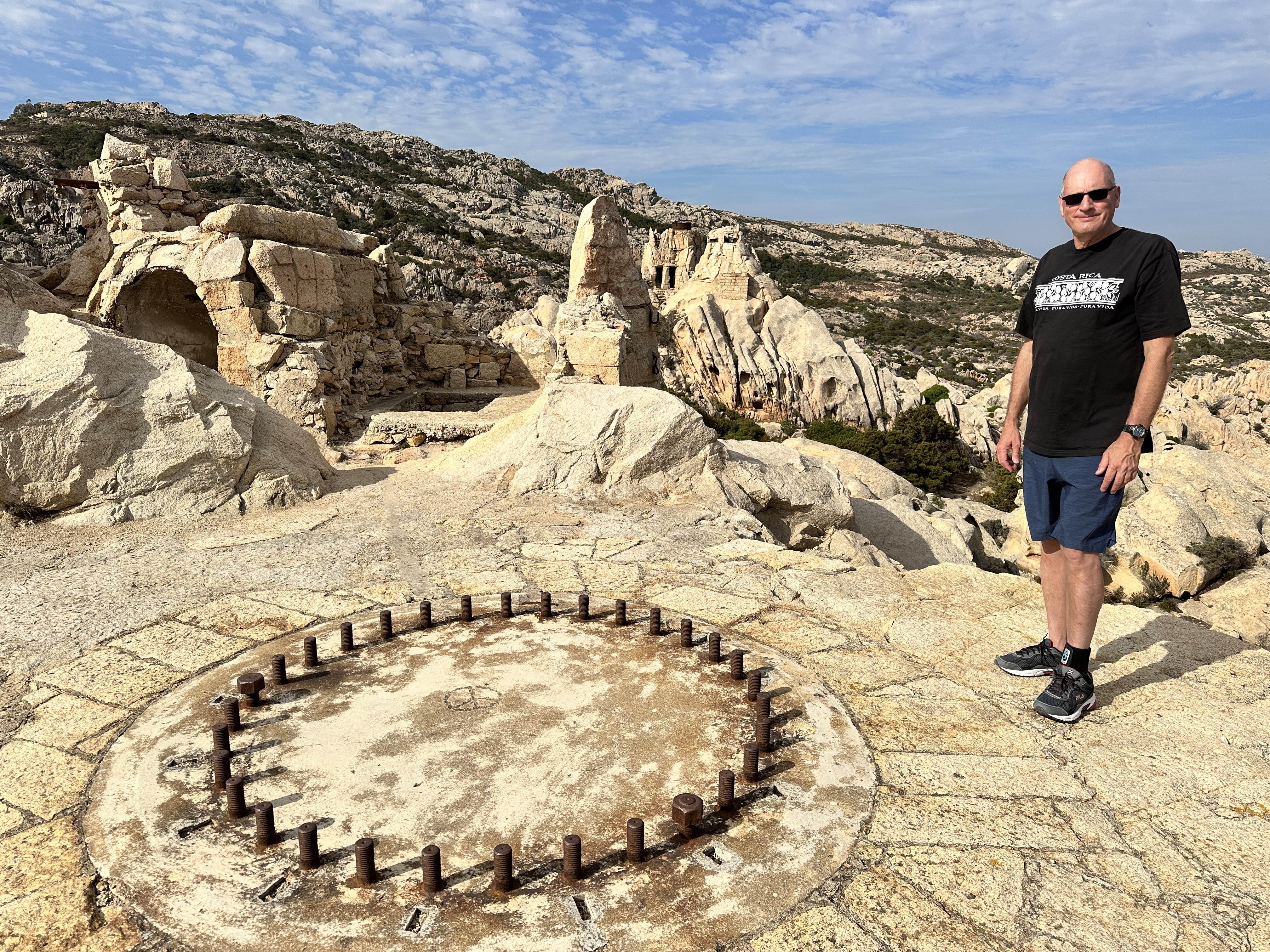
At the north end of Caprera is the military site of Batteria de Candeo, an anti-aircraft and ship emplacement built between World War I and World Ward II. It was built from the natural rock in the area and was well camouflaged – even today it looks like part of the natural landscape except for the doorways.
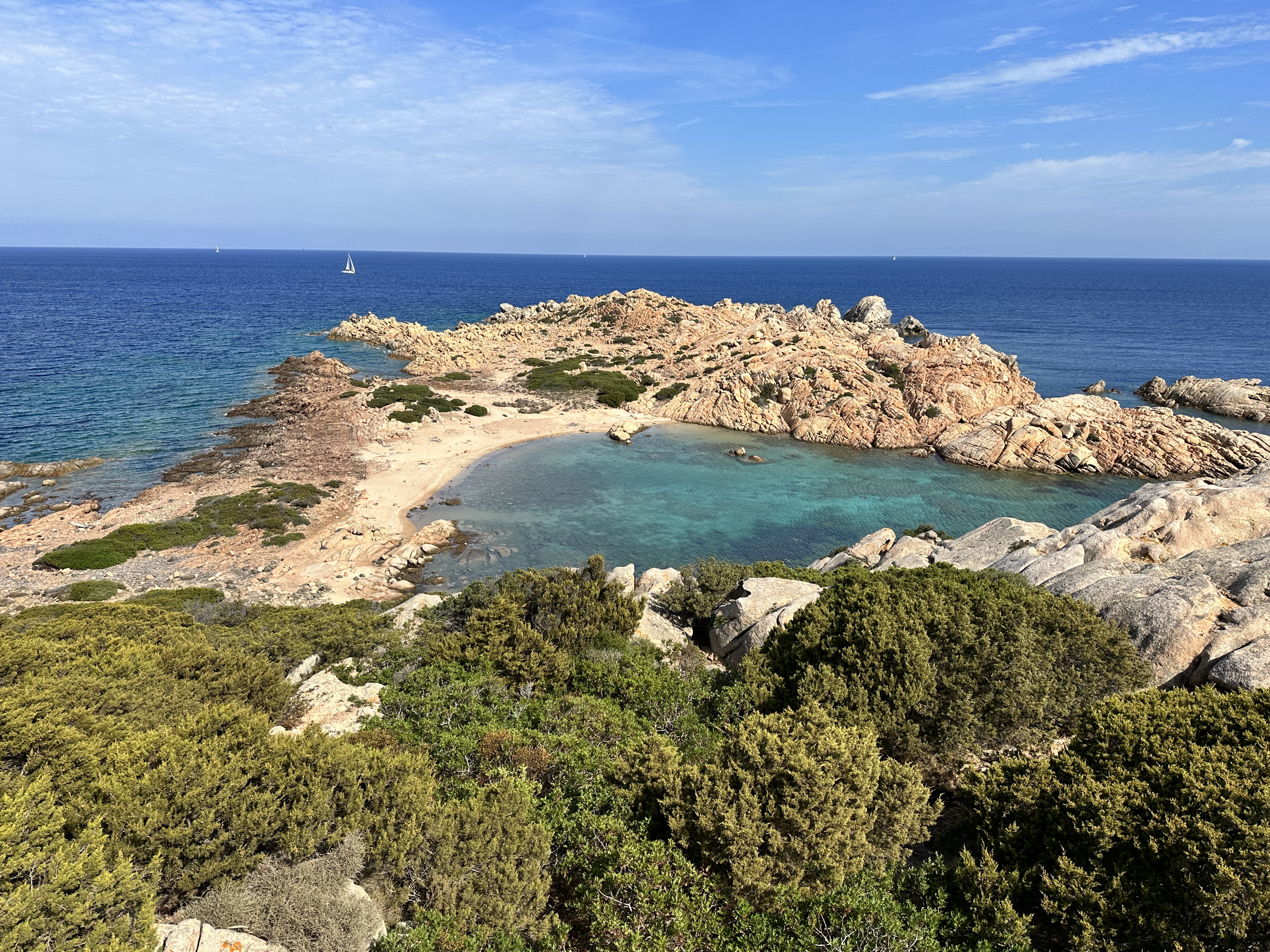
Other views of Candeo. Candeo can be accessed via the Caprera trail system.Other views and beaches accessed from the trail system in Caprera – left to right: Cala Crucitta, Cala Nepoletana, Cala Caprarese.
There are some beaches on the south end of the island also, such as Spiaggia Due Mari, for example. We visited the south end and spent a while lounging on Spiaggia Due Mari beach after our hike, but unfortunately I did not capture a photo!
Note: I had wanted to visit Cala Coticcio beach on Caprera, one of the most famous beaches in Sardinia. The only way to visit is with a guide (they limit access to this beach to preserve its natural state). I reserved a date with the guide, but I also needed a Park pass, and for some reason this was difficult to do online, so I gave up and cancelled our visit to this particular beach. It is a fairly long hike to Cala Coticcio and if we had done that hike, we would not have had time to do the hiking discussed above. I think it’s just a trade off on how you want to spend your time. As shown above, there are other stunning beaches and sights that don’t have the limitations of Cala Coticcio.
Day Trip Boat Tour
On our final day in La Maddalena, we decided to do a 6-hour boat tour of some other islands in the La Maddalena Archipelago and we’re glad we did. Below are photos from our various stops during the boat tour. It was a perfect day.
Buddelli Island and Pools – Buddelli Island is known for its pink sand beach (above left – small photo), but you cannot access the beach directly, they are trying to preserve and rehabilitate the pink sand. However, we did jump off the boat and swim in what they call the “Buddelli Pools” nearby – beautiful protected water.Santa Maria Island (above), we stopped at this island and beach for about 90 minutes. Spargi Island (above and below), the beaches here were stunning. We were able to swim and lounge for about two hours.Two more views of Spargi Island – with the wild boar terrorizing visitors on the left – we were warned to not bring food on the beach – the boar wandered around the beach area and were pretty aggressive in rummaging through beach bags! Another view of Spargi’s coves on the right – what a setting!
As with every other region of Sardinia, it would be easy to spend a week or more in these islands. The water was super clear, and the beaches were beautiful. If you go to Sardinia, don’t miss La Maddalena!
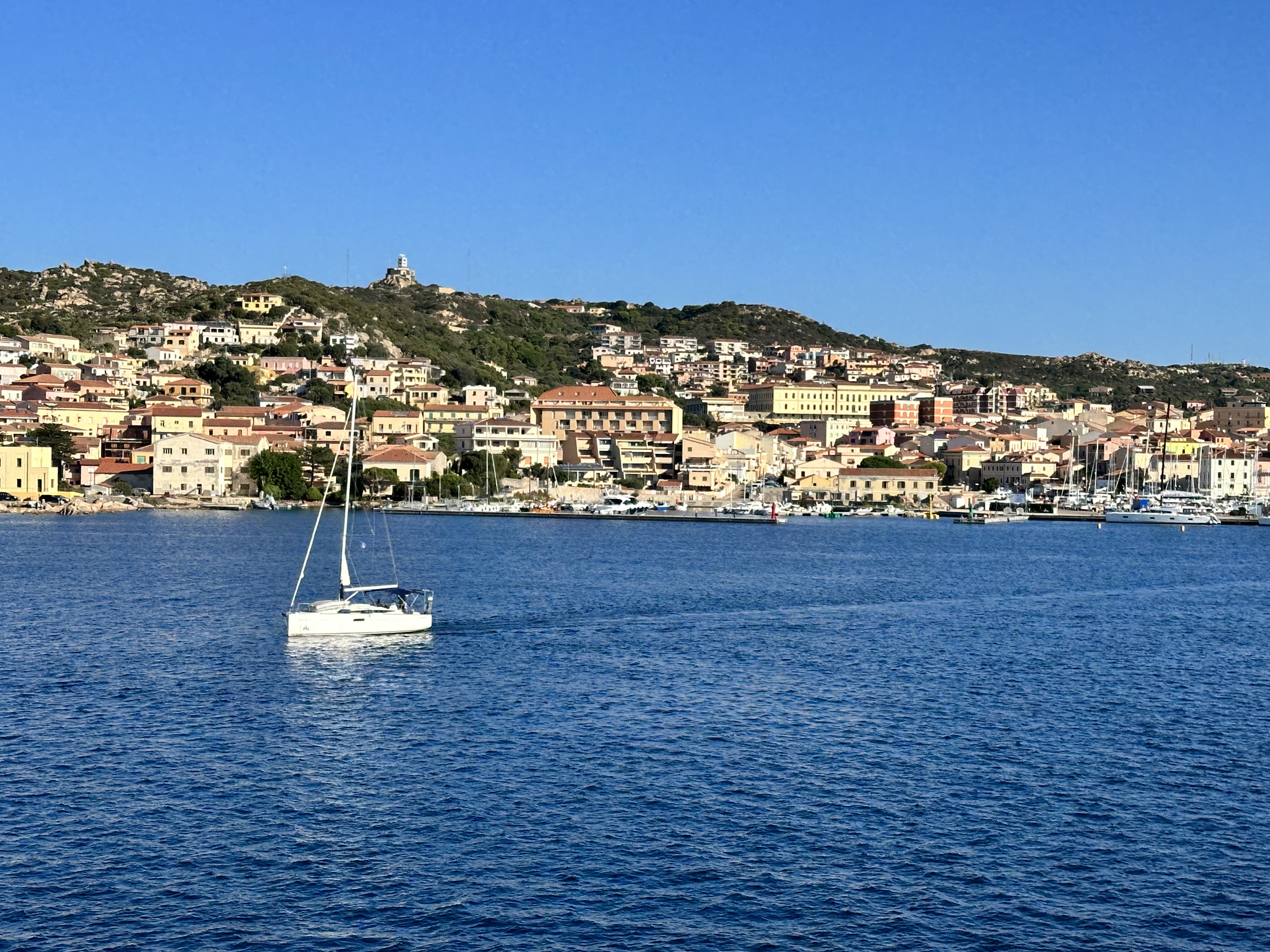
We started our Sardinia vacation by flying (from Frankfurt) into Olbia on the northeast coast of Sardinia. This was a great place to begin (and end) our Sardinian adventures. Olbia is ideally situated near the famous Costa Smeralda and the La Maddalena Archipelago, as well as other costal towns, archeological sites and beaches. (See here for an overview of regions we visited in Sardinia, we toured the island in a counter-clockwise route).
Olbia
While not a major tourist destination itself, Olbia has a lovely old town and is situated on a beautiful harbor. We spent our first night here, enjoying dinner in one of the many restaurants on the main pedestrian street and browsing the vendor booths lining the harbor promenade – a very festive atmosphere.
Views of Olbia and harbor, with Tavolara Island (right), the mountainous island with more beautiful beaches in the far distance.
The next morning we drove north toward Porto Cervo, the heart of Costa Smeralda, stopping at beaches along the way. Our first day started out cool, windy and slightly rainy, but by the afternoon it was warm and sunny. The weather didn’t stop us from enjoying the sights along the coast and wasn’t a factor for the rest of our trip.
Costa Smeralda
Costa Smeralda got its name and started becoming fashionable in the early 1960’s, due to development efforts led by Prince Karim Aga Khan. It’s maintained that status ever since. Our stay here was brief, given the many areas of Sardinia we wanted to visit. Below are a few images of the beautiful coastline of this region.
This sign, along the coastal road from Olbia to Porto Cervo lets you know you’re entering the fabled Costa Smeralda.
Capriccioli Beach
Spiaggia Principe, considered Sardinia’s most famous beach (although it’s only one of hundreds as beautiful), on Costa Esmarelda.
Porto Cervo, the center of Costa Smeralda, was pretty quiet in early October. We enjoyed walking around the harbor and the town, with many expensive shops.
The calm, clear waters of La Celvia Beach, south of Porto Cervo.
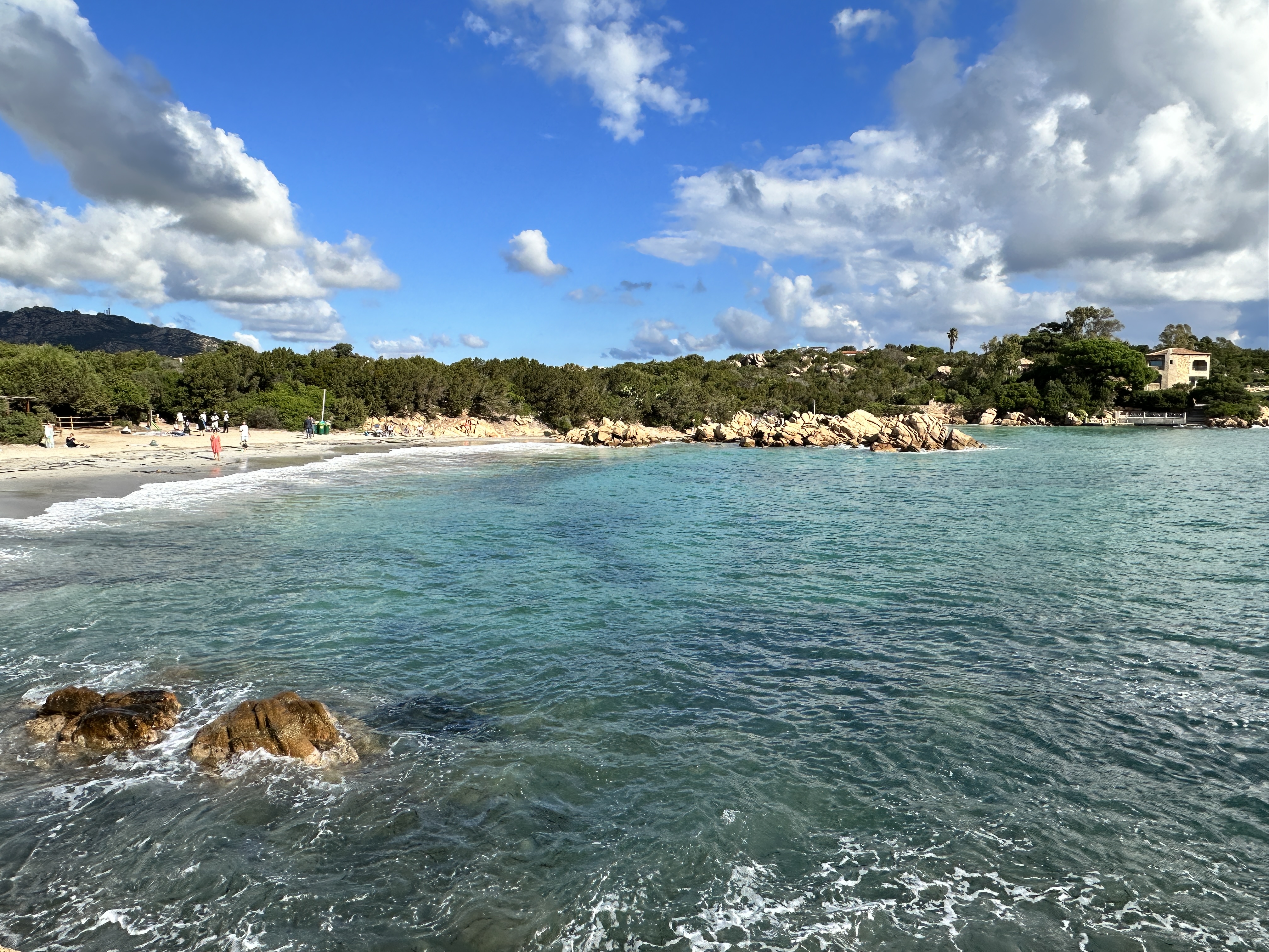
La Celvia beach (left and above), was just a short distance from our hotel in the Costa Smeralda resort area of Cala di Volpe (above right), and near a golf course as well as Capriccioli and Spiaggia Principe beaches. What more could you ask for!Although not directly part of Costa Smerelda, Spiaggia Cala Brandinchi, near San Teodoro, not far south of Olbia, is another great beach and park, with some lawn area just behind the beach for games or picnics. We were flying out of Sardinia shortly after our visit here and so we didn’t get to enjoy this beach for long!
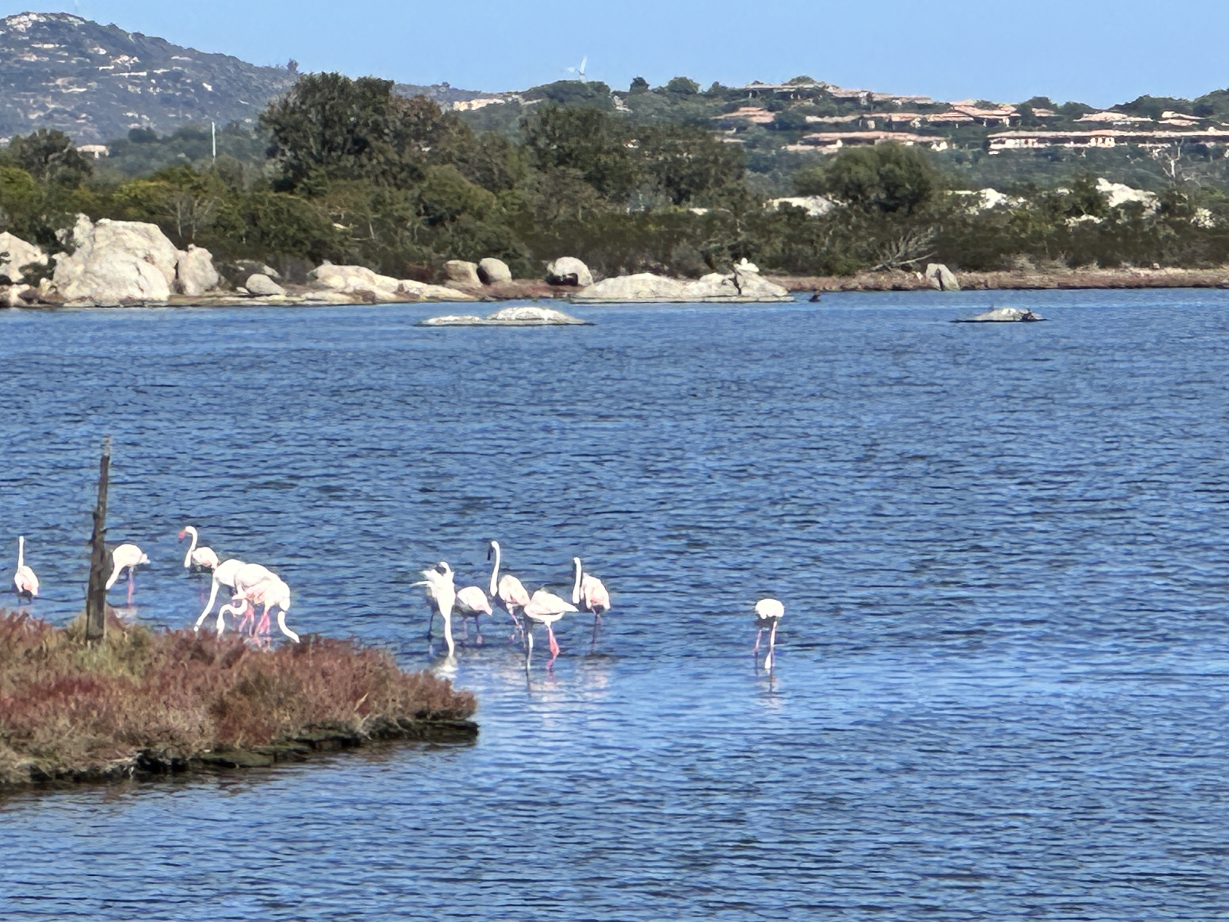
Real pink flamingoes near San Teodoro!
As with any region of Sardinia, it would be easy to spend your whole vacation right in (or around) Costa Esmeralda. If you want to live here, be ready to open your checkbook. It’s one of the most expensive regions in Europe and given its allure, it’s easy to see why.
As I have mentioned is previous posts, we LOVE the islands of the Mediterranean. They are some of my favorite destinations in world. After visiting Mallorca and Menorca (which belong to Spain), the next island on our list was Sardinia (part of Italy). We had been to Sardinia’s northern island neighbor, Corsica (part of France) years ago and from the beautiful southern coastal town of Bonafacio we could see Sardinia in the distance, only about 12 km (7.5 miles) away. We visited Sardinia in October, which is a great time to go – the water was still warm and the crowds were limited.
This map of Sardinia shows the five main regions we visited in Sardinia.
I will be sharing more posts on our Sardinian adventures soon, but first here are some things you may not know about about this beautiful island.
1. Sardinia is part of Italy
Although an autonomous region, Sardinia is definitely Italian. Some Americans have never heard of Sardinia and really have no idea that it’s part of Italy. The Sards have their own language but of course speak Italian, English, and other European languages quite fluently. It was easy for us to get by on English and a few Italian phrases. The food and gelato are wonderful, as in other regions of Italy.
2. Sardinia is big, and a relatively sparsely populated island
This is important to keep in mind when planning a trip – allow two or three weeks to see the whole island or if you have less time, perhaps concentrate your time in one region. Sardinia is the 2nd largest island in the Mediterranean (just slightly smaller than Sicily) but has just 1/3 of Sicily’s population. It is about 170 miles long and 90 miles wide. We covered a lot of ground in two weeks, but still did not see everything (see map above), including the southwest coast.
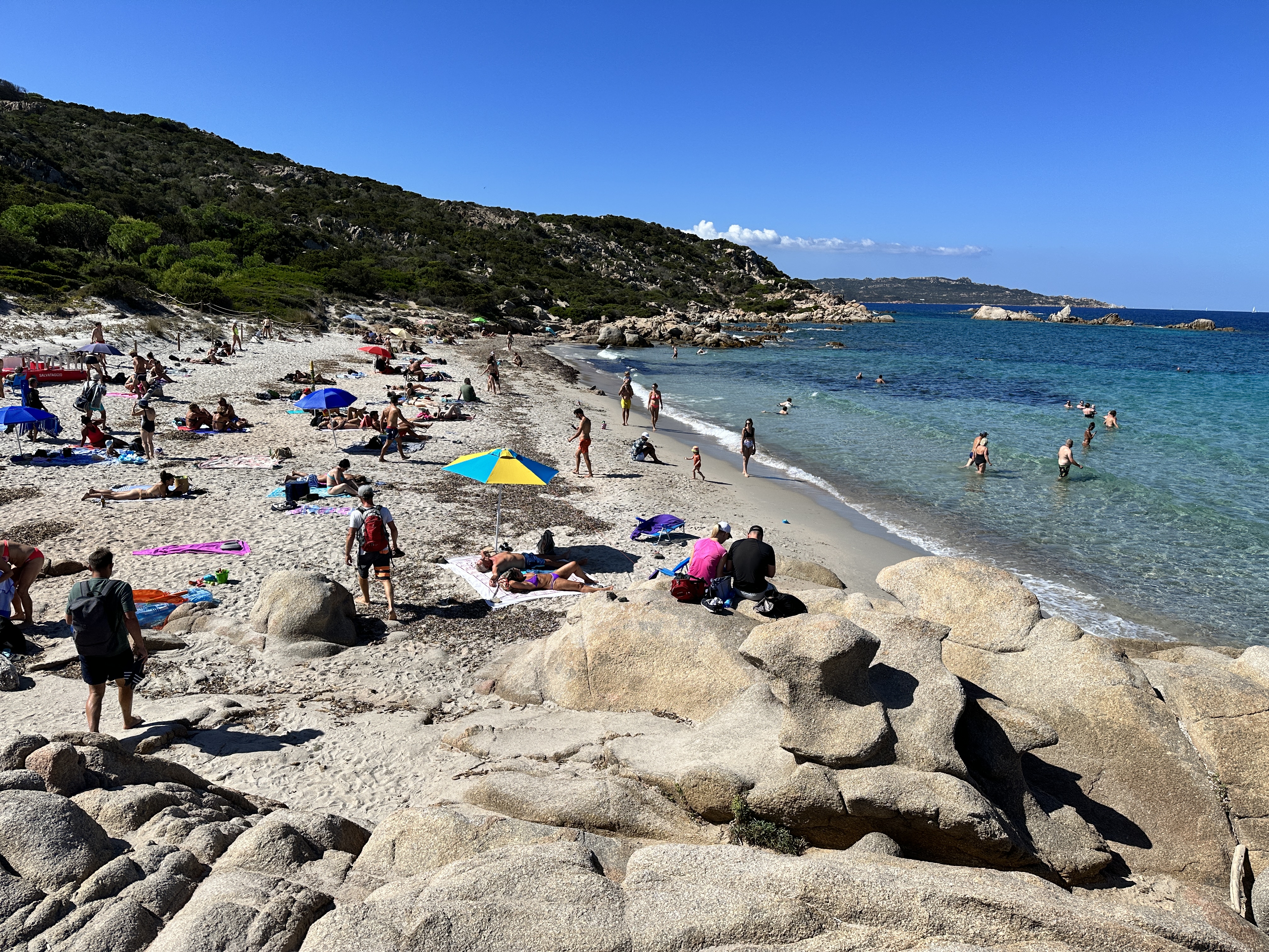
3. Sardinia boasts some of the most stunningly beautiful coastline (and water) in the world
Cala Goloritze, Gulf of Orosei, accessible only by boat or a 3.5 km hike. The color of the water was the most incredible turquoise hue I’ve ever seen.
Sardinia has an embarrassment of beaches – no matter where you are on the island, you’re close to some of the best beaches in the world. The Gulf of Orosei on the eastern side of the island has a breathtaking coast although it’s not easily accessible, except by boat or via some steep hiking trails.
4. There are hundreds of incredible beaches, many of which are undeveloped and uncrowded
La Pelosa Beach, near Stintino, Sardinia. You must make a reservation for this beach if visiting during high season. It is worth the hassle (which is not a big deal nor expensive).
Some beaches might have a refreshment stand, a few might be close to some resorts, but often there are no hotels or condos anywhere to be seen. Admittedly, there are (just a few) beaches that are so popular you must have reservations during the high season or can only be accessed with a guide, and there a few beaches that are not accessible at all – due to preservation efforts, speaking of which…
5. Sardinians take their beach sand seriously
From pink sand beaches to shiny quartz sand beaches to powdery white sand, the sand is beautiful everywhere. However, don’t even think about taking a sample home with you. You will be fined. You are also required to have mats underneath your beach towels so as to not inadvertently trap sand and take it home in your towels.
Spiaggia Rosa, on Budelli Island (near La Maddalena). You cannot set foot on this pink sand beach, they are protecting it for future generations. However you get a view of it from a boat tour, as in this photo.
Example of the fine quartz sand and pebbles found in Sardinia.
6. A car rental is essential
Unless you plan to go straight from the airport to a resort and straight back to the airport or plan on a tour by a group bus, a car is the only way to really see the island and reach some of the beaches and tourist sites. Some sights or hiking trails are remote. Since the island’s population is sparse, driving was not a problem – I did not feel rushed or on edge with crazy drivers pushing me to speed up or forcing me to get out of the way.
7. Sardinia offers something for everyone
Friendly, welcoming locals – check. Beautiful beaches – check. Warm, clear water – check and check. Charming medieval towns – check. Fascinating ancient historical sights – check. Remote mountains, rock climbing, forests and hiking trails – check, check, check and check. Diving – check. Excellent food – check. What more could a person want?
A view of Alghero, on the northwest coast of Sardinia, a beautiful medieval town, one of our favorites on Sardinia.
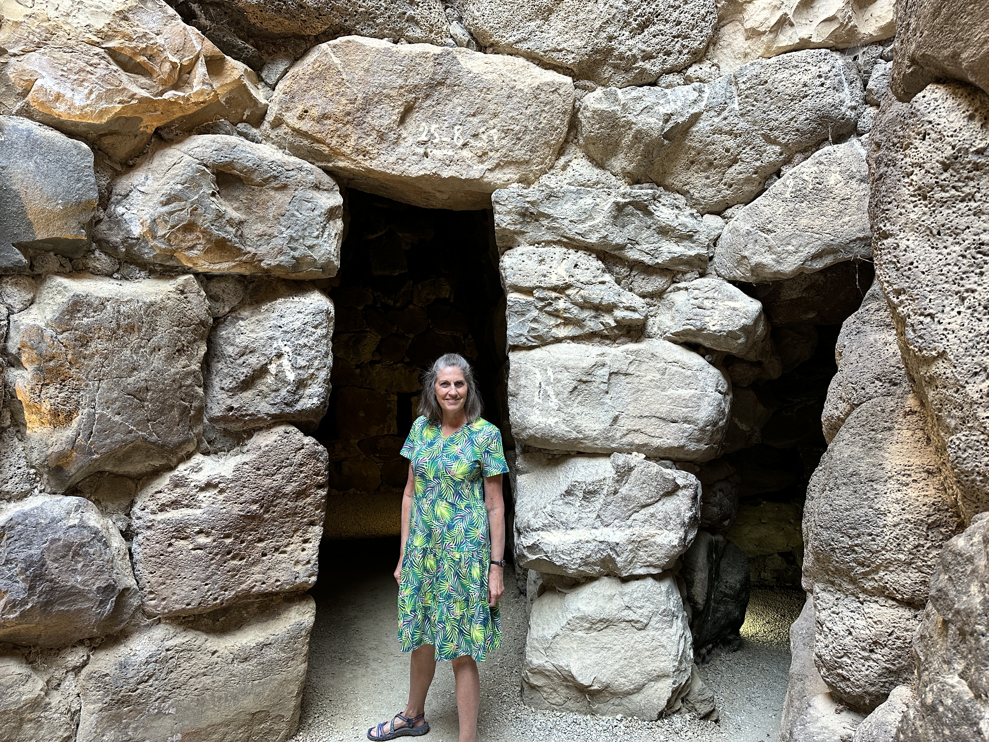
Nurhage La Prisigona Historical Site (14th century BC), near Arzachena, Sardinia.
8. Sardinia has its own island get-aways
As funny as it may sound, Sardinia can be considered a ‘mainland’ and just off its coast (such as the northeast coast) lie an archipelago of islands (the main island is La Maddalena – see map above) accessible by only ferry and smaller boat, some of which are part of a national park. These islands are home to some of the best beaches and best hikes anywhere in Sardinia.
The island of Spargi, part of the La Maddalena Archipelago. We could have stayed here our whole trip!
9. Sardinia is not just for the jet-setting crowd
In the 1960’s Coasta Esmeralda was popularized and has since become a jet-setting hotspot. This part of the northeast coast (near Olbia) certainly has some beautiful beaches and coastline. While you will find big yachts, high-end real estate, retail and eating establishments here, this is just one small enclave of the island. The rest of the island seems unfazed (and untouched) by the movie star and billionaire crowd.
View of Porto Cervo, the center of Coasta Esmeralda.
10. Go Now
Sardinia isn’t quite on the main tourist map yet, although posts like this don’t help! The majority of visitors are Italian (this is their backyard!), followed by French and Germans. On one of our boat tours, we were with some Swiss and Belgian tourists. We ran into a few tourists from the U.S., but not many. Very few tourists seem to explore the whole island, there are lots of “untouched” little mountain villages and quiet beaches to find solitude if that’s your thing.
The cute little village of Gavoi in north central Sardinia.
Word is getting out, so go now! Here’s one of my recommended websites for great information on Sardinia tourism. I read almost every post Claudia has written, very helpful. Of course, I will be publishing information on each region of Sardinia we visited over the course of the coming weeks.
Note: Featured image – Cala Marilou, Gulf of Orosei
After a few days in Yosemite National Park in California we drove south through Fresno and then east, climbing the hills up into Sequoia and Kings Canyon National Parks via Highway 180 that enters Kings Canyon National Park from the northwest. These two Parks adjoin one another. We spent two nights in Sequoia National Park and that was just enough time to see the major sights. Sequoia National Park felt very quiet compared to Yosemite, even with pretty full campgrounds and regular shuttle buses operating. It’s all relative!
Map of Kings Canyon and Sequoia National Parks.
The giant sequoias are unique to this area, with climate conditions that are perfect for their growth over thousands of years. These trees are also naturally resistant to fire, disease and insects due to the high concentration of tannin in the sequoia’s bark. In the Parks, you will see evidence of fire and how the trees have survived.
Below are a few highlights of our visit.
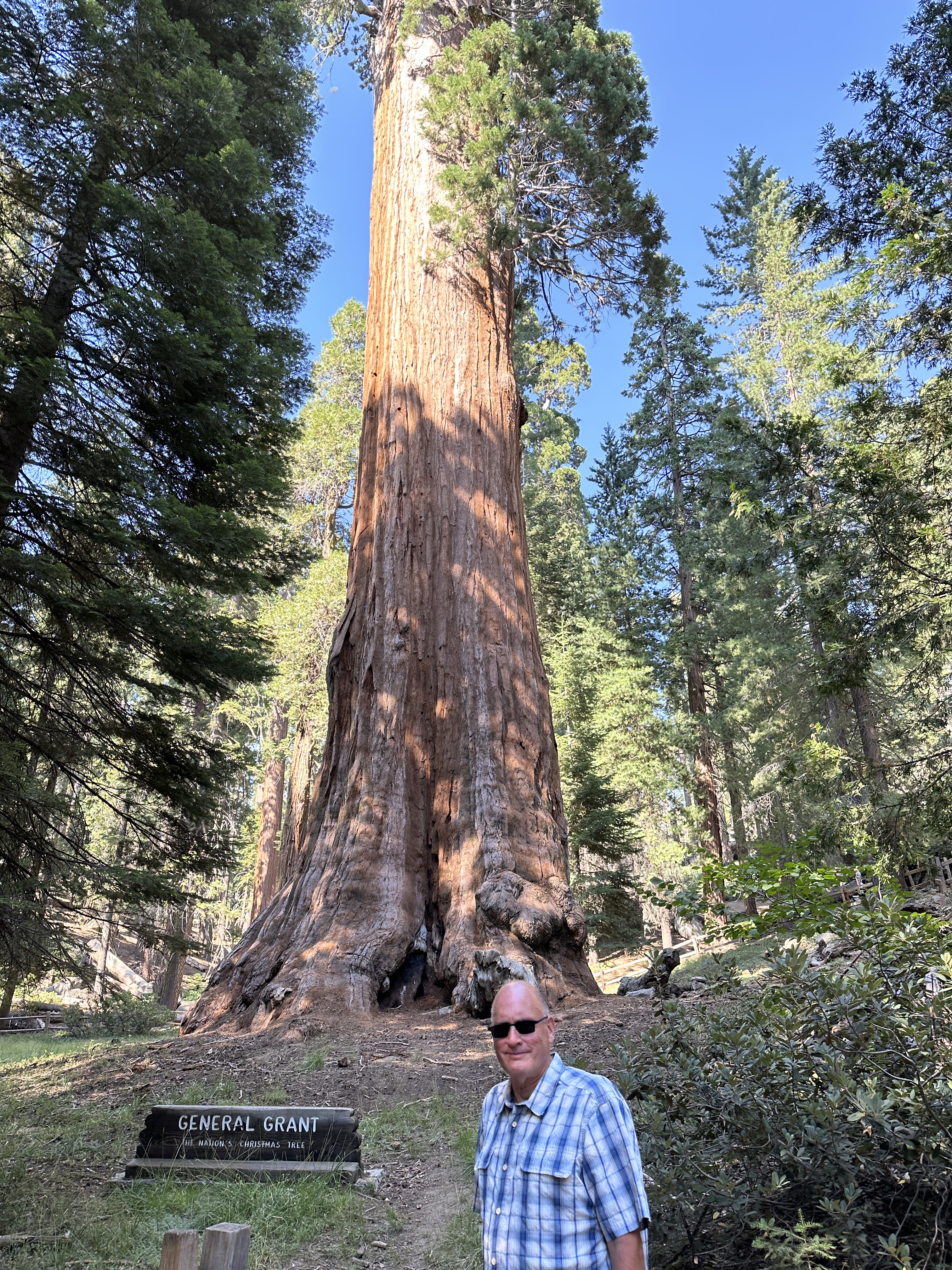
General Grant Tree (Kings Canyon NP)
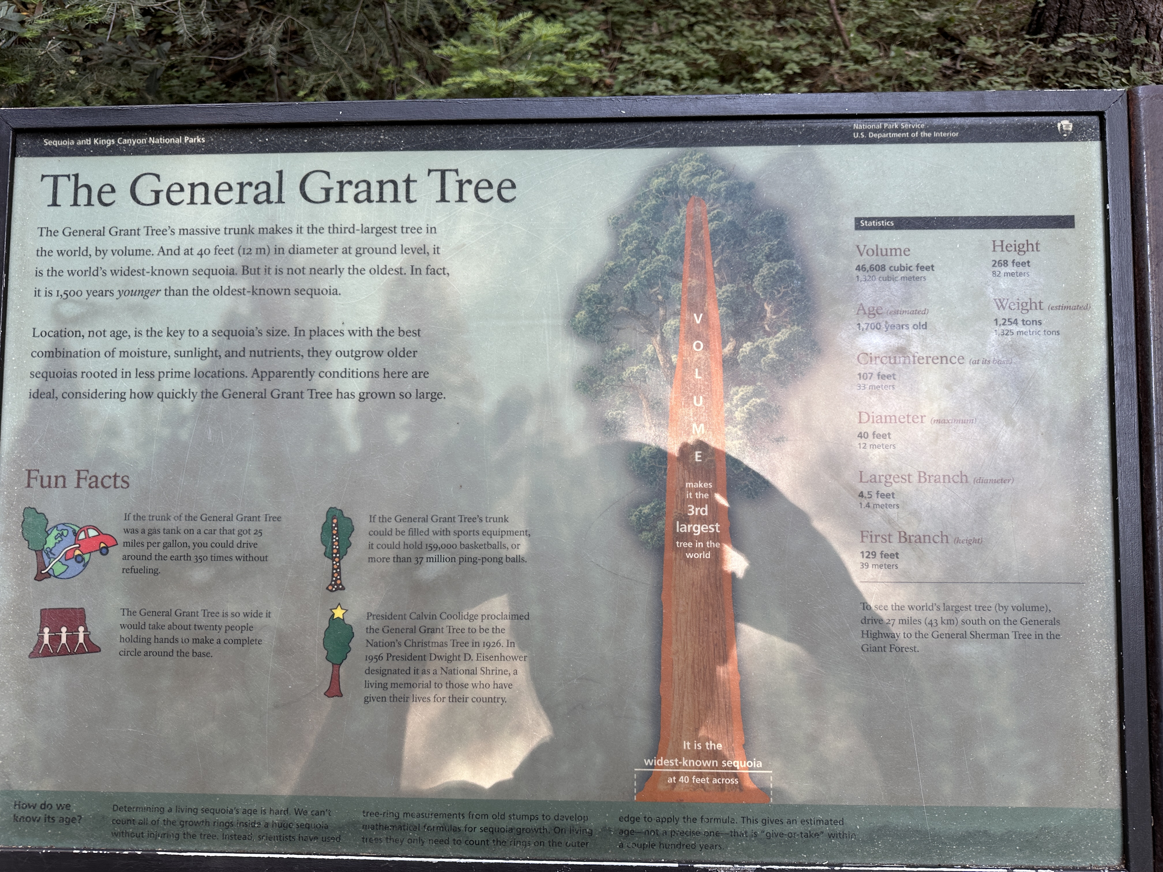
The General Grant tree was not far from the entrance to Kings Canyon and we made this our first stop. General Grant is 40 feet wide at its base, the widest-known sequoia tree and “just” 1,700 years old (some sequoias are 1,000 years older!). It was proclaimed to be the Nation’s Christmas tree in 1926. Good thing they didn’t cut it down! Other fun facts are shown in an image below.
The General Grant Tree in Kings Canyon National Park is the 2nd (or 3rd, depending on which literature you read) largest tree by volume in the world.
A few facts about the General Grant Tree.
Left and Middle Images – Fallen sequoia trees near General Grant. Right – near General Sherman.
Since we arrived late in the afternoon, after visiting General Grant we drove to Lodgepole Village and Campground in Sequoia National Park, passing through a small burn area at the entrance.
The Northwest entrance to Sequoia National Park, on the Generals Highway.
After getting settled in camp, we enjoyed a great park ranger talk that evening at the nearby amphitheater where we learned a great deal about the local black bear population (we learned that that black bears can be white, brown as well as black!).
General Sherman Tree
During the summer, shuttles operate between Lodgepole Village/Visitors Center and Moro Rock, so rather than drive and try to find parking at each stop, we took the shuttle, a very convenient way to go.
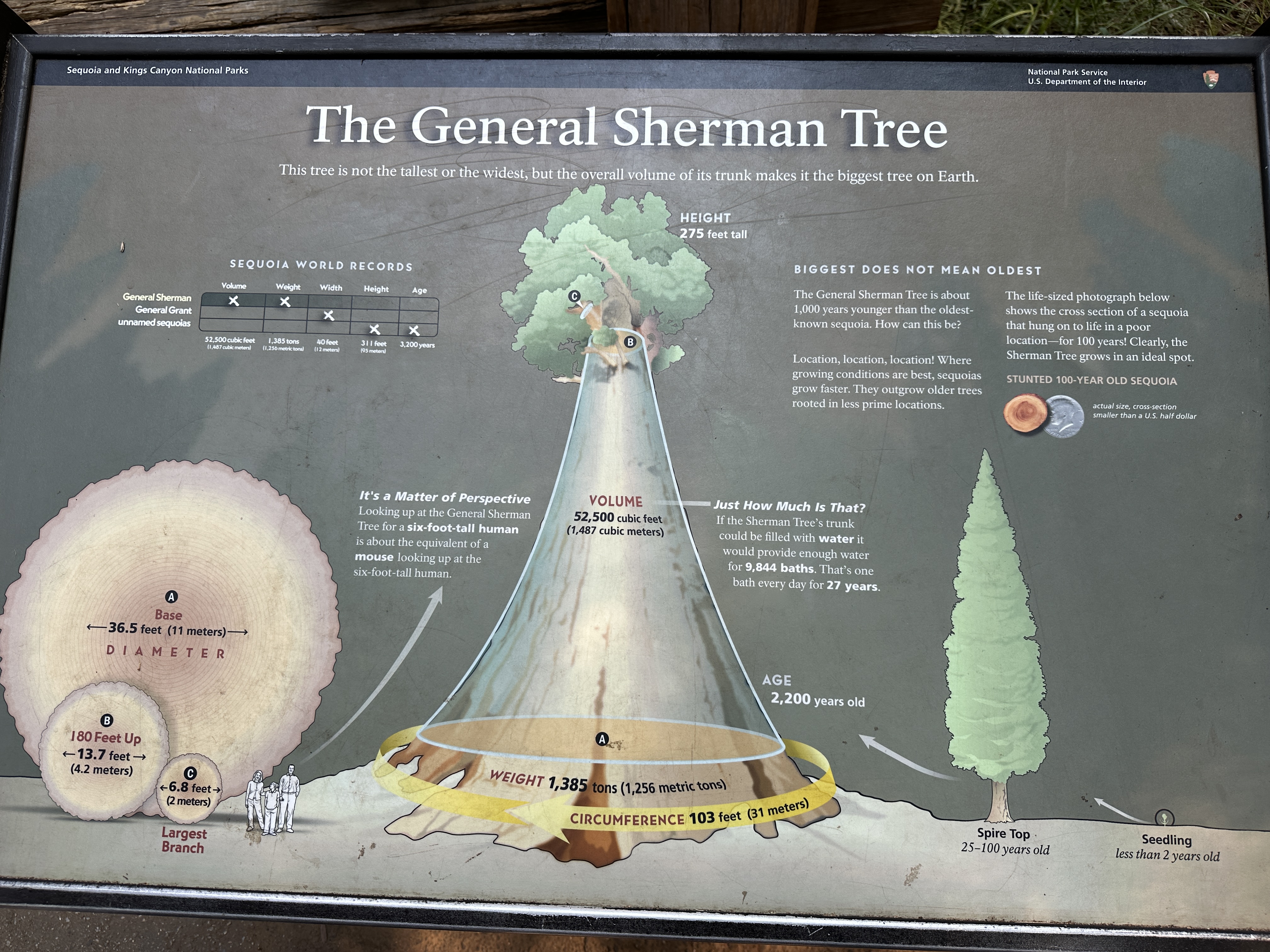
Our first stop was the General Sherman Tree, the largest tree in the world by volume, it’s 2,200 years old. A half-mile trail from the shuttle stop leads to General Sherman and provides access to other nearby trails.
A few fun facts about the General Sherman tree.
Big Trees Trail
A short distance south of General Sherman is the Big Trees Trail, a 1/2 mile loop that will take you on a tour of some of the other massive sequoias in the Park. Everywhere you look are these giant trees, making you feel very small! Also, along another 1/4 mile path, you can visit the Giant Forest Museum where the geology and history of these trees and area is explained.
Examples of the giant sequoias, note in the right image how the tree has swallowed up part of the huge boulder!Additional images of the Big Trees trail. On the right – Robyn is standing next to a very young sequoia that will probably outlive me by 2,000 years or more!
Near the Big Trees trail we saw a couple bears – we were a little way off and they didn’t pay much attention to us.
Moro Rock & Tunnel Log
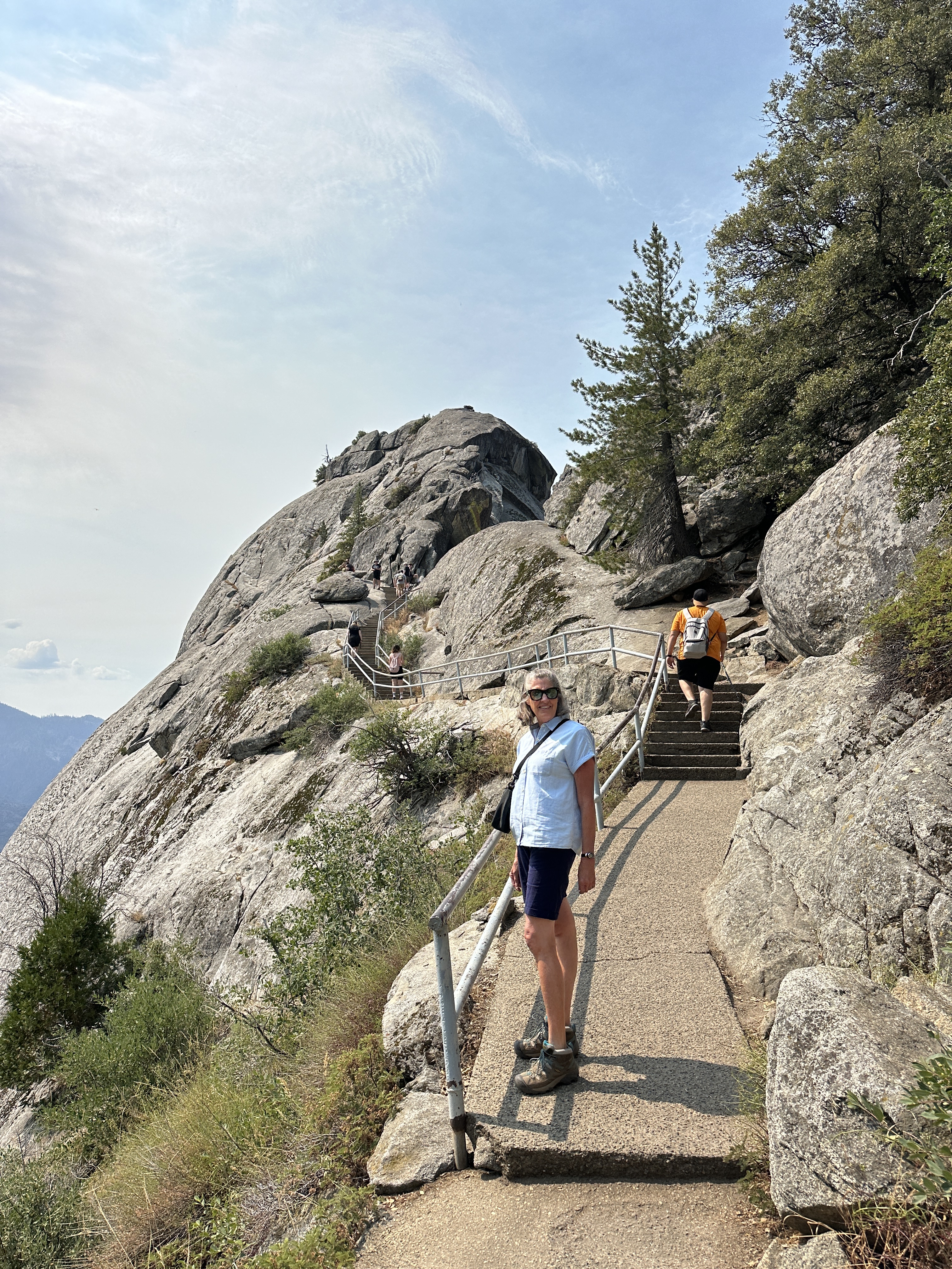
Continuing south from Big Trees Trail, and a short drive off the main road is Moro Rock. You can climb to the top via a 1/4 mile stairway taking you 300 feet up this granite dome for some amazing views of the surrounding mountains.
View of Moro Rock.
Stairway up Moro Rock.
View from the top of Moro Rock, looking east. Mt. Whitney, the tallest mountain in the continental U.S., is at the eastern edge of Sequoia National Park (not quite visible here).
The shuttle also travels past “Tunnel Log” near Moro Rock. Our camper van is too tall to take this tunnel, but if you have a car, go for it!
We camped at Lodgepole Campground in Sequoia NP, a good location for visiting the primary sights in the Park. Lodgepole Village has showers (although they are not the cleanest showers I’ve seen), laundry facilities and a small cafe and convenience store. As with Yosemite, we planned ahead (3-4 months) to ensure we got our campsite reservations.
Entrance to Lodgepole Campground.
Unfortunately we did not have time to really explore Kings Canyon National Park, I wish we could have. Please note there is really only one road into the primary area of Kings Canyon National Park (north of Sequoia NP) and it’s a pretty long drive. My recommendation would be to spend a least one night in Kings Canyon and then two nights in Sequoia National Park. Plan enough time for your visit, the roads are not fast, as with other roads in the area, they are windy, narrow and slow. We exited the Park on the southwest corner via Highway 198 towards Visalia and Bakersfield.
As much as I’ve traveled within the U.S., once place I’d never visited until this year was Yosemite National Park in California. When we bought a camper van last year we put Yosemite on our list as one of the places we definitely wanted to visit. Yosemite is certainly one of the most stunningly beautiful places I have ever been, and the world knows it. You will find many Californians here (of course), plus people from around the world – we heard a lot of different languages being spoken on the trails and around the sights.
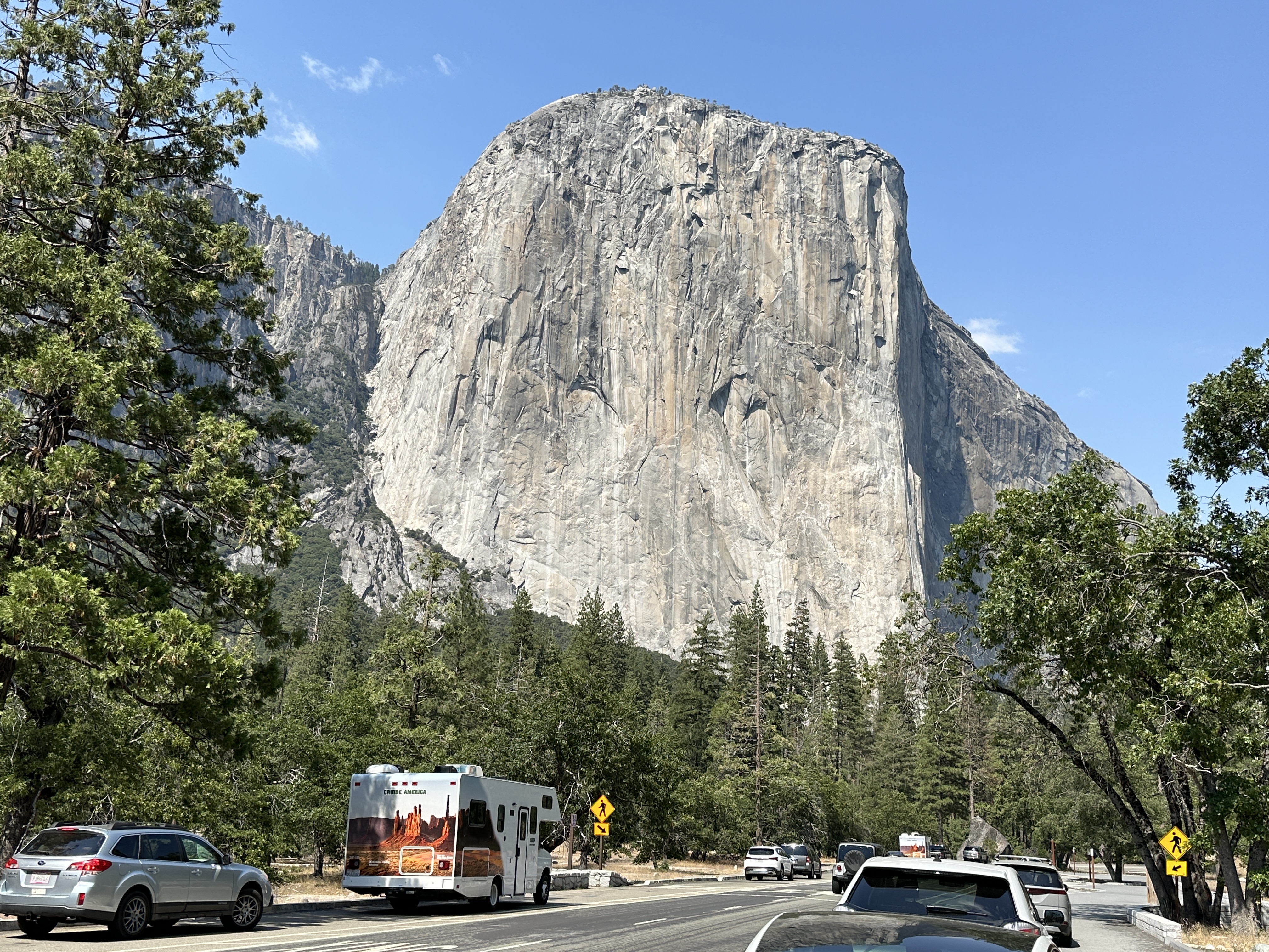
Views of Yosemite National Park, entering the Valley from the west.Left-Bridalveil Fall. Right – El Capitan – it’s difficult to capture in an image the sheer size of this granite monolith! We thought of Alex Honnold and his unbelievable free solo climb here in 2017. You can hike to the top via a tough 16+ mile trail.
Yosemite Falls
Views of Yosemite Falls. Right – the site of John Muir’s cabin in Yosemite – what a lovely location – you can see the separate upper and lower falls. We were fortunate that in late July the water was still flowing.
You can hike to the base of Lower Yosemite Falls if you don’t mind scrambling over big granite boulders – it was fun!
At the pool below Lower Yosemite Falls.We hiked up to Columbia Rock, on the trail that leads to the top of Yosemite Falls. It was steep, so be prepared! A view of Half Dome in the distance.
Merced River
Floating and wading in Merced River is a favorite pastime for families and children in Yosemite. Several campgrounds and trails are located right on or near the river.
Glacier Point Road
This 30 mile (or so) drive from Yosemite Valley is so worth it! The views from Glacier Point are awe-inspiring. If you plan ahead, you can get a tour shuttle up to the Point and take a steep one-way hike down to the Valley (about 4 miles). If I had been smart, we would have done this – the shuttle was already full when I called just a day or two in advance. There’s lots of parking at Glacier Point, but it does fill up – the good news is that people are coming and going all day long. There’s also a small gift shop and restrooms at the Point.
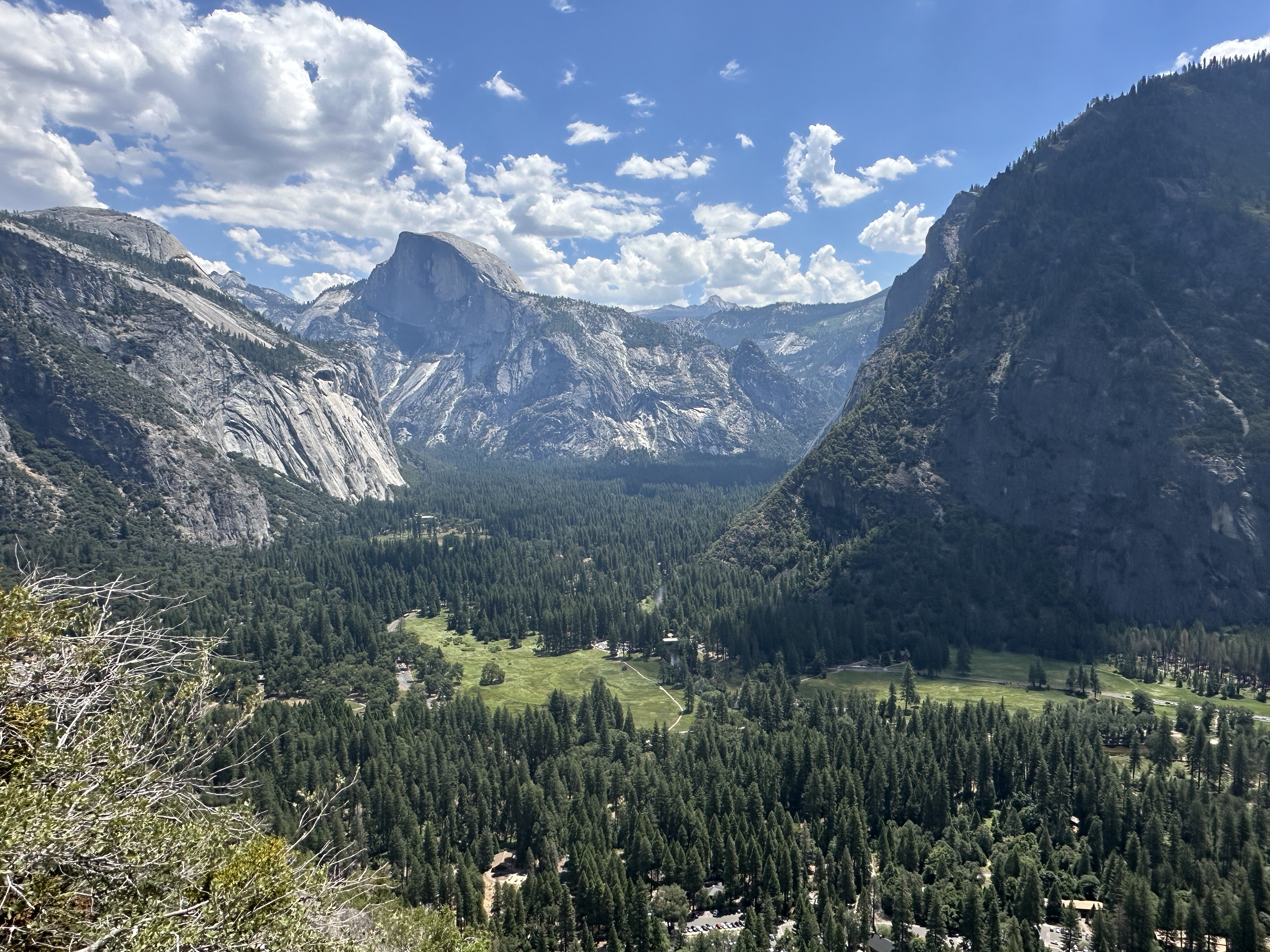
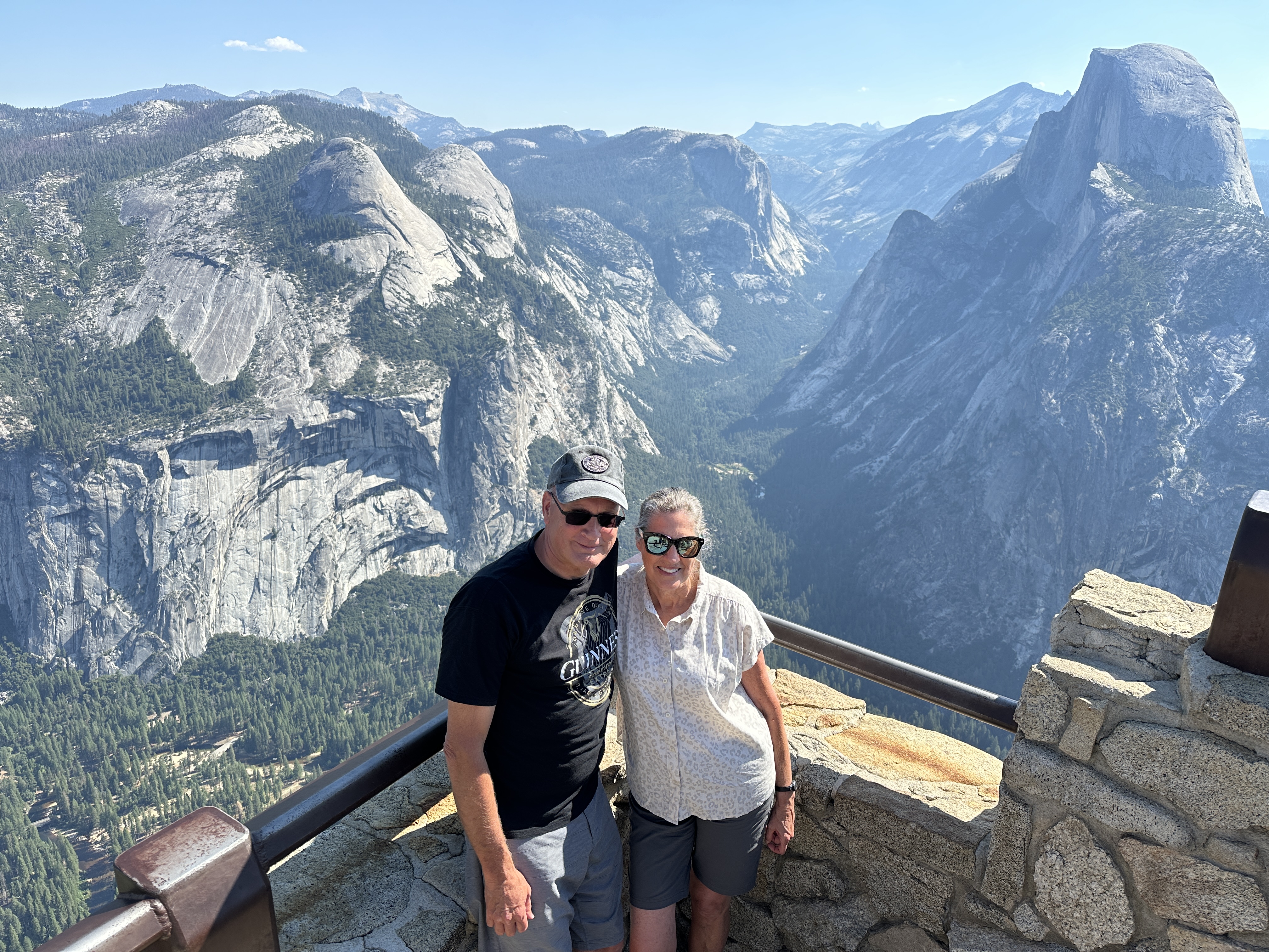
Views from Glacier Point – a great shot of Half Dome from here. If you really plan ahead and have the stamina, you can hike (about 8 miles) up to Half Dome and take the incredibly steep ladder/cable ascent to the top, we saw people at the top of Half Dome from Glacier Point. Permits are required. My nephew and his family did this just shortly after our visit.From the Glacier Point road, you can take a hike (less than 2 miles) to Taft Point (highly recommended!) with another great view of western Yosemite Valley. Right image – that’s me out on the rock looking straight down 3,500 ft. to the Valley floor at Taft Point!
This was the view (called Tunnel View) coming down from Glacier Point- every spot is a “Kodak Moment!”
Mirror Lake
Another great short hike (or bike ride most of the way) in Yosemite Valley (from Upper Pines campground) is to Mirror Lake, formed by Tenaya Creek. The lake is seasonal and in July it was more of a wide spot in the Creek, but with nice sandy play area!
Tips for Camping In Yosemite
If you want to camp within Yosemite and especially within Yosemite Valley, you need to plan (way) ahead. We started looking at campgrounds in February for a July trip and learned there is a four month rolling reservation window, meaning we had to book our campsite in March for July dates. We wanted to be in the Yosemite Village area, right in the heart of Yosemite Valley for my first visit (my wife had visited Yosemite as a child with her parents on several occasions). We spent 3 nights/2 full days in the Park. This was long enough to give us a good introduction to Yosemite. If you wanted to hike a lot of trails and explore the far reaches of the Park, then you might want to spend a week here.
Camping in Yosemite Valley has its pluses and minuses. The main plus is that you are very close to the well-known Yosemite attractions, the main minus is the lack of solitude. Even if you book (on recreation.gov) at the right time and date (at 7 am Pacific exactly 4 months from the date of your planned visit) there is no guarantee you will get a camping spot, they fill up within seconds of being released. We were lucky and were able to get a spot in Upper Pines Campground, right next to the Merced River, almost directly below Half Dome and within minutes of many Valley attractions. I wish I had taken photos of the campground. Don’t expect privacy – the campgrounds are always full, the spots are close together with a few pine trees scattered about. Bear lockers are provided and essential. While the campgrounds have the standard restrooms and water spigots, I don’t believe any of the campgrounds have RV hookups (e.g., water, electricity, sewer), but they do have dump stations where you can take care of your RV’s needs. There are several small stores in the Valley where you can get supplies and snacks, and several restaurants as well.
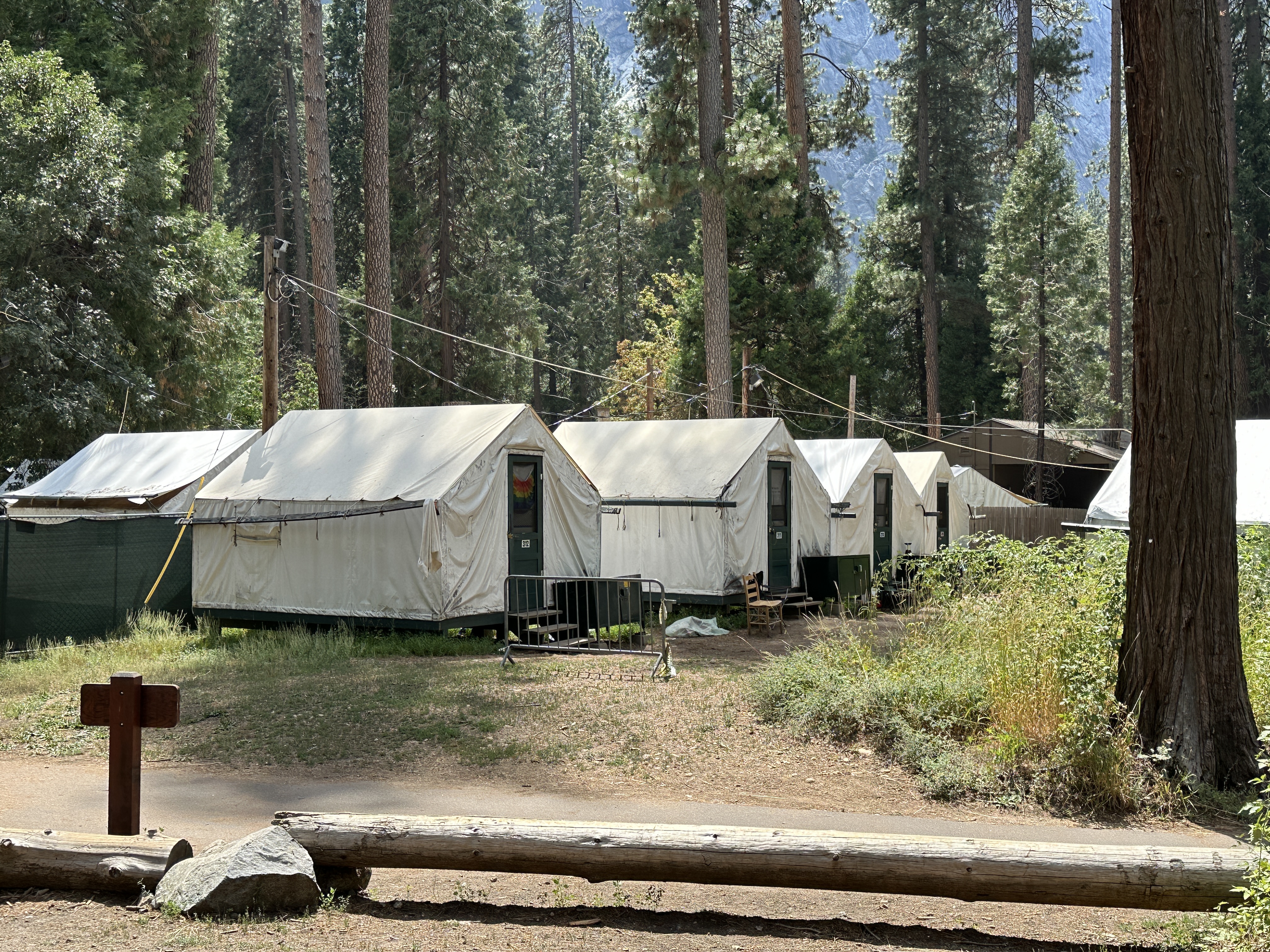
In addition to typical tent/RV campgrounds, you will find other accommodation options in the Park – from luxurious lodges to cabins, established tent communities and prison-like bunks in semi-open cinder block structures that have a table and not much else (the least appealing option in my mind, these are located in Housekeeping Village).
Some of the canvas tent accommodations available at Curry Village in Yosemite National Park.
Since we were on an extended camping trip (having also visited Lake Tahoe and Sequoia National Park as part of the same trip), access to laundry and shower facilities was helpful, these can be found at Curry Village and Housekeeping Village.
Getting Around
Given the volume of traffic and day trippers into Yosemite, car parking can be a challenge. If you can, bring your bicycle and leave your car or truck at the campsite, bikes are a great way to get around Yosemite Valley, the Village and adjacent hiking trails. I was glad we brought our bikes. You can also rent bicycles there.
Other Tips
The roads in Yosemite National Park are narrow, steep and windy, so driving is slow–it’s a big Park, so plan your time accordingly. During the summer months, if you do not have a camping (or other accommodation) reservations inside the Park you will need a timed reservation just to enter the Park, even for a day visit. The lines to enter the Park on a summer morning can be long (miles long). We came in via the Big Oak Flat entrance on the western side of the Park in the afternoon and had no wait. We left via the southwest entrance (Wawona, near Fish Camp) and saw a very long line of cars waiting to enter the Park at around 9 am. There are public buses that come to Yosemite as well from neighboring towns, and this might be an option depending on how long you want to stay.
I know my comments above may scare you away from visiting Yosemite, but in spite of the crowds, it is definitely worth the effort, just plan ahead and figure out your best options.
In addition to beautiful beaches, Menorca, Spain has some interesting and scenic towns to explore. During our short visit, we mixed in visits to the island’s towns, historic sites and beaches. The island is small and it only takes about 45 minutes by car to get from one end of the island to the other. Since the island is not large, any of these towns would be a good “home base” during your stay in Menorca. We decided to say in Cala Galdana, more of a resort area for our first time in Menorca which was also a good choice.
Map showing the relative locations of the major towns in Mencorca.
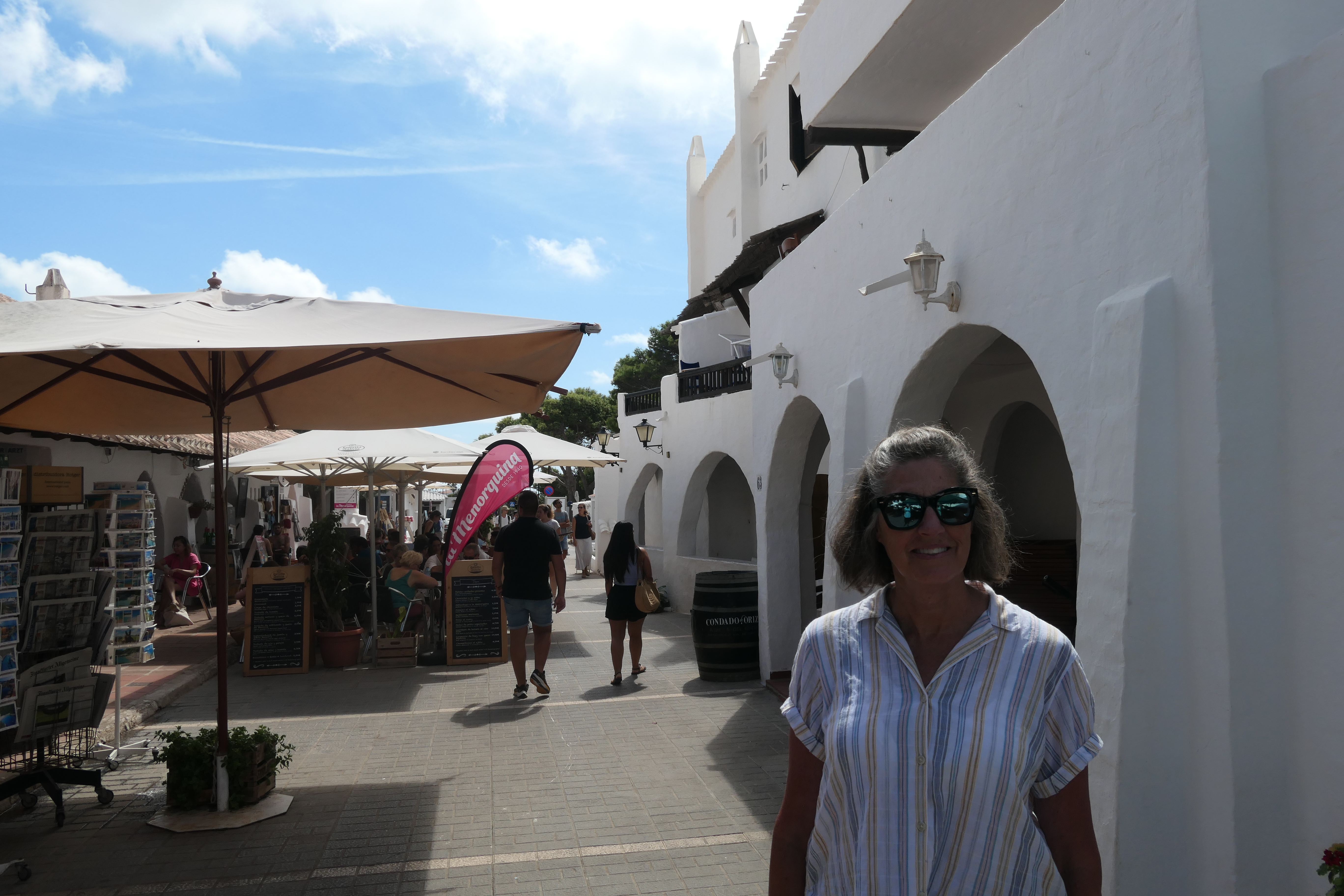
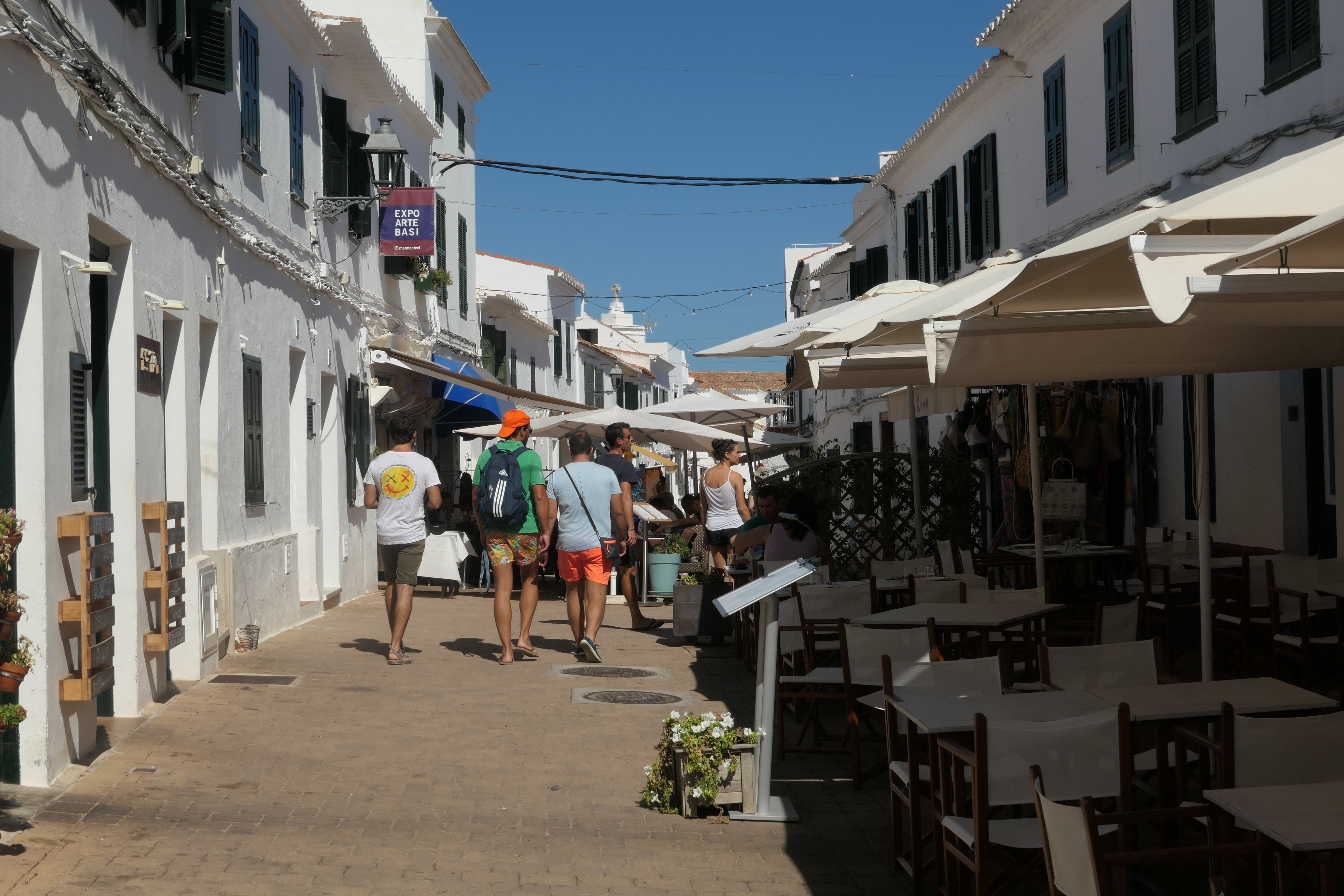
Ciutadella de Menorca
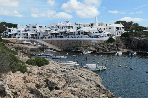
Ciutadella is located on the western end of Menorca and was a busier town than Mahón (discussed below), although that may have been due to the time of day we visited (early evening). Ciutadella is home to the main ferry route connecting Menorca to Mallorca. The town is ancient, dating back to the Carthaginians (~300 BC), and has a long (and at times sad) history, particularly in the 1500’s when the town came under siege by the Turks, who took the survivors and sold them into slavery in Constantinople (Istanbul).
This windmill stands out as a primary landmark as you enter Ciutadella.
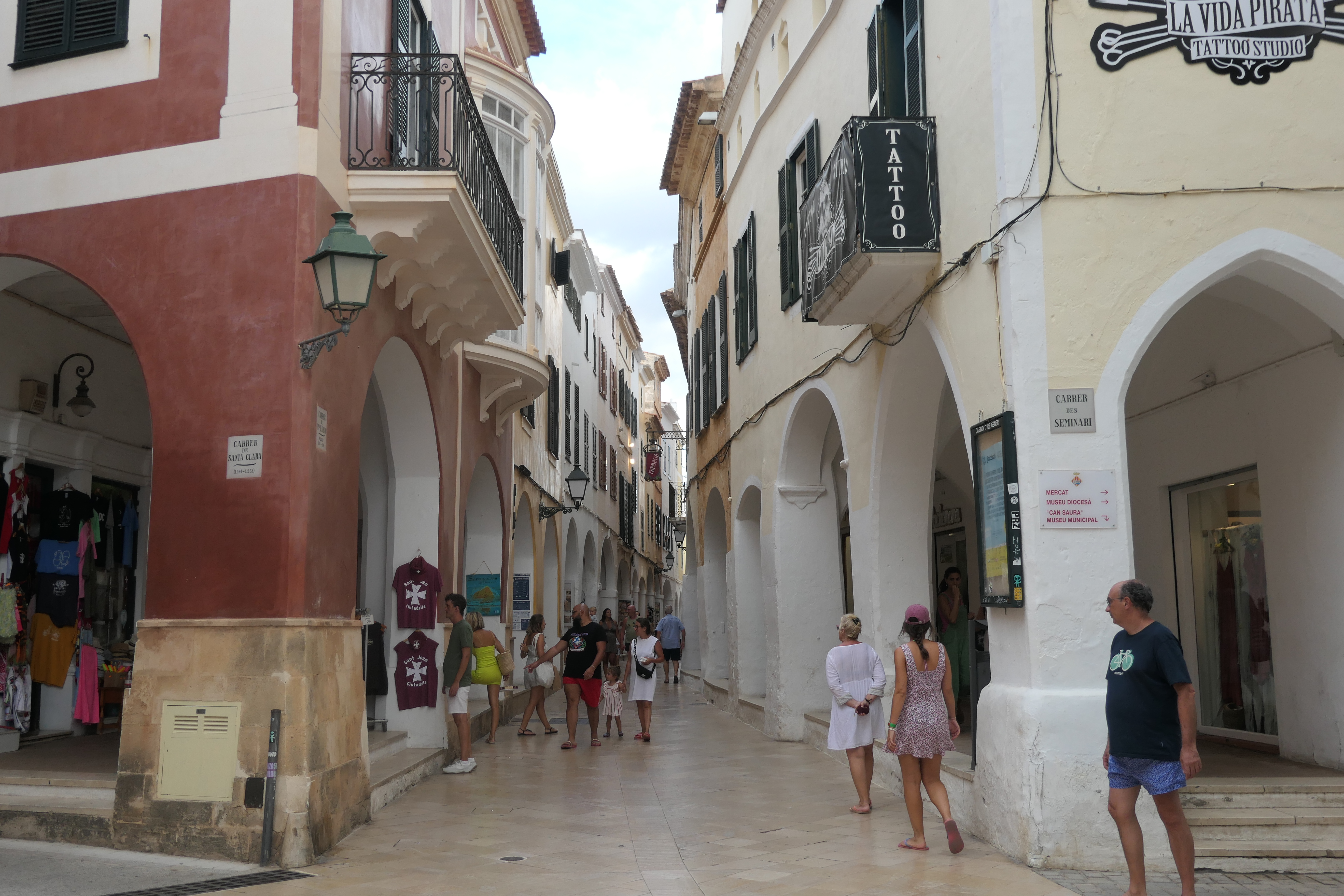
Street scenes in Ciutadella. There are some lovely pedestrian arcaded streets and shops and interesting architecture to be admired in Ciutadella.
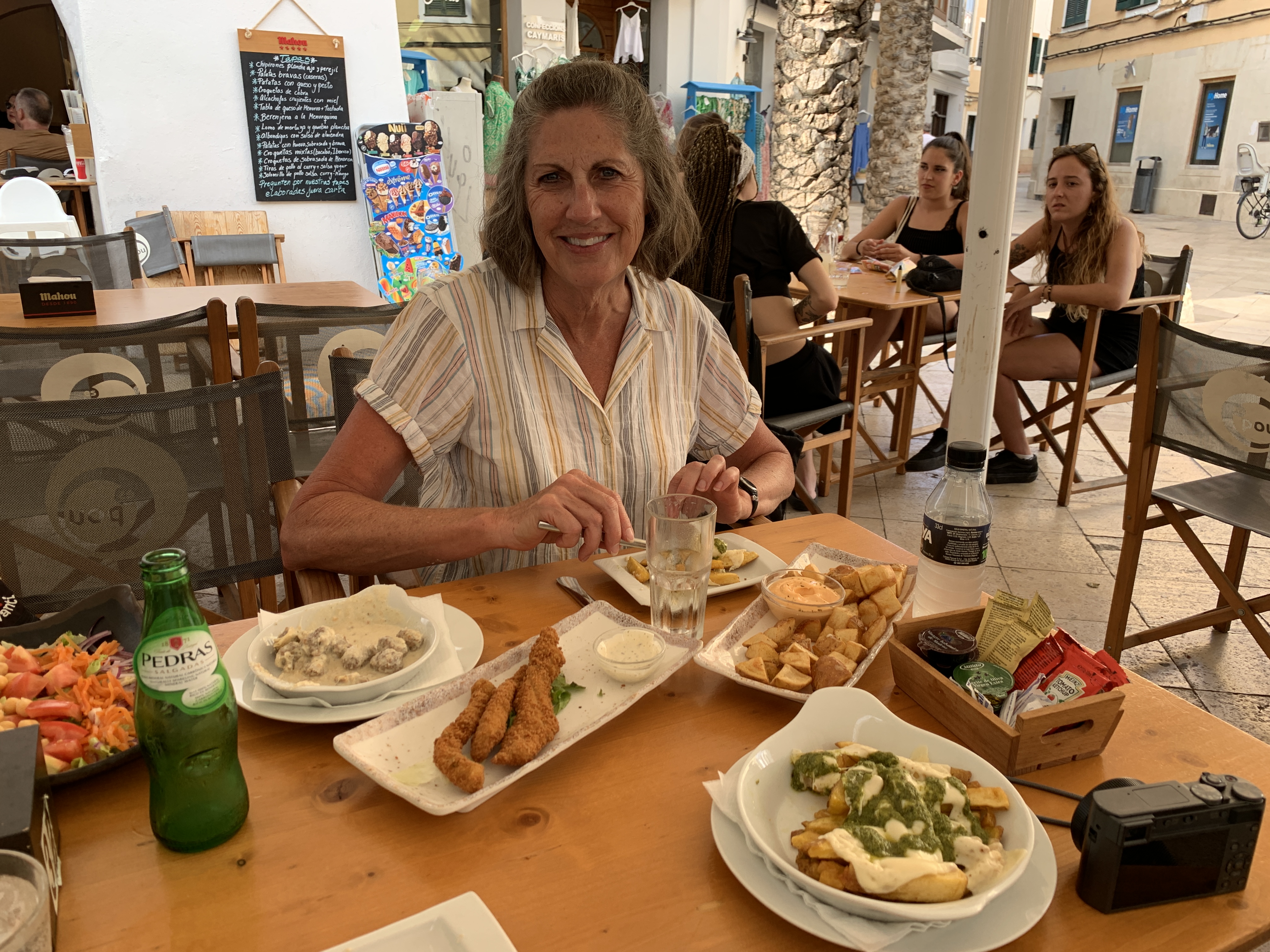
We enjoyed a great tapas meal in Ciutadella!
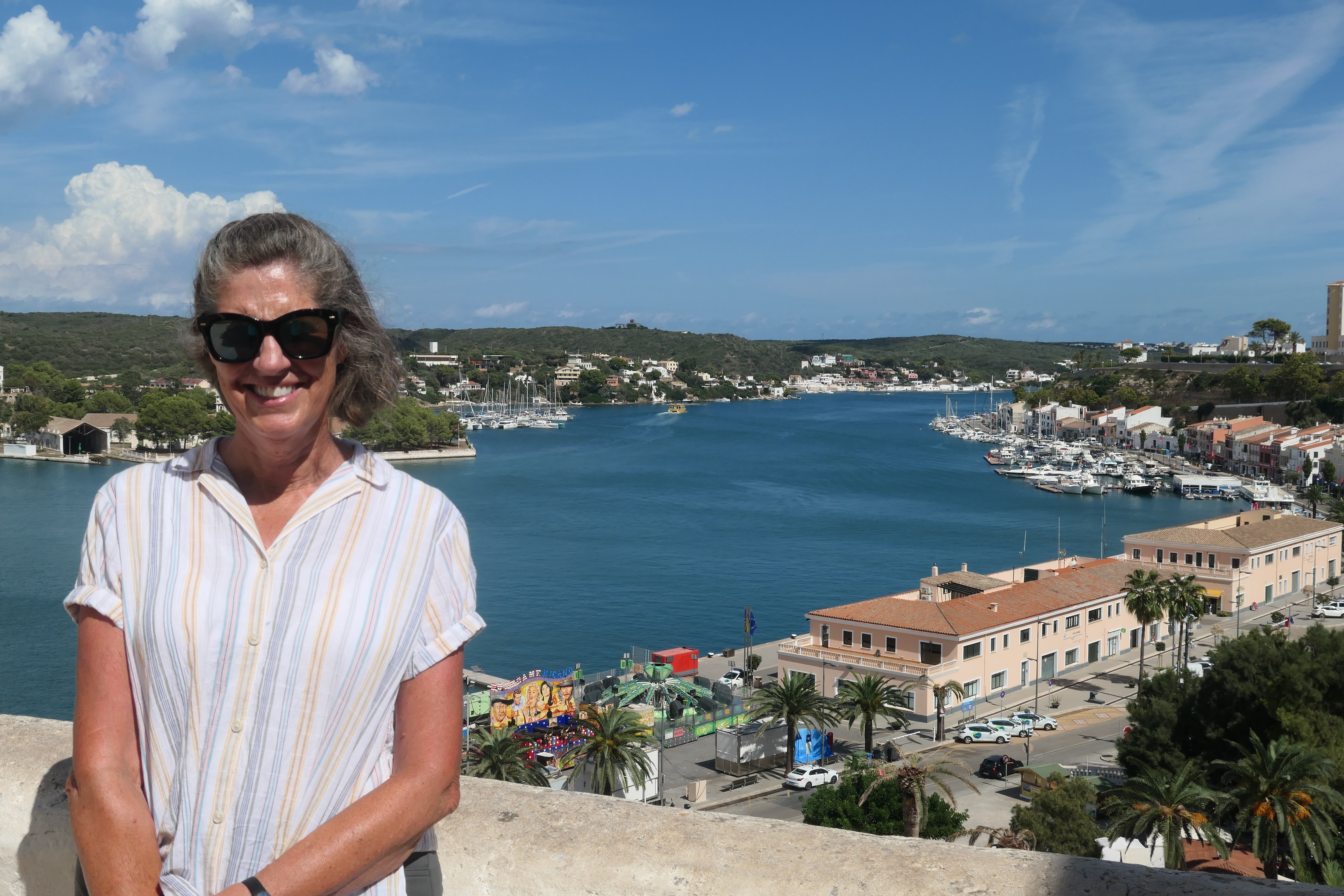
Mahón (or Maó)
Mahón is the largest town in Menorca and the island’s capital, located on the eastern edge of the island. It’s also the location of the island’s airport if you fly here. The town is quite pretty, with a lovely setting and harbor. There are some rumors that the word mayonnaise originated here! We found the town to be pretty quiet, with few tourists wandering about. Numerous boat tours are available from Mahón and perhaps most tourists were out for the day.
We had fun wandering the streets along the harbor and admiring the yachts at berth and enjoying some great gelato! Nearby are a number of prehistoric sites that may be visited.
Views of Mahón‘s Harbor.Street scenes in Mahón.
Binibeca (or Binibeca Vell)
Binibeca is a white town on Menorca’s southeast shore that is relatively new but looks like an old fishing village! It reminded me a bit of the Greek islands. It certainly makes for a postcard view. The town was built in 1968, and is in a great location – close to Mahón and yet it feels somewhat remote. The area near Binibeca is a growing tourist spot, with many small hotels/resorts and homes popping up nearby in the years since the village was built. In addition, there are numerous beaches and coves within a short distance if you want to enjoy the warm clear water.
View of Binebeca and its small harbor.
Views of Binibeca. It would be hard to find a more uniform-looking town anywhere in Europe!
A short walk from Binibeca will take you to some amazing coves and clear water – inviting you to stay and take a dip! We came back on another day and took advantage of these clear, warm waters.
Fornells
Fornells is the only major town on Menorca’s north shore and would make a great home base for visiting Menorca, if you want to enjoy a quieter experience and slower pace. Unlike Binibeca, this is an authentic fishing village and it’s known for its great seafood restaurants.
View of Fornells’ harbor.
Street scenes in Fornells.
Residences and vacation homes near Fornells on Menorca’s north shore – this area had a “California coast” feel.
One doesn’t have to go far from Fornells to find a great beach – Cala Tirant is just a couple kilometers as the crow files from Fornells, or an 8 km (4.5 mile) drive.
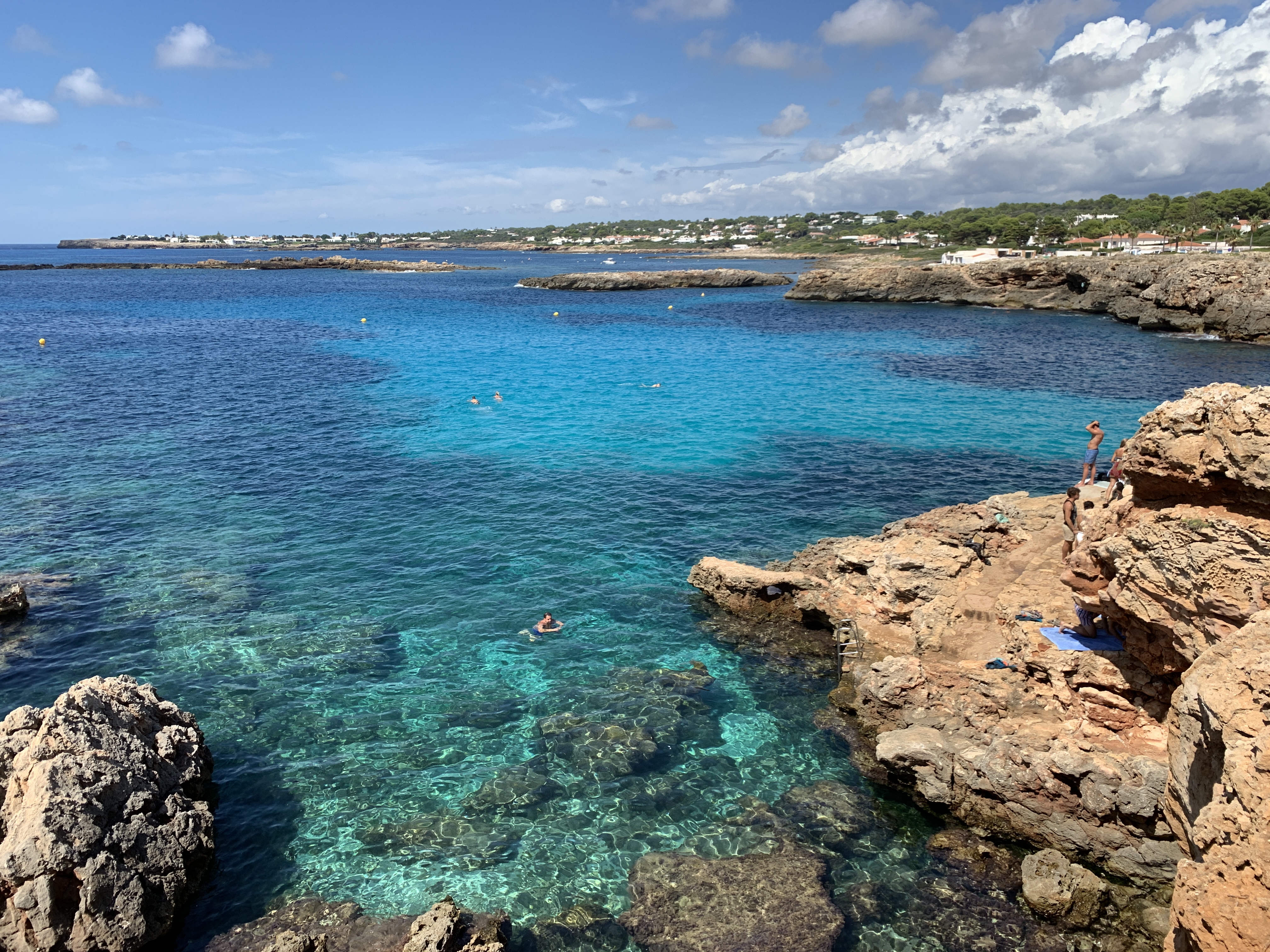
Like the other Balearic Islands, Menorca, Spain is blessed with some amazingly beautiful beaches and coves. Since we were in Menorca for only 4 days, we couldn’t visit all of its glorious beaches, but we did get to swim at several and see others during our (too) short stay. Listed below (in no particular order) are beaches & coves we were able to visit.
Primary beaches we visited are shown in red font.
Note: Someone asked me about encounters with jellyfish in Mallorca and Menorca – there was only one place we saw any jellyfish and that was at Cala Mitjana on Menorca (described below). They were brown (not the technical name) jellyfish and harmless.
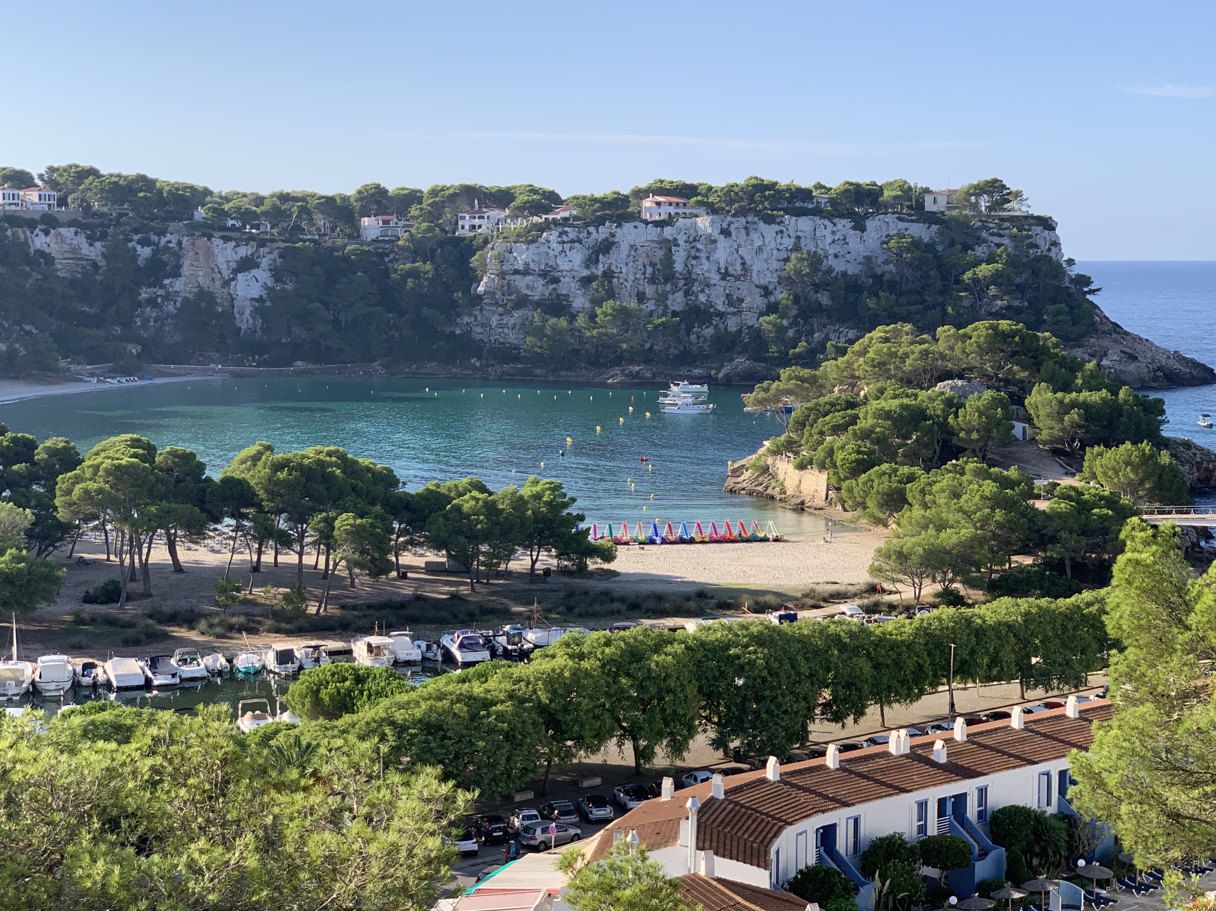
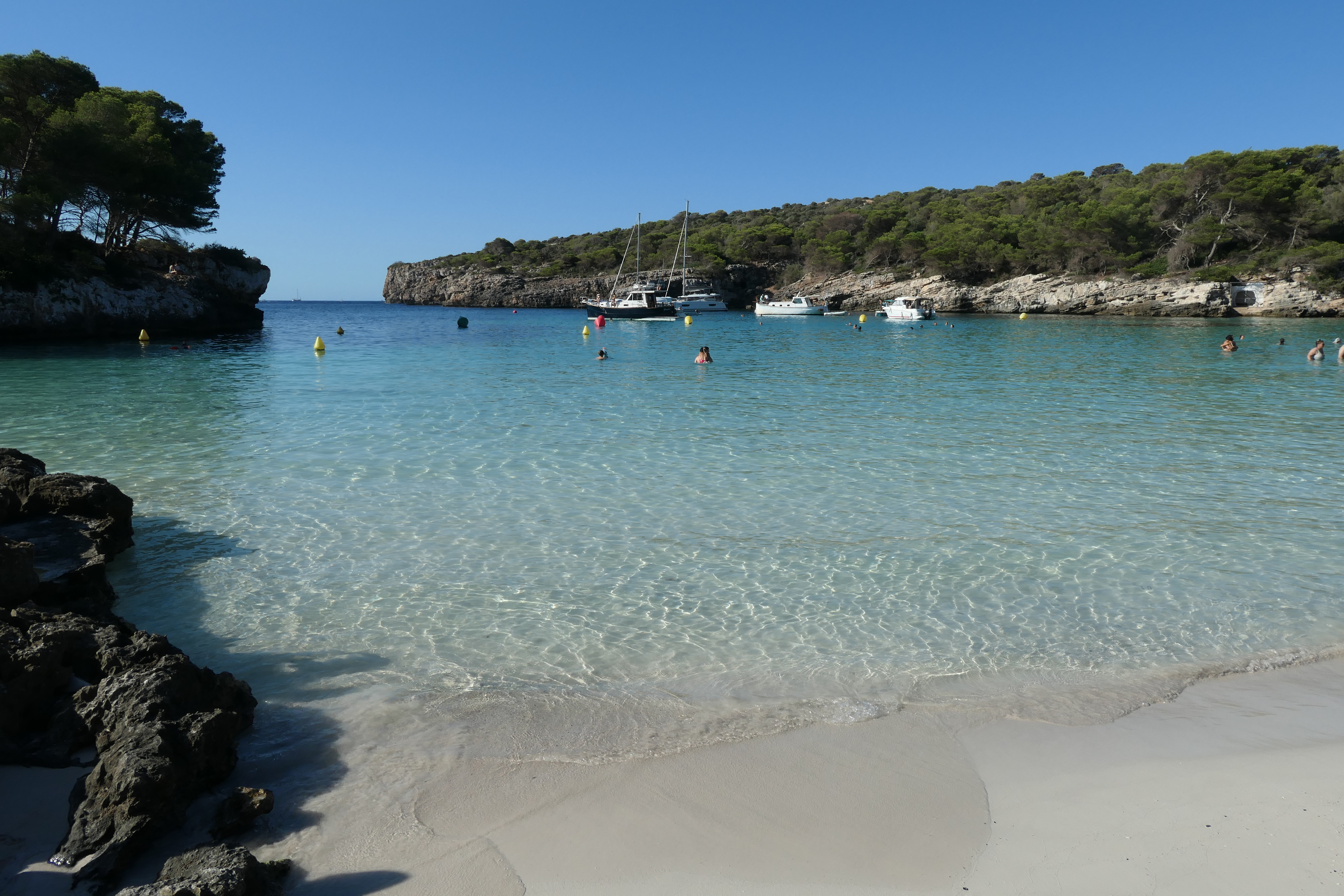
Cala Galdana
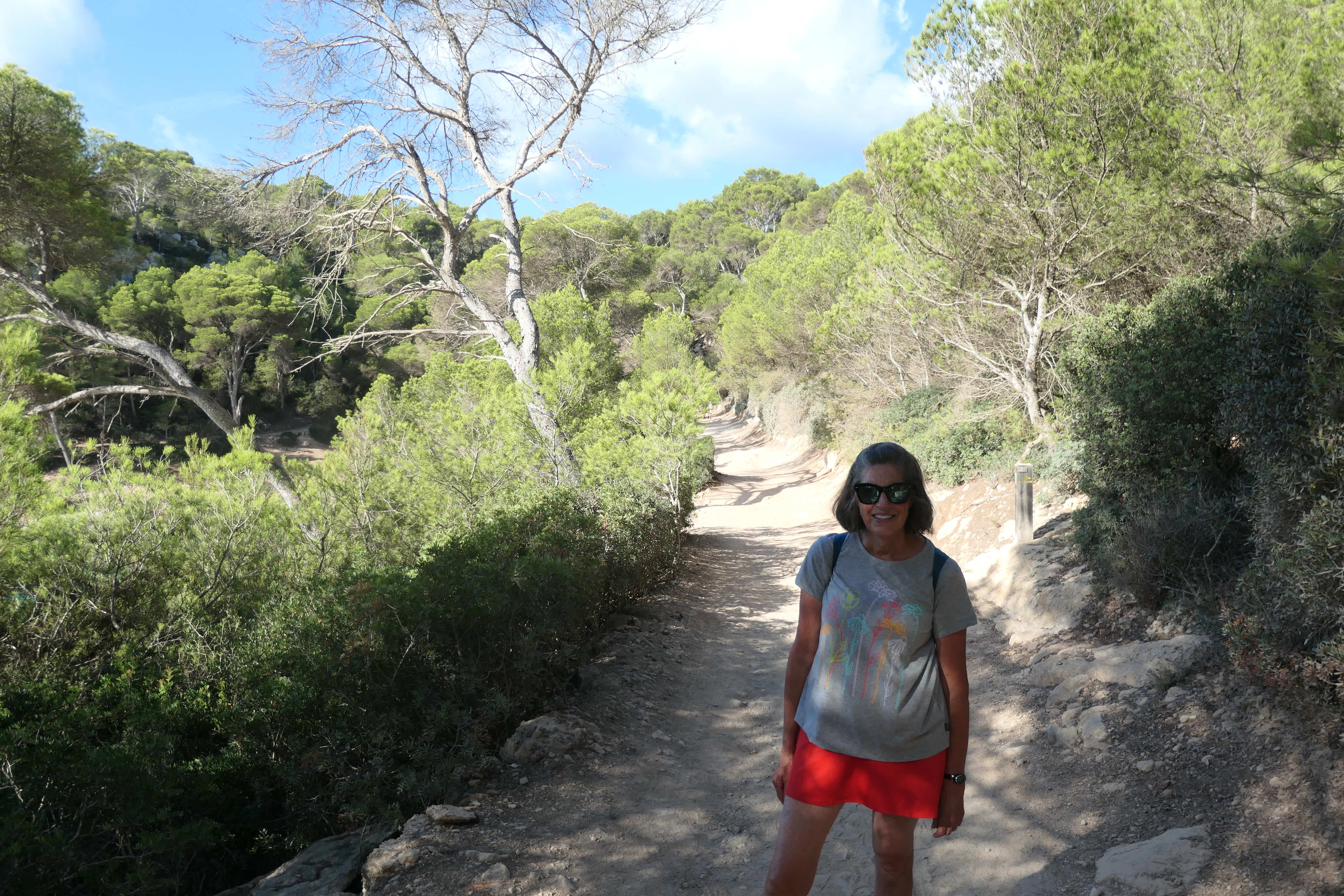
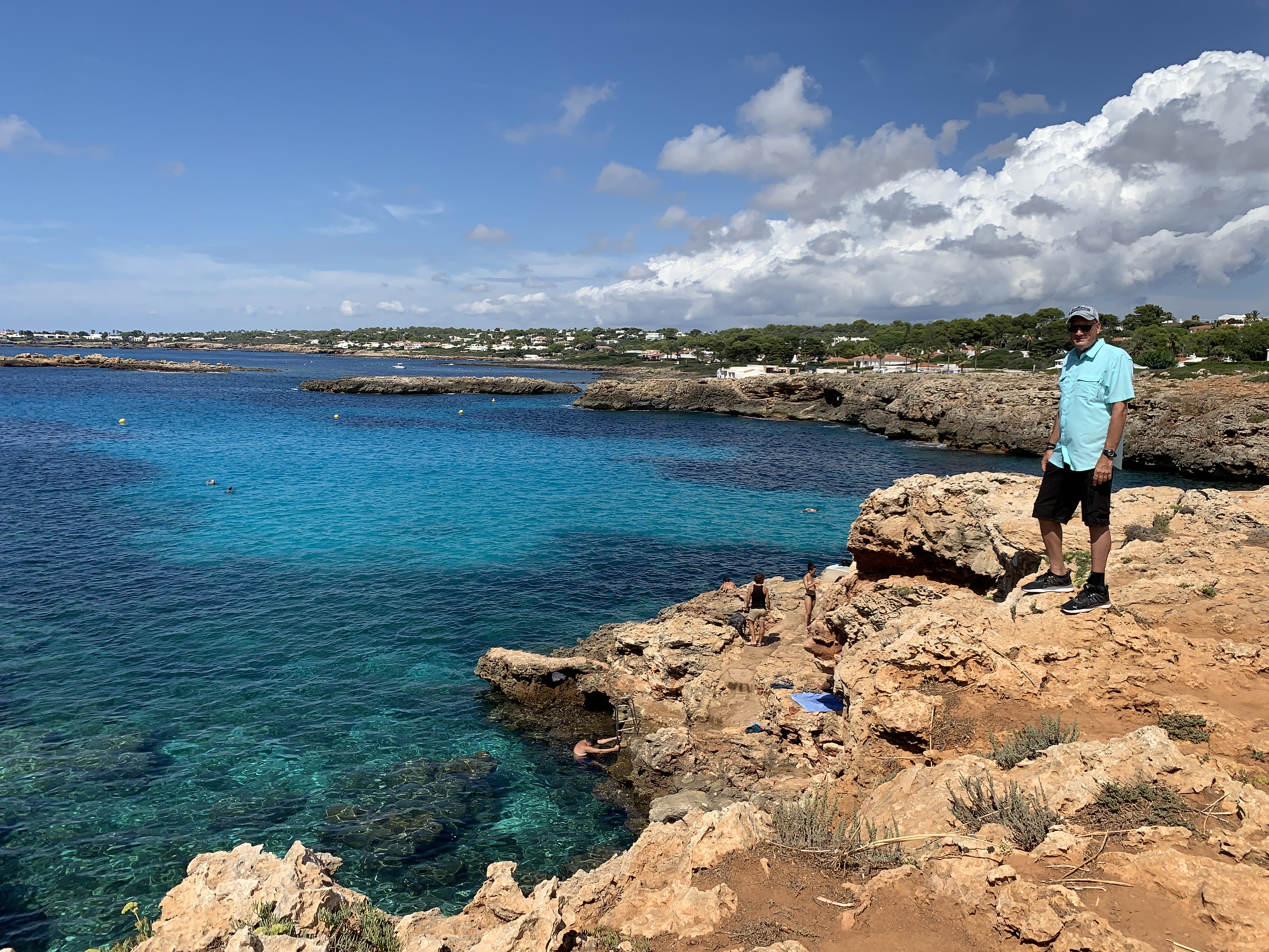
We stayed in Cala Galdana on the southern shore of Menorca–it is a lovely large cove, with a wide protected sandy beach, hotels, restaurants and tourist activity businesses nearby, a perfect spot to call home while you explore the island. The beach has numerous chairs and umbrellas for rent and the water is shallow and calm, making this a very family-friendly place to swim and enjoy the sun. Another plus of this location are the walking trails (part of the historic Cami de Cavalls) along the coast in either direction from Cala Galdana to other amazing places such as Cala Turqueta or Cala Mitjana. The trails are well signposted and point out the distance and direction of your destination (it’s a good idea to get a local island map). Make sure you are adequately prepared if you walk these trails – have plenty of water, sun protection, sturdy shoes and energy snacks.
Left image – view of Cala Galdana from our apartment/hotel balcony. Right image – view of the harbor/channel area of Cala Galdana.
The Comitas Florimar hotel where we stayed in Cala Galdana. The rooms were large and had kitchen facilities.
Additional views of Cala Galdana’s beach area.
Walking along Menorca’s coastal trail (Cami de Cavalls).
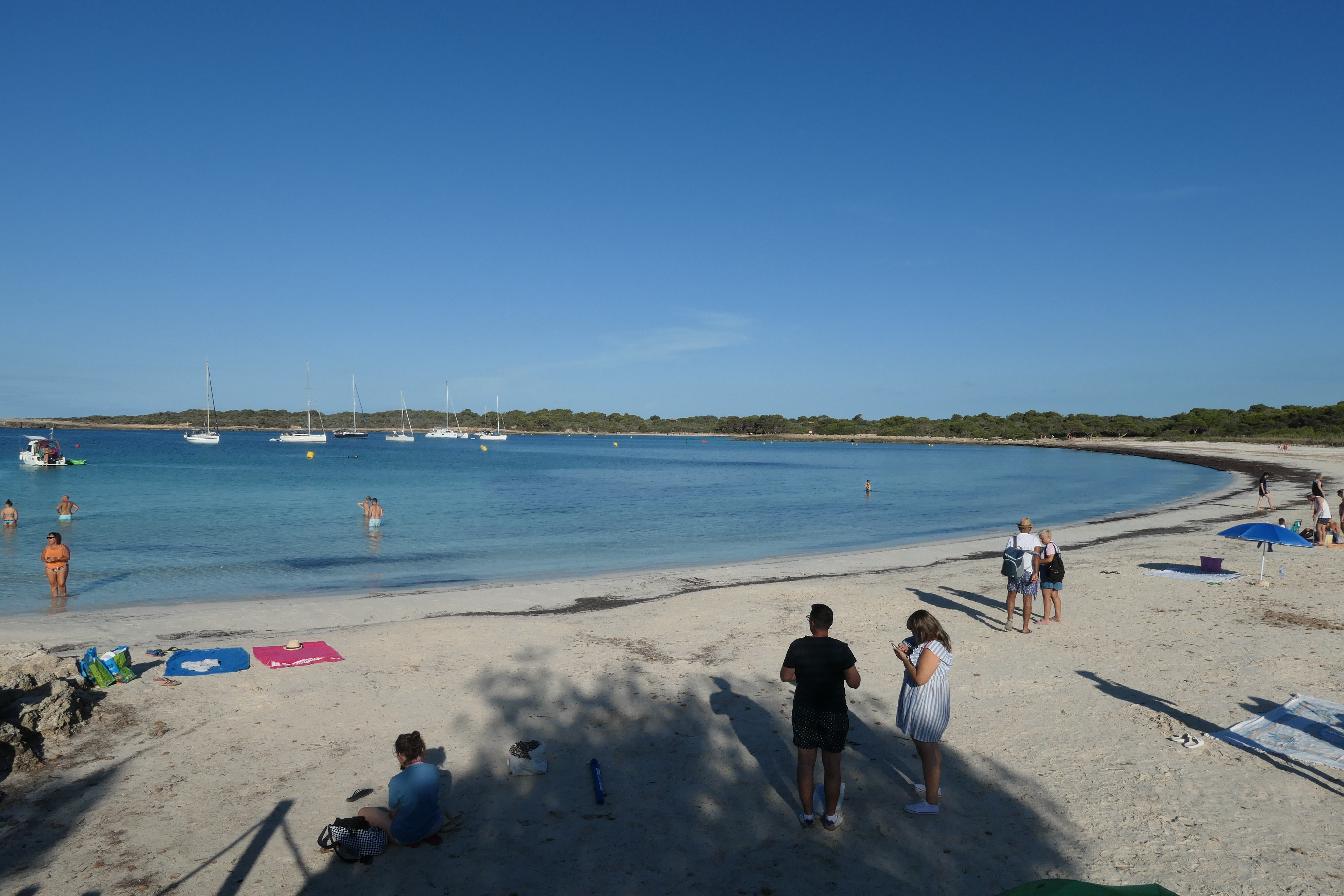
Cala Turqueta
This may be Menorca’s most famous beach. From Cala Galdana, it is just a few kilometers (6.4 km, or 4 miles) west by trail if you’re up for a little hike. The advantage of taking the trail to Cala Turqueta is that you avoid the parking problem. The Cala Turqueta parking area fills quickly (we arrived before 8 am and were turned away) and if you can’t get a spot you must drive back to the island’s main road and then down another road to another car park (Son Suara Beach – see below) and then hike from that car park along the coastal trail back to Cala Turqueta. I know this sounds a bit complicated, it’s because there is no coastal road connecting many of the beaches by car, you must use the main east-west road in the middle of Menorca as the main car route and then take the north-south spur roads that lead to the various beaches and coves. It’s not a huge issue, just be prepared to sometimes walk at least a couple of kilometers on the trails as noted above. The only route that connects the entire coastline is the non-motorized trail circumnavigating the island. In fact, a number of beaches can only be reached via the trail.
Bottom line, however you manage to get to Cala Turqueta, it is worth the effort!
Cala Turqueta – get here early if you want a little quieter experience.
Above and below – views of Cala Turqueta, Menorca.
Cala Mitjana
Cala Mitjana is less than 2 km (~1 mile) east of Cala Galdana via the walking trail and is very beautiful also. Since we walked, I’m not sure about the car park situation, but probably similar to Cala Turqueta – arrive early to get a spot if you need to drive here.
Views of Cala Mitjana from the coastal trail.
Cala Mitjana – just another lovely day at the beach!
Binibèquer Vell (Binibeca Vell)
I’ll share more about this unique town in another post, but this region of Menorca (southeast coast) has some great beaches and coves. It was one of my favorite spots on Menorca. We found this beautiful cove (below) just outside of the town of Binibeca Vell as we were exploring the area. It looked so inviting we came back another day specifically to swim here!
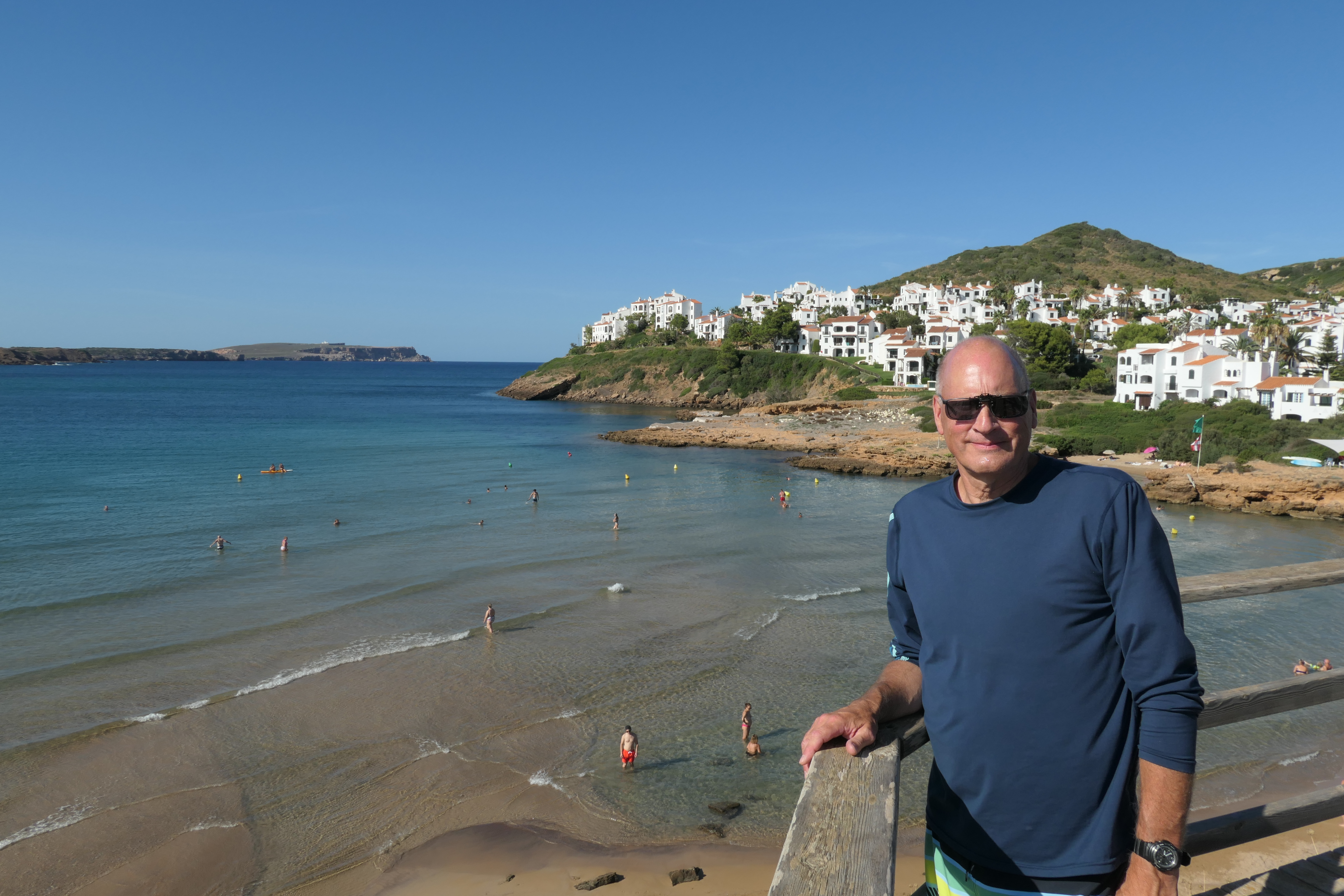
A cove near Binibeca Vell – the water is so clear – bring your snorkel gear!There are several ladders on the cliffs making it easy to get into and out of the water.Yours truly enjoying the warm, clear water near Binibeca Vell!
Some of Menorca’s Other Beaches
There are so many stunning beaches in Menorca – below are a few others we visited during our various exploration travels.
Cala Tirant – this beach is on the north shore, near the town of Fornells. Wide, open and I’m guessing it wouldn’t feel crowded even on a busy day.
Views of Cala Tirant, on the north shore of Menorca.
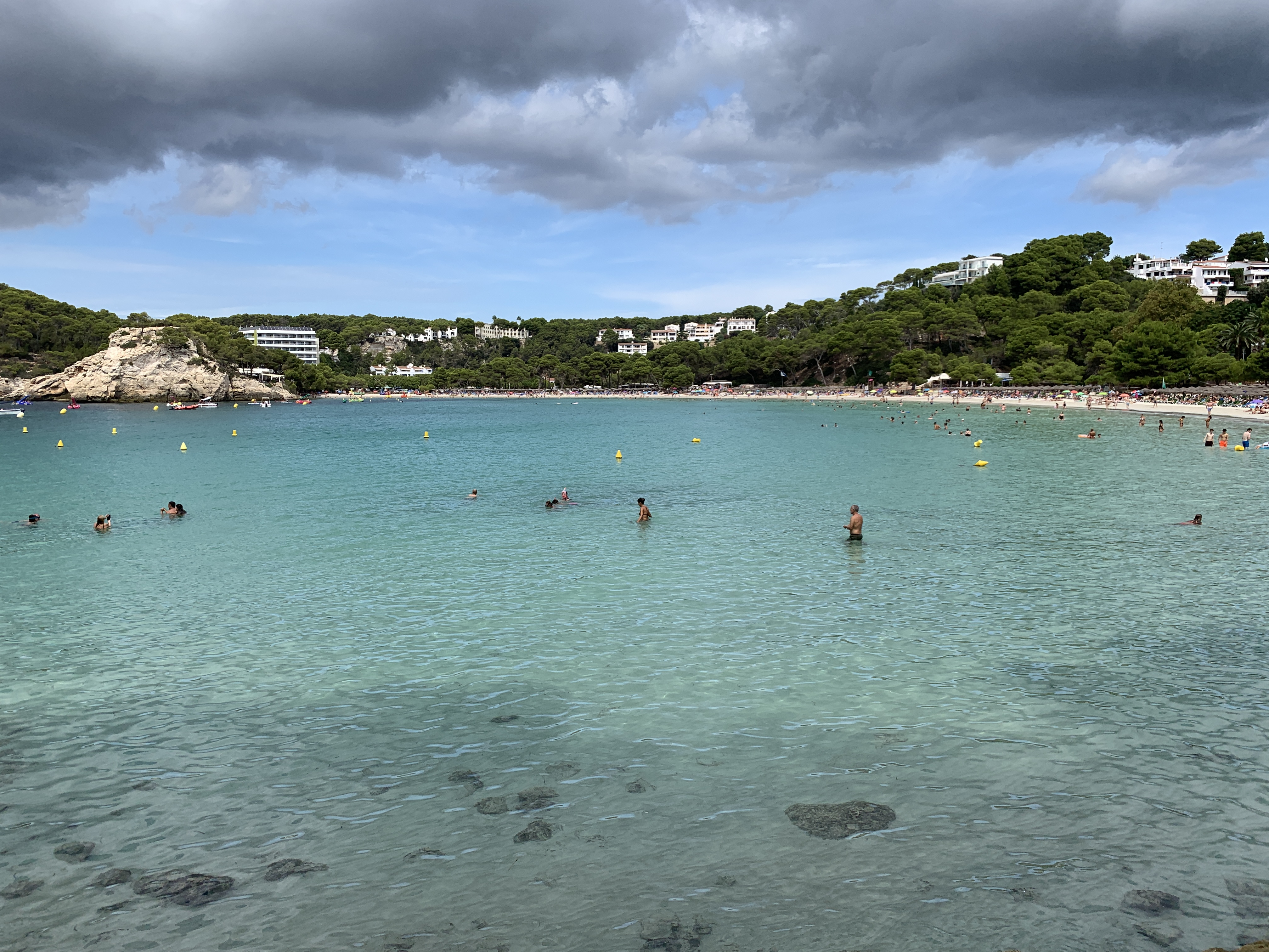
Son Bou – this popular beach is on the southern shore of Menorca, and close to the Torre d’en Galmés prehistoric ruins if you want to mix a little culture in with your beach day. There are also some 6th century church ruins right next to the beach.
Son Bou Beach.
Cala des Talaier – another beautiful small cove and beach on the southern coast, between Son Saura and Cala Turqueta.
Cala des Talaier – just off the walking path on the way to Cala Turqueta from Son Saura beach and parking area.
Son Saura – another amazing, wide, shallow and calm beach area on the south coast of Menorca.
Son Saura Beach, on the path from the Son Saura parking area to Cala des Talaier and Cala Turqueta.One really needn’t go any further than here to have a perfect beach experience!
I hope I have convinced you that you don’t have to go to Hawaii for great beaches – the Mediterranean Sea and specifically Mallorca and Menorca are blessed with an abundance of beautiful, safe, white sandy beaches and some of the clearest, warmest water you will ever find!
Many holidaymakers flock to Egypt for its pretty beach resorts which offer sun, sea, sand, and plenty of relaxation. For active travellers who prefer to stay busy, these quiet beach resorts are less appealing. Let’s take a look at three destinations in Egypt that have lots of fun activities on offer to appeal to energetic travellers.
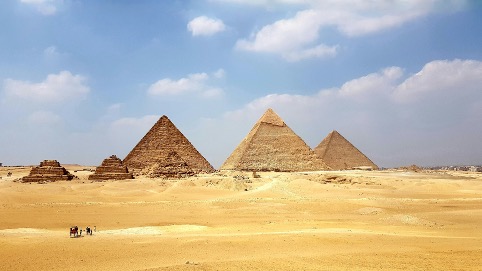
Cairo is Egypt’s capital city and it has a huge array of attractions to visit. Those who love to be on the go will certainly stay busy in Cairo. The Giza pyramid complex, which lies on the outskirts of the city, is by far the most popular historic site, but wandering around the ancient structures in the baking heat is not for the fainthearted. There’s also the Fortress of Babylon, the Mosque of Muhammad Ali, Abdeen Palace, Giza Zoo, and a vast range of museums to explore. Even strolling around the Egyptian Museum in Cairo requires some stamina due to the sheer scale of the collection; there are around 120,000 antiquities on display here. Cairo’s position on the Nile also allows for active travellers to try their hand at kayaking and rowing to see a different side to this sprawling city.
Marsa Alam is a scenic resort town that lies on the Red Sea’s western shore and although its beaches are lined with sun loungers and umbrellas, there’s far more to do than simply relax. The town is considered one of the best destinations in the world for kitesurfing. Its waters are relatively flat and see plenty of sunny, windy days that are perfect for kitesurfing, particularly between September and April when average temperatures range between 18 and 29.5°C (64 – 85 F). The waters in Marsa Alam are very clear and there are beautiful natural barrier reefs to explore if you’re into diving or snorkelling. You might even get the chance to see sea turtles, dolphins, and dugongs (sea cows). If you love water sports or enjoy trying new activities, Marsa Alam is a fantastic destination.
Luxor is a fascinating city best known for its proximity to the Valley of the Kings and the Valley of the Queens, two royal burial sites that have played an important role in our understanding of ancient Egypt. More than 150 tombs have been excavated across the two sites, including that of Pharaoh Tutankhamun. On the opposite bank of the river, there’s the Karnak temple complex to explore. This is an enormous 247-acre site that was developed over the course of 1,500 years by 30 successive pharaohs. There are many more temples and monuments in Luxor to explore, such as the Ramesseum, the Colossi of Memnon, and the Memorial Temple of Hatshepsut, as well as some excellent museums such as Luxor Museum and the Mummification Museum. You’ll need to be on the go throughout your stay in Luxor for a chance to see all the sights.
Egypt is the perfect destination for an active holiday
There’s so much to see and do in Egypt that it’s the perfect holiday destination for active travellers. Choose one of these three cities as your base or consider travelling around the country to experience all that Egypt has to offer.