Just southwest of the heart of Lisbon, Portugal along the Rio Tejo (River Tagus) is the suburb of Belém (or Bethlehem). This spot was the launch point for many voyages of discovery in the 1400 and 1500’s. In 1498, Vasco da Gama sailed from here and was the first to circumnavigate Africa via the Cape of Good Hope, thereby establishing a sea route to India. Reaching India was of course the goal of Columbus in 1492 when he sailed west and landed in the Caribbean. This feat would soon make Portugal the leader in world trade, displacing the Venetians who ruled the merchant routes in the 1400’s. At Belém, the river becomes wide as it empties into the Atlantic Ocean. Don’t miss visiting Belém on a trip to Lisbon. For information on Lisbon and a map of sights I visited in Portugal, click here.
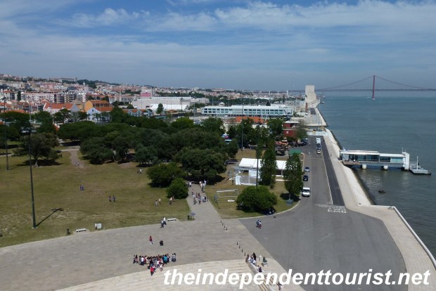
View towards Lisbon and the River Tagus from the Belem Tower (the Discoveries Monument is in the distance at the river’s edge).
Getting to Belém
It is easy to get here from central Lisbon. Lisbon has a great subway (Metro) system. Take the Metro to the Cais do Sodre stop and then take a bus right outside the station (about a 15 minute ride) to Belém just along the river front. There is a lot to see in Belem. Since I just had a couple hours, I visited the Belém Tower and the Mosteiro dos Jeronimos. You can get a combination ticket to theses sights for 10 Euros, there is a kiosk at the monastery. In addition to the main sights, there are some beautiful gardens along the river front and the town is worth exploring too, with several restaurants nearby.
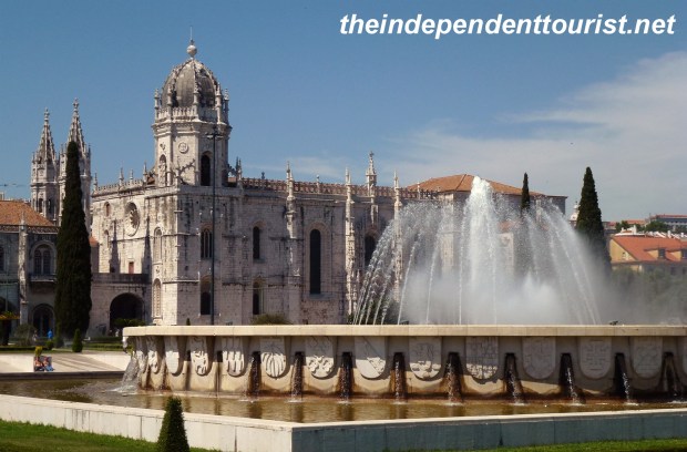
The gardens and fountain in front of the Belem Monastery.
Belém Tower (Torre de Belém)
This tower is a symbol of Lisbon and dates to 1515—it was a defensive structure protecting the harbor of Lisbon. The tower’s decorative stone work is considered a classic of 16th century military architecture. It sits in the Tagus River’s edge, just in the water although when built it was on dry land—the water level has risen over 500 years. You can climb all the way to the top (6 levels, a great view from the roof level) and at each level there are exhibits about the history of the world explorations that began from Lisbon.
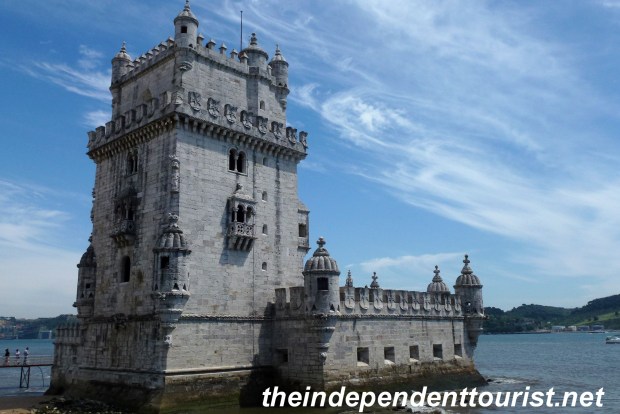
A view of the Belem Tower (built in 1515).
It was here where I learned why Brazil speaks Portuguese and the rest of Latin America speaks Spanish–due to an agreement (the Treaty of Tordesillas, 1494) by King Manuel I (1469-1521) of Portugal and the Crown of Spain. They drew a north-south line 370 leagues west of the Cape Verde Islands (off Africa), which was halfway between the Cape Verde Islands (Portuguese) and Columbus’s initial claims in the Caribbean for Spain. This line happened to run through eastern Brazil, although they didn’t know it at the time.
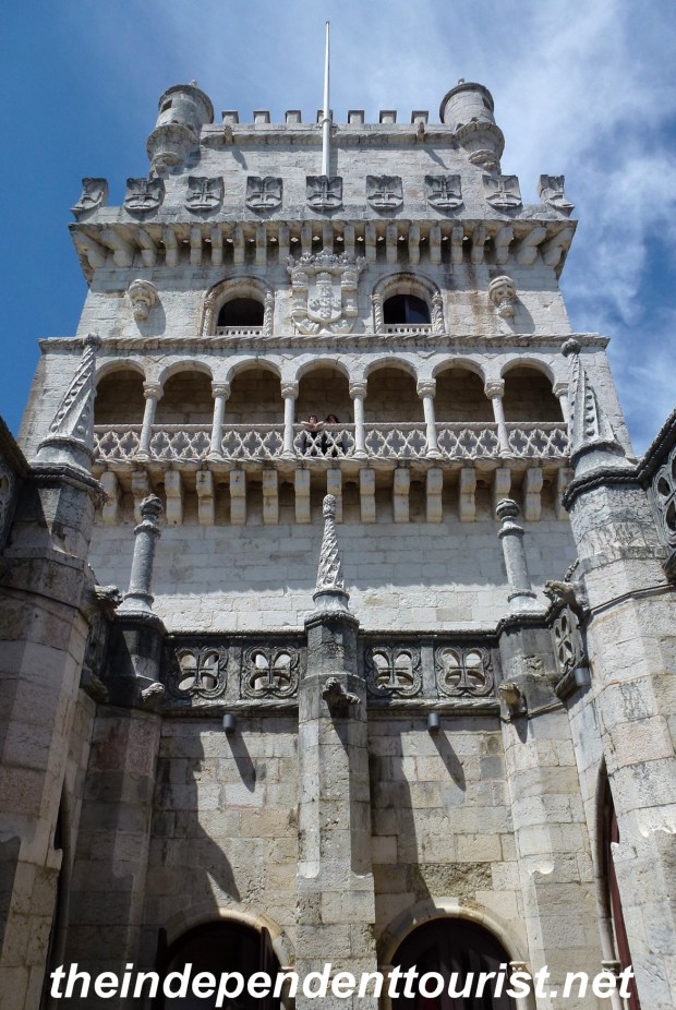
The intricate stonework of the Belem Tower.
Belém Monastery (Mosteiro dos Jeronimos)
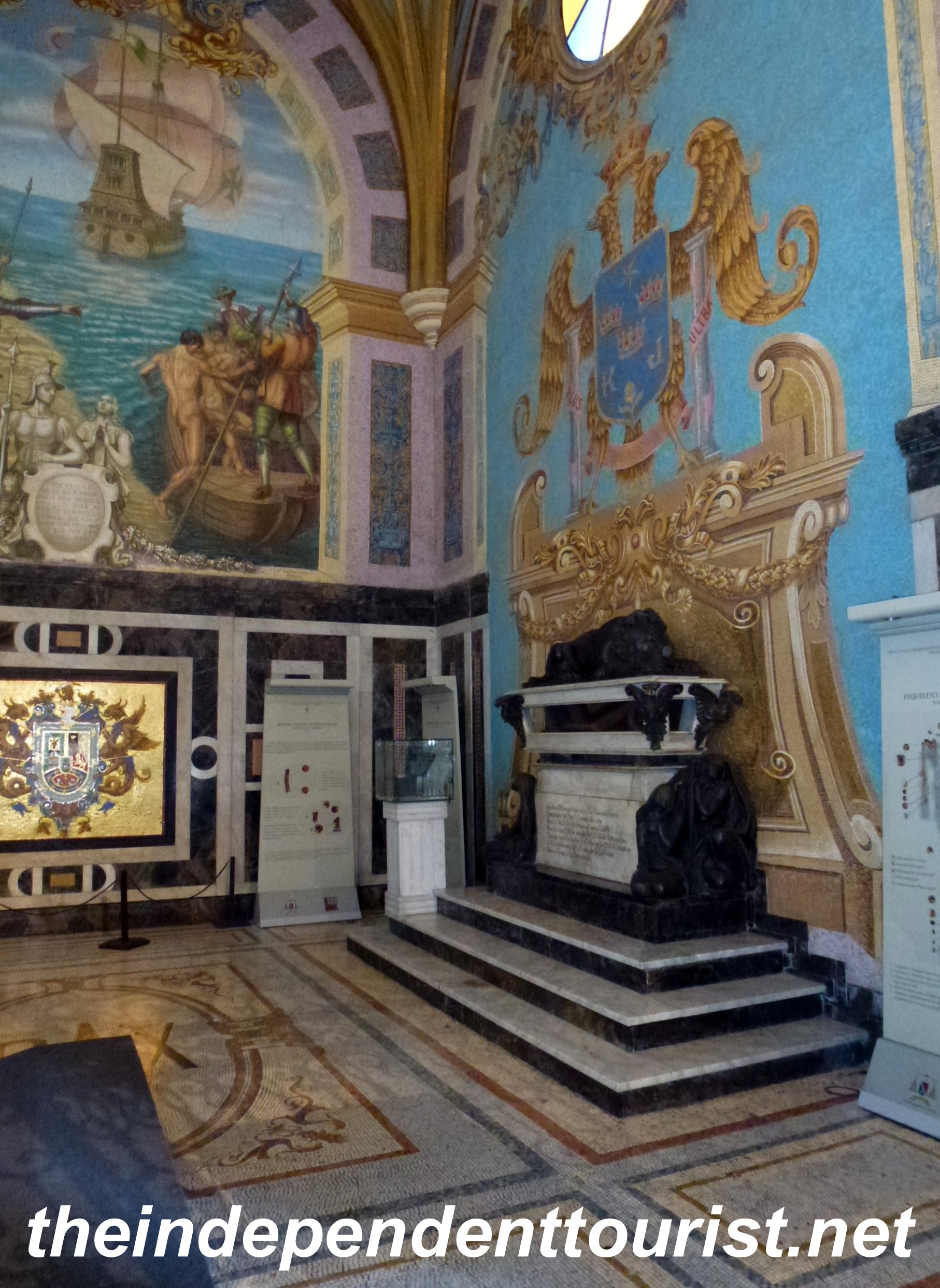
This is where the explorers and merchants would worship prior to leaving on long voyages and upon their safe return. The monastery was established in 1496 by King Manuel I, and the church was constructed in 1501. This masterpiece is considered one of the great architectural achievements of the 1500’s. From a technical standpoint, it was so well constructed that it survived a devastating earthquake in 1755 that leveled most of Lisbon. The “Manueline style” of decoration and architecture is an acknowledgement of the King’s influence. Vasco de Gama’s tomb is here.
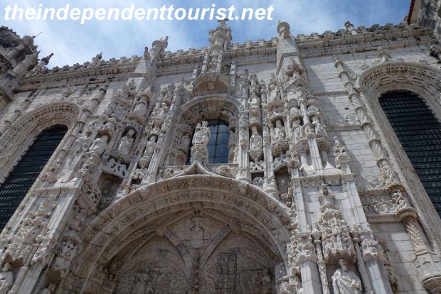
The intricate decorations above the doorway (south portal).
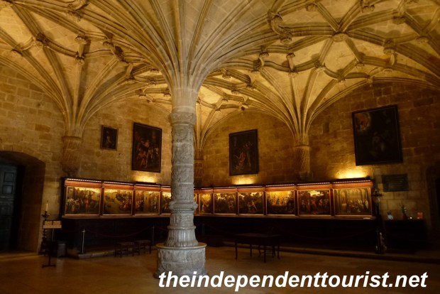
Inside the Sacristy with many paintings.
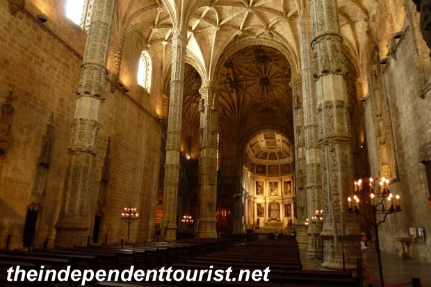
Interior view of the church.
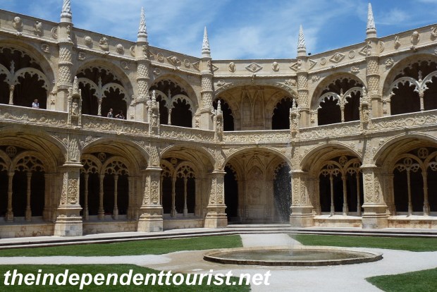
The cloisters of the monastery. The tracery decor is Manueline style.
Discoveries Monument (Padrāo dos Descobrimentos)
Built in 1960 to commemorate the 500th anniversary of the death of Prince Henry the Navigator, the great uncle of King Manuel I. Just east of the Torre de Belém is the Discoveries Monument, paying homage to the many explorers and discoveries to come from Portugal. Inside is a multimedia exhibit on the history of Lisbon.

The Discoveries Monument. Henry the Navigator leads the way.
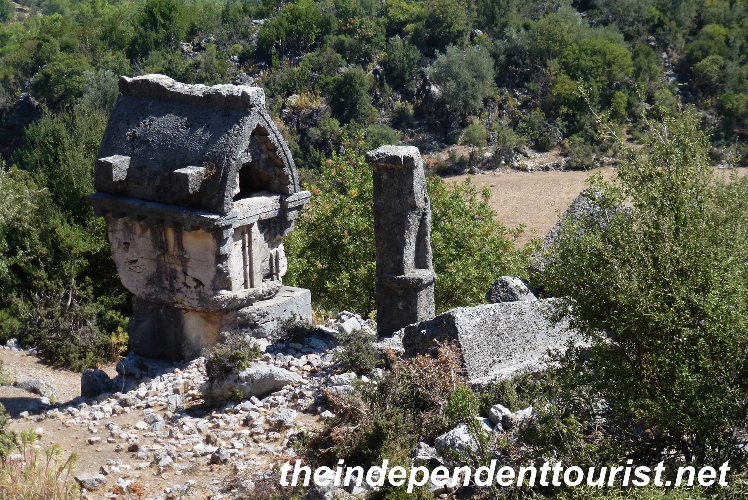
There are also several museums in Belém, including the Museum of Coaches (beautiful decorated old royal coaches), and the Maritime Museum; given more time these would be worthwhile to visit.
References: Great Monasteries of Europe, by Bernhard Schütz, Abbeville Press Publishers, 2004; informational plaques at Belém Tower.