Central & South America

Arenal Volcano, La Fortuna, Costa Rica

Costa Rica – Pura Vida II

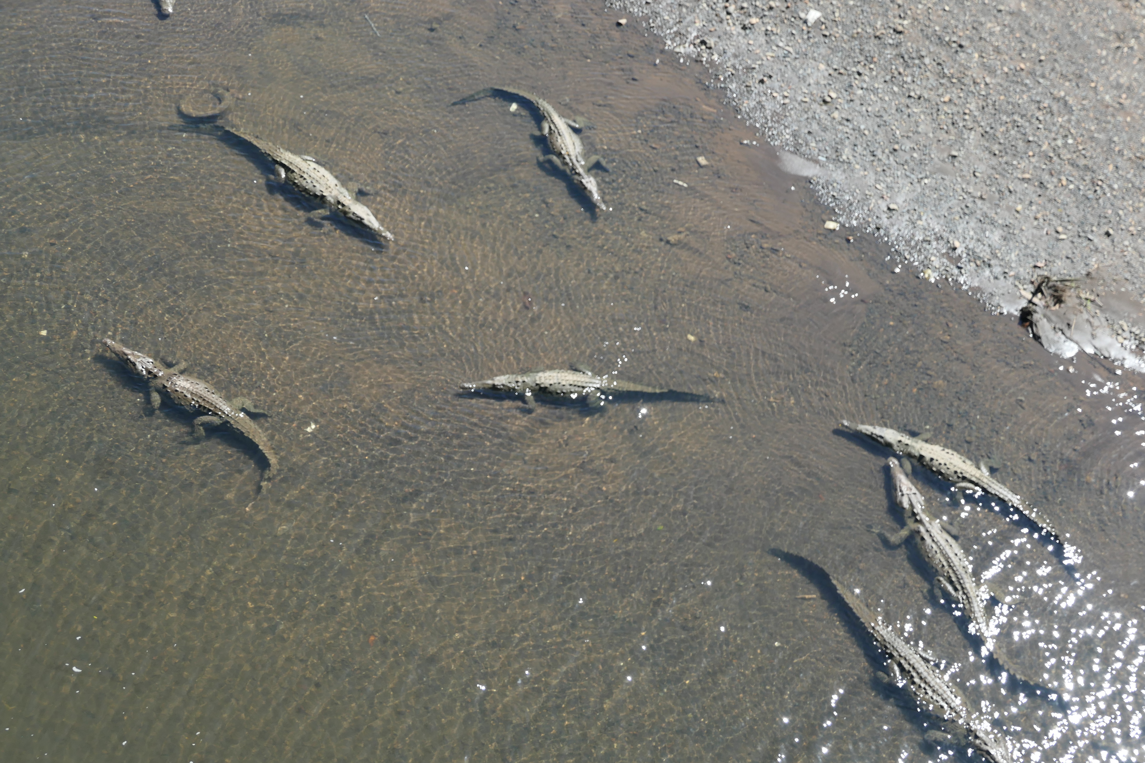
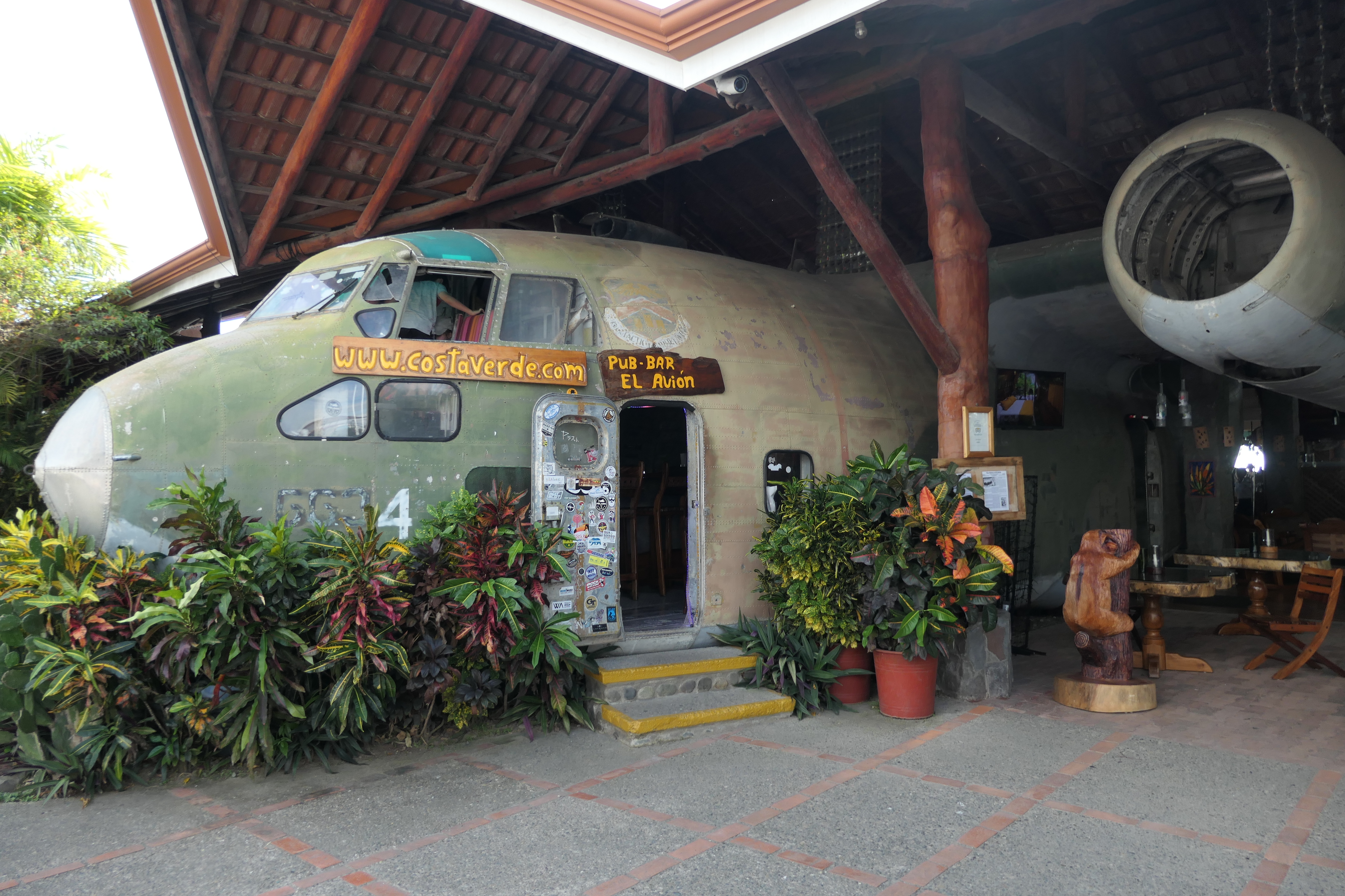
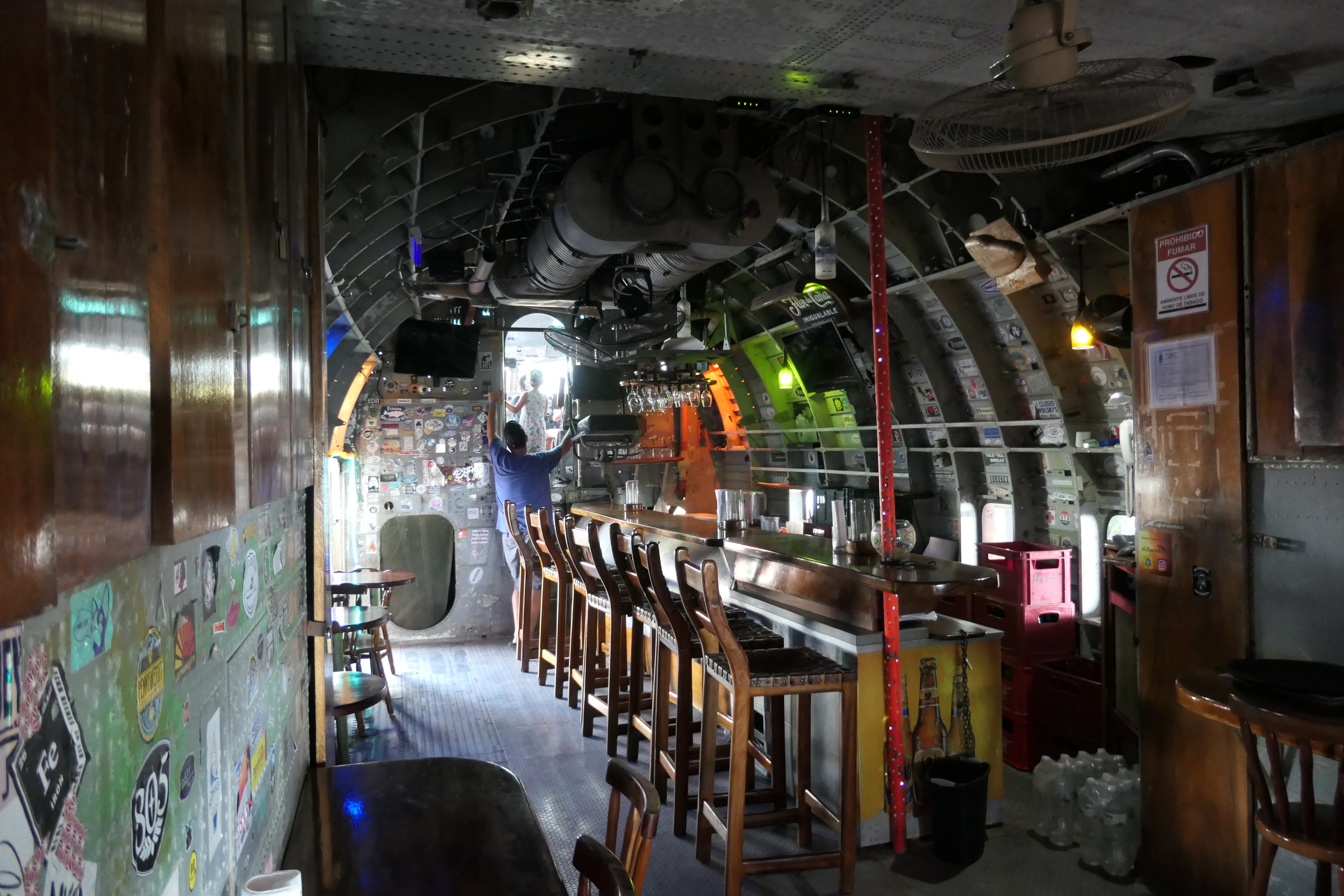
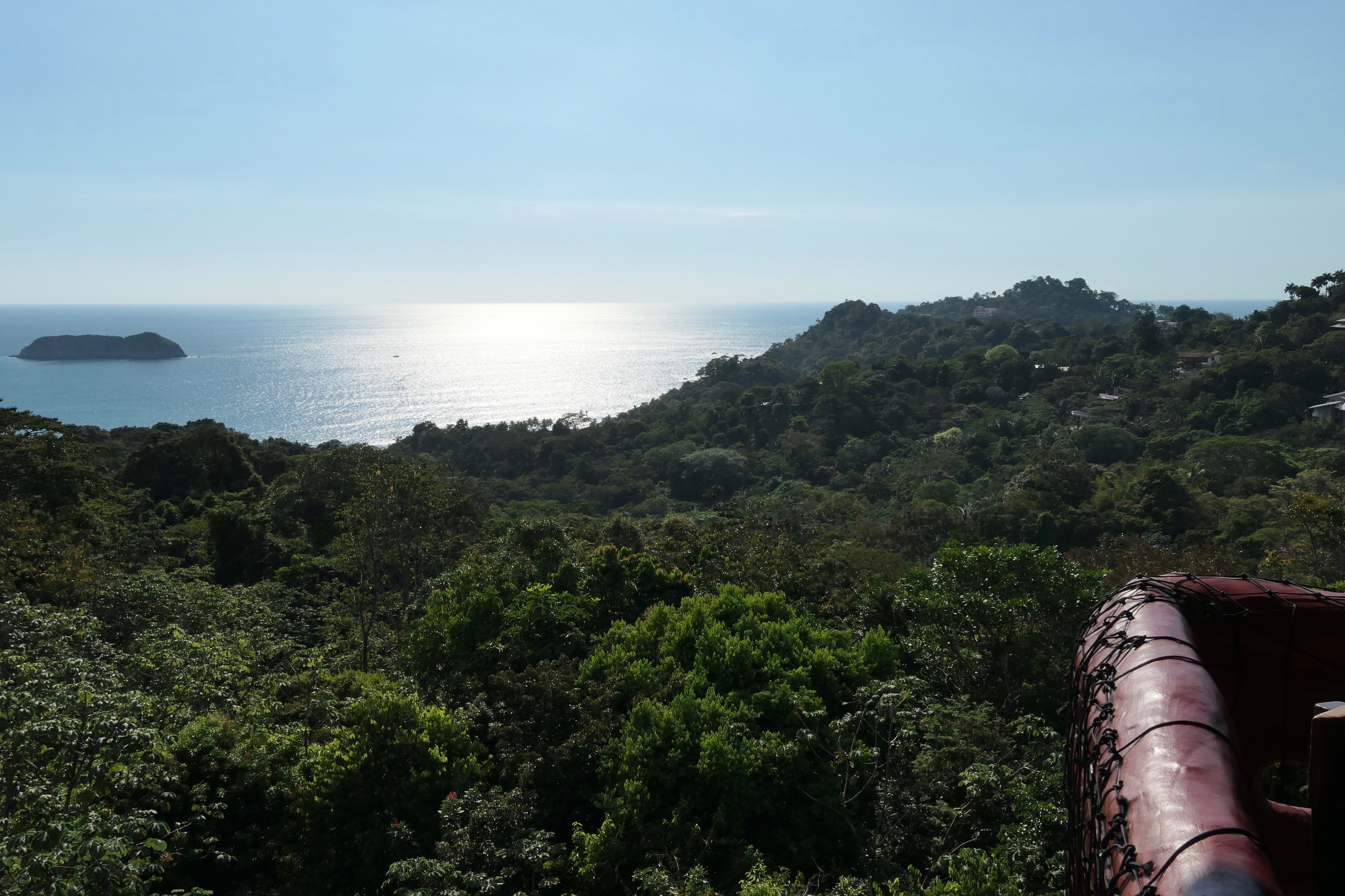
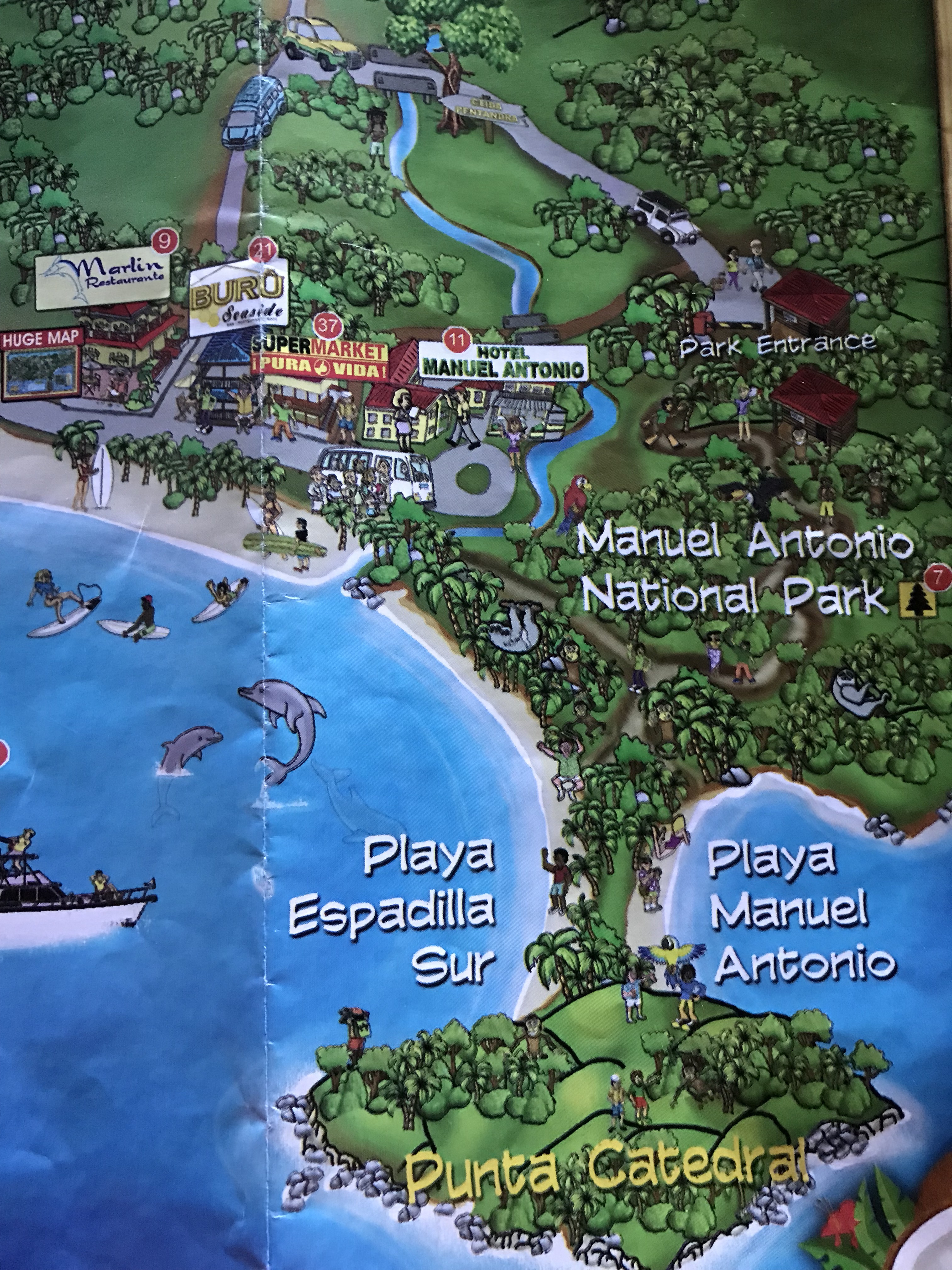
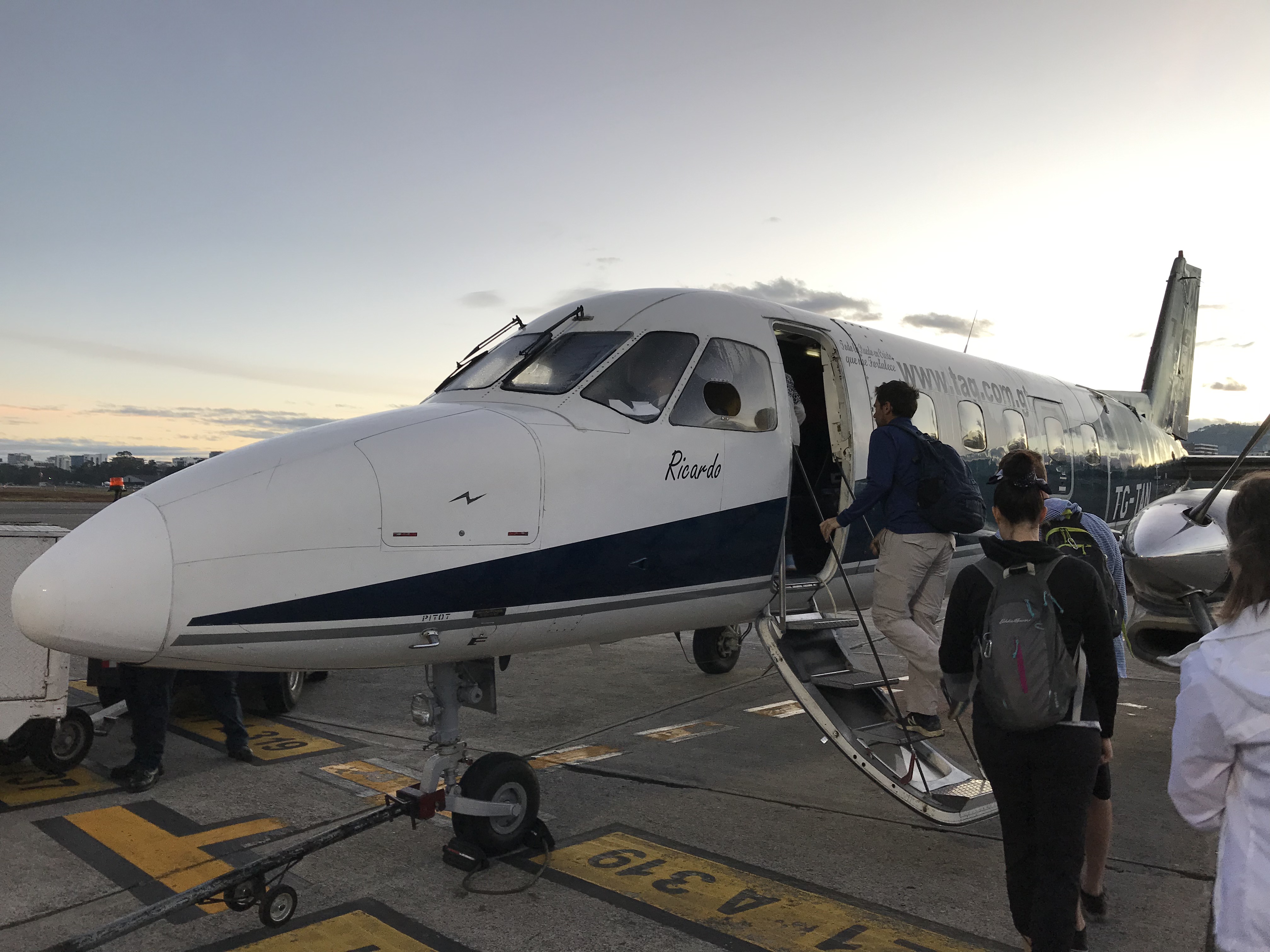
From Quepos & Manuel Antonio National Park (see Costa Rica – Pura Vida I), we drove (via a hired driver and car) to the town of La Fortuna, near Arenal Volcano, in north central Costa Rica. This ride took about 5 hours, although it’s only 135 miles (218 km). The roads are narrow, slow, and twisting through the mountainous countryside.

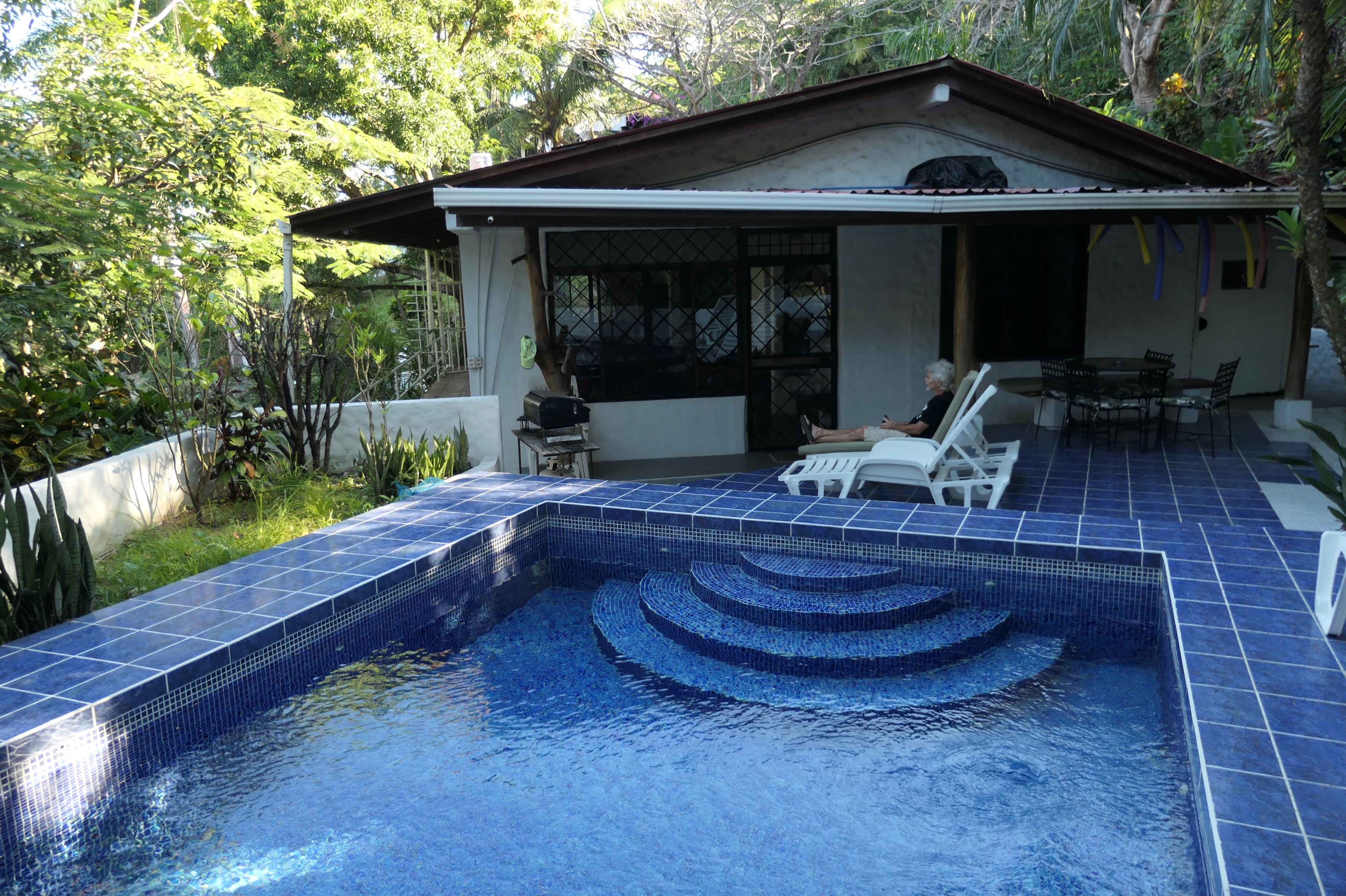
We arrived at our hotel in La Fortuna in the early afternoon, and the hotel very kindly helped us arrange the activities for our short stay. My wife, son and daughter were able to take a tour of a cocoa (chocolate) plantation that same afternoon, while I hit the hotel’s pool.

Costa Rica Arenal Volcano Area1

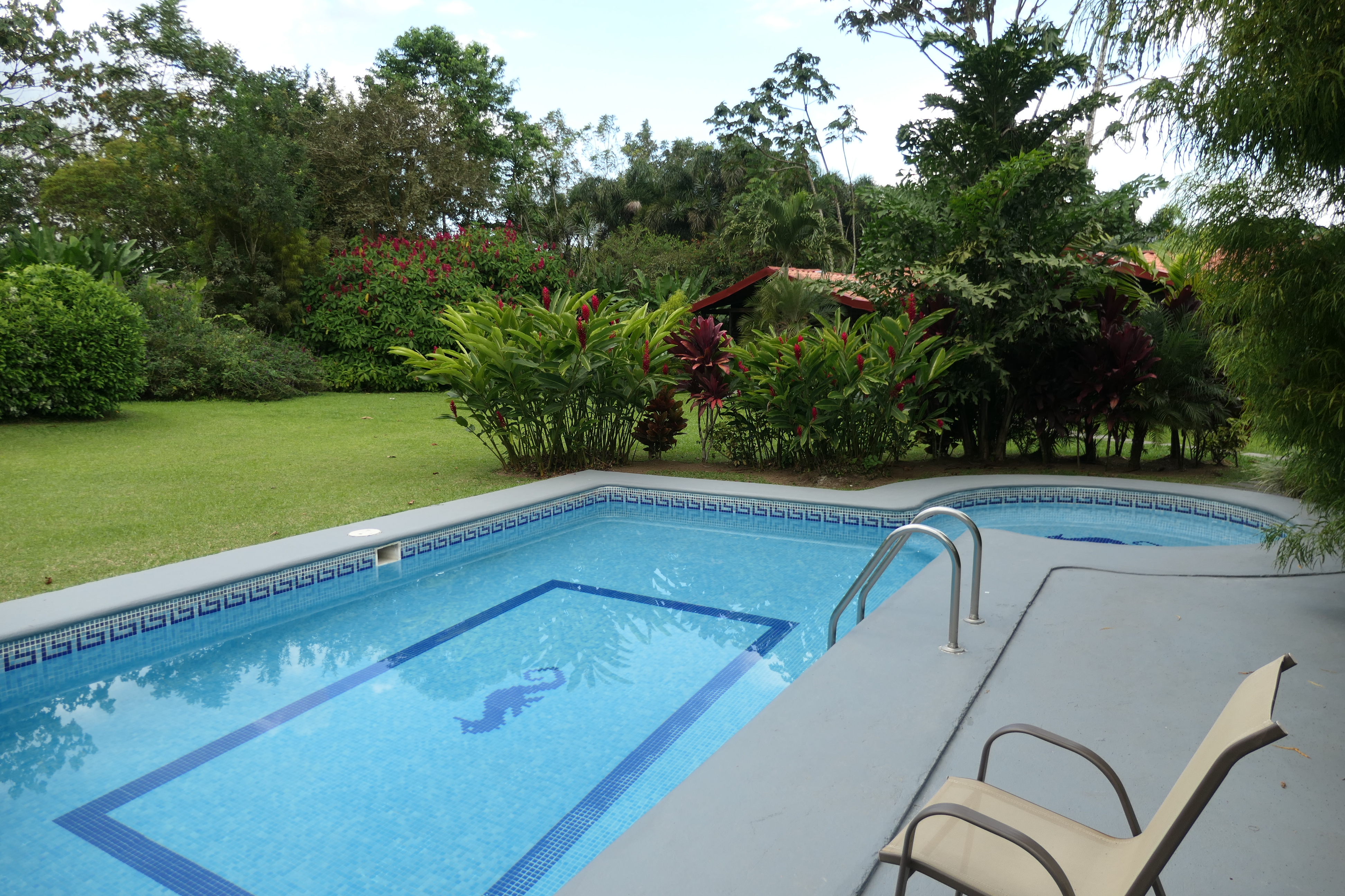
The pool at our small hotel on the outskirts of La Fortuna. It felt good after a 5 hour drive!

My family couldn’t stop talking about the cocoa tour when they returned–they learned a lot and really enjoyed it. We all enjoyed the ground cocoa bean mix we brought back to the U.S, it made the best hot chocolate I’ve ever tasted.

The hotel helped us arrange an all-day tour for the following day, our only full day in La Fortuna. It was a good tour and covered a lot of ground. We did the following in our one day:

Hike

The first activity was a guided hike on lava flows near the base of Arenal volcano.

Costa Rica Arenal Volcano Area9

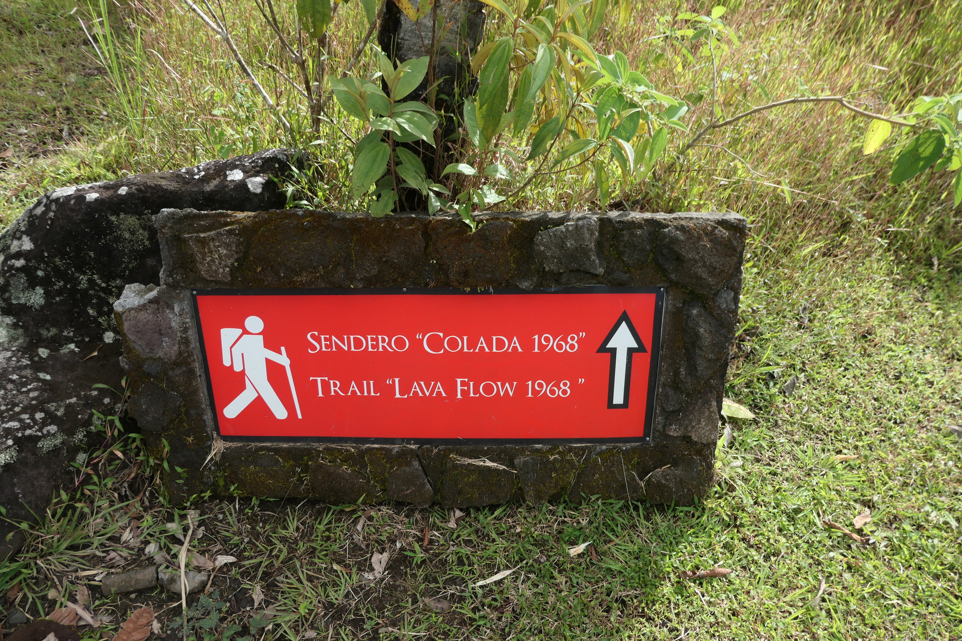
This sign points out that the lava flow we hiked over happened in 1968.

Arenal Volcano, La Fortuna, Costa Rica

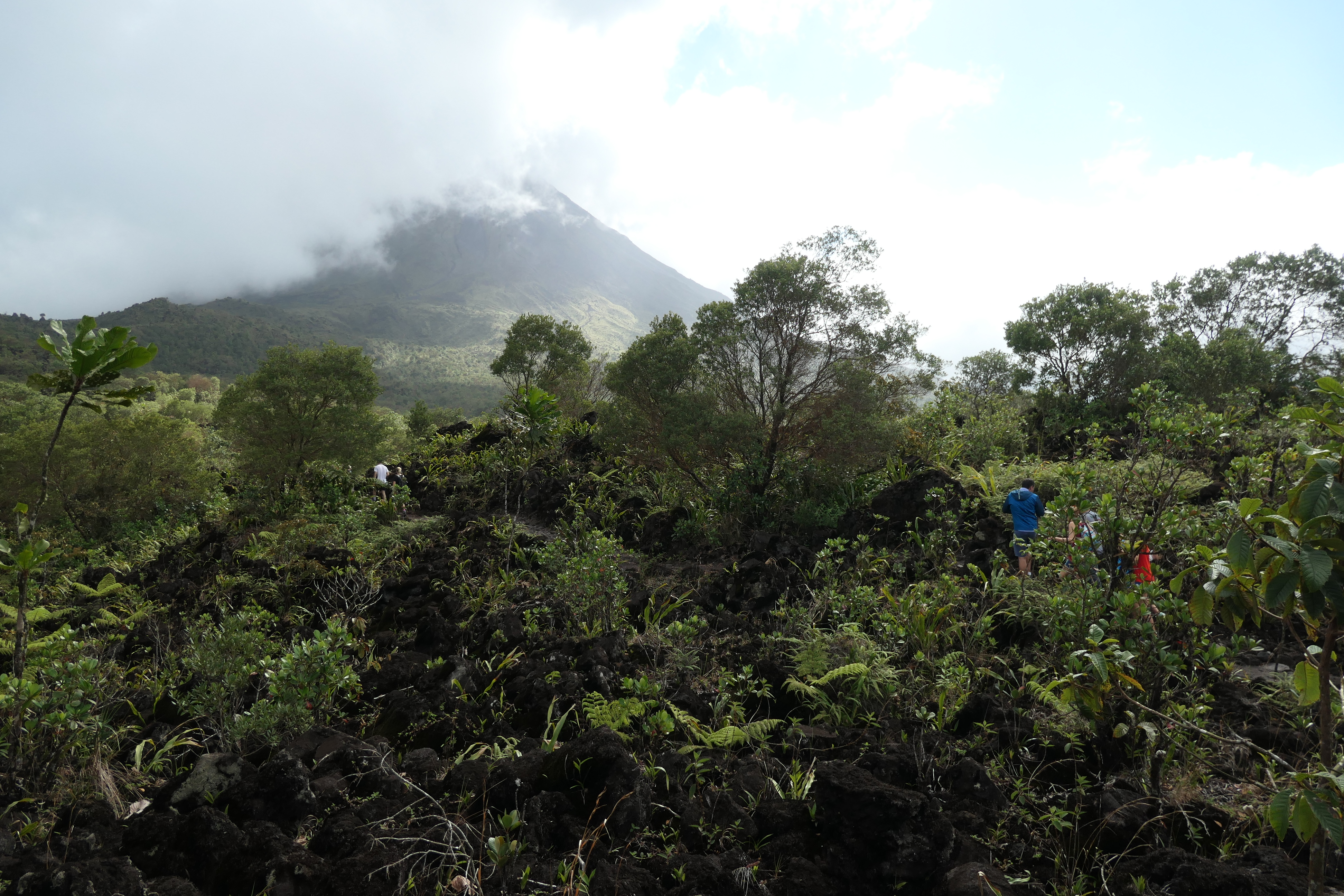
Our hike through the lava fields with Arenal Volcano in the background.

We climbed through the lava fields and jungle-like vegetation, with some good views of the volcano and surrounding countryside, including Lake Arenal.

Lake Arenal, La Fortuna, Costa Rica

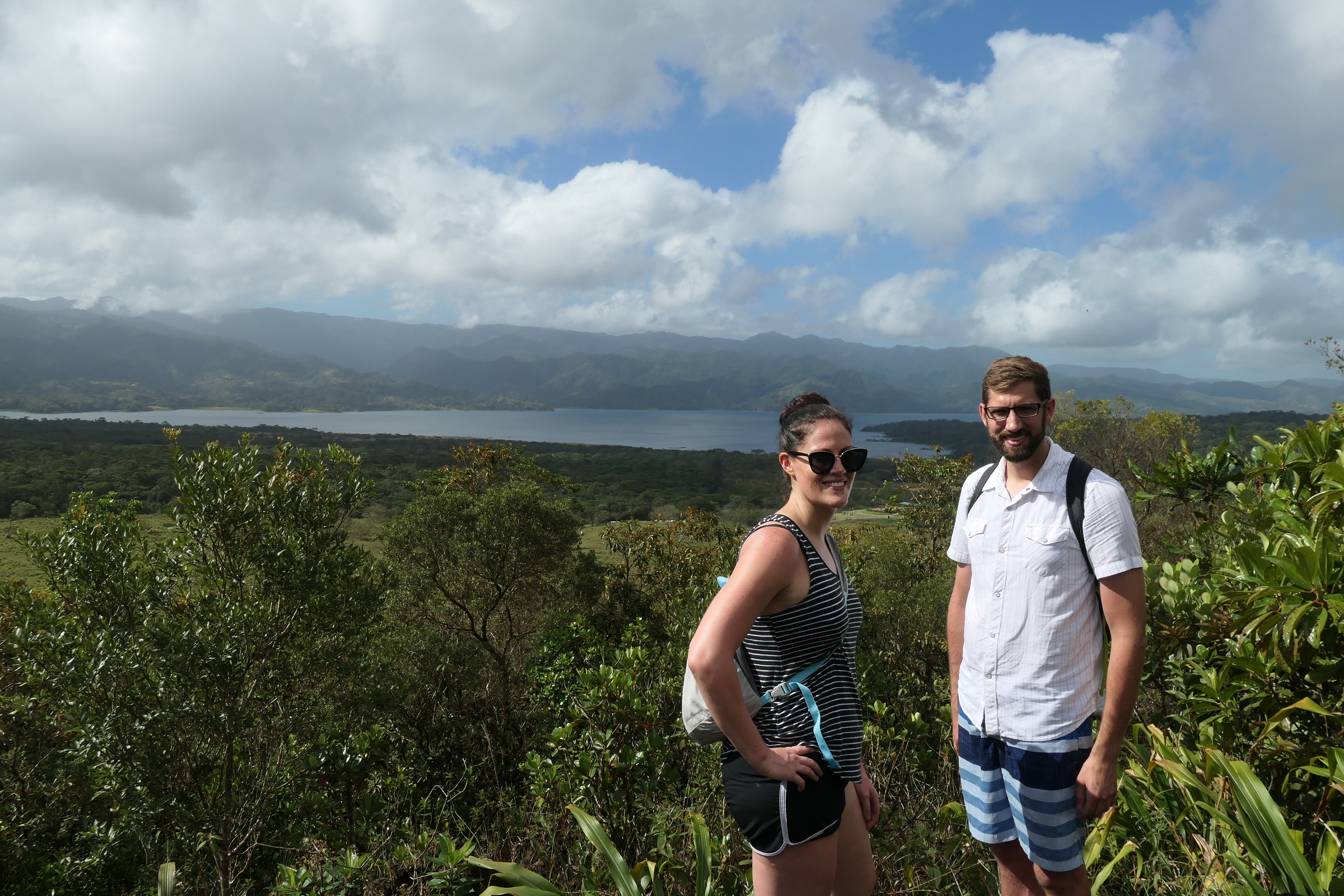
Lake Arenal, from our hiking trail.

La Fortuna Falls

We then traveled to La Fortuna Falls, where we hiked down a steep hill (via a long wooden stairway) for about 1/3 of a mile to the base of the beautiful falls.

La Fortuna Falls, La Fortuna, Costa Rica

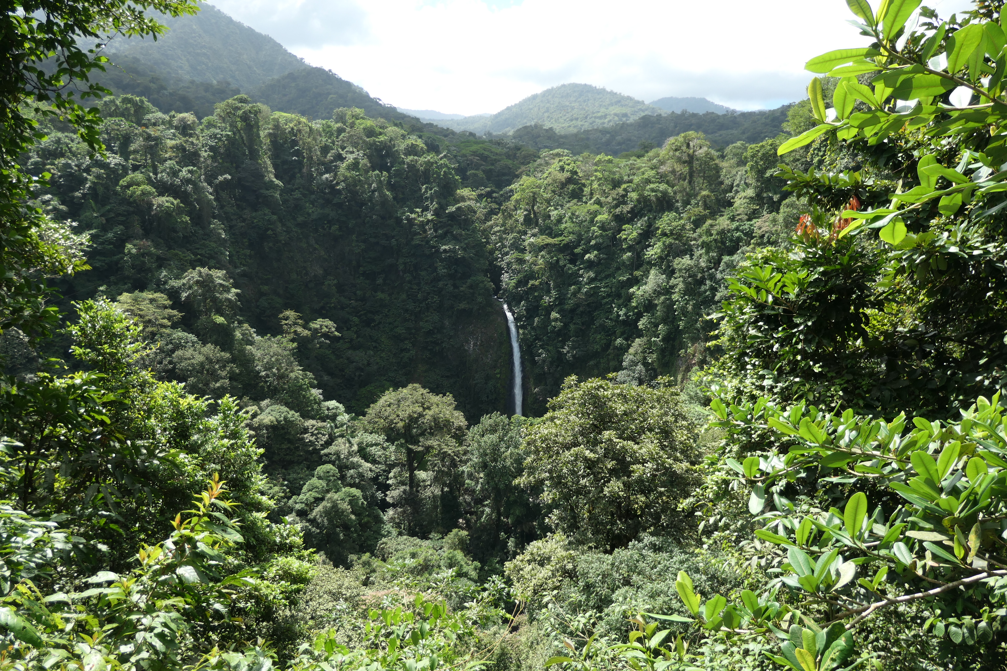
View of La Fortuna Falls at the start of the hike.

Costa Rica Arenal Volcano Area La Fortuna Falls9

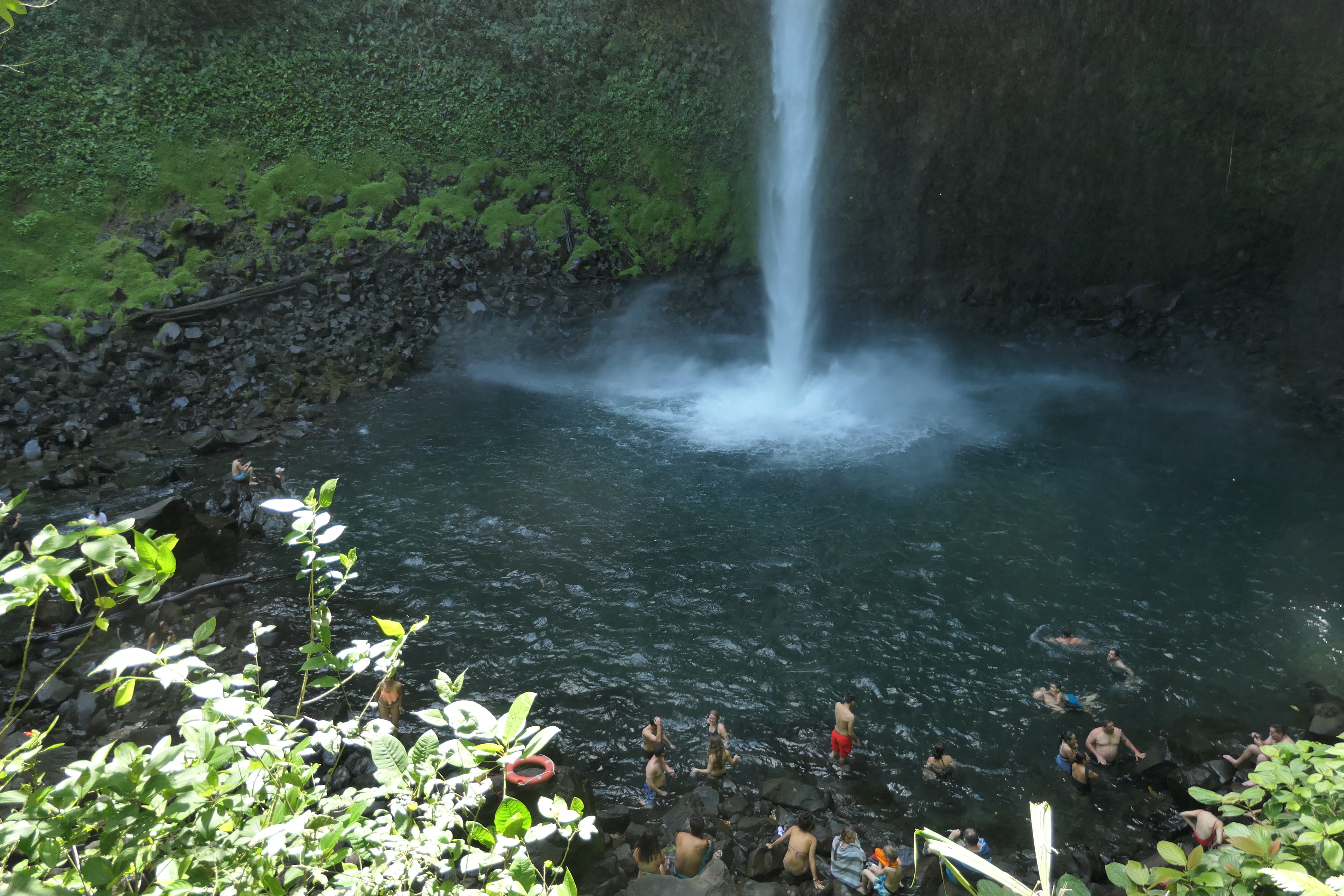
Reaching the base of La Fortuna Falls after a steep stairway down.

Costa Rica Arenal Volcano Area La Fortuna Falls19

Another view of the base of La Fortuna Falls.

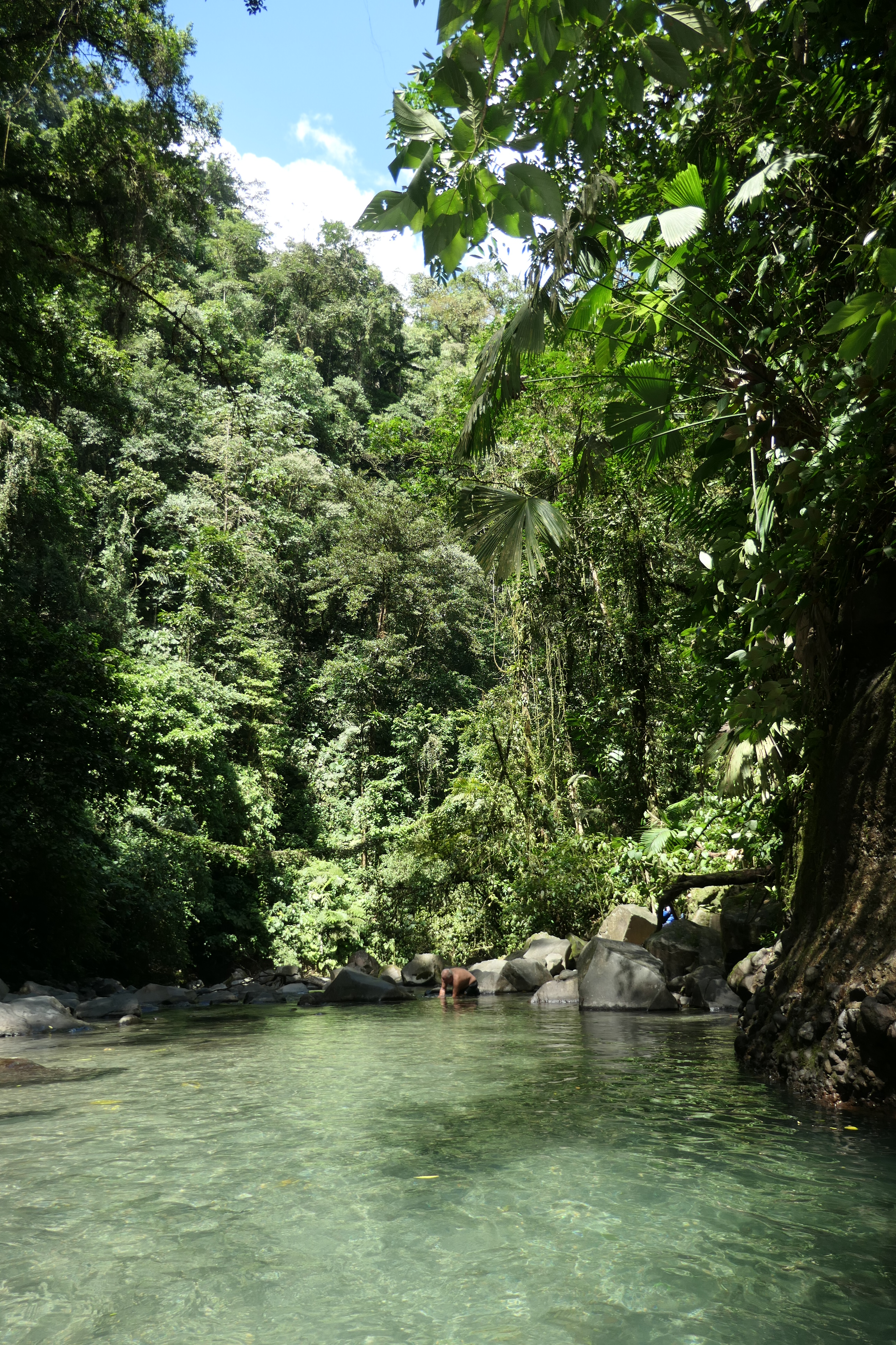
There were several natural pools when you can wade into the water and get a refreshing shower from the spray of the falls.

La Fortuna Falls,

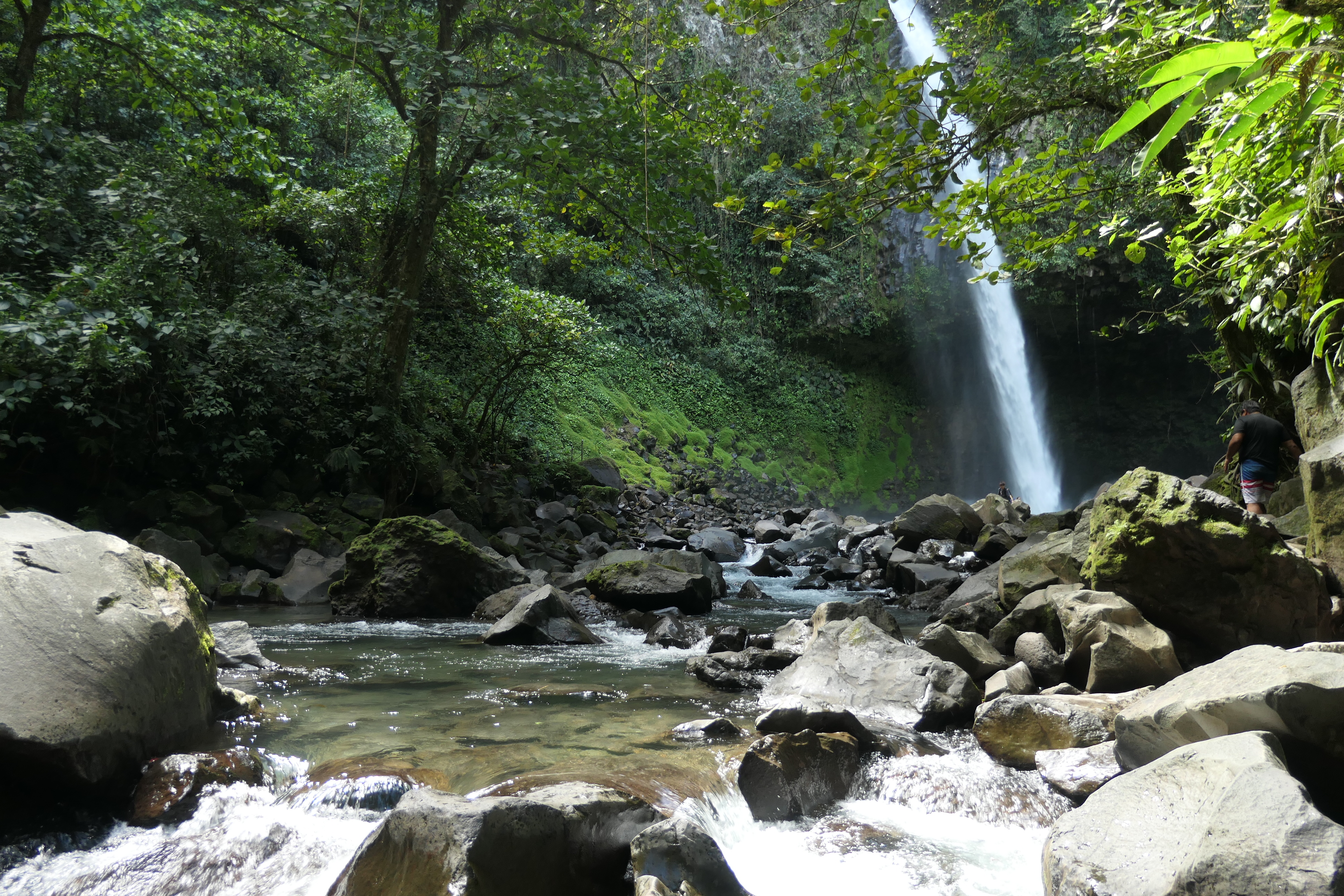
Another beautiful pool near the base of La Fortuna Falls.

There are also some wooden platforms and benches for changing shoes and toweling off after a swim. At the entrance to the Falls there is a restaurant and small shop.
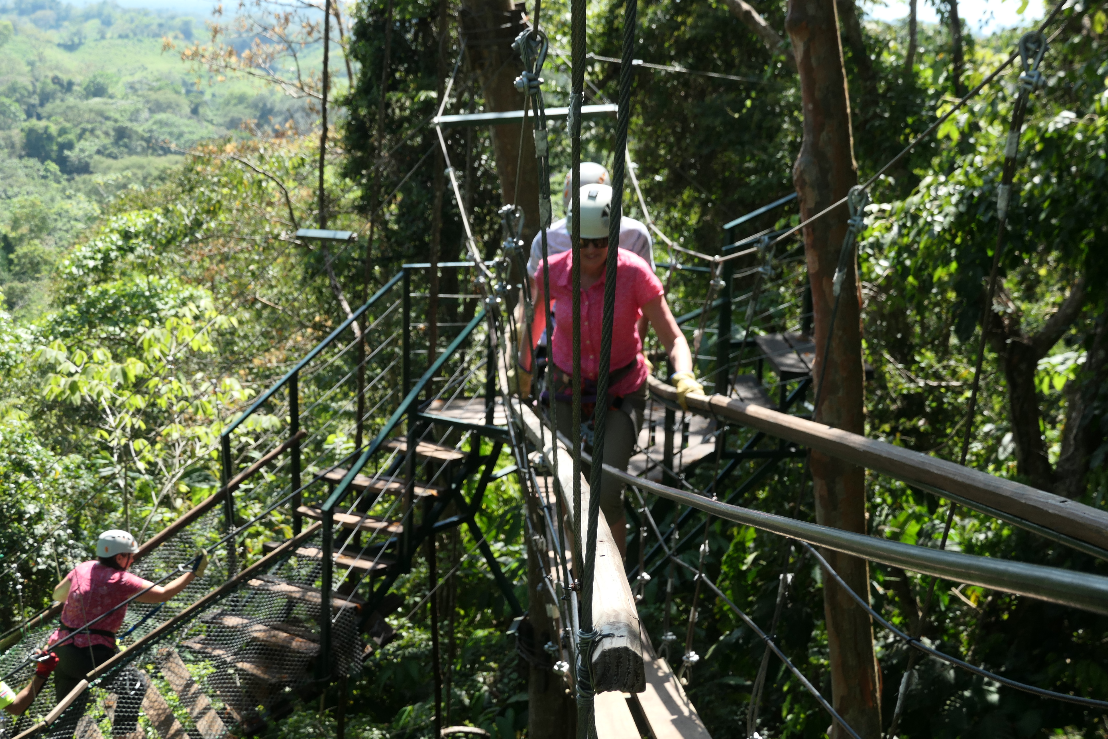
Hanging Bridges

After a very good lunch, we drove out to an extensive set of hanging bridges constructed through the jungle, again with some great views of the volcano, which dominates the landscape.

Costa Rica Arenal Volcano Area57

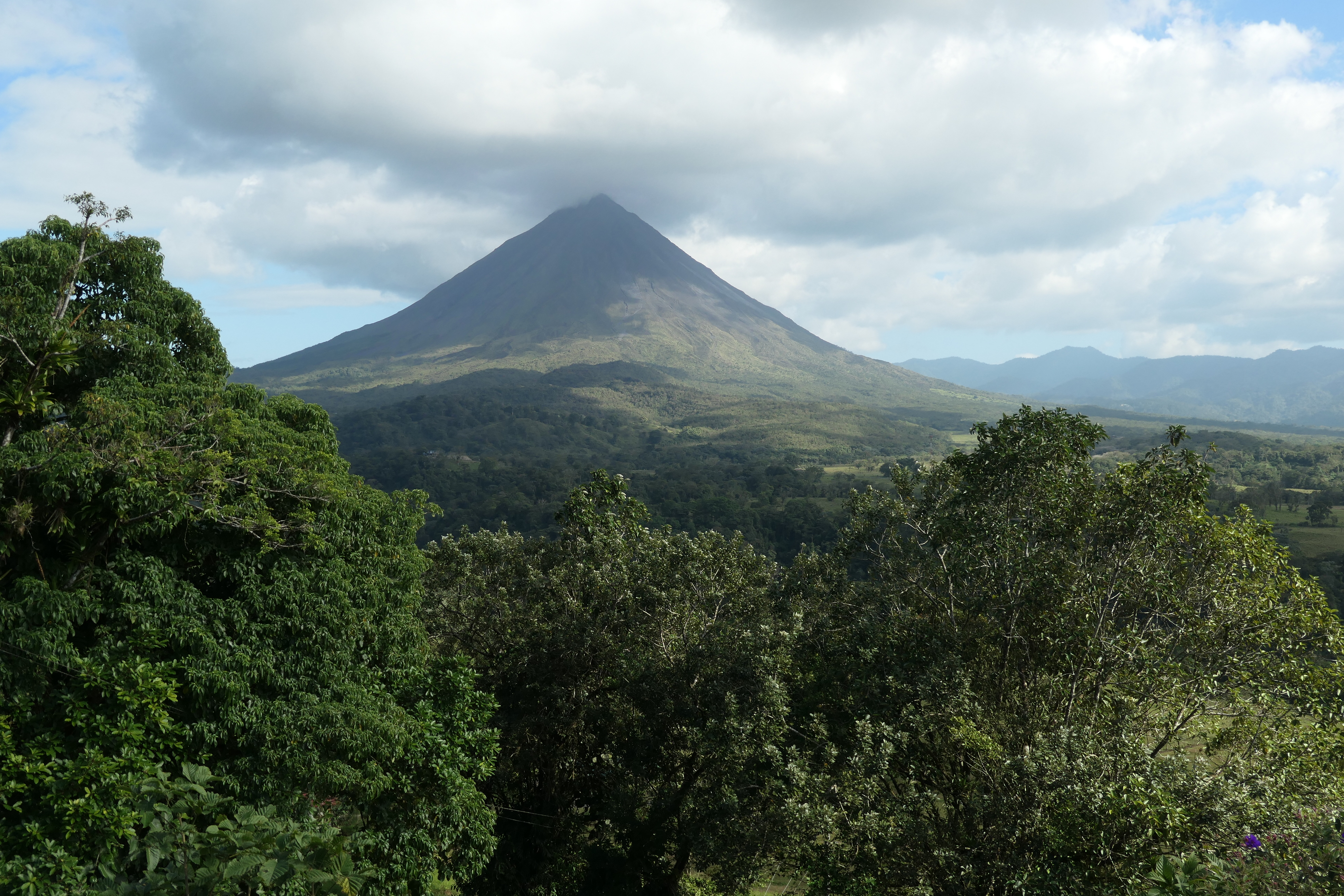
View of Arenal Volcano from the Hanging Bridges park.

Hanging Bridges, La Fortuna, Costa Rica

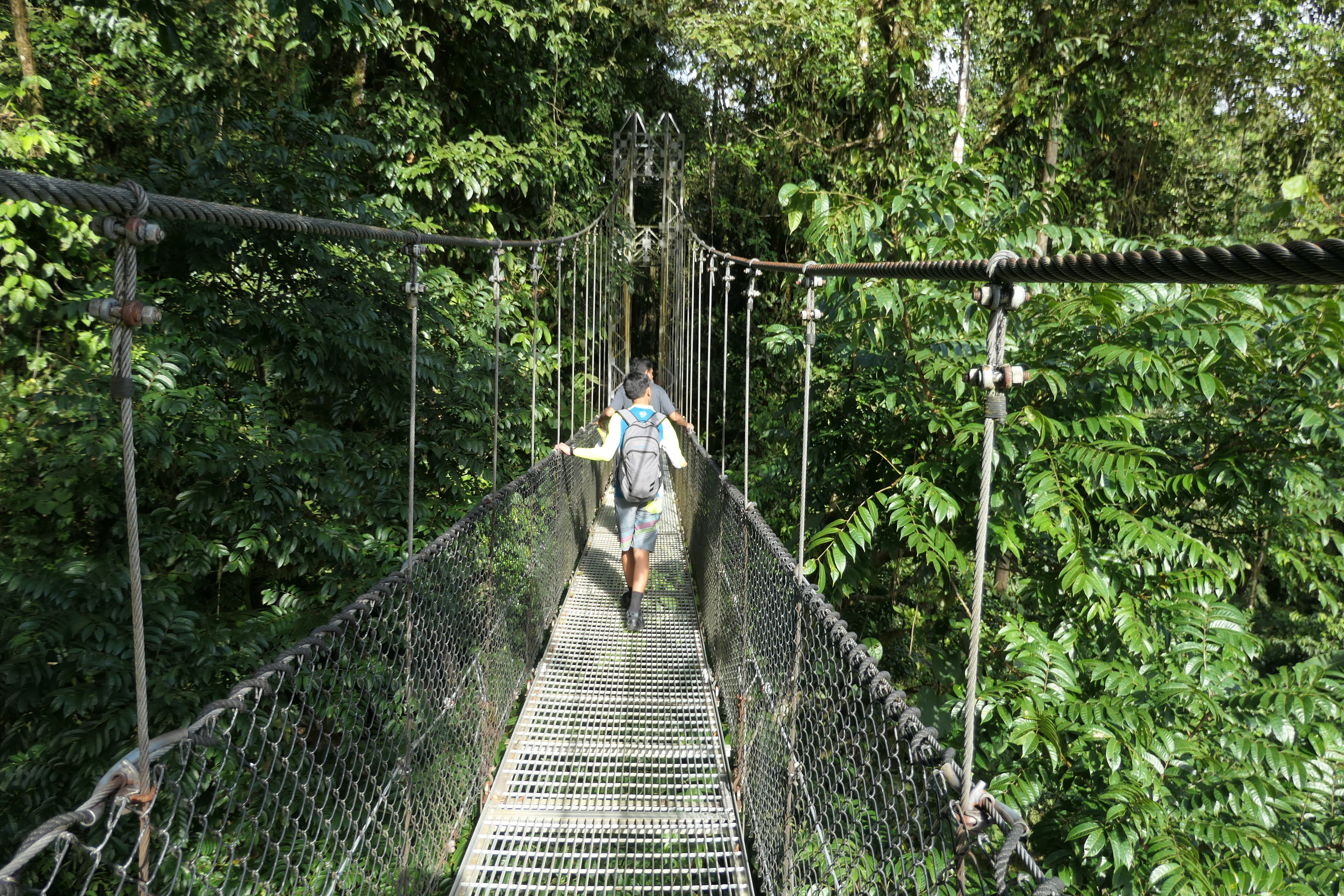
One of the hanging bridges.

Hanging Bridges, La Fortuna, Costa Rica

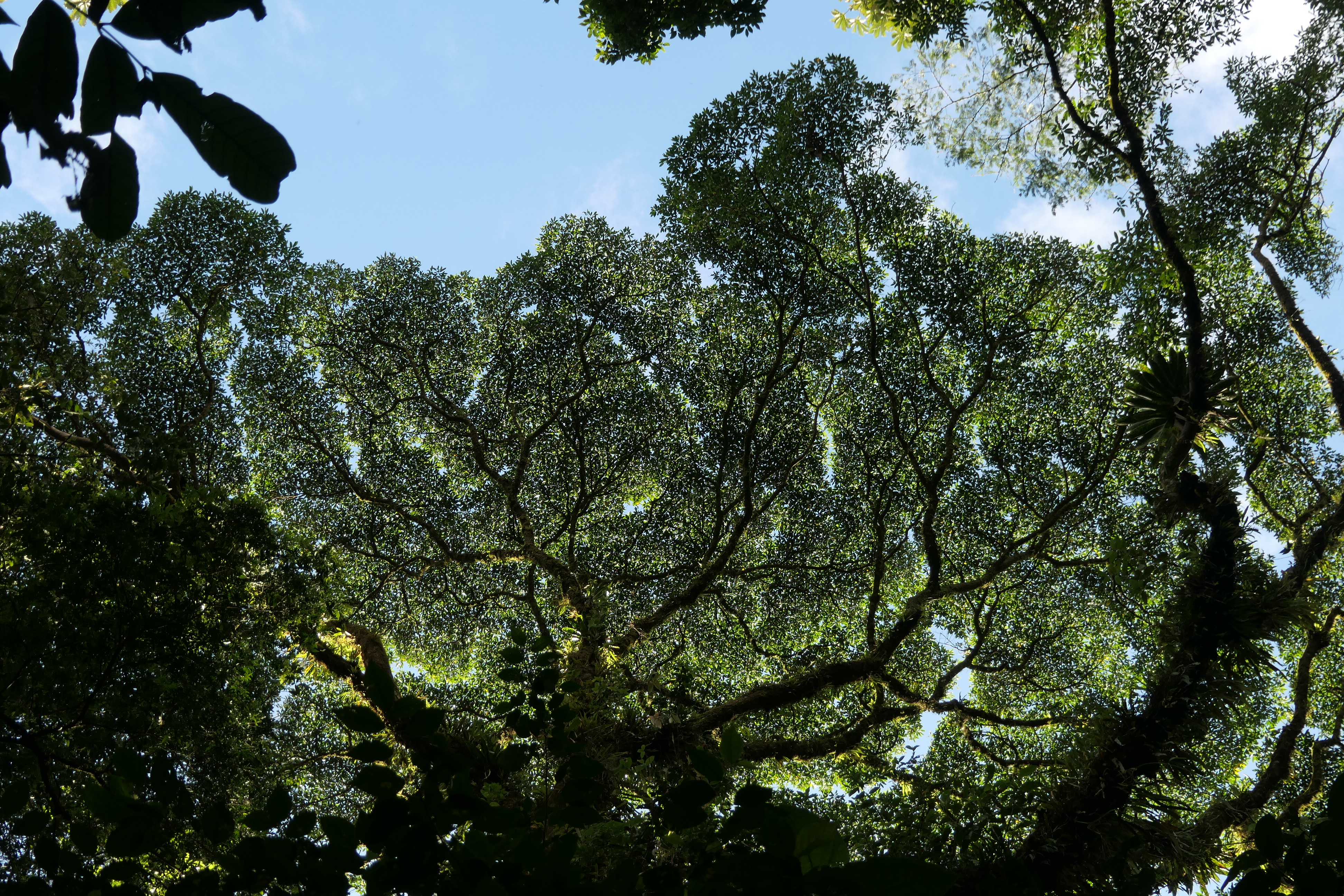
I love this image of the tree I took from the hanging bridges. The leaves look so intricate.

These bridges are suspended over some deep ravines. We learned about the local plant and animal life on this walk. As you wander on the trails and over bridges you wonder how many creatures’ eyes are following you!

Baldi Hot Springs

Visiting these hot springs was probably the highlight of the day. In this volcanic region, there are numerous hot springs, many with beautiful hotels/spas built in and around them.

Baldi Hot Springs, La Fortuna, Costa Rica

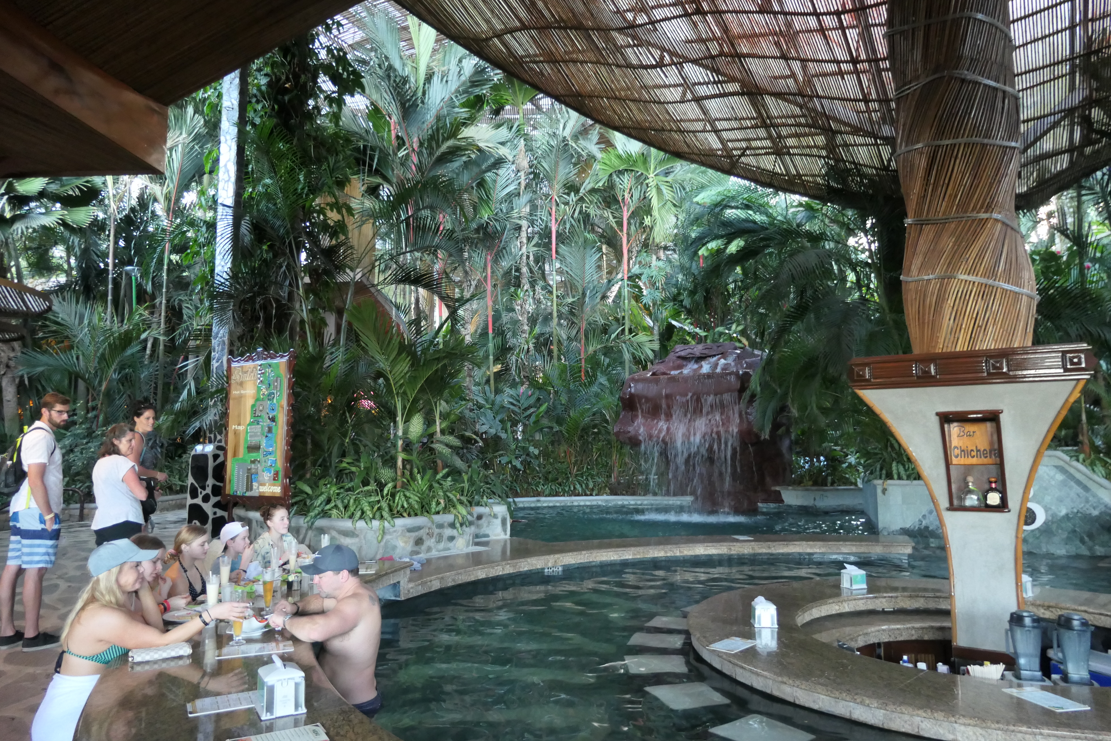
Swim up bar at Baldi Hot Springs.

Baldi Hot Springs, La Fortuna, Costa Rica

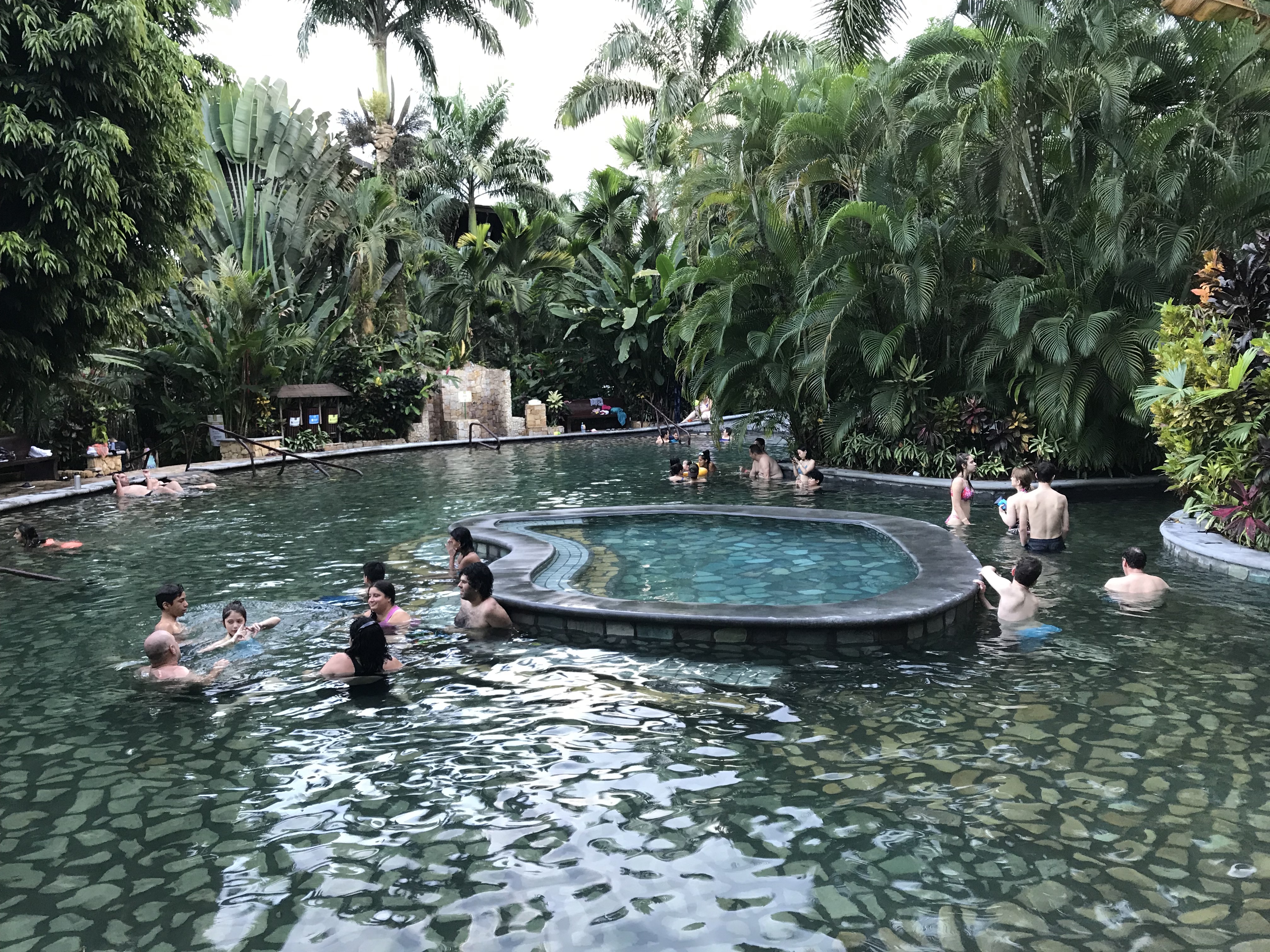
One of the pools at Baldi Hot Springs. There are numerous pools that vary in temperature. We tried several of them, it would take half a day to try them all!

Baldi Hot Springs, La Fortuna, Costa Rica

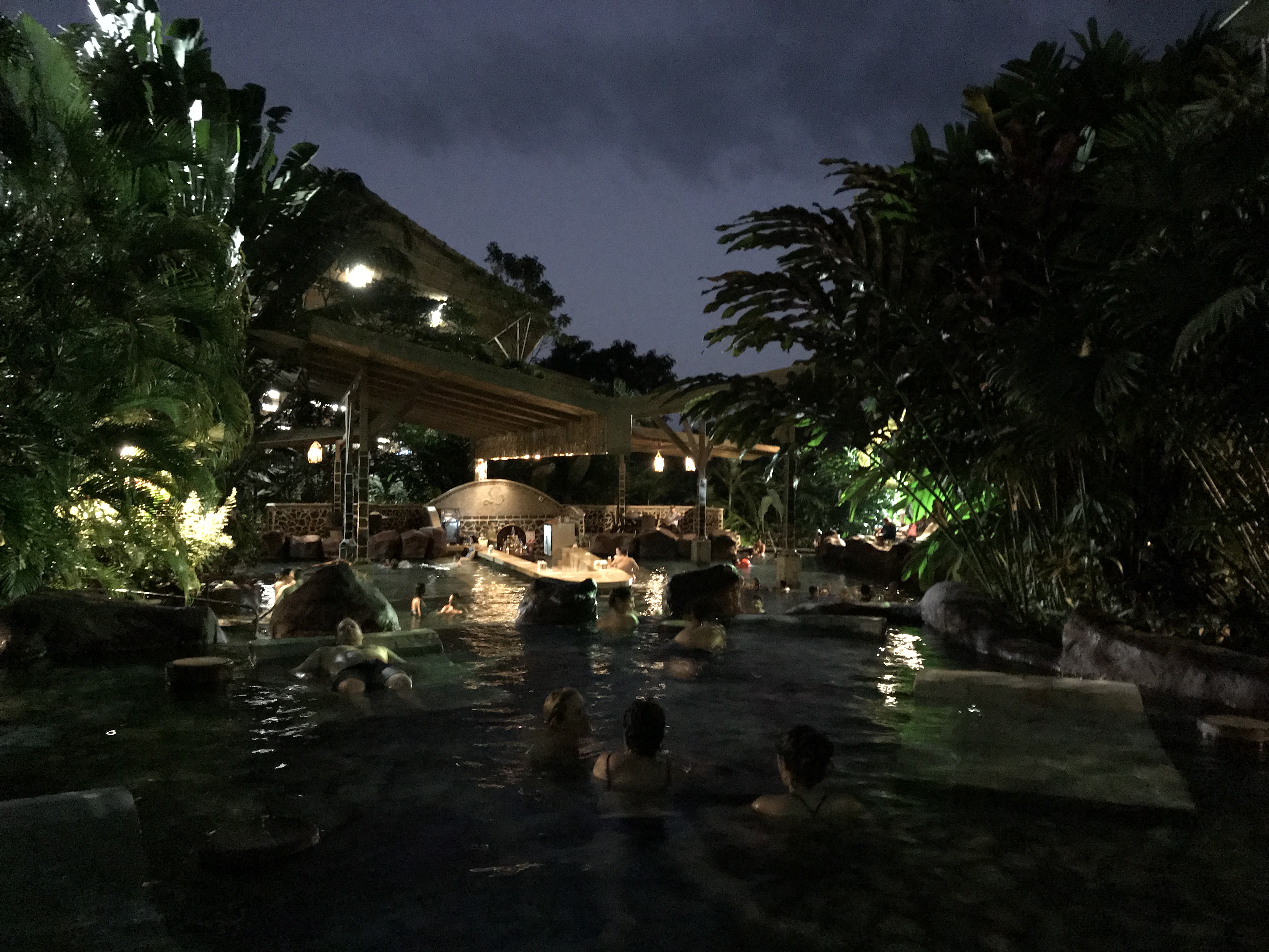
Dusk descends on Baldi Hot Springs.

You also see areas along the rivers with hot springs where locals hang out without paying the high resort fees. We spent a couple hours enjoying the a series of pools (and fun slides!) and then indulged ourselves at a buffet dinner at the resort, before being picked up and transferred back to our hotel.

Although Baldi Hot Springs is beautiful, this particular hot spring/hotel was probably our 2nd choice, since we had only booked the day before and it was a holiday period (New Year’s). Our 1st choice, Tabacon, was fully booked. We won’t complain too much, Baldi was great.

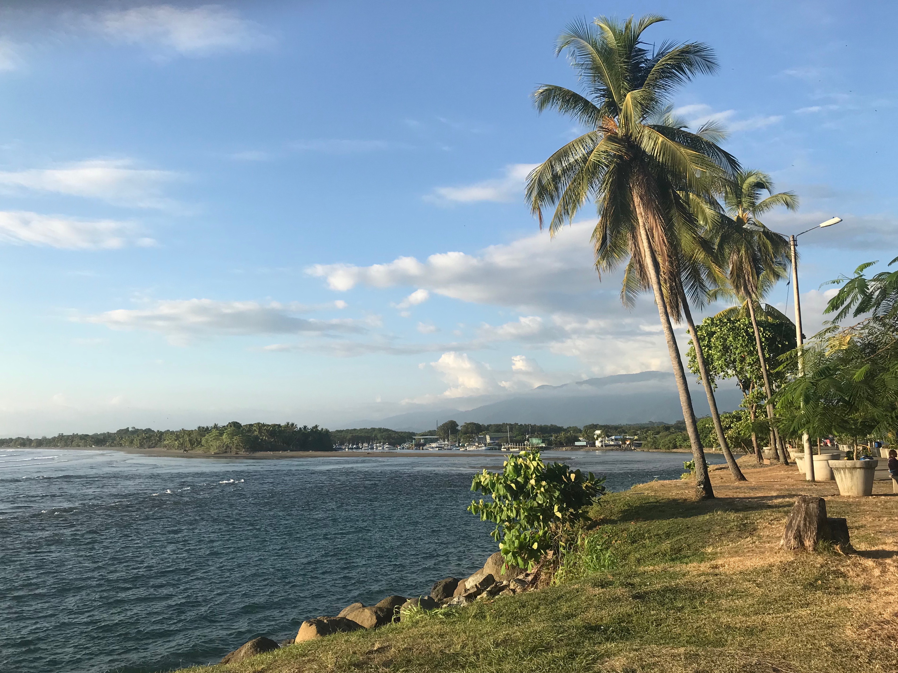
It was a very enjoyable stay in La Fortuna. If I were to go back, I’d spend a few more days in this area, explore more of the hot springs and enjoying  ATV’s and other adventures. The next day we had a driver take us to San Jose, where we spent the afternoon/evening before flying back home the following day.

Costa Rica – Pura Vida, Part I

Note from The Independent Tourist: While tourist travel during this time of the coronavirus pandemic is unrealistic, I think we can safely assume that one day the virus will be under control and we can resume connecting with the world again via personal travel. In fact, there may be a pent-up demand for tourist travel once things settle down. Let’s use this downtime to do our part to protect our loved ones, reduce the spread and stay safe, while demonstrating our hope for a fun-filled travel future through continuing to learn about great destinations! 

After four great days in Guatemala, we flew to San Jose, Costa Rica. We had two primary destinations picked out for our few days in Costa Rica: Manuel Antonio National Park (near the Pacific coastal town of Quepos) and Arenal Volcano, near the town of La Fortuna, located in the interior of the country. These two spots were a perfect introduction to this beautiful part of Central America. Costa Rica has a very different feel than Guatemala, more “Hawaii-like”. Guatemala felt more like a ‘foreign’ country while Costa Rica felt more like the U.S. – lots of tourists, with many US expatriates living here. Costs in Costa Rica are generally higher than Guatemala too.

The town of Quepos is almost directly south of San Jose and on the map it doesn’t look very far – only about 80 km (50 miles) as the crow flies. But by car, you have to take a circuitous route of 163 km (101 miles) to get there. Most of Costa Rica is very mountainous with few fast or straight roads, therefore it takes a lot longer to get where you’re going than you might imagine. Our drive to Quepos was about 3 hours, with a couple of stops along the way.

Jaco Beach, Costa Rica

Jaco Beach, about halfway between San Jose and Quepos, where the road drops out of the mountains and follows the beach to Quepos.

Also along the way we stopped at the famous Tarcoles Bridge, known for the crocodiles who gather here.

Tarcoles Bridge, Costa Rica

The view from Tarcoles Bridge. Those are some friendly crocodiles enjoying the sunny day in the river!

Costa Rica Tarcoles Bridge Crocodiles4

A bit closer view of the crocs.

Quepos

We arrived in Quepos and found our Airbnb house, just outside of town along the narrow and hilly coastal road that connects Quepos to Manuel Antonio National Park.

Costa Rica Quepos House 1 2

Our Air bnb house in Quepos. It was a great spot for our family to call home for a few days–two bedrooms, a large kitchen, living room and pool!

We did not have a car, so we either walked or used the local bus system to get back and forth from Quepos to Manuel Antonio Park. The bus worked great, it was $2 for each ride and a good option since there was little parking available along the narrow, hilly streets – cliffs or coast line on one side and mountains on the other.

Quepos, Costa Rica.

The town of Quepos, with lots of restaurants, shopping markets and tour offices.

Quepos, Costa Rica

A park in Quepos along the Pacific coastline.

Manuel Antonio National Park

The narrow stretch of road between Quepos and Manuel Antonio National Park is dotted with restaurants, boutique hotels or guesthouses, and shops. We had lunch at the famous El Avion, a restaurant that is built in and around a C-123 Fairchild Cargo plane–no one can tell you how it mysteriously ended up here, but it is a great conversation piece. There is a story posted near the plane about the scandalous 1980’s Nicaraguan Contra affair – and the smuggling of weapons and drugs. Perhaps this plane was involved? We may never know.

El Avion, Manuel Antonio National Park, Costa Rica

Inside the airplane is a bar, and the restaurant surrounds the plane, with great views of the coastline.

Costa Rica Quepos El Avion6

The El Avion bar inside the plane.

Costa Rica Quepos El Avion2 2

View of the Pacific Ocean from El Avion restaurant.

From the restaurant we made our way down to the Park and beach. The Park entrance is a bit tricky – they only allow so many people into the Park each day, no food may be brought in (they check you very carefully – I assume they don’t want you feeding the animals), and the Park (including beaches) closes at 4 pm (I have no idea why since it’s light until at least 7 pm). The Park is a nature preserve, with boardwalks through the jungle and posted information pointing out the flora and fauna and various jungle animals (we did get to see a sloth).

Costa Rica Beach Area Manuel Antonio2

Shops near the entrance to Manuel Antonio National Park; there are lots of restaurants near the beach for a sunset meal after a day in the water and sun.

Costa Rica Manuel Antonio Map

A very simplified map of Manuel Antonio Park – Quepos and El Avion would be to the left just off the map.

Playa Manuel Antonio Beach and Park, Costa Rica

Playa Manuel Antonio. A lovely beach that we got to enjoy for a couple hours before being chased out of the water and the Park at 4 pm by staff with loud whistles.

Playa Espadilla Sur, Manuel Antonio Park, Costa Rica

Playa Espadilla Sur, just on the opposite side of Playa Manuel Antonio. Since this beach is not in the Park, it’s open all day.

Other Activities in Quepos

In addition to the Park, we enjoyed a couple other activities in Quepos – jet skiing and a zipline adventure.

Costa Rica Jet Ski Tour8 2

Jet skiing off the coast near Quepos. The water was warm and we had a blast, as my son and daughter will tell you!

Zipline, Quepos, Costa Rica

We did a zipline adventure in the mountains near Quepos. It was a lot of fun.

Zipline, Costa Rica

My wife, Robyn, zipping across the jungle canopy. There were 7 segments, and some of them were over a half mile long – and fast!

Costa Rica Quepos Zipline Tour53

After the final segment, you get lowered to the ground via a harness – a great way to end the adventure. This was a half-day trip – they fed us a meal at the end and transported us back to our guest house.

As the Costa Ricans (or Ticos) say when greeting you, “Pura Vida!” – which means “simple life” or “pure life” – it’s way of describing the local attitude and laid-back way of being here. Life is pretty good in Costa Rica – let your troubles go and just enjoy the ride!

My next post will cover Arenal Volcano – another great adventure!


Images of Tikal National Park, Guatemala

In my previous post on Tikal, I explained the important details to help ensure a successful visit. In this post, I’ll share images of the beautiful ruins. The order of images below is in the approximate order of our visit over about 7 1/2 hours in one day. Tikal is a large park and it will take a full day to see most of the ruins. The ancient city covered about 25 square miles and only about 15% has been excavated, meaning there is far more out there than meets the eye.

Map of Tikal, Guatemala

Map of Tikal National Park, showing the proximity of the major sights to one another. You can reference this map with the images below for an idea of the layout and structures in the Park.

Gran Plaza

This is the focal point of a visit to Tikal, and the “postcard” view spot. You can climb up Temple II, for a view of Temple I and the Plaza, as shown below.

Gran Plaza, Acropolis Norte, Temple 1, Tikal, Guatemala

Gran Plaza, Acropolis Norte to the left, Temple 1 (Gran Jaguar) on the right.

Temple 1 (Gran Jaguar), Gran Plaza

Temple 1 (Gran Jaguar), Gran Plaza, in the early morning mist.

Temple II, Gran Plaza, from Acropolis Norte.

A framed view of Temple II, Gran Plaza, from Acropolis Norte. This temple can be climbed from a stairway on the back side.

Acropolis Central, Gran Plaza, Tikal, Guatemala

Acropolis Central. This acropolis is on the south side of the Gran Plaza.

Temple III

Hidden behind Temple II just to the west of the Gran Plaza is Temple III. It is hard to see it through the trees, you’re looking straight up trying to find it! Most of this temple is still covered with jungle foliage.

Temple III, Tikal, Guatemala

Temple III, just behind Temple II. Most of Temple III is unexcavated, making a photo difficult. It dates from 810 CE.

Plaza de los Siete Templos

This site is at the southwest side of the Park, and was very quiet during our visit. While the structures may be a bit less grand here, it was a fun area to explore with no other tourists in sight. This site gets its name from seven small temples at one end of the plaza. There are 3 ball courts here, which is unique in Mayan archeological sites.

Plaza de lost Siete Templos, Tikal, Guatemala

Plaza de los Siete Templos is a bit off the beaten path.

Plaza de los Siete Templos, Tikal, Guatemala

One of the structures in Plaza de los Siete Templos, in its more natural ruined state.

Mundo Perdido

Also tucked away in the southwest corner of the Park is Mundo Perdido, or “Lost Word”. It kind of feels like that. This was one of my favorite locations in Tikal, partially due to the remote setting with the huge temples and the views from the top of the Great Pyramid.

Great Pyramid, Mundo Perdido, Tikal, Guatemala

This structure, called the Great Pyramid, is the oldest in Tikal and is part of a complex called Mundo Perdido (Lost World). Great views from the top!

Tikal, Guatemala

View from the top of the Great Pyramid, Mundo Perdido. On the right are the tops of Temples I and II (the Gran Plaza), on the left is the top of Temple III.

Sloping Panel Temple, Tikal, Guatemala

This is the Sloping Panel Temple, also part of Mundo Perdido (Lost World).

Palacio de las Ventanas (Palace of the Windows)

Another spot a bit off the beaten path. If you like bats, you’ll find them here. This structure is between Mundo Perdido and Temple IV. You can climb into the structure, at least there were no signs indicating this wasn’t allowed.

Palacio de las Ventanas, Tikal, Guatemala

A bit of a hike up to the Palacio de las Ventanas – somewhat steep and slick.

Palacio de las Ventanas, Tikal, Guatemala

Another view of Palacio de las Ventanas.

Temple IV

Temple IV is at the far west end of the Park. You can climb it (via a wooden stairway) for a view of the surrounding structures in the Park.

Temple IV, Tikal, Guatemala

This is Temple IV, it is extremely difficult to get a picture of, due to thick jungle growth all around it. It is the tallest temple in Tikal at 70 meters (230 ft).

North Zone, Complex “P”

We visited Complex “P” after Temple IV. It was a 20-25 minute walk. This complex is on the northern edge of the Park, and once again it was very quiet, I think we were the only tourists out here at the time.

North Zone, Complex "P", Tikal, Guatemala

These temples are part of the North Zone, Complex “P”.

North Zone, Complex P, Tikal, Guatemala

Another view of Complex “P” in the North Zone.

North Zone, Complex "Q", Tikal, Guatemala

Also part of the North Zone, Complex “Q”. Complex Q is closer to the Gran Plaza and therefore had more visitors. Note the stelae in front of the structures (the upright stones and circular altars) – their function is unclear, but they might have been used in worship rituals or commemorating various important events. Note: the map I have names these structures “Complex O” but the sign in the Park called these “Complex Q”).

Temple V

Temple V is on the south side of the Gran Plaza in its own little corner. On the signpost at this temple, it shows some photos of the excavation process – what a lot of work!

Temple V, Tikal, Guatemala

This is Temple V, it is 57 meters (187 feet) high, and dates from 650 CE.

Plaza Este y Mercado

Plaza Este y Mercado, Tikal, Guatemala

The Plaza Este y Mercado is located just to the southeast of the Gran Plaza. As its name implies, this must have been a commercial or shopping area.

Palacio de las Acanaladuras

Palacio de las Acanaladuras, Tikal, Guatemala

The Palacio de las Acanaladuras was a residential area. It is located about halfway from the Gran Plaza to Temple VI

Temple VI

Probably the most remote ruin in the Tikal visitor circuit, it’s a good temple to see on your way out, since it’s at the southeast end of the Park, and from here it’s a straight shot back to the main entrance.

Temple VI, Tikal, Guatemala

This is the back side of Temple VI. Although very hard to see, there are hieroglyphs on the upper part of this side, the most extensive amount found in Tikal to-date.

Temple VI, Tikal, Guatemala

Front view of Temple VI, very hard to get a good photo of this temple also.

As shown above, there’s lots to see in Tikal. Plan for a full day, put on some comfortable shoes and have fun exploring this magnificent Mayan site, one of the grandest and largest in Central America.

Exploring the town of Flores and Yaxha Archeological Site, Guatemala

After our day trip to Antigua and Iximche, we flew early the next morning to Flores, Guatemala (Mundo Maya Airport), a great home base for visiting the stellar Mayan archeological sites of Yaxha and Tikal, and other more remote sites if you have the time.

The flight to Flores from Guatemala City was short, less than one hour. From the small Mundo Maya airport, it is only a 5-10 minute drive to the town of Flores.

Guatemala plane to Tikal

Our tiny plane for the trip to Flores from Guatemala City.


Flores

The main town of Flores is situated on a small island in Lake Petén Itzá, connected by a causeway to the mainland.

Flores, Guatemala

View of Lake Petén Itzá from the town of Flores.

We stayed in Flores where there are a number of boutique hotels along with restaurants that cater to the tourist crowd. You can walk across the island town in about 15 minutes.

Flores, Guatemala

Street scene in Flores.

Guatemala Flores Town1

Our hotel in Flores. It had a nice atrium and breakfast veranda overlooking Lake Petén Itzá from the rear of the hotel.

Since we arrived at our hotel around 8:30 am, our room wasn’t ready yet and so we had a leisurely breakfast and then asked the hotel staff to arrange a tour to Yaxha for that afternoon (and for Tikal the next day), giving us some time to wander the town and prepare for the long (but enjoyable) afternoon/evening ahead.

Yaxha Archeological Site

I am so glad we took the time to see Yaxha our first afternoon before going to Tikal the following day, there is quite a bit to see here and it’s relatively quiet from a tourist standpoint – it felt a bit off the beaten path. Yaxha is growing in popularity, but still does not receive near the visitors that its more famous neighbor does. We were in a mini van with perhaps 10 other tourists. The road to Yaxha was not paved and very rough in spots. In fact, at one point the van could not make it up a hill (due to slick mud) and several passengers had to get out and walk while the driver made a couple more attempts to climb the hill, which he was finally able to do. At the parking lot in Yaxha, we saw just a handful of other tourist vans. The drive from Flores took about 1.5 hours, mainly due to the rough dirt “road” to the site after turning off the main road. This Wikipedia site give some good information on Yaxha, including a map of archeological sites in the Flores region.

The images below are in the approximate order of our visit to the main sites within Yaxha.

Minor Astronomy Complex, Yaxha, Guatemala

This structure is part of Yaxha’s Minor Astronomy Complex (also called Plaza C), near the parking lot.

Yaxha Juego de Pelota del Palacio, Guatemala

This site is known as Juego de Pelota del Palacio, or Palace Ball Game site. The ball court area sits behind this structure.

Yaxha Ruins Major Astronomy Complex, Guatemala

This unexcavated pyramid is part of the Major Astronomy Complex in Yaxha. From the top (called Mirador Lookout, using the stairway), you have a view of Lake Yaxha and some of the surrounding pyramids.

Plaza de las Sombras, Grupo Maler, Yaxha, Guatemala

Plaza de las Sombras, Grupo Maler, at Yaxha. This grouping was the farthest point in our exploration that afternoon, about 30 minutes walk from the parking lot.

Plaza de las Sombras, Grupo Maler, Yaxha, Guatemala

Another big temple structure at Plaza de las Sombras, Grupo Maler, Yaxha.

Acropolis North, Yaxha, Guatemala

You can climb one of the pyramids in Acropolis North, in the distance (called North Pyramid). There were numerous Howler monkeys in this area, and boy are they loud and scary sounding!

Acropolis North, Yaxha, Guatemala

Looking over the Acropolis North, from the North Pyramid. These are probably the most complete set of excavations in Yaxha.

Acropolis North, Yaxha, Guatemala

Another view within the Acropolis North, a huge pyramid on the east side of this complex.

After exploring the Acropolis North, it was time to make our way back to Las Manos Rojas pyramid, part of Acropolis East, to watch the sunset over Lake Yaxha. It is the highest spot in the archeological site.

Las Manos Rojas, Yaxha, Guatemala

The Las Manos Rojas (Red Hands) pyramid (also known as Structure 216), from which we watched a very peaceful sunset over Lake Yaxha. Our tour guide asked everyone to stop talking for about 15 minutes so we could enjoy a little quiet time as the sun set – a great idea.

Lake Yaxha sunset, Yaxha, Guatemala

The sun setting over Lake Yaxha, from the top of Las Manos Rojas pyramid. There is a stairway down to the lake if you wish to reach its shore.

We felt that a half day in Yaxha was sufficient, we were able to see everything we wanted to in that time and still have plenty of time to take photos and enjoy the evening quiet that comes over the remote jungle (once the Howler monkeys decide to go to bed!). Our entry tickets, transportation and tour guide all came together in one price. It was a long but perfect day (since our flight had left Guatemala City at 7 am and we didn’t get back to Flores until about 8 pm that evening). But what a way to spend one of our 4 precious days in Guatemala!


Four Days in Guatemala

We combined a visit to Guatemala with a few days in Costa Rica and therefore our time was at a premium in both of these fabulous countries. Here’s how we made the most of four days in Guatemala.

Day 1 – Guatemala City

You could argue that a precious day in Guatemala could be spent elsewhere. However, we were waiting for our daughter to fly into the country that morning and spending our first day in the city made sense based on our schedule. It also allowed us to see the “real” Guatemala – there wasn’t another tourist in sight in the capital city.  Since we were there right before Christmas, there was a lot going on in “Parque Central” (the main plaza) – live music, ice skating, and numerous clothing and food stalls. We enjoyed wandering around and taking in all the festivities.

Guatemala City, Guatemala

Ice skaters in the December 70 F degree weather in Guatemala City. Behind the skating rink is the National Palace of Culture, formerly the headquarters of the president of Guatemala, now a museum. All roads in the country originate from this spot, known as Parque Central.

Guatemala City, Guatemala.

One of the many tasty food stalls we saw during the Christmas celebrations in Guatemala City. We tried some good dishes!

Guatemala City, Guatemala

Wandering the colorful clothing shops set up near Parque Central in Guatemala City.

Guatemala City, Guatemala

A family strolling the main plaza in Guatemala City. The traditional women’s clothing is worn as everyday wear and is not just for “show”.

Guatemala City Cathedral, Guatemala City, Guatemala

Guatemala City Cathedral, which dates from 1783. It has suffered damage over the years from numerous earthquakes, but is still standing near the main plaza.

Guatemala City Cathedral 2

Nativity display in Guatemala City’s Cathedral.

Day 2 – Antigua and Iximche Ruins Day Trip

This was a very enjoyable and full day, we combined a visit to a small collection of ruins in Iximche (I’m a ruin junkie!) with a tour of the colonial town of Antigua. I felt an afternoon in Antigua was sufficient and splitting the day between the two sites worked out well.

Iximche, Guatemala

Ruins of Iximche. A small Pre-Columbian Mesoamerican archeological site and one of the closest to Guatemala City. Its heyday was in the late 15th century.

Antigua, Guatemala

View of the quaint Spanish colonial city of Antigua, Guatemala.

It was less than a 2 hour drive to the Iximche ruins from Guatemala City and then about 1.5 hrs from Iximche to Antigua and only about 45 minutes from Antigua back to Guatemala City. I will do a separate post with more detail on this day trip.

Day 3 – Fly to Flores and a Visit to Yaxha Ruins

We caught a 6 am flight from Guatemala City and arrived in the small town of Flores by 8 am or so. The town is on an island (connected to the mainland by a causeway) in Lake Peten Itza and made a great place to stay – lots of small hotels and close to Tikal and other Mesoamerican archeological sites, such as Yaxha. We wandered the town in the morning and then took a tour of Yaxha in the afternoon, which included taking in a beautiful sunset over Yaxha from the top of a temple.

Acropolis North ruins, Yaxha, Guatemala

My daughter and son in the Acropolis North ruins at Yaxha.

Lake Yaxha, Guatemala

Sunset over Lake Yaxha in the Yaxha archeological park.

A separate post on Yaxha will be forthcoming!

Day 4 – Visit Tikal Ruins and Fly to Guatemala City

This was very long but great day. We got on our tour bus in Flores at about 4:30 am and we were at the archeological park by 7 am. We exited the park around 3 pm.

Temple 5, Tikal, Guatemala

Temple 5 in Tikal.

We arrived back in Flores by about 5 pm, had dinner and then took a flight back to Guatemala City around 7:30 pm. We then flew out of Guatemala City early on Day 5, traveling to San Jose, Costa Rica. I will do a separate post on Tikal. (Posts on Costa Rica to follow Guatemala!)

With all of our flights into and out of Guatemala City, we stayed at the Courtyard Marriott, only about 15 minutes from the airport. The hotel is in a nice section of Guatemala City and there are good restaurants nearby. We found the Guatemalan people to be very friendly, kind and prompt. The food was excellent and prices were very good for most items. The weather in Guatemala City is lovely throughout the year and December was warm and pleasant with low humidity.

Kacao restaurant, Guatemala City, Guatemala

A fantastic dinner spread at the Kacao restuarant, near the Courtyard Marriott hotel, Guatemala City.


Images of Machu Picchu

In my post “Machu Picchu–A Practical View” I explained the logistics of our visit. In this post I’ll share some of the photos of this incredible engineering marvel, hidden for centuries (thank goodness!) from the world’s view. A North American archeologist and explorer, Hiram Bingham, “discovered” Machu Picchu on July 24, 1911 (locals of course knew of its existence).

A view of the urban area of Machu Picchu – the ceremonial area is on the left and the residential area is on the right.

Construction

I was surprised by the varied construction techniques. In some places, each stone is fit perfectly with those next to it. In other cases, the construction is more rough, not unlike what one sees in medieval castles in Europe. The Inca understood that trapezoidal shapes are stronger than square shapes, and doorways, windows and carved niches are almost all trapezoidal in shape.

The main entrance to the city of Machu Picchu

Trapezoidal entryways and doors are found throughout Machu Picchu, which were much stronger and more resistant to earthquake damage.

Examples of varied construction techniques in the walls.

An interesting wall–the lower part is constructed of carefully cut and fitted stones and the upper part is much more hastily built.

Another example of the varied building techniques–note the trapezoidal niches and post extensions in the background.

Water System

There is a spring on the hill of Machu Picchu and the Incas utilized it to the fullest extent to provide water to the crops and the inhabitants.  They used the law of gravity to provide a running water supply.

Carved channels for water flow–another engineering masterpiece.

Temple of the Sun

One of the most important buildings in Machu Picchu is the Temple of the Sun. It is quite unique in its construction due to the rounded walls, in addition to the windows that align with the summer and winter solstices.

The Temple of the Sun in the foreground–the windows are aligned perfectly with the summer and winter solstices. This building was Hiram Bingham’s first discovery at Machu Picchu. In the distance are the terraced agricultural fields.

Stairway and chambers directly below the Temple of the Sun. Named the “Royal Tomb” by Hiram Bingham, although the function is unknown.

The Agricultural Area

Machu Picchu is divided into two main zones, the urban zone and the agricultural zone, which is the purpose of the extensive terraces.  A birds-eye view would show that the majority of land area of Machu Picchu was terraced (I didn’t have an airplane!).

Looking up at some of the many terraces.

The Urban Zone

The urban zone is really two main areas:  The Sacred Plaza with temples and ceremonial places, and the residential area, which has 109 stairways containing about 3,000 steps, and a sophisticated canal system.  This city clearly had great urban planners!

The Sacred Plaza

Temple of the Three Windows, in the ceremonial part of the city, called the Sacred Plaza. Note that these windows are carved from huge stones.

The near-perfect stone work on the outside of the “Main Temple” – thought to be a temple due to the extremely careful construction

Residential Area

We found the residential side of the city quieter (fewer tourists) than the ceremonial/Sacred Plaza side, probably partly due to the vast size of the residential area.

A view of the residential area, agricultural terraces, and the winding dirt road leading up to Machu Picchu from Aguas Calientes.

A view (in the opposite direction from the picture above) of the residential area, additional terraces, and Waynapicchu (in the background).

One of my favorite images of Machu Picchu, looking toward the residential area.

If you have the opportunity to visit this world wonder, do it!

Information Source: Machu Picchu, Sacred City of the Incas, by Mayer Joel Abanto, 2009.

Mitad del Mundo, Ecuador – The Middle of the World (Almost)

Location of Mitad del Mundo, near Quito, Ecuador

During a May 2011 business trip to Quito, Ecuador I visited Mitad del Mundo on a Saturday morning. This spot marks the location of the equator—half way between the north and south poles. Mitad del Mundo is about 45 minutes by car north of Quito. I hired the car and driver from the Radisson Hotel (where I was staying) for $70, which also included a visit to the old colonial part of Quito. A local bus would have been much cheaper, but I didn’t have the time. I enjoyed the drive out to the monument—through a valley with farms, small towns and many nice townhouses and homes.

Mitad del Mundo monument

The monument was built during the years 1979 to 1982. I’ve heard (according to those with the latest GPS tools), that the exact location of the equator is a few hundred yards to the north, but given the earth’s equatorial circumference of about 24,901 miles, the variance is less than .0006%—not enough for me to lose any sleep.

The equatorial line - right side is nothern hemisphere, left side is southern hemisphere

The site is basically a park that has a large stone monument noting the latitude and the hemispheres. The site entry cost was $2 (Ecuador uses the U.S. dollar) and there is another charge of $3 to go up to the observation platform on the monument. There are several little shops and restaurants, and a museum (where the equator actually is), so one could make a day of the visit. I got there about 10 am and shops were just opening for the day.

Shops at Mitad del Mundo

Additional shops at Mitad del Mundo

My driver asked if I also wanted to visit a nearby volcano, Puluhahua, to which I agreed. Ecuador has61 volcanoes (with 15 more on the Galapagos Islands), several of which surround Quito. The short drive up to the old crater from Mitad del Mundo was a bit like going into the alpine tundra in my home state of Colorado. If I hadn’t learned that Pululahua was a volcanic crater (3,356 meters elevation), I would have thought it was just a high small valley surrounded by peaks, but as we learned a little more from a local guide, I could more clearly see the crater, which last erupted in 500 BC.

Farming in Pululahua crater

On the way down from the crater, I caught sight of my first roasted cuy (guinea pig) by the side of the road—as tempting as it was, no one was there to sell the treat (darn), and I wasn’t quite ready for lunch.

Roasting cuy...yum!

I enjoyed this little trip, just to get into the countryside of this beautiful country for a few hours.